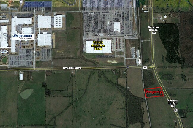
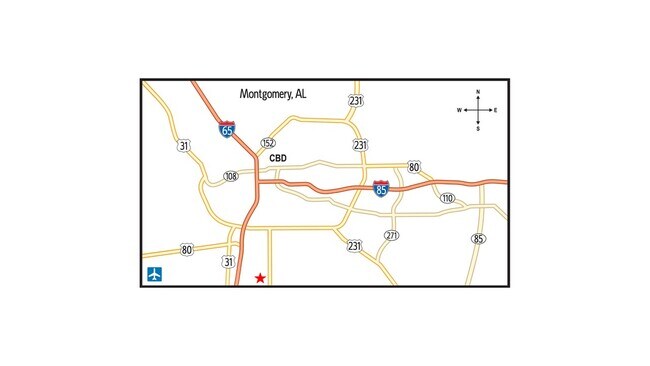
Property Record
5600 Norman Bridge Rd, Montgomery, AL 36105

Property Detail
5600 Norman Bridge Rd
Montgomery, AL
THE SOUTH 5.72 AC SAID LOT 1 1406130000002006
14-06-13-0-000-002.006
MONTGOMERY
Commercialacreage
Alabama
M-1
1
B and X Area of moderate flood hazard, usually the area between the limits of the 100-year and 500-year floods.
5.72 AC
2025
Outlying Montgomery Cnty
2025
Montgomery
005904
NEARBY LISTINGS FOR SALE OR LEASE
DEMOGRAPHICS near 5600 Norman Bridge Rd
1 mile
3 mile
5 mile
2025 Total Population
14
3,968
39,435
2030 Population
15
3,927
39,185
Pop Growth 2025-2030
+ 7.14%
(1.03%)
(0.63%)
Average Age
40
42
40
2025 Total Households
6
1,560
15,768
HH Growth 2025-2030
0.00%
(0.96%)
(0.58%)
Median Household Inc
$59,999
$61,268
$50,631
Avg Household Size
1.80
2.40
2.40
2025 Avg HH Vehicles
2.00
2.00
2.00
Median Home Value
$199,999
$97,609
$102,910
Median Year Built
1987
1974
1970
Nearby Places
Map Layers
Map Styles
 Street
 Aerial
Layers
 Traffic
 Biking
Places
Listings with unknown addresses are not visible on the map
- Restaurants
- Banks
- Shops
- Fitness
- Groceries
PUBLIC TRANSPORTATION
AIRPORT
Montgomery Regional (Dannelly Field)
Drive
Walk
Distance
Montgomery Regional (Dannelly Field)
16 min
10.6 mi
SALE & LEASE HISTORY
LISTING DATE
SALE/LEASE

Jun 25, 2021
For Sale
Nearby Properties
Address
Land Use
TOTAL SIZE
Lot Size
Zoning
Address
Land Use
TOTAL SIZE
Lot Size
Zoning
909,718 SF
310.14 AC
M-3
Address
Land Use
TOTAL SIZE
Lot Size
Zoning
1,408 SF
Address
Land Use
TOTAL SIZE
Lot Size
Zoning
3,670 SF
239.11 AC
Address
Land Use
TOTAL SIZE
Lot Size
Zoning
403,088 SF
114.39 AC
M-1
Address
Land Use
TOTAL SIZE
Lot Size
Zoning
9,060 SF
524.11 AC
Address
Land Use
TOTAL SIZE
Lot Size
Zoning
482.36 AC
AGR-1
Address
Land Use
TOTAL SIZE
Lot Size
Zoning
92,810 SF
100 AC
M-3
Address
Land Use
TOTAL SIZE
Lot Size
Zoning
16,016 SF
30 AC
AGR-1
Address
Land Use
TOTAL SIZE
Lot Size
Zoning
396 SF
312.19 AC
AGR-1
Address
Land Use
TOTAL SIZE
Lot Size
Zoning
271.07 AC
AGR-1
Address
Land Use
TOTAL SIZE
Lot Size
Zoning
52,355 SF
2.19 AC
B-2
Address
Land Use
TOTAL SIZE
Lot Size
Zoning
231.10 AC
Address
Land Use
TOTAL SIZE
Lot Size
Zoning
5,040 SF
162.48 AC
Address
Land Use
TOTAL SIZE
Lot Size
Zoning
25,273 SF
1.50 AC
M-1
Address
Land Use
TOTAL SIZE
Lot Size
Zoning
39,050 SF
13 AC
R-65-S
Address
Land Use
TOTAL SIZE
Lot Size
Zoning
27,888 SF
1.20 AC
M-1
Address
Land Use
TOTAL SIZE
Lot Size
Zoning
115 AC
M-3
Address
Land Use
TOTAL SIZE
Lot Size
Zoning
79.25 AC
Address
Land Use
TOTAL SIZE
Lot Size
Zoning
2,767 SF
43.60 AC
AGR-1
Address
Land Use
TOTAL SIZE
Lot Size
Zoning
77.54 AC
AGR-1
Address
Land Use
TOTAL SIZE
Lot Size
Zoning
1,100 SF
3.50 AC
AGR-1
Address
Land Use
TOTAL SIZE
Lot Size
Zoning
60.70 AC
M-3
Address
Land Use
TOTAL SIZE
Lot Size
Zoning
4,089 SF
1.70 AC
B-2
Address
Land Use
TOTAL SIZE
Lot Size
Zoning
8,812 SF
1.64 AC
M-1
Address
Land Use
TOTAL SIZE
Lot Size
Zoning
20,039 SF
18 AC
M-3
Address
Land Use
TOTAL SIZE
Lot Size
Zoning
14,008 SF
M-3
Address
Land Use
TOTAL SIZE
Lot Size
Zoning
3,891 SF
3.94 AC
Address
Land Use
TOTAL SIZE
Lot Size
Zoning
6,279 SF
1.62 AC
B-2
Address
Land Use
TOTAL SIZE
Lot Size
Zoning
10,856 SF
2.40 AC
B-2
Address
Land Use
TOTAL SIZE
Lot Size
Zoning
12,918 SF
5.10 AC
B-3
The World's #1 Commercial Real Estate Marketplace
Connect with us
© 2026 CoStar Group
The information above has been obtained from sources believed reliable. While we do not doubt its accuracy we have not verified it and make no guarantee, warranty or representation about it. It is your responsibility to independently confirm its accuracy and completeness. Any projections, opinions, assumptions, or estimates used are for example only and do not represent the current or future performance of the property. The value of this transaction to you depends on tax and other factors which should be evaluated by your tax, financial, and legal advisors. You and your advisors should conduct a careful, independent investigation of the property to determine to your satisfaction the suitability of the property for your needs.