Property Record
5600 Se Crain Hwy, Upper Marlboro, MD 20772


NEARBY LISTINGS FOR SALE OR LEASE
-
-
View all Upper Marlboro listings for sale on LoopNet.com
Property Detail
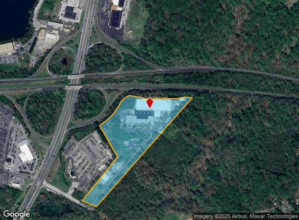
5600 Se Crain Hwy
03-0227942
PARCEL B-1
Shipyard
Prince George's
AE
Maryland
24033C0280E
15.72 AC
2023
Upper Marlboro
2025
Washington, DC
800707
Washington-Arlington-Alexandria, DC-VA-MD-WV
113,997 SF
DEMOGRAPHICS near 5600 Se Crain Hwy
1 Mile
3 Mile
5 Mile
2024 Total Population
264
21,338
51,607
2029 Population
257
20,959
50,738
Pop Growth 2024-2029
(2.65%)
(1.78%)
(1.68%)
Average Age
42
40
41
2024 Total Households
100
7,958
18,656
HH Growth 2024-2029
(3.00%)
(1.87%)
(1.78%)
Median Household Inc
$108,035
$116,879
$128,525
Avg Household Size
2.60
2.60
2.70
2024 Avg HH Vehicles
2.00
2.00
2.00
Median Home Value
$456,818
$375,707
$418,379
Median Year Built
1982
1992
1994
Nearby Places
Map Layers
Map Styles
 Street
 Aerial
- Restaurants
- Banks
- Shops
- Fitness
- Groceries
PUBLIC TRANSPORTATION
AIRPORT
Ronald Reagan Washington Ntl
DRIVE
WALK
Distance
Ronald Reagan Washington Ntl
38 min
22.4 mi
Baltimore/Washington International Thurgood Marshall
DRIVE
WALK
Distance
Baltimore/Washington International Thurgood Marshall
48 min
32.0 mi
Freight Ports
Port of Baltimore
DRIVE
WALK
Distance
Port of Baltimore
56 min
37.5 mi
Nearby Properties
Address
Land Use
TOTAL SIZE
Lot Size
Zoning
Address
Land Use
TOTAL SIZE
Lot Size
Zoning
643,009 SF
2.15 AC
CGO
Address
Land Use
TOTAL SIZE
Lot Size
Zoning
28.85 AC
RR
Address
Land Use
TOTAL SIZE
Lot Size
Zoning
219.84 AC
ROS
Address
Land Use
TOTAL SIZE
Lot Size
Zoning
6.65 AC
LCD
Address
Land Use
TOTAL SIZE
Lot Size
Zoning
135,099 SF
147.75 AC
AR
Address
Land Use
TOTAL SIZE
Lot Size
Zoning
147,395 SF
8.28 AC
LCD
Address
Land Use
TOTAL SIZE
Lot Size
Zoning
117,395 SF
12.84 AC
IE
Address
Land Use
TOTAL SIZE
Lot Size
Zoning
2,538 SF
36.50 AC
C3
Address
Land Use
TOTAL SIZE
Lot Size
Zoning
88,689 SF
12.71 AC
LCD
Address
Land Use
TOTAL SIZE
Lot Size
Zoning
68,096 SF
10.54 AC
CGO
Address
Land Use
TOTAL SIZE
Lot Size
Zoning
109,507 SF
10.21 AC
RSF95
Address
Land Use
TOTAL SIZE
Lot Size
Zoning
284,580 SF
4.77 AC
CGO
Address
Land Use
TOTAL SIZE
Lot Size
Zoning
48,247 SF
26.15 AC
AR
Address
Land Use
TOTAL SIZE
Lot Size
Zoning
62,250 SF
8.36 AC
IE
Address
Land Use
TOTAL SIZE
Lot Size
Zoning
343,409 SF
0.43 AC
CGO
Address
Land Use
TOTAL SIZE
Lot Size
Zoning
1,240 SF
13.56 AC
R5
Address
Land Use
TOTAL SIZE
Lot Size
Zoning
201,975 SF
3.09 AC
CGO
Address
Land Use
TOTAL SIZE
Lot Size
Zoning
69,527 SF
4.95 AC
IE
Address
Land Use
TOTAL SIZE
Lot Size
Zoning
80,939 SF
13.50 AC
C4
Address
Land Use
TOTAL SIZE
Lot Size
Zoning
720 SF
36.16 AC
RA
Address
Land Use
TOTAL SIZE
Lot Size
Zoning
55,600 SF
8.87 AC
CGO
Address
Land Use
TOTAL SIZE
Lot Size
Zoning
31,687 SF
4.14 AC
C3
Address
Land Use
TOTAL SIZE
Lot Size
Zoning
1,624 SF
4.26 AC
RMF48
Address
Land Use
TOTAL SIZE
Lot Size
Zoning
77,751 SF
27.24 AC
IE
Address
Land Use
TOTAL SIZE
Lot Size
Zoning
53,958 SF
10.40 AC
RR
Address
Land Use
TOTAL SIZE
Lot Size
Zoning
45,945 SF
5.17 AC
CSC
Address
Land Use
TOTAL SIZE
Lot Size
Zoning
61,316 SF
13.15 AC
IE
Address
Land Use
TOTAL SIZE
Lot Size
Zoning
31,828 SF
18.50 AC
RR
Address
Land Use
TOTAL SIZE
Lot Size
Zoning
38,308 SF
5.25 AC
CGO
The World's #1 Commercial Real Estate Marketplace
Connect with us
© 2026 CoStar Group
The information above has been obtained from sources believed reliable. While we do not doubt its accuracy we have not verified it and make no guarantee, warranty or representation about it. It is your responsibility to independently confirm its accuracy and completeness. Any projections, opinions, assumptions, or estimates used are for example only and do not represent the current or future performance of the property. The value of this transaction to you depends on tax and other factors which should be evaluated by your tax, financial, and legal advisors. You and your advisors should conduct a careful, independent investigation of the property to determine to your satisfaction the suitability of the property for your needs.