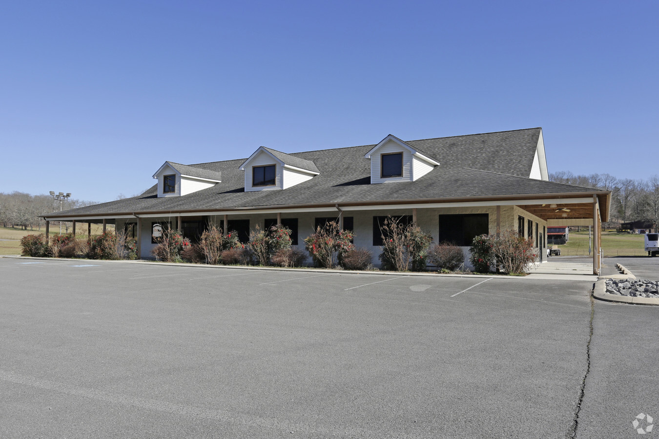
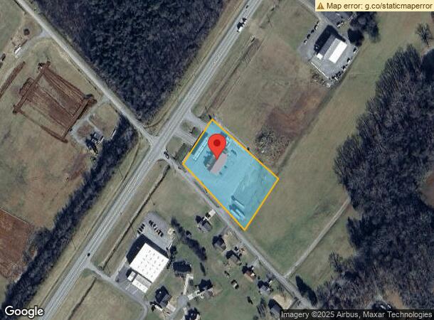
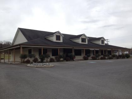
Property Record
5658 State Route 28, Dunlap, TN 37327
NEARBY LISTINGS FOR SALE OR LEASE
-
-
View all Dunlap listings for sale on LoopNet.com
Property Detail
5658 State Route 28
054-059.21
Farley
Supermarket
DISTRICT: 4
A
Sequatchie
47153C0160C
Tennessee
2023
2.29 AC
2023
Sequatchie County
060104
Chattanooga
10,106 SF
Chattanooga, TN-GA
DEMOGRAPHICS near 5658 State Route 28
1 Mile
3 Mile
5 Mile
2024 Total Population
1,577
5,849
9,478
2029 Population
1,795
6,694
10,861
Pop Growth 2024-2029
+ 13.82%
+ 14.45%
+ 14.59%
Average Age
41
42
42
2024 Total Households
605
2,226
3,660
HH Growth 2024-2029
+ 13.55%
+ 14.24%
+ 14.34%
Median Household Inc
$44,743
$43,468
$46,683
Avg Household Size
2.50
2.50
2.50
2024 Avg HH Vehicles
2.00
2.00
2.00
Median Home Value
$165,517
$163,792
$174,119
Median Year Built
1991
1992
1994
Nearby Places
- Restaurants
- Banks
- Shops
- Fitness
- Groceries
PUBLIC TRANSPORTATION
AIRPORT
Lovell Field
DRIVE
WALK
Distance
Lovell Field
57 min
47.0 mi
SALE & LEASE HISTORY
LISTING DATE
SALE/LEASE

Jul 31, 2017
For Sale
Nearby Properties
Address
Land Use
TOTAL SIZE
Lot Size
Zoning
Address
Land Use
TOTAL SIZE
Lot Size
Zoning
11,968 SF
8.60 AC
Address
Land Use
TOTAL SIZE
Lot Size
Zoning
13,161 SF
2 AC
FLOOD
Address
Land Use
TOTAL SIZE
Lot Size
Zoning
37.80 AC
Address
Land Use
TOTAL SIZE
Lot Size
Zoning
9,960 SF
1.38 AC
FLOOD
Address
Land Use
TOTAL SIZE
Lot Size
Zoning
6,267 SF
10 AC
FLOOD
Address
Land Use
TOTAL SIZE
Lot Size
Zoning
34,320 SF
3 AC
Address
Land Use
TOTAL SIZE
Lot Size
Zoning
15,180 SF
2.76 AC
Address
Land Use
TOTAL SIZE
Lot Size
Zoning
3,614 SF
5.35 AC
Address
Land Use
TOTAL SIZE
Lot Size
Zoning
14,018 SF
17.69 AC
Address
Land Use
TOTAL SIZE
Lot Size
Zoning
12,033 SF
0.30 AC
FLOOD
Address
Land Use
TOTAL SIZE
Lot Size
Zoning
10,220 SF
0.39 AC
FLOOD
Address
Land Use
TOTAL SIZE
Lot Size
Zoning
31.60 AC
FLOOD
Address
Land Use
TOTAL SIZE
Lot Size
Zoning
14,698 SF
1.47 AC
FLOOD
Address
Land Use
TOTAL SIZE
Lot Size
Zoning
16,010 SF
0.72 AC
FLOOD
Address
Land Use
TOTAL SIZE
Lot Size
Zoning
11,825 SF
1.43 AC
Address
Land Use
TOTAL SIZE
Lot Size
Zoning
8,078 SF
2 AC
Address
Land Use
TOTAL SIZE
Lot Size
Zoning
3,807 SF
1.57 AC
Address
Land Use
TOTAL SIZE
Lot Size
Zoning
18,246 SF
3.10 AC
Address
Land Use
TOTAL SIZE
Lot Size
Zoning
10,501 SF
1.90 AC
Address
Land Use
TOTAL SIZE
Lot Size
Zoning
11,455 SF
0.87 AC
FLOOD
Address
Land Use
TOTAL SIZE
Lot Size
Zoning
3,452 SF
0.75 AC
Address
Land Use
TOTAL SIZE
Lot Size
Zoning
5,536 SF
1.57 AC
Address
Land Use
TOTAL SIZE
Lot Size
Zoning
1,696 SF
5.94 AC
Address
Land Use
TOTAL SIZE
Lot Size
Zoning
3,033 SF
4.81 AC
Address
Land Use
TOTAL SIZE
Lot Size
Zoning
5.60 AC
FLOOD
Address
Land Use
TOTAL SIZE
Lot Size
Zoning
8,075 SF
1.04 AC
FLOOD
Address
Land Use
TOTAL SIZE
Lot Size
Zoning
14,717 SF
1.40 AC
Address
Land Use
TOTAL SIZE
Lot Size
Zoning
10,118 SF
1.40 AC
Address
Land Use
TOTAL SIZE
Lot Size
Zoning
4,970 SF
1.55 AC
FLOOD
The World's #1 Commercial Real Estate Marketplace
Connect with us
© 2025 CoStar Group
The information above has been obtained from sources believed reliable. While we do not doubt its accuracy we have not verified it and make no guarantee, warranty or representation about it. It is your responsibility to independently confirm its accuracy and completeness. Any projections, opinions, assumptions, or estimates used are for example only and do not represent the current or future performance of the property. The value of this transaction to you depends on tax and other factors which should be evaluated by your tax, financial, and legal advisors. You and your advisors should conduct a careful, independent investigation of the property to determine to your satisfaction the suitability of the property for your needs.