Property Record
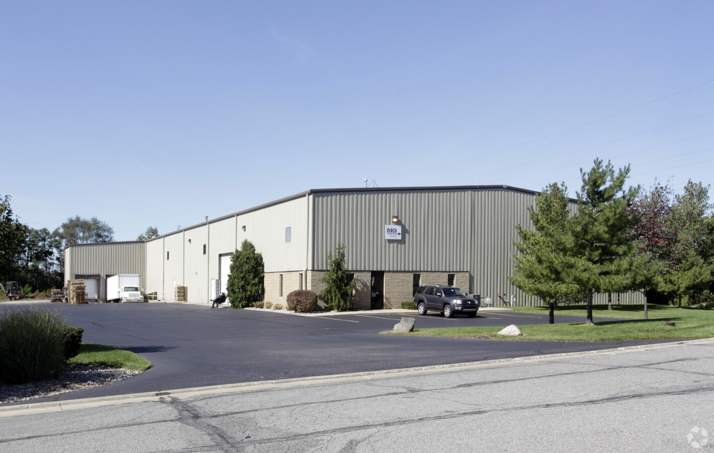
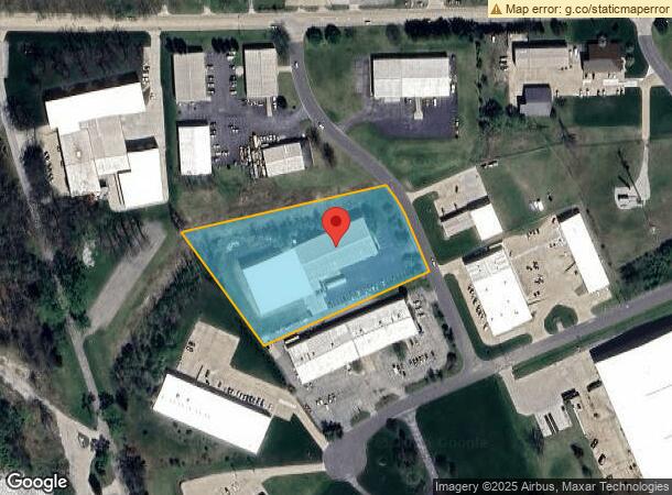
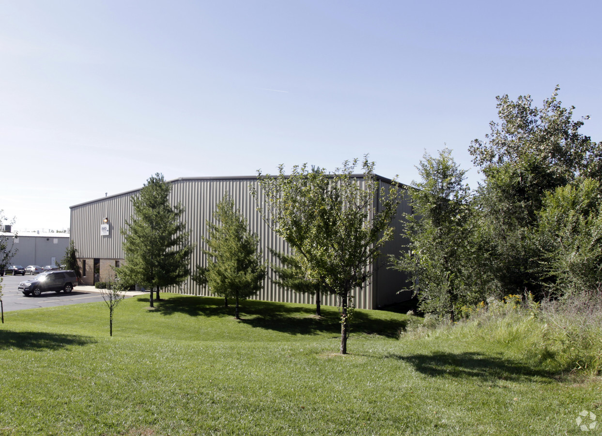
56599 Twin Branch Dr, Mishawaka, IN 46545
NEARBY LISTINGS FOR SALE OR LEASE
Property Detail
56599 Twin Branch Dr
South Bend-Mishawaka, IN-MI
Twin Branch Energy Park 3Rd Replat
71-09-12-326-005.000-031
LOT AA TWIN BRANCH ENERGY PARK 3RD REPLAT 00-01 SET UP NEW REPLAT PER TRANS #6065 8-10-99
Lightindustrial
St Joseph
X
Indiana
18141C0217E
aa
2022
3.62 AC
2023
Outlying St Joseph County
011503
South Bend/Mishawaka
41,680 SF
DEMOGRAPHICS near 56599 Twin Branch Dr
1 Mile
3 Mile
5 Mile
2024 Total Population
3,665
42,565
109,936
2029 Population
3,616
42,135
109,335
Pop Growth 2024-2029
(1.34%)
(1.01%)
(0.55%)
Average Age
42
40
39
2024 Total Households
1,530
17,553
46,409
HH Growth 2024-2029
(1.44%)
(1.00%)
(0.52%)
Median Household Inc
$69,028
$62,998
$59,032
Avg Household Size
2.30
2.40
2.30
2024 Avg HH Vehicles
2.00
2.00
2.00
Median Home Value
$182,991
$161,529
$159,128
Median Year Built
1973
1971
1970
Nearby Places
- Restaurants
- Banks
- Shops
- Fitness
- Groceries
PUBLIC TRANSPORTATION
COMMUTER RAIL
Elkhart Amtrak Station (Capitol Limited - Amtrak, Lake Shore Limited - Amtrak)
DRIVE
WALK
Distance
Elkhart Amtrak Station (Capitol Limited - Amtrak, Lake Shore Limited - Amtrak)
16 min
9.5 mi
South Bend Amtrak Station (Capitol Limited - Amtrak, Lake Shore Limited - Amtrak)
DRIVE
WALK
Distance
South Bend Amtrak Station (Capitol Limited - Amtrak, Lake Shore Limited - Amtrak)
17 min
9.9 mi
AIRPORT
South Bend International
DRIVE
WALK
Distance
South Bend International
30 min
12.9 mi
Freight Ports
Port Milwaukee
DRIVE
WALK
Distance
Port Milwaukee
225 min
188.4 mi
Nearby Properties
Address
Land Use
TOTAL SIZE
Lot Size
Zoning
Address
Land Use
TOTAL SIZE
Lot Size
Zoning
397,501 SF
3.50 AC
Address
Land Use
TOTAL SIZE
Lot Size
Zoning
653,141 SF
32.18 AC
Address
Land Use
TOTAL SIZE
Lot Size
Zoning
107,258 SF
1.62 AC
Address
Land Use
TOTAL SIZE
Lot Size
Zoning
124,260 SF
5.68 AC
Address
Land Use
TOTAL SIZE
Lot Size
Zoning
87,409 SF
15.88 AC
Address
Land Use
TOTAL SIZE
Lot Size
Zoning
623,232 SF
74.18 AC
Address
Land Use
TOTAL SIZE
Lot Size
Zoning
85,524 SF
3.24 AC
Address
Land Use
TOTAL SIZE
Lot Size
Zoning
149,821 SF
11.73 AC
Address
Land Use
TOTAL SIZE
Lot Size
Zoning
389,851 SF
23.89 AC
Address
Land Use
TOTAL SIZE
Lot Size
Zoning
270,962 SF
27.20 AC
Address
Land Use
TOTAL SIZE
Lot Size
Zoning
245,765 SF
18.94 AC
Address
Land Use
TOTAL SIZE
Lot Size
Zoning
62,115 SF
3.54 AC
Address
Land Use
TOTAL SIZE
Lot Size
Zoning
144,362 SF
14.32 AC
Address
Land Use
TOTAL SIZE
Lot Size
Zoning
120,513 SF
7.92 AC
Address
Land Use
TOTAL SIZE
Lot Size
Zoning
102,057 SF
2 AC
Address
Land Use
TOTAL SIZE
Lot Size
Zoning
105,917 SF
5.90 AC
Address
Land Use
TOTAL SIZE
Lot Size
Zoning
240,212 SF
44 SF
Address
Land Use
TOTAL SIZE
Lot Size
Zoning
261,621 SF
23.42 AC
Address
Land Use
TOTAL SIZE
Lot Size
Zoning
66,953 SF
8.59 AC
Address
Land Use
TOTAL SIZE
Lot Size
Zoning
45,700 SF
4.65 AC
Address
Land Use
TOTAL SIZE
Lot Size
Zoning
35,066 SF
3.16 AC
Address
Land Use
TOTAL SIZE
Lot Size
Zoning
198,582 SF
10.37 AC
Address
Land Use
TOTAL SIZE
Lot Size
Zoning
152,542 SF
9.45 AC
Address
Land Use
TOTAL SIZE
Lot Size
Zoning
43,602 SF
3.22 AC
Address
Land Use
TOTAL SIZE
Lot Size
Zoning
295,683 SF
21.32 AC
Address
Land Use
TOTAL SIZE
Lot Size
Zoning
26,105 SF
5 AC
Address
Land Use
TOTAL SIZE
Lot Size
Zoning
43,745 SF
3.24 AC
Address
Land Use
TOTAL SIZE
Lot Size
Zoning
204,322 SF
14.99 AC
Address
Land Use
TOTAL SIZE
Lot Size
Zoning
226,496 SF
25.73 AC
Address
Land Use
TOTAL SIZE
Lot Size
Zoning
147,528 SF
14.41 AC
The World's #1 Commercial Real Estate Marketplace
Connect with us
© 2025 CoStar Group
The information above has been obtained from sources believed reliable. While we do not doubt its accuracy we have not verified it and make no guarantee, warranty or representation about it. It is your responsibility to independently confirm its accuracy and completeness. Any projections, opinions, assumptions, or estimates used are for example only and do not represent the current or future performance of the property. The value of this transaction to you depends on tax and other factors which should be evaluated by your tax, financial, and legal advisors. You and your advisors should conduct a careful, independent investigation of the property to determine to your satisfaction the suitability of the property for your needs.