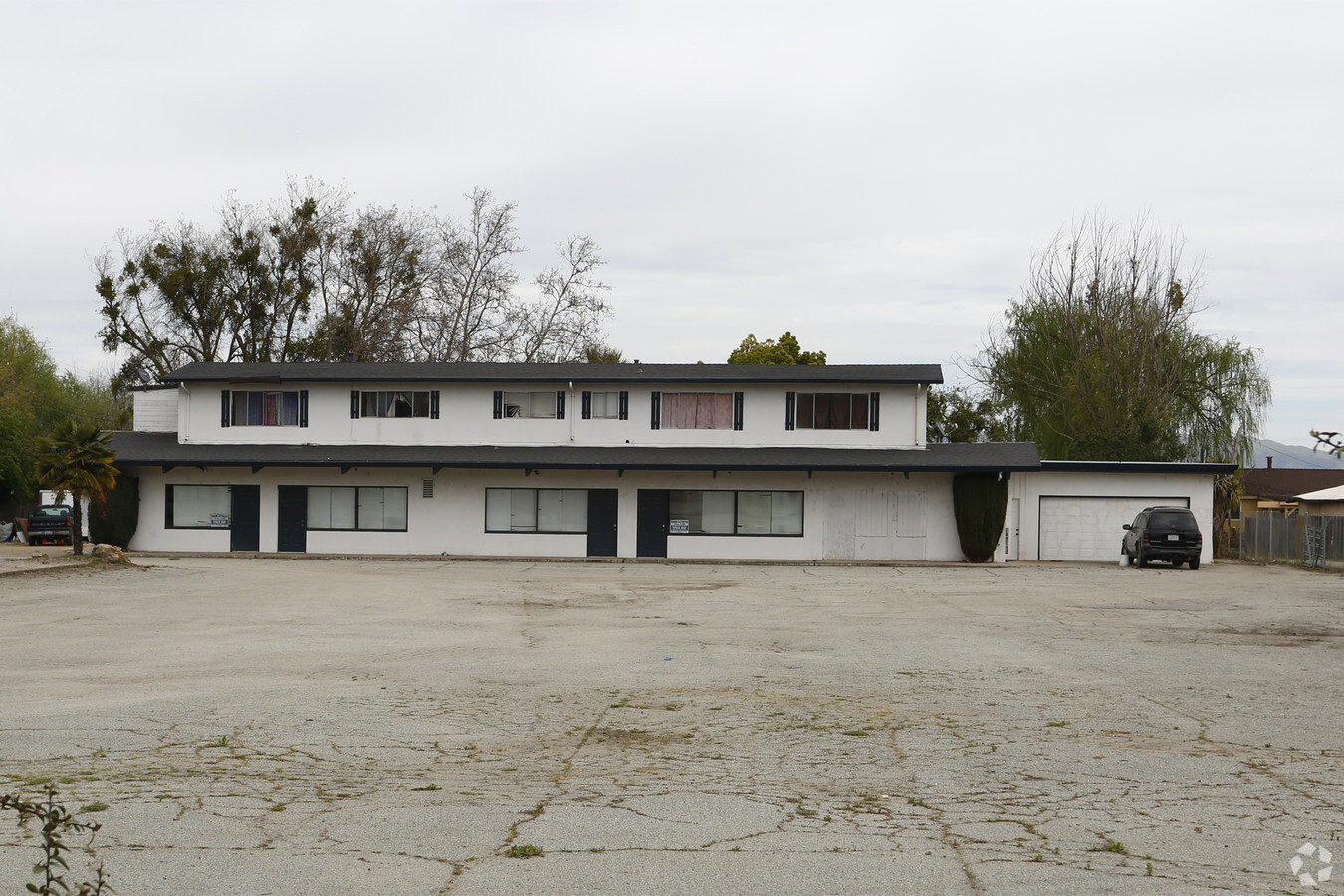
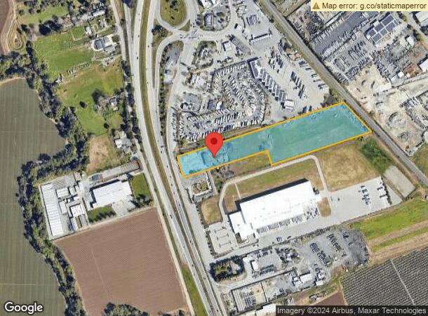
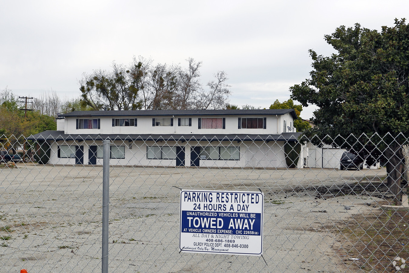
Property Record
5680 Monterey Rd, Gilroy, CA 95020
NEARBY LISTINGS FOR SALE OR LEASE
Property Detail
5680 Monterey Rd
841-14-028
Las Animas Rancho
Storebuilding
Santa Clara
A
California
06087C0435E
0.49 AC
2023
Outlying Santa Clara Cnty
2023
South Bay/San Jose
512513
San Jose-Sunnyvale-Santa Clara, CA
6,630 SF
DEMOGRAPHICS near 5680 Monterey Rd
1 Mile
3 Mile
5 Mile
2024 Total Population
2,346
32,516
59,762
2029 Population
2,232
31,328
57,258
Pop Growth 2024-2029
(4.86%)
(3.65%)
(4.19%)
Average Age
36
37
38
2024 Total Households
650
9,387
17,492
HH Growth 2024-2029
(5.23%)
(3.92%)
(4.48%)
Median Household Inc
$118,835
$92,501
$111,168
Avg Household Size
3.50
3.30
3.30
2024 Avg HH Vehicles
3.00
2.00
2.00
Median Home Value
$843,632
$772,325
$829,105
Median Year Built
1993
1981
1988
Nearby Places
- Restaurants
- Banks
- Shops
- Fitness
- Groceries
PUBLIC TRANSPORTATION
COMMUTER RAIL
Gilroy (Caltrain - Caltrain (Caltrain))
Drive
Walk
Distance
Gilroy (Caltrain - Caltrain (Caltrain))
3 min
1.9 mi
San Martin (Caltrain - Caltrain (Caltrain))
Drive
Walk
Distance
San Martin (Caltrain - Caltrain (Caltrain))
12 min
8.8 mi
Freight Ports
Port of Redwood City
Drive
Walk
Distance
Port of Redwood City
66 min
55.0 mi
Nearby Properties
Address
Land Use
TOTAL SIZE
Lot Size
Zoning
Address
Land Use
TOTAL SIZE
Lot Size
Zoning
270205
6.65 AC
M2
Address
Land Use
TOTAL SIZE
Lot Size
Zoning
921750
40.33 AC
M2
Address
Land Use
TOTAL SIZE
Lot Size
Zoning
156290
5.87 AC
APD
Address
Land Use
TOTAL SIZE
Lot Size
Zoning
133498
12.16 AC
C3
Address
Land Use
TOTAL SIZE
Lot Size
Zoning
189303
28.73 AC
CM
Address
Land Use
TOTAL SIZE
Lot Size
Zoning
55.03 AC
AW
Address
Land Use
TOTAL SIZE
Lot Size
Zoning
113883
9.63 AC
C1
Address
Land Use
TOTAL SIZE
Lot Size
Zoning
94345
10.68 AC
C1
Address
Land Use
TOTAL SIZE
Lot Size
Zoning
219622
19.80 AC
A1-25
Address
Land Use
TOTAL SIZE
Lot Size
Zoning
56.33 AC
M2
Address
Land Use
TOTAL SIZE
Lot Size
Zoning
59.87 AC
M2
Address
Land Use
TOTAL SIZE
Lot Size
Zoning
142684
4.94 AC
CD
Address
Land Use
TOTAL SIZE
Lot Size
Zoning
123268
7.62 AC
R3
Address
Land Use
TOTAL SIZE
Lot Size
Zoning
64893
4.32 AC
R3
Address
Land Use
TOTAL SIZE
Lot Size
Zoning
90677
11.26 AC
C1
Address
Land Use
TOTAL SIZE
Lot Size
Zoning
148663
14.79 AC
PUD
Address
Land Use
TOTAL SIZE
Lot Size
Zoning
4853
11.59 AC
HC
Address
Land Use
TOTAL SIZE
Lot Size
Zoning
129000
6.84 AC
MULIT
Address
Land Use
TOTAL SIZE
Lot Size
Zoning
123709
9.26 AC
M2
Address
Land Use
TOTAL SIZE
Lot Size
Zoning
138262
10.83 AC
PUD
Address
Land Use
TOTAL SIZE
Lot Size
Zoning
63560
7.63 AC
A1-25
Address
Land Use
TOTAL SIZE
Lot Size
Zoning
126503
4.61 AC
MI
Address
Land Use
TOTAL SIZE
Lot Size
Zoning
20,140.41 AC
SJ
Address
Land Use
TOTAL SIZE
Lot Size
Zoning
70209
5.40 AC
COM
Address
Land Use
TOTAL SIZE
Lot Size
Zoning
1.51 AC
CM
Address
Land Use
TOTAL SIZE
Lot Size
Zoning
163200
8.62 AC
M-2
Address
Land Use
TOTAL SIZE
Lot Size
Zoning
56020
2.61 AC
M2
Address
Land Use
TOTAL SIZE
Lot Size
Zoning
96524
5 AC
R3
Address
Land Use
TOTAL SIZE
Lot Size
Zoning
77519
3.05 AC
HC
Address
Land Use
TOTAL SIZE
Lot Size
Zoning
146682
11.83 AC
A1-25
Start a new search to find other properties for sale or lease
Connect with us
© 2024 CoStar Group
The information above has been obtained from sources believed reliable. While we do not doubt its accuracy we have not verified it and make no guarantee, warranty or representation about it. It is your responsibility to independently confirm its accuracy and completeness. Any projections, opinions, assumptions, or estimates used are for example only and do not represent the current or future performance of the property. The value of this transaction to you depends on tax and other factors which should be evaluated by your tax, financial, and legal advisors. You and your advisors should conduct a careful, independent investigation of the property to determine to your satisfaction the suitability of the property for your needs.