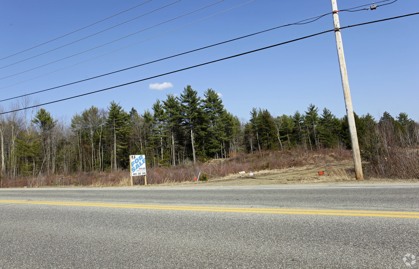
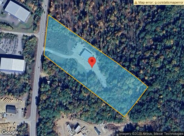
Property Record
569 Laconia Rd, Belmont, NH 03220
NEARBY LISTINGS FOR SALE OR LEASE
-
-
View all Belmont listings for sale on LoopNet.com
Property Detail
569 Laconia Rd
BLMT-000224-000040
Belknap
Autorepair
New Hampshire
2023
8.58 AC
2023
Concord/New Hampshire North Area
965802
Other Market Areas
5,600 SF
Laconia, NH
DEMOGRAPHICS near 569 Laconia Rd
1 Mile
3 Mile
5 Mile
2024 Total Population
590
6,515
20,756
2029 Population
597
6,645
21,301
Pop Growth 2024-2029
+ 1.19%
+ 2.00%
+ 2.63%
Average Age
42
43
43
2024 Total Households
233
2,664
8,649
HH Growth 2024-2029
+ 0.86%
+ 1.61%
+ 2.28%
Median Household Inc
$80,803
$59,285
$60,711
Avg Household Size
2.50
2.40
2.30
2024 Avg HH Vehicles
2.00
2.00
2.00
Median Home Value
$246,000
$227,538
$240,894
Median Year Built
1985
1982
1972
Nearby Places
- Restaurants
- Banks
- Shops
- Fitness
- Groceries
Nearby Properties
Address
Land Use
TOTAL SIZE
Lot Size
Zoning
Address
Land Use
TOTAL SIZE
Lot Size
Zoning
78,038 SF
35 AC
RA
Address
Land Use
TOTAL SIZE
Lot Size
Zoning
99,548 SF
36.88 AC
RESM
Address
Land Use
TOTAL SIZE
Lot Size
Zoning
896 SF
9.50 AC
IND
Address
Land Use
TOTAL SIZE
Lot Size
Zoning
31,818 SF
23.86 AC
VIL
Address
Land Use
TOTAL SIZE
Lot Size
Zoning
45,997 SF
55 AC
RESM
Address
Land Use
TOTAL SIZE
Lot Size
Zoning
4,102 SF
34.50 AC
RES
Address
Land Use
TOTAL SIZE
Lot Size
Zoning
619 SF
71.80 AC
RESM
Address
Land Use
TOTAL SIZE
Lot Size
Zoning
76,632 SF
7.92 AC
IND
Address
Land Use
TOTAL SIZE
Lot Size
Zoning
2,400 SF
17.41 AC
COM
Address
Land Use
TOTAL SIZE
Lot Size
Zoning
1,146 SF
19.40 AC
RESM
Address
Land Use
TOTAL SIZE
Lot Size
Zoning
31 AC
RESM
Address
Land Use
TOTAL SIZE
Lot Size
Zoning
9.03 AC
COM
Address
Land Use
TOTAL SIZE
Lot Size
Zoning
8,680 SF
24 AC
RESM
Address
Land Use
TOTAL SIZE
Lot Size
Zoning
4,608 SF
4.50 AC
VIL
Address
Land Use
TOTAL SIZE
Lot Size
Zoning
28,499 SF
23.76 AC
IND
Address
Land Use
TOTAL SIZE
Lot Size
Zoning
6,304 SF
4.79 AC
VIL
Address
Land Use
TOTAL SIZE
Lot Size
Zoning
21,536 SF
2.01 AC
COM
Address
Land Use
TOTAL SIZE
Lot Size
Zoning
6,400 SF
4.50 AC
COM
Address
Land Use
TOTAL SIZE
Lot Size
Zoning
23,108 SF
2.63 AC
COM
Address
Land Use
TOTAL SIZE
Lot Size
Zoning
21,064 SF
5.10 AC
COM
Address
Land Use
TOTAL SIZE
Lot Size
Zoning
43,751 SF
3.06 AC
IND
Address
Land Use
TOTAL SIZE
Lot Size
Zoning
36,508 SF
6.58 AC
IND
Address
Land Use
TOTAL SIZE
Lot Size
Zoning
5,664 SF
19.60 AC
LR
Address
Land Use
TOTAL SIZE
Lot Size
Zoning
3,920 SF
2.10 AC
COM
Address
Land Use
TOTAL SIZE
Lot Size
Zoning
2,835 SF
0.78 AC
RES
Address
Land Use
TOTAL SIZE
Lot Size
Zoning
7,040 SF
5.46 AC
COM
Address
Land Use
TOTAL SIZE
Lot Size
Zoning
27.27 AC
RES
Address
Land Use
TOTAL SIZE
Lot Size
Zoning
2,626 SF
11.01 AC
RESM
Address
Land Use
TOTAL SIZE
Lot Size
Zoning
35,655 SF
9.43 AC
COM
Address
Land Use
TOTAL SIZE
Lot Size
Zoning
6,444 SF
1.40 AC
VIL
The World's #1 Commercial Real Estate Marketplace
Connect with us
© 2025 CoStar Group
The information above has been obtained from sources believed reliable. While we do not doubt its accuracy we have not verified it and make no guarantee, warranty or representation about it. It is your responsibility to independently confirm its accuracy and completeness. Any projections, opinions, assumptions, or estimates used are for example only and do not represent the current or future performance of the property. The value of this transaction to you depends on tax and other factors which should be evaluated by your tax, financial, and legal advisors. You and your advisors should conduct a careful, independent investigation of the property to determine to your satisfaction the suitability of the property for your needs.