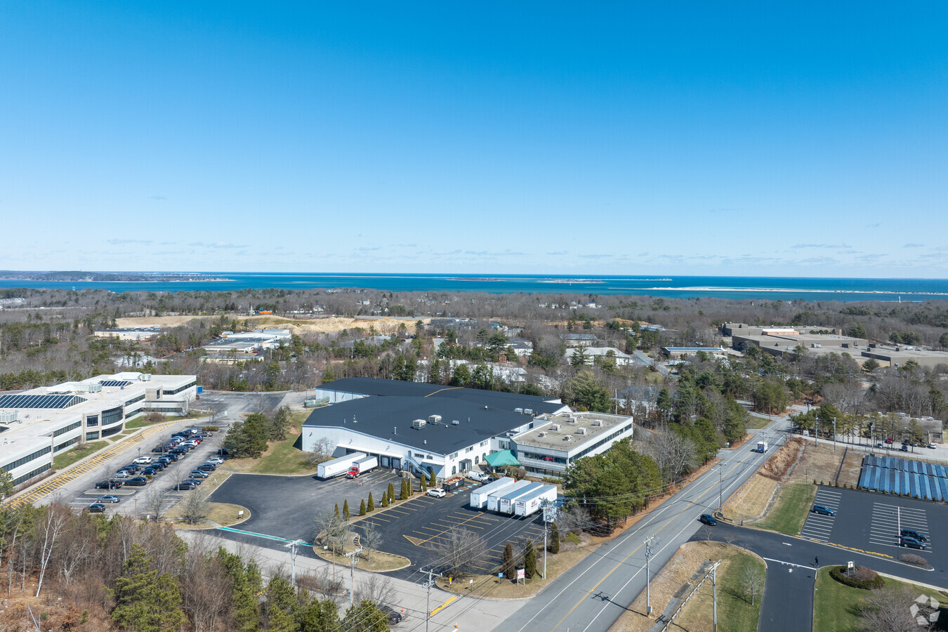
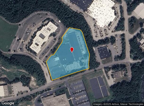
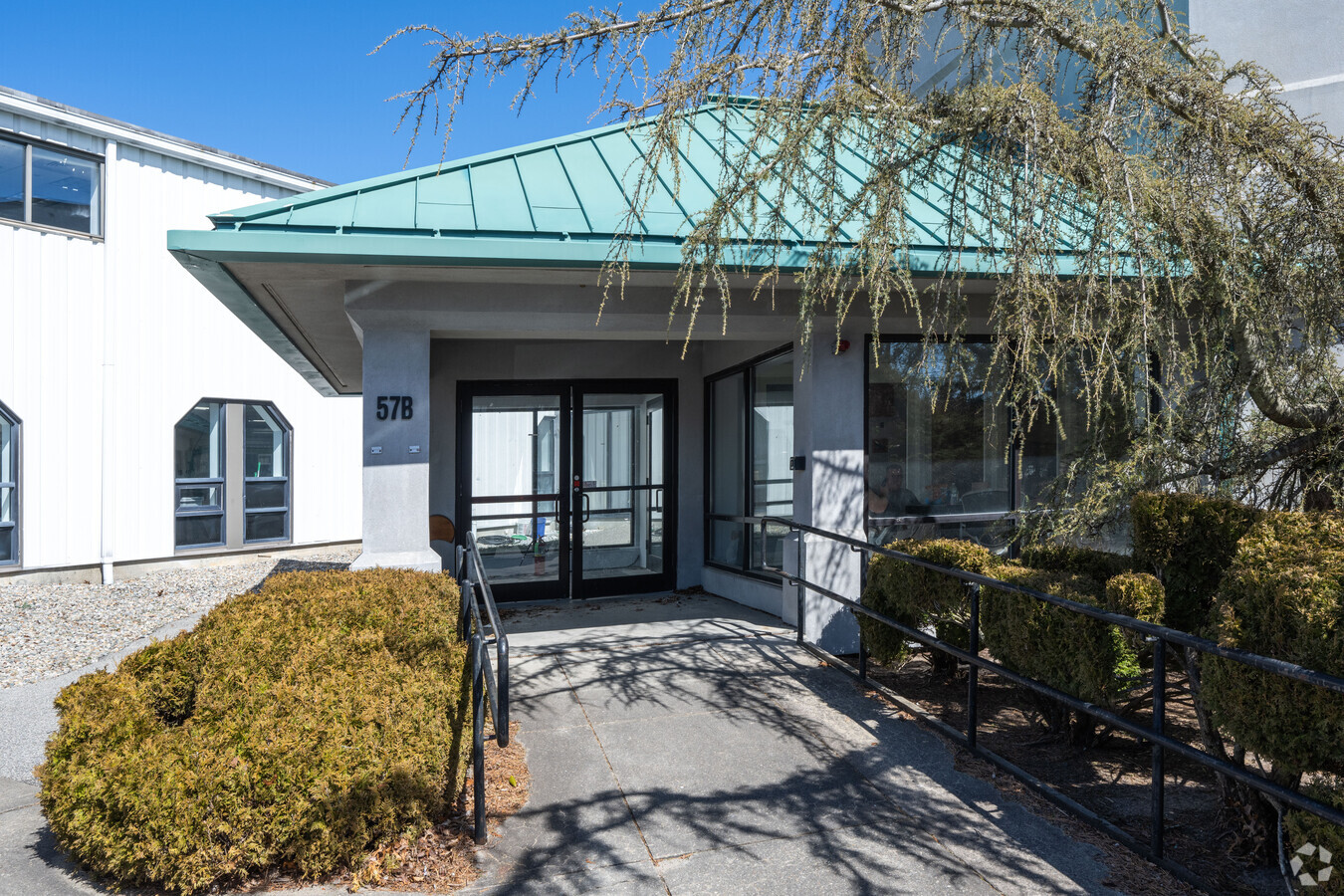
Property Record
57 Armstrong Rd, Plymouth, MA 02360
Current Lease Availabilities
NEARBY LISTINGS FOR SALE OR LEASE
Property Detail
57 Armstrong Rd
PLYM-000101-000000-000043H
Plymouth
Industrialgeneral
Massachusetts
X
43h
25023C0354K
4.82 AC
2025
Route 3 South
2025
Boston
530100
Boston-Cambridge-Newton, MA-NH
103,764 SF
DEMOGRAPHICS near 57 Armstrong Rd
1 Mile
3 Mile
5 Mile
2024 Total Population
3,969
30,214
50,457
2029 Population
4,007
30,506
50,836
Pop Growth 2024-2029
+ 0.96%
+ 0.97%
+ 0.75%
Average Age
44
43
44
2024 Total Households
1,801
12,432
19,817
HH Growth 2024-2029
+ 0.94%
+ 0.88%
+ 0.72%
Median Household Inc
$81,701
$94,641
$99,962
Avg Household Size
2.20
2.30
2.40
2024 Avg HH Vehicles
2.00
2.00
2.00
Median Home Value
$417,755
$448,781
$470,325
Median Year Built
1981
1973
1974
Nearby Places
- Restaurants
- Banks
- Shops
- Fitness
- Groceries
PUBLIC TRANSPORTATION
COMMUTER RAIL
Kingston/Route 3 (Kingston/Plymouth Line - Massachusetts Bay Transportation Authority Commuter Rail (Purple Line))
DRIVE
WALK
Distance
Kingston/Route 3 (Kingston/Plymouth Line - Massachusetts Bay Transportation Authority Commuter Rail (Purple Line))
11 min
3.3 mi
Freight Ports
Port of New Bedford Harbor
DRIVE
WALK
Distance
Port of New Bedford Harbor
51 min
32.4 mi
Nearby Properties
Address
Land Use
TOTAL SIZE
Lot Size
Zoning
Address
Land Use
TOTAL SIZE
Lot Size
Zoning
14.60 AC
MC
Address
Land Use
TOTAL SIZE
Lot Size
Zoning
24.64 AC
HC
Address
Land Use
TOTAL SIZE
Lot Size
Zoning
42.20 AC
R25
Address
Land Use
TOTAL SIZE
Lot Size
Zoning
56.81 AC
LI
Address
Land Use
TOTAL SIZE
Lot Size
Zoning
12.26 AC
R25
Address
Land Use
TOTAL SIZE
Lot Size
Zoning
16.04 AC
Address
Land Use
TOTAL SIZE
Lot Size
Zoning
205,540 SF
8.16 AC
LI
Address
Land Use
TOTAL SIZE
Lot Size
Zoning
4.67 AC
LI
Address
Land Use
TOTAL SIZE
Lot Size
Zoning
375,020 SF
10.07 AC
Address
Land Use
TOTAL SIZE
Lot Size
Zoning
26.16 AC
MC
Address
Land Use
TOTAL SIZE
Lot Size
Zoning
27.31 AC
MC
Address
Land Use
TOTAL SIZE
Lot Size
Zoning
69.81 AC
Address
Land Use
TOTAL SIZE
Lot Size
Zoning
18.38 AC
AC
Address
Land Use
TOTAL SIZE
Lot Size
Zoning
214,442 SF
21.50 AC
MC
Address
Land Use
TOTAL SIZE
Lot Size
Zoning
197,178 SF
47.10 AC
RR
Address
Land Use
TOTAL SIZE
Lot Size
Zoning
98,501 SF
4.74 AC
R20M
Address
Land Use
TOTAL SIZE
Lot Size
Zoning
122,558 SF
17.44 AC
GC
Address
Land Use
TOTAL SIZE
Lot Size
Zoning
134,760 SF
13.18 AC
HC
Address
Land Use
TOTAL SIZE
Lot Size
Zoning
18.33 AC
LI
Address
Land Use
TOTAL SIZE
Lot Size
Zoning
233,971 SF
14.93 AC
R20M
Address
Land Use
TOTAL SIZE
Lot Size
Zoning
62,502 SF
0.92 AC
R20S
Address
Land Use
TOTAL SIZE
Lot Size
Zoning
12.71 AC
LI
Address
Land Use
TOTAL SIZE
Lot Size
Zoning
4.58 AC
R20M
Address
Land Use
TOTAL SIZE
Lot Size
Zoning
5.50 AC
HC
Address
Land Use
TOTAL SIZE
Lot Size
Zoning
120,654 SF
14.14 AC
R25
Address
Land Use
TOTAL SIZE
Lot Size
Zoning
9.41 AC
MC
Address
Land Use
TOTAL SIZE
Lot Size
Zoning
166,865 SF
22.21 AC
HC
Address
Land Use
TOTAL SIZE
Lot Size
Zoning
16.30 AC
GC
Address
Land Use
TOTAL SIZE
Lot Size
Zoning
97,390 SF
16.25 AC
LI
Address
Land Use
TOTAL SIZE
Lot Size
Zoning
13.88 AC
LI
The World's #1 Commercial Real Estate Marketplace
Connect with us
© 2025 CoStar Group
The information above has been obtained from sources believed reliable. While we do not doubt its accuracy we have not verified it and make no guarantee, warranty or representation about it. It is your responsibility to independently confirm its accuracy and completeness. Any projections, opinions, assumptions, or estimates used are for example only and do not represent the current or future performance of the property. The value of this transaction to you depends on tax and other factors which should be evaluated by your tax, financial, and legal advisors. You and your advisors should conduct a careful, independent investigation of the property to determine to your satisfaction the suitability of the property for your needs.