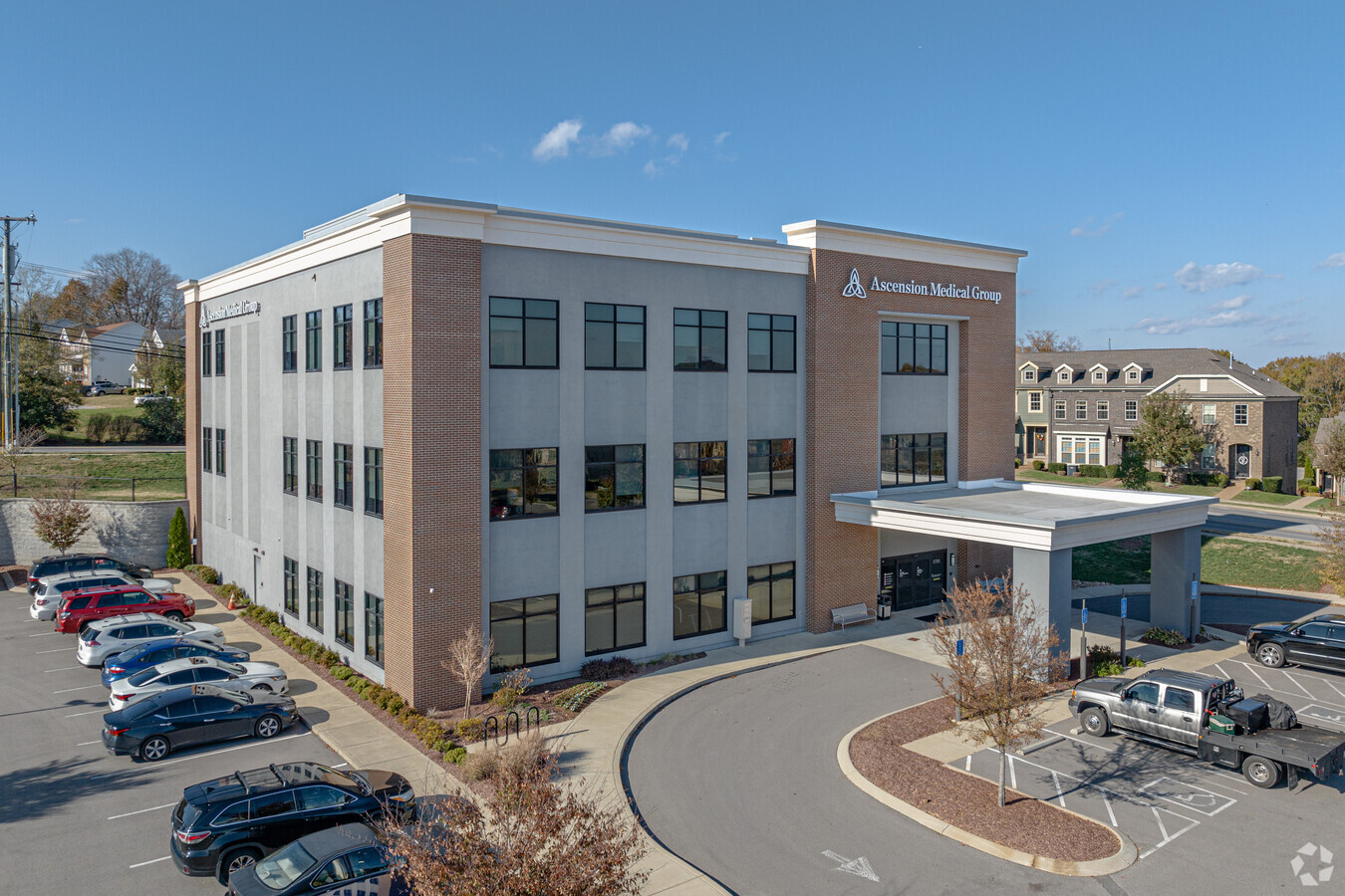
Property Record
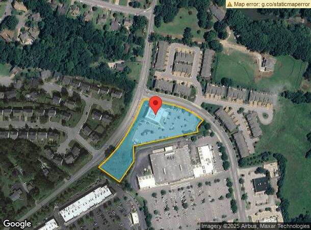
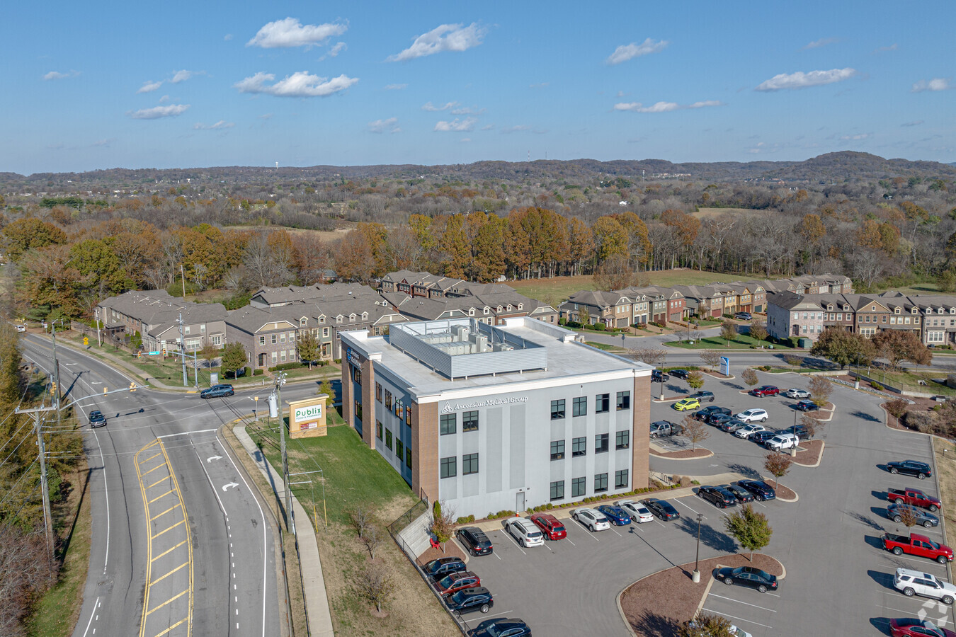
5700 Temple Rd, Nashville, TN 37221
NEARBY LISTINGS FOR SALE OR LEASE
Property Detail
5700 Temple Rd
156-09-0A-007-00
Harpeth Village Pud
Medicalbuilding
OUTPARCEL 7 HARPETH VILLAGE
X
Davidson
47037C0337J
Tennessee
2024
2.77 AC
2024
West
018405
Nashville
22,386 SF
Nashville-Davidson--Murfreesboro--Franklin, TN
DEMOGRAPHICS near 5700 Temple Rd
1 Mile
3 Mile
5 Mile
2024 Total Population
5,142
31,975
55,171
2029 Population
5,002
31,995
55,652
Pop Growth 2024-2029
(2.72%)
+ 0.06%
+ 0.87%
Average Age
43
42
41
2024 Total Households
1,836
13,611
23,444
HH Growth 2024-2029
(3.27%)
(1.13%)
(0.26%)
Median Household Inc
$126,857
$98,788
$97,948
Avg Household Size
2.70
2.30
2.30
2024 Avg HH Vehicles
2.00
2.00
2.00
Median Home Value
$412,675
$383,585
$416,406
Median Year Built
1993
1991
1991
Nearby Places
- Restaurants
- Banks
- Shops
- Fitness
- Groceries
PUBLIC TRANSPORTATION
AIRPORT
Nashville International
DRIVE
WALK
Distance
Nashville International
32 min
20.4 mi
Freight Ports
Port of Mobile
DRIVE
WALK
Distance
Port of Mobile
490 min
446.6 mi
Nearby Properties
Address
Land Use
TOTAL SIZE
Lot Size
Zoning
Address
Land Use
TOTAL SIZE
Lot Size
Zoning
46,528 SF
45.95 AC
SCR
Address
Land Use
TOTAL SIZE
Lot Size
Zoning
22,986 SF
16.04 AC
SCR
Address
Land Use
TOTAL SIZE
Lot Size
Zoning
2,193 SF
27.08 AC
RM4
Address
Land Use
TOTAL SIZE
Lot Size
Zoning
2,704 SF
30.75 AC
RM9
Address
Land Use
TOTAL SIZE
Lot Size
Zoning
224,590 SF
5.66 AC
MULTIZONE
Address
Land Use
TOTAL SIZE
Lot Size
Zoning
189,503 SF
8.50 AC
AR2A
Address
Land Use
TOTAL SIZE
Lot Size
Zoning
26,145 SF
24.18 AC
RM4
Address
Land Use
TOTAL SIZE
Lot Size
Zoning
8,156 SF
27.77 AC
RM9
Address
Land Use
TOTAL SIZE
Lot Size
Zoning
139,993 SF
17.39 AC
SP
Address
Land Use
TOTAL SIZE
Lot Size
Zoning
32,987 SF
10.77 AC
RM20
Address
Land Use
TOTAL SIZE
Lot Size
Zoning
2,850 SF
16.84 AC
R15
Address
Land Use
TOTAL SIZE
Lot Size
Zoning
2,295 SF
5.69 AC
RS15
Address
Land Use
TOTAL SIZE
Lot Size
Zoning
55,156 SF
6.50 AC
RM9
Address
Land Use
TOTAL SIZE
Lot Size
Zoning
14,040 SF
24.73 AC
R15
Address
Land Use
TOTAL SIZE
Lot Size
Zoning
2,056 SF
15.88 AC
RM9
Address
Land Use
TOTAL SIZE
Lot Size
Zoning
46,672 SF
7.45 AC
AR2A
Address
Land Use
TOTAL SIZE
Lot Size
Zoning
17,264 SF
15.39 AC
RM9
Address
Land Use
TOTAL SIZE
Lot Size
Zoning
46,936 SF
6.11 AC
RS15
Address
Land Use
TOTAL SIZE
Lot Size
Zoning
4,960 SF
26.64 AC
R15
Address
Land Use
TOTAL SIZE
Lot Size
Zoning
67,063 SF
6.79 AC
MULTI-ZONE
Address
Land Use
TOTAL SIZE
Lot Size
Zoning
27,002 SF
3.68 AC
SCC
Address
Land Use
TOTAL SIZE
Lot Size
Zoning
37,790 SF
273.34 AC
R40
Address
Land Use
TOTAL SIZE
Lot Size
Zoning
47,172 SF
8.10 AC
CL
Address
Land Use
TOTAL SIZE
Lot Size
Zoning
50,030 SF
7.02 AC
R15
Address
Land Use
TOTAL SIZE
Lot Size
Zoning
62,595 SF
5.98 AC
SCC
Address
Land Use
TOTAL SIZE
Lot Size
Zoning
8.38 AC
MULTIZONE
Address
Land Use
TOTAL SIZE
Lot Size
Zoning
69,032 SF
1.81 AC
SCR
Address
Land Use
TOTAL SIZE
Lot Size
Zoning
64,125 SF
6.88 AC
SCC
Address
Land Use
TOTAL SIZE
Lot Size
Zoning
27,310 SF
6.42 AC
CL
The World's #1 Commercial Real Estate Marketplace
Connect with us
© 2025 CoStar Group
The information above has been obtained from sources believed reliable. While we do not doubt its accuracy we have not verified it and make no guarantee, warranty or representation about it. It is your responsibility to independently confirm its accuracy and completeness. Any projections, opinions, assumptions, or estimates used are for example only and do not represent the current or future performance of the property. The value of this transaction to you depends on tax and other factors which should be evaluated by your tax, financial, and legal advisors. You and your advisors should conduct a careful, independent investigation of the property to determine to your satisfaction the suitability of the property for your needs.