Property Record
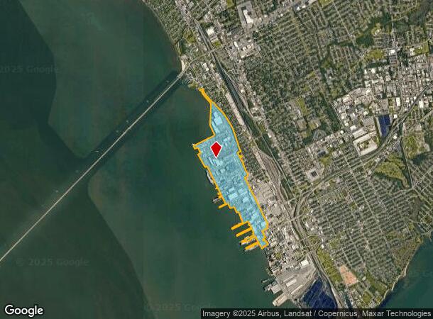
5701 Huntington Ave, Newport News, VA 23607
NEARBY LISTINGS FOR SALE OR LEASE
-
-
View all Newport News listings for sale on LoopNet.com
Property Detail
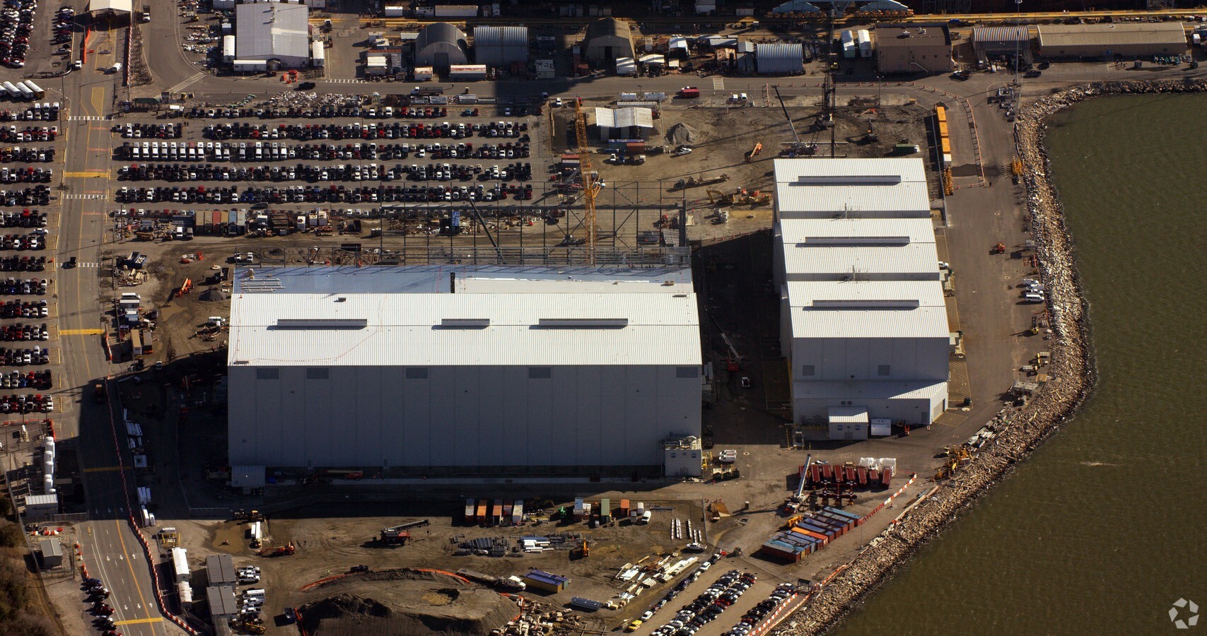
5701 Huntington Ave
291.00-01-01
Ward 4
Industrialgeneral
444.26AC N & S YARD ET ALS
AE
Newport News
51093C0177E
Virginia
2023
444.26 AC
2024
Downtown Newport News
031100
Hampton Roads
1 SF
Virginia Beach-Norfolk-Newport News, VA-NC
DEMOGRAPHICS near 5701 Huntington Ave
1 Mile
3 Mile
5 Mile
2024 Total Population
5,664
56,426
122,246
2029 Population
5,597
56,729
123,259
Pop Growth 2024-2029
(1.18%)
+ 0.54%
+ 0.83%
Average Age
40
39
39
2024 Total Households
2,724
24,158
51,912
HH Growth 2024-2029
(1.17%)
+ 0.49%
+ 0.85%
Median Household Inc
$49,278
$45,955
$53,077
Avg Household Size
2.00
2.20
2.20
2024 Avg HH Vehicles
1.00
2.00
2.00
Median Home Value
$155,495
$175,039
$198,300
Median Year Built
1974
1965
1968
Nearby Places
- Restaurants
- Banks
- Shops
- Fitness
- Groceries
PUBLIC TRANSPORTATION
COMMUTER RAIL
Newport News (Northeast Regional - Amtrak)
DRIVE
WALK
Distance
Newport News (Northeast Regional - Amtrak)
7 min
2.4 mi
AIRPORT
Newport News/Williamsburg International
DRIVE
WALK
Distance
Newport News/Williamsburg International
25 min
11.6 mi
Norfolk International
DRIVE
WALK
Distance
Norfolk International
38 min
23.5 mi
Freight Ports
Virginia Port Authority - Newport News
DRIVE
WALK
Distance
Virginia Port Authority - Newport News
7 min
2.2 mi
Nearby Properties
Address
Land Use
TOTAL SIZE
Lot Size
Zoning
Address
Land Use
TOTAL SIZE
Lot Size
Zoning
2,993 SF
169.83 AC
M2
Address
Land Use
TOTAL SIZE
Lot Size
Zoning
110,881 SF
2.30 AC
C3
Address
Land Use
TOTAL SIZE
Lot Size
Zoning
116,905 SF
7.42 AC
C3
Address
Land Use
TOTAL SIZE
Lot Size
Zoning
135,333 SF
8.22 AC
C3
Address
Land Use
TOTAL SIZE
Lot Size
Zoning
281,232 SF
17.16 AC
9 R-M MULT
Address
Land Use
TOTAL SIZE
Lot Size
Zoning
7,362 SF
19.76 AC
9 R-M MULT
Address
Land Use
TOTAL SIZE
Lot Size
Zoning
260,228 SF
37.04 AC
M1
Address
Land Use
TOTAL SIZE
Lot Size
Zoning
100 SF
35.50 AC
R7
Address
Land Use
TOTAL SIZE
Lot Size
Zoning
100 SF
26.21 AC
R7
Address
Land Use
TOTAL SIZE
Lot Size
Zoning
60,350 SF
27.53 AC
M1
Address
Land Use
TOTAL SIZE
Lot Size
Zoning
255,906 SF
36.57 AC
P1
Address
Land Use
TOTAL SIZE
Lot Size
Zoning
195,709 SF
1.52 AC
C3
Address
Land Use
TOTAL SIZE
Lot Size
Zoning
1 SF
101 AC
M2
Address
Land Use
TOTAL SIZE
Lot Size
Zoning
94,032 SF
1.64 AC
C3
Address
Land Use
TOTAL SIZE
Lot Size
Zoning
31,855 SF
4.37 AC
C3
Address
Land Use
TOTAL SIZE
Lot Size
Zoning
11,941 SF
61.74 AC
M2
Address
Land Use
TOTAL SIZE
Lot Size
Zoning
123,236 SF
24.90 AC
14 C-2 LIM
Address
Land Use
TOTAL SIZE
Lot Size
Zoning
458,744 SF
28.01 AC
17 M-3 HEA
Address
Land Use
TOTAL SIZE
Lot Size
Zoning
53,551 SF
9.87 AC
P1
Address
Land Use
TOTAL SIZE
Lot Size
Zoning
1 SF
16.10 AC
M2
Address
Land Use
TOTAL SIZE
Lot Size
Zoning
133,633 SF
5.39 AC
C3
Address
Land Use
TOTAL SIZE
Lot Size
Zoning
100 SF
22.45 AC
R8 R4
Address
Land Use
TOTAL SIZE
Lot Size
Zoning
1 SF
19.69 AC
M2
Address
Land Use
TOTAL SIZE
Lot Size
Zoning
83,907 SF
33.80 AC
P1
Address
Land Use
TOTAL SIZE
Lot Size
Zoning
14,784 SF
10.56 AC
9 R-M MULT
Address
Land Use
TOTAL SIZE
Lot Size
Zoning
1.05 AC
C3
Address
Land Use
TOTAL SIZE
Lot Size
Zoning
67,134 SF
11.90 AC
C1
Address
Land Use
TOTAL SIZE
Lot Size
Zoning
10.89 AC
R8
Address
Land Use
TOTAL SIZE
Lot Size
Zoning
4,600 SF
9.43 AC
9 R-M MULT
The World's #1 Commercial Real Estate Marketplace
Connect with us
© 2025 CoStar Group
The information above has been obtained from sources believed reliable. While we do not doubt its accuracy we have not verified it and make no guarantee, warranty or representation about it. It is your responsibility to independently confirm its accuracy and completeness. Any projections, opinions, assumptions, or estimates used are for example only and do not represent the current or future performance of the property. The value of this transaction to you depends on tax and other factors which should be evaluated by your tax, financial, and legal advisors. You and your advisors should conduct a careful, independent investigation of the property to determine to your satisfaction the suitability of the property for your needs.