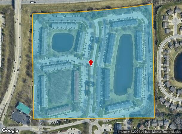
Property Record
5726 Seneca Dr, Mishawaka, IN 46545


NEARBY LISTINGS FOR SALE OR LEASE
Property Detail
5726 Seneca Dr
71-04-27-301-002.000-036
NW SW SEC 27-38-3E LYG S OF & ADJ TO TOLL ROAD 29.14 ACS ANNEXED FROM 6-1012-0173
Apartment
St Joseph
X
Indiana
18141C0208D
29.14 AC
2022
Mishawaka
2023
South Bend/Mishawaka
011505
South Bend-Mishawaka, IN-MI
410,568 SF
DEMOGRAPHICS near 5726 Seneca Dr
1 Mile
3 Mile
5 Mile
2024 Total Population
5,530
56,286
148,199
2029 Population
5,493
56,002
147,976
Pop Growth 2024-2029
(0.67%)
(0.50%)
(0.15%)
Average Age
39
39
38
2024 Total Households
2,630
22,737
58,957
HH Growth 2024-2029
(0.57%)
(0.41%)
(0.09%)
Median Household Inc
$63,770
$62,356
$61,683
Avg Household Size
2.00
2.20
2.30
2024 Avg HH Vehicles
2.00
2.00
2.00
Median Home Value
$229,725
$199,147
$173,139
Median Year Built
1990
1979
1970
Nearby Places
- Restaurants
- Banks
- Shops
- Fitness
- Groceries
PUBLIC TRANSPORTATION
COMMUTER RAIL
South Bend Amtrak Station (Capitol Limited - Amtrak, Lake Shore Limited - Amtrak)
DRIVE
WALK
Distance
South Bend Amtrak Station (Capitol Limited - Amtrak, Lake Shore Limited - Amtrak)
17 min
7.3 mi
South Bend Airport Station (South Shore Line - Northern Indiana Commuter Transportation District (South Shore Line))
DRIVE
WALK
Distance
South Bend Airport Station (South Shore Line - Northern Indiana Commuter Transportation District (South Shore Line))
19 min
8.9 mi
AIRPORT
South Bend International
DRIVE
WALK
Distance
South Bend International
29 min
11.1 mi
Freight Ports
Port Milwaukee
DRIVE
WALK
Distance
Port Milwaukee
224 min
182.5 mi
Nearby Properties
Address
Land Use
TOTAL SIZE
Lot Size
Zoning
Address
Land Use
TOTAL SIZE
Lot Size
Zoning
625,641 SF
89.04 AC
Address
Land Use
TOTAL SIZE
Lot Size
Zoning
685,516 SF
62.26 AC
Address
Land Use
TOTAL SIZE
Lot Size
Zoning
529,154 SF
30.30 AC
Address
Land Use
TOTAL SIZE
Lot Size
Zoning
276,540 SF
13.81 AC
Address
Land Use
TOTAL SIZE
Lot Size
Zoning
426,478 SF
6 AC
Address
Land Use
TOTAL SIZE
Lot Size
Zoning
276,683 SF
30.53 AC
Address
Land Use
TOTAL SIZE
Lot Size
Zoning
254,564 SF
Address
Land Use
TOTAL SIZE
Lot Size
Zoning
599,502 SF
39.10 AC
Address
Land Use
TOTAL SIZE
Lot Size
Zoning
239,363 SF
8.26 AC
Address
Land Use
TOTAL SIZE
Lot Size
Zoning
195,495 SF
17.90 AC
Address
Land Use
TOTAL SIZE
Lot Size
Zoning
146,854 SF
11.57 AC
Address
Land Use
TOTAL SIZE
Lot Size
Zoning
18,028 SF
80.67 AC
Address
Land Use
TOTAL SIZE
Lot Size
Zoning
802,926 SF
49.31 AC
Address
Land Use
TOTAL SIZE
Lot Size
Zoning
140,994 SF
13.58 AC
Address
Land Use
TOTAL SIZE
Lot Size
Zoning
331,913 SF
30 AC
Address
Land Use
TOTAL SIZE
Lot Size
Zoning
146,337 SF
20.82 AC
Address
Land Use
TOTAL SIZE
Lot Size
Zoning
347,751 SF
32.52 AC
Address
Land Use
TOTAL SIZE
Lot Size
Zoning
192,770 SF
12.21 AC
Address
Land Use
TOTAL SIZE
Lot Size
Zoning
151,852 SF
0.86 AC
Address
Land Use
TOTAL SIZE
Lot Size
Zoning
360,056 SF
19.59 AC
Address
Land Use
TOTAL SIZE
Lot Size
Zoning
124,260 SF
5.68 AC
Address
Land Use
TOTAL SIZE
Lot Size
Zoning
87,409 SF
15.88 AC
Address
Land Use
TOTAL SIZE
Lot Size
Zoning
97,681 SF
8.61 AC
Address
Land Use
TOTAL SIZE
Lot Size
Zoning
147,760 SF
17.87 AC
Address
Land Use
TOTAL SIZE
Lot Size
Zoning
218,000 SF
24.56 AC
Address
Land Use
TOTAL SIZE
Lot Size
Zoning
148,214 SF
18.11 AC
Address
Land Use
TOTAL SIZE
Lot Size
Zoning
85,367 SF
5.67 AC
Address
Land Use
TOTAL SIZE
Lot Size
Zoning
583,276 SF
40 AC
Address
Land Use
TOTAL SIZE
Lot Size
Zoning
54,226 SF
4.65 AC
The World's #1 Commercial Real Estate Marketplace
Connect with us
© 2025 CoStar Group
The information above has been obtained from sources believed reliable. While we do not doubt its accuracy we have not verified it and make no guarantee, warranty or representation about it. It is your responsibility to independently confirm its accuracy and completeness. Any projections, opinions, assumptions, or estimates used are for example only and do not represent the current or future performance of the property. The value of this transaction to you depends on tax and other factors which should be evaluated by your tax, financial, and legal advisors. You and your advisors should conduct a careful, independent investigation of the property to determine to your satisfaction the suitability of the property for your needs.