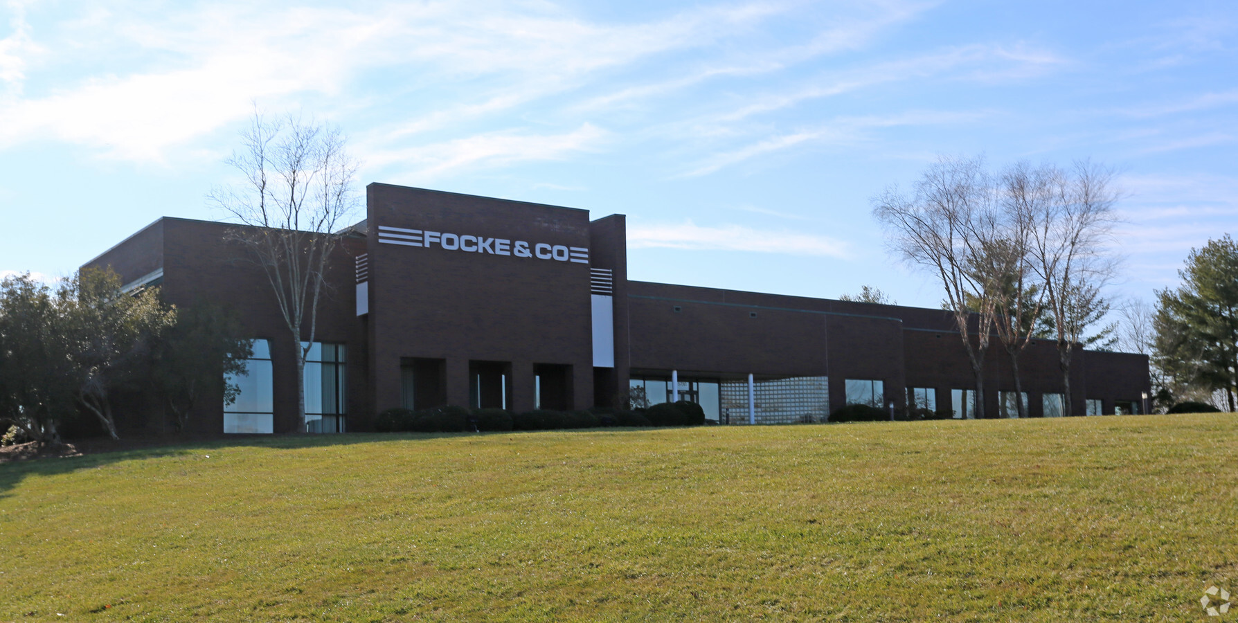
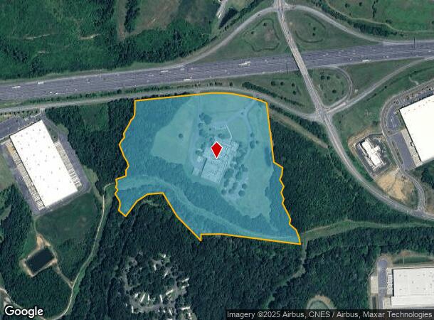
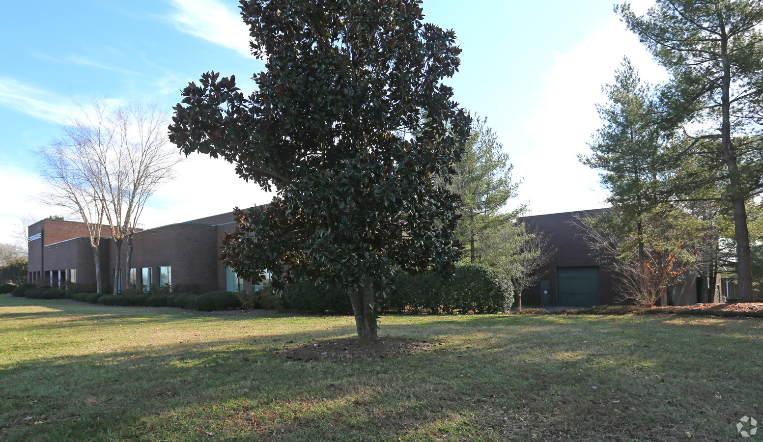
Property Record
5730 Millstream Rd, Whitsett, NC 27377
NEARBY LISTINGS FOR SALE OR LEASE
Property Detail
5730 Millstream Rd
0108811
35.67 AC
Industrialgeneral
Guilford
AE
North Carolina
3710881400J
35
2023
35.67 AC
2023
SE Guilford County
017200
Greensboro/Winston-Salem
88,524 SF
Greensboro-High Point, NC
DEMOGRAPHICS near 5730 Millstream Rd
1 Mile
3 Mile
5 Mile
2024 Total Population
2,015
11,074
32,068
2029 Population
2,008
11,104
32,677
Pop Growth 2024-2029
(0.35%)
+ 0.27%
+ 1.90%
Average Age
42
40
40
2024 Total Households
827
4,428
12,657
HH Growth 2024-2029
(0.36%)
+ 0.18%
+ 1.98%
Median Household Inc
$102,847
$79,238
$77,165
Avg Household Size
2.40
2.50
2.50
2024 Avg HH Vehicles
2.00
2.00
2.00
Median Home Value
$247,941
$229,425
$223,651
Median Year Built
1998
2000
2001
Nearby Places
- Restaurants
- Banks
- Shops
- Fitness
- Groceries
PUBLIC TRANSPORTATION
AIRPORT
Piedmont Triad International
DRIVE
WALK
Distance
Piedmont Triad International
35 min
22.3 mi
Freight Ports
Virginia Port Authority - Richmond
DRIVE
WALK
Distance
Virginia Port Authority - Richmond
214 min
186.8 mi
Nearby Properties
Address
Land Use
TOTAL SIZE
Lot Size
Zoning
Address
Land Use
TOTAL SIZE
Lot Size
Zoning
495,088 SF
105.18 AC
LI
Address
Land Use
TOTAL SIZE
Lot Size
Zoning
414,500 SF
103.57 AC
PI
Address
Land Use
TOTAL SIZE
Lot Size
Zoning
531,300 SF
29.40 AC
LI
Address
Land Use
TOTAL SIZE
Lot Size
Zoning
297,670 SF
37.41 AC
LI
Address
Land Use
TOTAL SIZE
Lot Size
Zoning
475,200 SF
46.54 AC
LI
Address
Land Use
TOTAL SIZE
Lot Size
Zoning
93,763 SF
33.51 AC
LI
Address
Land Use
TOTAL SIZE
Lot Size
Zoning
173,361 SF
20.81 AC
BP
Address
Land Use
TOTAL SIZE
Lot Size
Zoning
300,464 SF
19.67 AC
LI
Address
Land Use
TOTAL SIZE
Lot Size
Zoning
235,503 SF
38.75 AC
LI
Address
Land Use
TOTAL SIZE
Lot Size
Zoning
246,317 SF
18.72 AC
CU-PDR
Address
Land Use
TOTAL SIZE
Lot Size
Zoning
260,000 SF
20.35 AC
LI
Address
Land Use
TOTAL SIZE
Lot Size
Zoning
240,155 SF
21.72 AC
LI
Address
Land Use
TOTAL SIZE
Lot Size
Zoning
162,161 SF
19.18 AC
CU-RM-8
Address
Land Use
TOTAL SIZE
Lot Size
Zoning
652,985 SF
104.62 AC
BP
Address
Land Use
TOTAL SIZE
Lot Size
Zoning
271,850 SF
25.24 AC
LI
Address
Land Use
TOTAL SIZE
Lot Size
Zoning
85,715 SF
15.34 AC
CU-PDM
Address
Land Use
TOTAL SIZE
Lot Size
Zoning
215,233 SF
18.98 AC
LI
Address
Land Use
TOTAL SIZE
Lot Size
Zoning
92,497 SF
22.35 AC
LI
Address
Land Use
TOTAL SIZE
Lot Size
Zoning
146,028 SF
11.36 AC
BP
Address
Land Use
TOTAL SIZE
Lot Size
Zoning
86,400 SF
7.11 AC
BP
Address
Land Use
TOTAL SIZE
Lot Size
Zoning
158,080 SF
16.35 AC
LI
Address
Land Use
TOTAL SIZE
Lot Size
Zoning
90,000 SF
8.95 AC
LI
Address
Land Use
TOTAL SIZE
Lot Size
Zoning
37,100 SF
3.53 AC
CD-SC
Address
Land Use
TOTAL SIZE
Lot Size
Zoning
58,144 SF
10.84 AC
CD-SC
Address
Land Use
TOTAL SIZE
Lot Size
Zoning
218,126 SF
22.41 AC
LI
Address
Land Use
TOTAL SIZE
Lot Size
Zoning
136,934 SF
14.80 AC
CU-PDR
Address
Land Use
TOTAL SIZE
Lot Size
Zoning
112,837 SF
15.22 AC
LI
Address
Land Use
TOTAL SIZE
Lot Size
Zoning
57,829 SF
2.65 AC
LI
Address
Land Use
TOTAL SIZE
Lot Size
Zoning
106,884 SF
15 AC
LI
Address
Land Use
TOTAL SIZE
Lot Size
Zoning
45,878 SF
1.68 AC
LI
The World's #1 Commercial Real Estate Marketplace
Connect with us
© 2025 CoStar Group
The information above has been obtained from sources believed reliable. While we do not doubt its accuracy we have not verified it and make no guarantee, warranty or representation about it. It is your responsibility to independently confirm its accuracy and completeness. Any projections, opinions, assumptions, or estimates used are for example only and do not represent the current or future performance of the property. The value of this transaction to you depends on tax and other factors which should be evaluated by your tax, financial, and legal advisors. You and your advisors should conduct a careful, independent investigation of the property to determine to your satisfaction the suitability of the property for your needs.