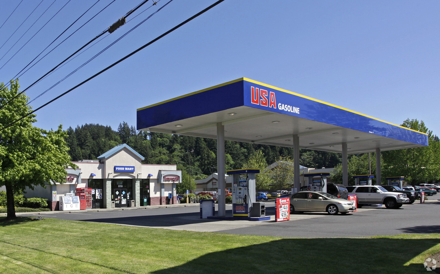
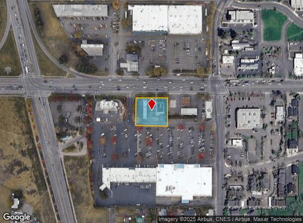
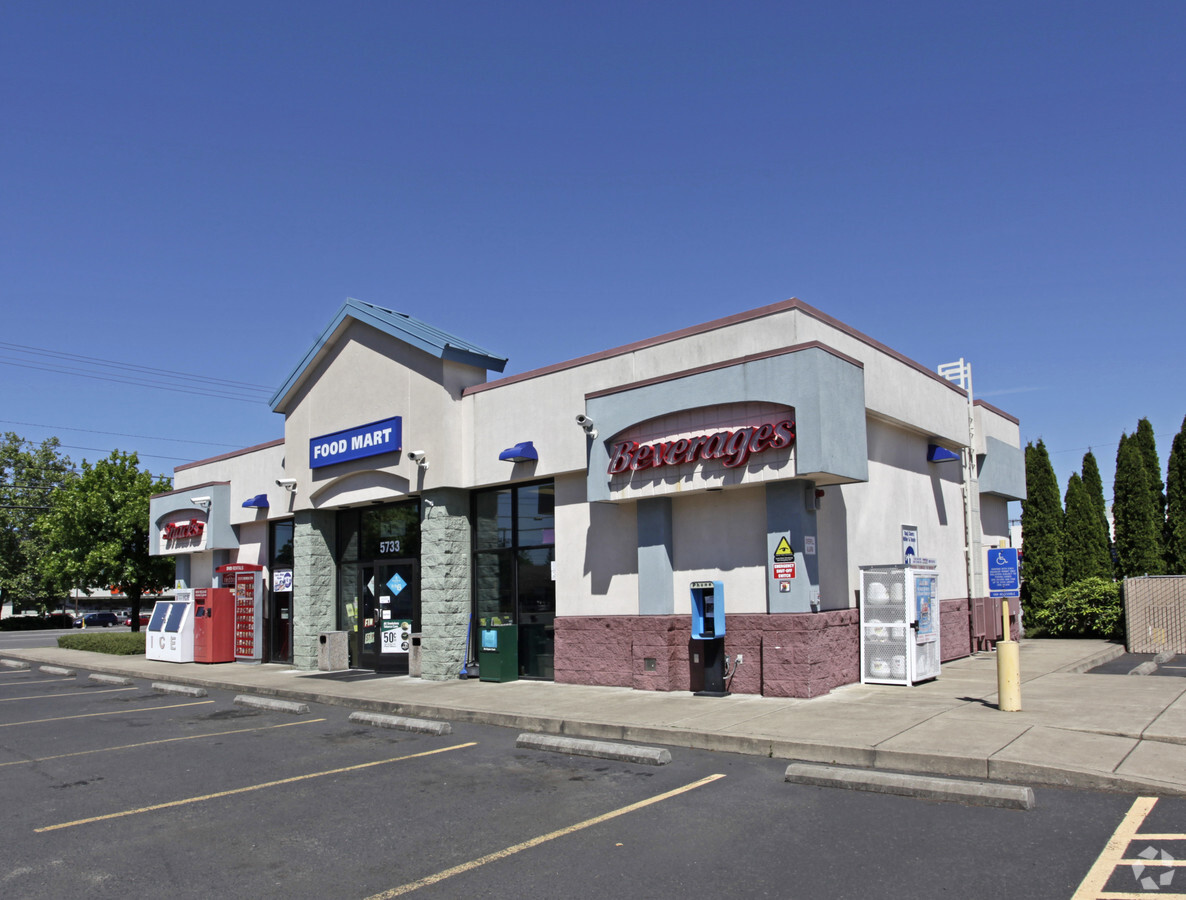
Property Record
5733 Main St, Springfield, OR 97478
NEARBY LISTINGS FOR SALE OR LEASE
Property Detail
5733 Main St
Eugene, OR
TL 03900
1723608
Lane
Commercialbuilding
Oregon
X
3900
41039C1166F
0.65 AC
2023
Lane County
2023
Portland
0018013000
DEMOGRAPHICS near 5733 Main St
1 Mile
3 Mile
5 Mile
2024 Total Population
12,834
33,528
60,465
2029 Population
12,814
33,556
60,453
Pop Growth 2024-2029
(0.16%)
+ 0.08%
(0.02%)
Average Age
41
39
40
2024 Total Households
4,927
12,417
23,619
HH Growth 2024-2029
(0.35%)
(0.02%)
(0.10%)
Median Household Inc
$63,148
$68,950
$63,986
Avg Household Size
2.50
2.60
2.50
2024 Avg HH Vehicles
2.00
2.00
2.00
Median Home Value
$300,056
$318,324
$328,472
Median Year Built
1977
1978
1974
Nearby Places
- Restaurants
- Banks
- Shops
- Fitness
- Groceries
PUBLIC TRANSPORTATION
COMMUTER RAIL
Eugene (Amtrak Cascades - Amtrak, Coast Starlight - Amtrak)
DRIVE
WALK
Distance
Eugene (Amtrak Cascades - Amtrak, Coast Starlight - Amtrak)
13 min
9.5 mi
AIRPORT
Mahlon Sweet Field
DRIVE
WALK
Distance
Mahlon Sweet Field
28 min
17.9 mi
Freight Ports
Port of Coos Bay, OR
DRIVE
WALK
Distance
Port of Coos Bay, OR
164 min
117.9 mi
Nearby Properties
Address
Land Use
TOTAL SIZE
Lot Size
Zoning
Address
Land Use
TOTAL SIZE
Lot Size
Zoning
Address
Land Use
TOTAL SIZE
Lot Size
Zoning
179 AC
E30
Address
Land Use
TOTAL SIZE
Lot Size
Zoning
22.52 AC
LD
Address
Land Use
TOTAL SIZE
Lot Size
Zoning
50.28 AC
LD
Address
Land Use
TOTAL SIZE
Lot Size
Zoning
Address
Land Use
TOTAL SIZE
Lot Size
Zoning
27.44 AC
LD
Address
Land Use
TOTAL SIZE
Lot Size
Zoning
Address
Land Use
TOTAL SIZE
Lot Size
Zoning
11.12 AC
HI
Address
Land Use
TOTAL SIZE
Lot Size
Zoning
9.19 AC
E25
Address
Land Use
TOTAL SIZE
Lot Size
Zoning
5.39 AC
LD
Address
Land Use
TOTAL SIZE
Lot Size
Zoning
15.54 AC
HI
Address
Land Use
TOTAL SIZE
Lot Size
Zoning
3.58 AC
HD
Address
Land Use
TOTAL SIZE
Lot Size
Zoning
13.84 AC
HD
Address
Land Use
TOTAL SIZE
Lot Size
Zoning
9.23 AC
LD
Address
Land Use
TOTAL SIZE
Lot Size
Zoning
18.70 AC
E30
Address
Land Use
TOTAL SIZE
Lot Size
Zoning
7.78 AC
LD
Address
Land Use
TOTAL SIZE
Lot Size
Zoning
5.88 AC
LD
Address
Land Use
TOTAL SIZE
Lot Size
Zoning
119.05 AC
E30
Address
Land Use
TOTAL SIZE
Lot Size
Zoning
4.47 AC
CC
Address
Land Use
TOTAL SIZE
Lot Size
Zoning
5.14 AC
LD
Address
Land Use
TOTAL SIZE
Lot Size
Zoning
5.09 AC
LD
Address
Land Use
TOTAL SIZE
Lot Size
Zoning
3.92 AC
CC
Address
Land Use
TOTAL SIZE
Lot Size
Zoning
7.79 AC
E30
Address
Land Use
TOTAL SIZE
Lot Size
Zoning
6.58 AC
LD
Address
Land Use
TOTAL SIZE
Lot Size
Zoning
9.93 AC
LD
Address
Land Use
TOTAL SIZE
Lot Size
Zoning
5.94 AC
HI
Address
Land Use
TOTAL SIZE
Lot Size
Zoning
32.97 AC
E30
Address
Land Use
TOTAL SIZE
Lot Size
Zoning
3.49 AC
HI
Address
Land Use
TOTAL SIZE
Lot Size
Zoning
46.87 AC
E30
Address
Land Use
TOTAL SIZE
Lot Size
Zoning
5.40 AC
HI
The World's #1 Commercial Real Estate Marketplace
Connect with us
© 2025 CoStar Group
The information above has been obtained from sources believed reliable. While we do not doubt its accuracy we have not verified it and make no guarantee, warranty or representation about it. It is your responsibility to independently confirm its accuracy and completeness. Any projections, opinions, assumptions, or estimates used are for example only and do not represent the current or future performance of the property. The value of this transaction to you depends on tax and other factors which should be evaluated by your tax, financial, and legal advisors. You and your advisors should conduct a careful, independent investigation of the property to determine to your satisfaction the suitability of the property for your needs.