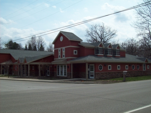
Property Record
5735 E Lake Rd, Erie, PA 16511
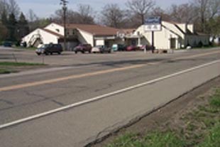
NEARBY LISTINGS FOR SALE OR LEASE
-
-
View all Erie listings for sale on LoopNet.com
Property Detail
5735 E Lake Rd
27-020-042.0-007.00
Butt Heirs Farm Subdivision
Officebuilding
5735 E LAKE RD 1.59 AC
AE
Erie
42049C0086E
Pennsylvania
2024
1.59 AC
2024
Outlying Erie County
011509
Erie
12,567 SF
Erie, PA
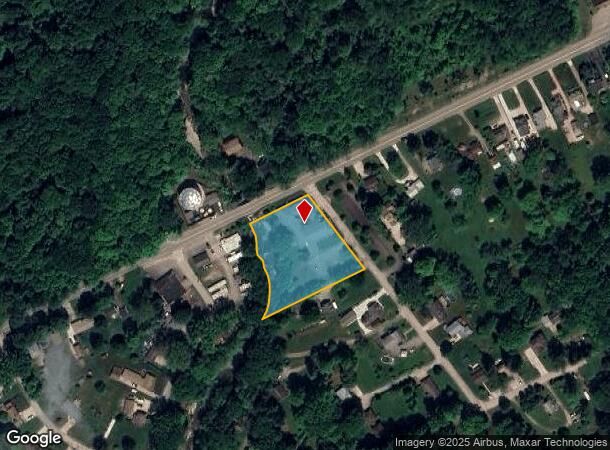
DEMOGRAPHICS near 5735 E Lake Rd
1 Mile
3 Mile
5 Mile
2024 Total Population
2,346
16,257
45,512
2029 Population
2,330
16,113
44,929
Pop Growth 2024-2029
(0.68%)
(0.89%)
(1.28%)
Average Age
47
44
40
2024 Total Households
974
6,545
17,499
HH Growth 2024-2029
(0.62%)
(0.99%)
(1.41%)
Median Household Inc
$58,153
$65,980
$56,553
Avg Household Size
2.30
2.40
2.40
2024 Avg HH Vehicles
2.00
2.00
2.00
Median Home Value
$183,050
$165,552
$136,133
Median Year Built
1968
1964
1960
Nearby Places
- Restaurants
- Banks
- Shops
- Fitness
- Groceries
PUBLIC TRANSPORTATION
COMMUTER RAIL
Erie Amtrak Station (Lake Shore Limited - Amtrak)
DRIVE
WALK
Distance
Erie Amtrak Station (Lake Shore Limited - Amtrak)
14 min
6.9 mi
AIRPORT
Erie International/Tom Ridge Field
DRIVE
WALK
Distance
Erie International/Tom Ridge Field
24 min
12.6 mi
Freight Ports
Port of Toledo
DRIVE
WALK
Distance
Port of Toledo
265 min
222.0 mi
SALE & LEASE HISTORY
LISTING DATE
SALE/LEASE

Sep 23, 2016
For Sale
Oct 05, 2016
For Sale
Oct 05, 2016
For Lease
Nov 20, 2018
For Lease
Mar 16, 2020
For Sale
Nearby Properties
Address
Land Use
TOTAL SIZE
Lot Size
Zoning
Address
Land Use
TOTAL SIZE
Lot Size
Zoning
227,630 SF
343.90 AC
I1
Address
Land Use
TOTAL SIZE
Lot Size
Zoning
75.24 AC
R2A
Address
Land Use
TOTAL SIZE
Lot Size
Zoning
92,635 SF
8.45 AC
B1
Address
Land Use
TOTAL SIZE
Lot Size
Zoning
23.31 AC
C1
Address
Land Use
TOTAL SIZE
Lot Size
Zoning
189,305 SF
42.45 AC
B1
Address
Land Use
TOTAL SIZE
Lot Size
Zoning
9.38 AC
C1
Address
Land Use
TOTAL SIZE
Lot Size
Zoning
121,197 SF
7.58 AC
Address
Land Use
TOTAL SIZE
Lot Size
Zoning
62.79 AC
R2B
Address
Land Use
TOTAL SIZE
Lot Size
Zoning
4.76 AC
R3
Address
Land Use
TOTAL SIZE
Lot Size
Zoning
13,620 SF
1.21 AC
B1
Address
Land Use
TOTAL SIZE
Lot Size
Zoning
202,500 SF
46.30 AC
I
Address
Land Use
TOTAL SIZE
Lot Size
Zoning
75,487 SF
7.32 AC
R3
Address
Land Use
TOTAL SIZE
Lot Size
Zoning
70,022 SF
9.07 AC
B1
Address
Land Use
TOTAL SIZE
Lot Size
Zoning
51.13 AC
R2A
Address
Land Use
TOTAL SIZE
Lot Size
Zoning
37,926 SF
52.49 AC
R2A
Address
Land Use
TOTAL SIZE
Lot Size
Zoning
10.50 AC
R2A
Address
Land Use
TOTAL SIZE
Lot Size
Zoning
148,072 SF
13.90 AC
R2B
Address
Land Use
TOTAL SIZE
Lot Size
Zoning
30,144 SF
3.03 AC
I
Address
Land Use
TOTAL SIZE
Lot Size
Zoning
48,432 SF
6.71 AC
R3
Address
Land Use
TOTAL SIZE
Lot Size
Zoning
273,835 SF
23.05 AC
R1
Address
Land Use
TOTAL SIZE
Lot Size
Zoning
14.13 AC
R1
Address
Land Use
TOTAL SIZE
Lot Size
Zoning
64,237 SF
9 AC
R2A
Address
Land Use
TOTAL SIZE
Lot Size
Zoning
22.14 AC
R1
Address
Land Use
TOTAL SIZE
Lot Size
Zoning
44,488 SF
16.58 AC
R2A
Address
Land Use
TOTAL SIZE
Lot Size
Zoning
49,104 SF
22.72 AC
R2B
Address
Land Use
TOTAL SIZE
Lot Size
Zoning
1.18 AC
Address
Land Use
TOTAL SIZE
Lot Size
Zoning
34,860 SF
3.60 AC
R3
Address
Land Use
TOTAL SIZE
Lot Size
Zoning
23,712 SF
147.14 AC
C1
Address
Land Use
TOTAL SIZE
Lot Size
Zoning
18,324 SF
1.96 AC
B1
Address
Land Use
TOTAL SIZE
Lot Size
Zoning
19.28 AC
R2B
The World's #1 Commercial Real Estate Marketplace
Connect with us
© 2025 CoStar Group
The information above has been obtained from sources believed reliable. While we do not doubt its accuracy we have not verified it and make no guarantee, warranty or representation about it. It is your responsibility to independently confirm its accuracy and completeness. Any projections, opinions, assumptions, or estimates used are for example only and do not represent the current or future performance of the property. The value of this transaction to you depends on tax and other factors which should be evaluated by your tax, financial, and legal advisors. You and your advisors should conduct a careful, independent investigation of the property to determine to your satisfaction the suitability of the property for your needs.