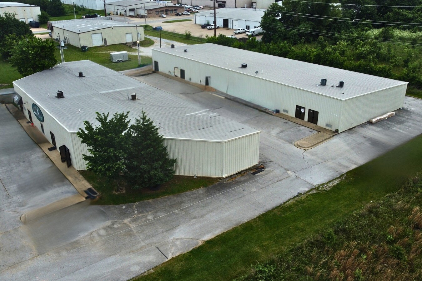
Property Record
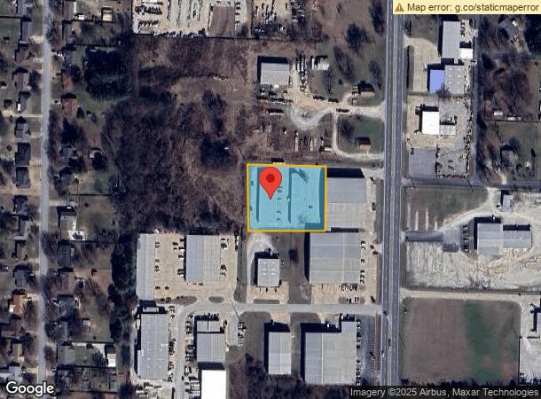
5764 N Thompson St, Springdale, AR 72764
Current Lease Availabilities
NEARBY LISTINGS FOR SALE OR LEASE
Property Detail
5764 N Thompson St
21-00116-040
Springdale
Industrialgeneral
A PART OF THE NE 1/4 OF THE NE 1/4 OF SECTION 14, TOWNSHIP 18 NORTH, RANGE 30 WEST, BENTON COUNTY, ARKANSAS, BEING MORE PARTICULARLY DESCRIBED AS FOLLOWS: COMMENCING AT THE SE CORNER OF SAID 40 ACRE TRACT, BEING ON THE CENTERLINE OF US HIGHWAY 71-B;
X
Benton
05143C0060G
Arkansas
2024
1.44 AC
2024
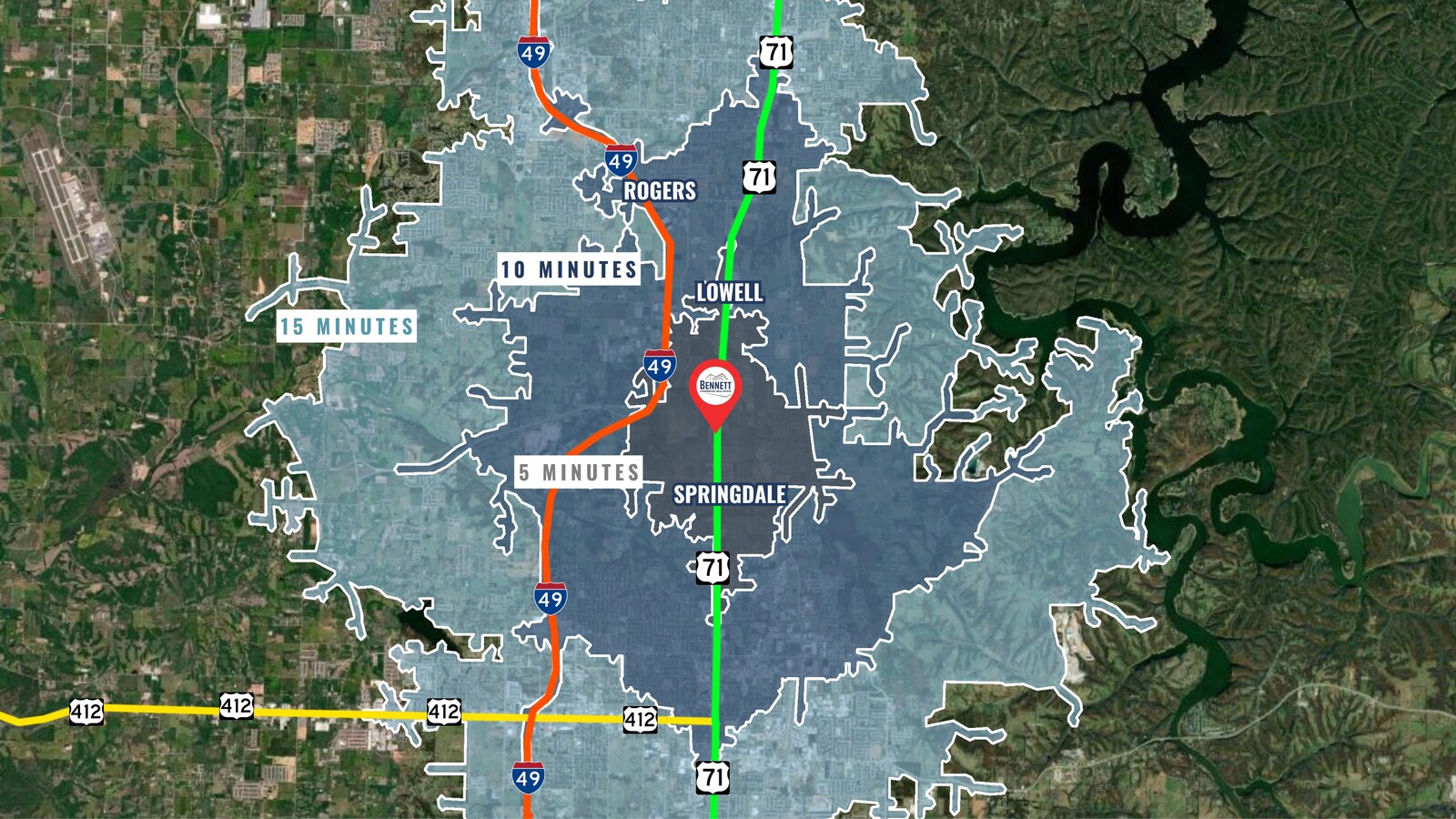
Greater Springdale
021315
Fayetteville/Springdale/Rogers
19,956 SF
Fayetteville-Springdale-Rogers, AR-MO
DEMOGRAPHICS near 5764 N Thompson St
1 Mile
3 Mile
5 Mile
2024 Total Population
3,033
32,289
102,256
2029 Population
3,554
36,787
116,107
Pop Growth 2024-2029
+ 17.18%
+ 13.93%
+ 13.55%
Average Age
35
35
34
2024 Total Households
943
10,129
32,853
HH Growth 2024-2029
+ 17.29%
+ 14.19%
+ 13.93%
Median Household Inc
$87,768
$75,483
$72,968
Avg Household Size
3.20
3.00
3.00
2024 Avg HH Vehicles
2.00
2.00
2.00
Median Home Value
$221,136
$217,178
$228,475
Median Year Built
1998
1996
1997
Nearby Places
- Restaurants
- Banks
- Shops
- Fitness
- Groceries
PUBLIC TRANSPORTATION
AIRPORT
Northwest Arkansas Regional
DRIVE
WALK
Distance
Northwest Arkansas Regional
20 min
13.3 mi
Freight Ports
Port of Shreveport
DRIVE
WALK
Distance
Port of Shreveport
1 min
269.6 mi
Nearby Properties
Address
Land Use
TOTAL SIZE
Lot Size
Zoning
Address
Land Use
TOTAL SIZE
Lot Size
Zoning
367,076 SF
57.31 AC
Address
Land Use
TOTAL SIZE
Lot Size
Zoning
251,508 SF
30 AC
Address
Land Use
TOTAL SIZE
Lot Size
Zoning
132,494 SF
21.56 AC
Address
Land Use
TOTAL SIZE
Lot Size
Zoning
306,148 SF
49.82 AC
Address
Land Use
TOTAL SIZE
Lot Size
Zoning
191,100 SF
10.03 AC
Address
Land Use
TOTAL SIZE
Lot Size
Zoning
75,610 SF
5.62 AC
Address
Land Use
TOTAL SIZE
Lot Size
Zoning
249,393 SF
10.70 AC
Address
Land Use
TOTAL SIZE
Lot Size
Zoning
174,333 SF
25 AC
I1I2
Address
Land Use
TOTAL SIZE
Lot Size
Zoning
348,916 SF
24.69 AC
Address
Land Use
TOTAL SIZE
Lot Size
Zoning
29,670 SF
5.80 AC
Address
Land Use
TOTAL SIZE
Lot Size
Zoning
127,043 SF
6.82 AC
Address
Land Use
TOTAL SIZE
Lot Size
Zoning
12,882 SF
12.33 AC
Address
Land Use
TOTAL SIZE
Lot Size
Zoning
39,793 SF
4.94 AC
Address
Land Use
TOTAL SIZE
Lot Size
Zoning
182,415 SF
68.93 AC
Address
Land Use
TOTAL SIZE
Lot Size
Zoning
61,012 SF
18.96 AC
Address
Land Use
TOTAL SIZE
Lot Size
Zoning
147,762 SF
Address
Land Use
TOTAL SIZE
Lot Size
Zoning
123,740 SF
13.96 AC
Address
Land Use
TOTAL SIZE
Lot Size
Zoning
170,442 SF
12.62 AC
Address
Land Use
TOTAL SIZE
Lot Size
Zoning
51,400 SF
14.17 AC
Address
Land Use
TOTAL SIZE
Lot Size
Zoning
65,200 SF
9.26 AC
Address
Land Use
TOTAL SIZE
Lot Size
Zoning
150,076 SF
9.55 AC
Address
Land Use
TOTAL SIZE
Lot Size
Zoning
90,860 SF
5.80 AC
Address
Land Use
TOTAL SIZE
Lot Size
Zoning
51,376 SF
5.86 AC
Address
Land Use
TOTAL SIZE
Lot Size
Zoning
84,023 SF
4.76 AC
Address
Land Use
TOTAL SIZE
Lot Size
Zoning
81,121 SF
10.99 AC
Address
Land Use
TOTAL SIZE
Lot Size
Zoning
113,482 SF
8.71 AC
Address
Land Use
TOTAL SIZE
Lot Size
Zoning
49,059 SF
2.42 AC
Address
Land Use
TOTAL SIZE
Lot Size
Zoning
68,099 SF
17.38 AC
Address
Land Use
TOTAL SIZE
Lot Size
Zoning
55,135 SF
10.22 AC
Address
Land Use
TOTAL SIZE
Lot Size
Zoning
64,932 SF
9.29 AC
The World's #1 Commercial Real Estate Marketplace
Connect with us
© 2025 CoStar Group
The information above has been obtained from sources believed reliable. While we do not doubt its accuracy we have not verified it and make no guarantee, warranty or representation about it. It is your responsibility to independently confirm its accuracy and completeness. Any projections, opinions, assumptions, or estimates used are for example only and do not represent the current or future performance of the property. The value of this transaction to you depends on tax and other factors which should be evaluated by your tax, financial, and legal advisors. You and your advisors should conduct a careful, independent investigation of the property to determine to your satisfaction the suitability of the property for your needs.