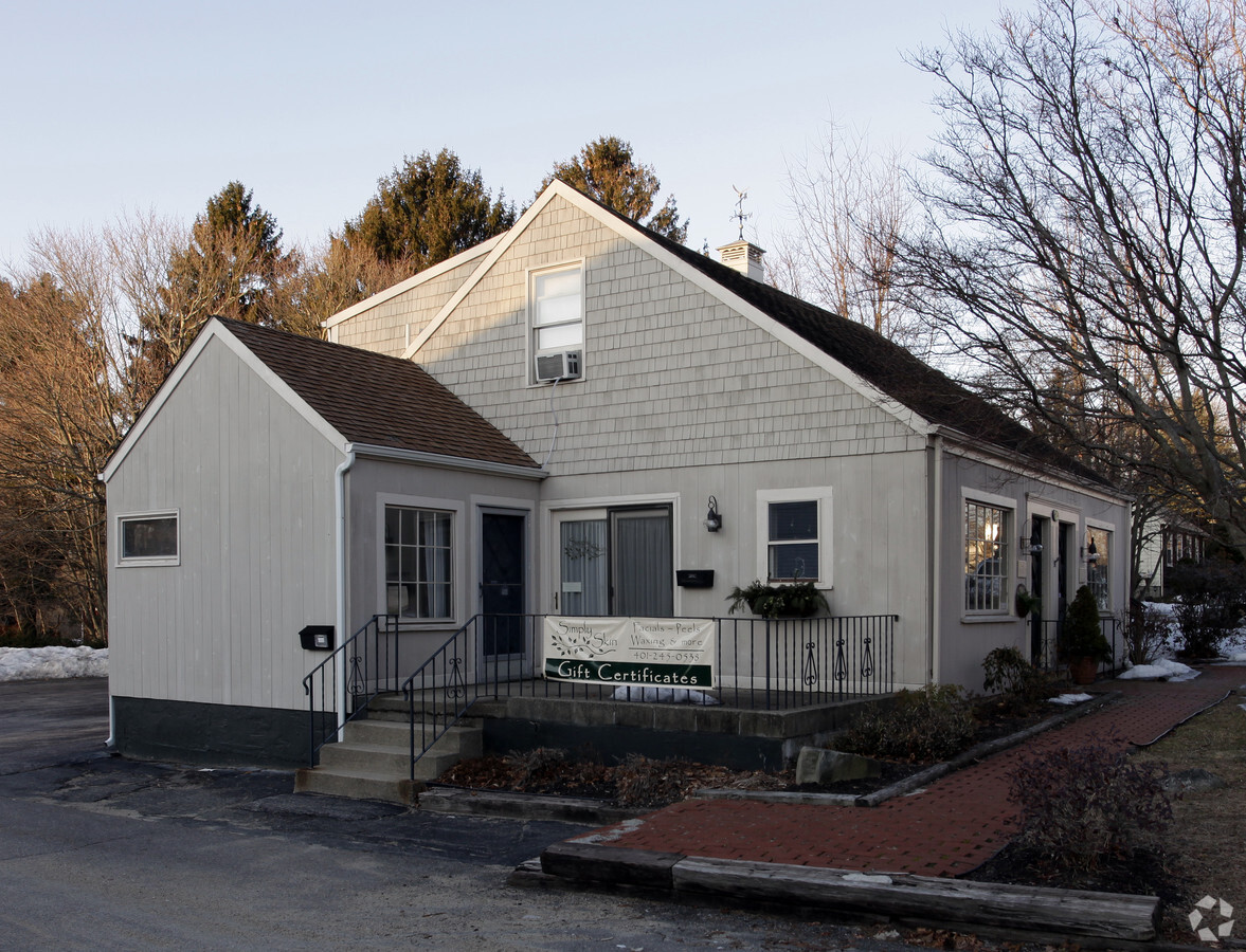
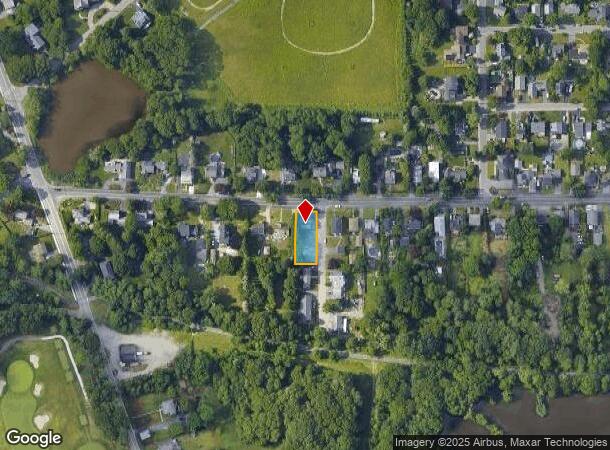
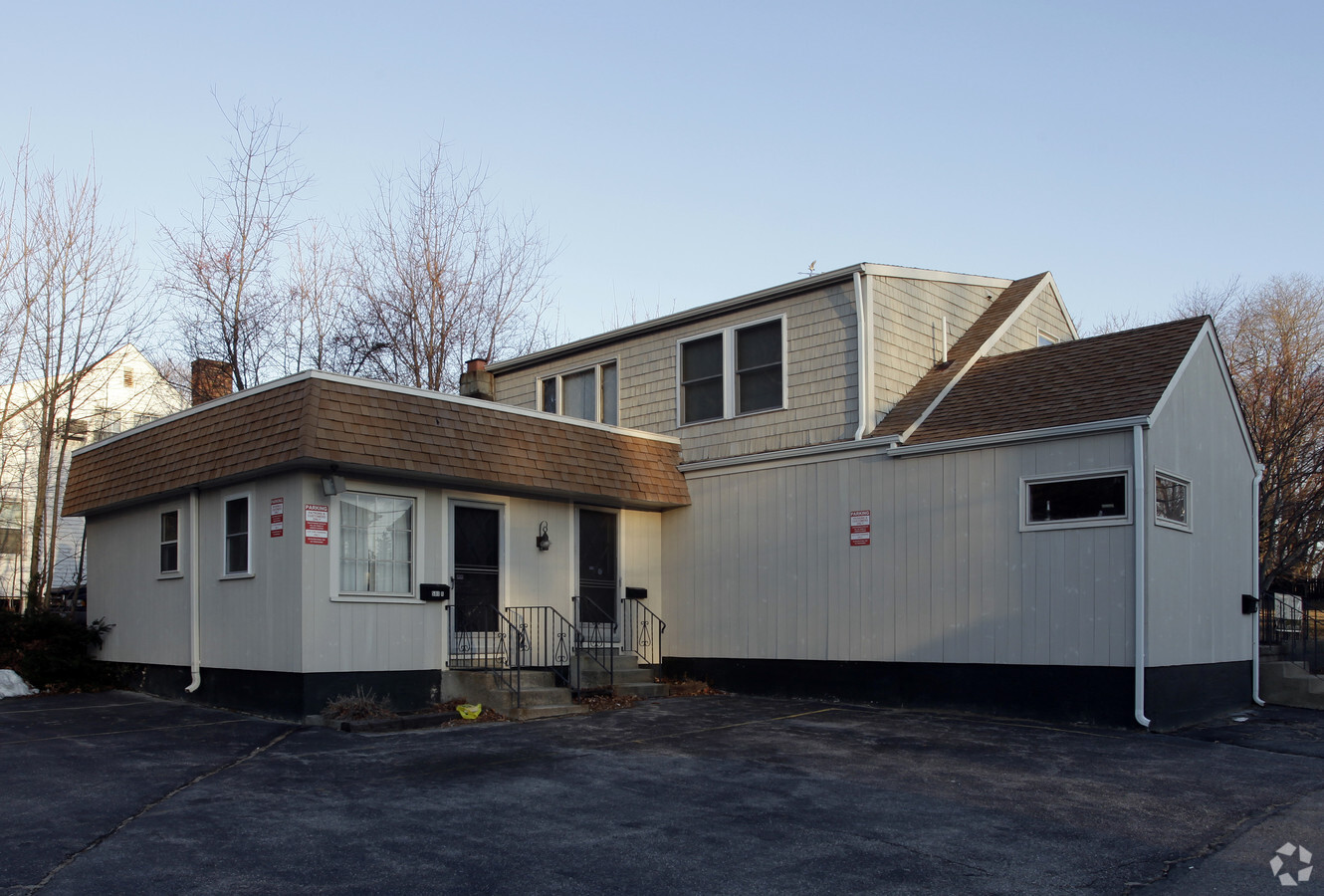
Property Record
580 Maple Ave, Barrington, RI 02806

NEARBY LISTINGS FOR SALE OR LEASE
Property Detail
580 Maple Ave
BARR-000019-000000-000023
Bristol
Commercialbuilding
Rhode Island
X
23
44003C0155G
0.23 AC
2024
Bristol County
2024
Providence
030200
Providence-Warwick, RI-MA
2,195 SF
DEMOGRAPHICS near 580 Maple Ave
1 Mile
3 Mile
5 Mile
2024 Total Population
5,090
37,705
121,112
2029 Population
5,077
37,725
121,480
Pop Growth 2024-2029
(0.26%)
+ 0.05%
+ 0.30%
Average Age
41
43
43
2024 Total Households
1,858
15,514
50,190
HH Growth 2024-2029
(0.32%)
(0.03%)
+ 0.28%
Median Household Inc
$116,730
$100,467
$87,043
Avg Household Size
2.70
2.40
2.30
2024 Avg HH Vehicles
2.00
2.00
2.00
Median Home Value
$552,802
$391,794
$349,194
Median Year Built
1955
1956
1958
Nearby Places
- Restaurants
- Banks
- Shops
- Fitness
- Groceries
PUBLIC TRANSPORTATION
COMMUTER RAIL
Providence (Providence/Stoughton Line - Massachusetts Bay Transportation Authority Commuter Rail (Purple Line))
DRIVE
WALK
Distance
Providence (Providence/Stoughton Line - Massachusetts Bay Transportation Authority Commuter Rail (Purple Line))
16 min
9.8 mi
AIRPORT
Rhode Island Tf Green International
DRIVE
WALK
Distance
Rhode Island Tf Green International
30 min
16.7 mi
Freight Ports
Port of Davisville, RI
DRIVE
WALK
Distance
Port of Davisville, RI
46 min
29.0 mi
SALE & LEASE HISTORY
LISTING DATE
SALE/LEASE

Mar 23, 2024
For Lease
Nearby Properties
Address
Land Use
TOTAL SIZE
Lot Size
Zoning
Address
Land Use
TOTAL SIZE
Lot Size
Zoning
187,151 SF
29.41 AC
RE
Address
Land Use
TOTAL SIZE
Lot Size
Zoning
367,305 SF
8.23 AC
WF
Address
Land Use
TOTAL SIZE
Lot Size
Zoning
17,500 SF
5.92 AC
WF
Address
Land Use
TOTAL SIZE
Lot Size
Zoning
183,710 SF
30.50 AC
RE
Address
Land Use
TOTAL SIZE
Lot Size
Zoning
110,031 SF
5.07 AC
EH
Address
Land Use
TOTAL SIZE
Lot Size
Zoning
9.35 AC
C1
Address
Land Use
TOTAL SIZE
Lot Size
Zoning
25.24 AC
R10
Address
Land Use
TOTAL SIZE
Lot Size
Zoning
2.71 AC
B
Address
Land Use
TOTAL SIZE
Lot Size
Zoning
6.58 AC
R5
Address
Land Use
TOTAL SIZE
Lot Size
Zoning
84,316 SF
8.15 AC
C1
Address
Land Use
TOTAL SIZE
Lot Size
Zoning
5.40 AC
WB
Address
Land Use
TOTAL SIZE
Lot Size
Zoning
4.39 AC
B
Address
Land Use
TOTAL SIZE
Lot Size
Zoning
4.60 AC
C1
Address
Land Use
TOTAL SIZE
Lot Size
Zoning
138.20 AC
RE
Address
Land Use
TOTAL SIZE
Lot Size
Zoning
53.20 AC
C1
Address
Land Use
TOTAL SIZE
Lot Size
Zoning
218.86 AC
C
Address
Land Use
TOTAL SIZE
Lot Size
Zoning
7.90 AC
RE
Address
Land Use
TOTAL SIZE
Lot Size
Zoning
31,338 SF
0.95 AC
GI
Address
Land Use
TOTAL SIZE
Lot Size
Zoning
61,743 SF
42.75 AC
R20
Address
Land Use
TOTAL SIZE
Lot Size
Zoning
19,144 SF
7.28 AC
R40
Address
Land Use
TOTAL SIZE
Lot Size
Zoning
79,010 SF
2.71 AC
EH
Address
Land Use
TOTAL SIZE
Lot Size
Zoning
39,150 SF
10.10 AC
C
Address
Land Use
TOTAL SIZE
Lot Size
Zoning
31,588 SF
18.21 AC
RE
Address
Land Use
TOTAL SIZE
Lot Size
Zoning
48,986 SF
10.33 AC
RE
Address
Land Use
TOTAL SIZE
Lot Size
Zoning
19,799 SF
13.36 AC
GI
Address
Land Use
TOTAL SIZE
Lot Size
Zoning
28,160 SF
11.36 AC
OSA
Address
Land Use
TOTAL SIZE
Lot Size
Zoning
50,973 SF
6.07 AC
R3
Address
Land Use
TOTAL SIZE
Lot Size
Zoning
64,850 SF
11.67 AC
CI
Address
Land Use
TOTAL SIZE
Lot Size
Zoning
26,446 SF
4.22 AC
GI
Address
Land Use
TOTAL SIZE
Lot Size
Zoning
4,398 SF
2.91 AC
R40
The World's #1 Commercial Real Estate Marketplace
Connect with us
© 2025 CoStar Group
The information above has been obtained from sources believed reliable. While we do not doubt its accuracy we have not verified it and make no guarantee, warranty or representation about it. It is your responsibility to independently confirm its accuracy and completeness. Any projections, opinions, assumptions, or estimates used are for example only and do not represent the current or future performance of the property. The value of this transaction to you depends on tax and other factors which should be evaluated by your tax, financial, and legal advisors. You and your advisors should conduct a careful, independent investigation of the property to determine to your satisfaction the suitability of the property for your needs.