Property Record
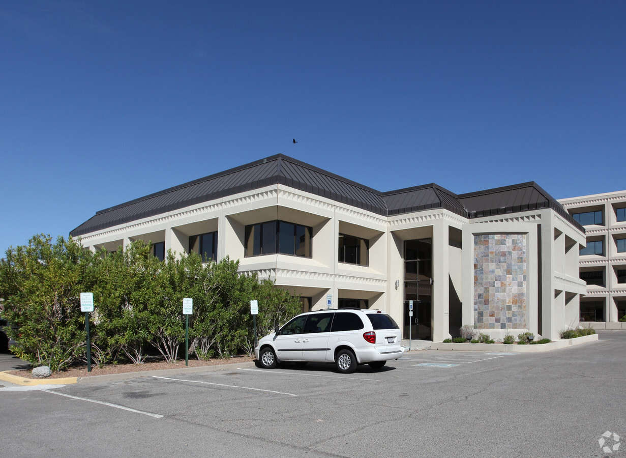
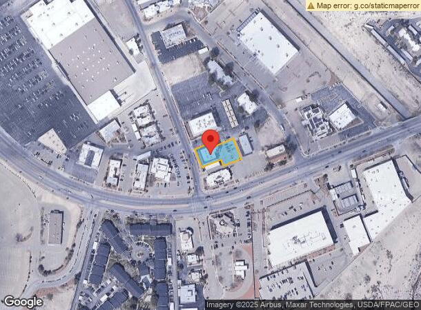
5812 Cromo Dr, El Paso, TX 79912

NEARBY LISTINGS FOR SALE OR LEASE
Property Detail
5812 Cromo Dr
El Paso, TX
Park West Replat
P395-999-0030-1000
3 PARK WEST REPLAT PT OF 1 (0.479 AC)
Commercialnec
El Paso
2023
Texas
2023
0.48 AC
001114
West
11,488 SF
El Paso
DEMOGRAPHICS near 5812 Cromo Dr
1 Mile
3 Mile
5 Mile
2024 Total Population
11,663
70,566
153,996
2029 Population
11,857
71,798
156,741
Pop Growth 2024-2029
+ 1.66%
+ 1.75%
+ 1.78%
Average Age
36
39
39
2024 Total Households
4,931
28,984
59,792
HH Growth 2024-2029
+ 1.03%
+ 1.68%
+ 1.83%
Median Household Inc
$44,700
$56,451
$57,043
Avg Household Size
2.30
2.40
2.50
2024 Avg HH Vehicles
2.00
2.00
2.00
Median Home Value
$162,326
$204,124
$205,923
Median Year Built
1985
1981
1982
Nearby Places
- Restaurants
- Banks
- Shops
- Fitness
- Groceries
PUBLIC TRANSPORTATION
AIRPORT
El Paso International
DRIVE
WALK
Distance
El Paso International
34 min
21.1 mi
Freight Ports
Port of Corpus Christi
DRIVE
WALK
Distance
Port of Corpus Christi
691 min
702.0 mi
SALE & LEASE HISTORY
LISTING DATE
SALE/LEASE

Aug 11, 2022
For Lease
Nearby Properties
Address
Land Use
TOTAL SIZE
Lot Size
Zoning
Address
Land Use
TOTAL SIZE
Lot Size
Zoning
439,669 SF
33.95 AC
A2
Address
Land Use
TOTAL SIZE
Lot Size
Zoning
587,416 SF
27.36 AC
AO
Address
Land Use
TOTAL SIZE
Lot Size
Zoning
229,489 SF
22.80 AC
R3
Address
Land Use
TOTAL SIZE
Lot Size
Zoning
191,148 SF
20.29 AC
C3
Address
Land Use
TOTAL SIZE
Lot Size
Zoning
60,057 SF
7.22 AC
SCZ
Address
Land Use
TOTAL SIZE
Lot Size
Zoning
248,997 SF
14.85 AC
C3S
Address
Land Use
TOTAL SIZE
Lot Size
Zoning
201,291 SF
43.23 AC
R3
Address
Land Use
TOTAL SIZE
Lot Size
Zoning
226,548 SF
18.50 AC
PR2
Address
Land Use
TOTAL SIZE
Lot Size
Zoning
164,712 SF
4.68 AC
GM
Address
Land Use
TOTAL SIZE
Lot Size
Zoning
246,802 SF
11.08 AC
C3
Address
Land Use
TOTAL SIZE
Lot Size
Zoning
46,534 SF
9.81 AC
C4C
Address
Land Use
TOTAL SIZE
Lot Size
Zoning
173,552 SF
10.65 AC
A2S
Address
Land Use
TOTAL SIZE
Lot Size
Zoning
231,480 SF
12.77 AC
C4S
Address
Land Use
TOTAL SIZE
Lot Size
Zoning
127,595 SF
9.64 AC
C4S
Address
Land Use
TOTAL SIZE
Lot Size
Zoning
44,909 SF
3.01 AC
C3
Address
Land Use
TOTAL SIZE
Lot Size
Zoning
640 AC
PMD
Address
Land Use
TOTAL SIZE
Lot Size
Zoning
65,601 SF
15.64 AC
R2A
Address
Land Use
TOTAL SIZE
Lot Size
Zoning
66,535 SF
12.14 AC
C3S
Address
Land Use
TOTAL SIZE
Lot Size
Zoning
212,938 SF
9.38 AC
C1
Address
Land Use
TOTAL SIZE
Lot Size
Zoning
289,013 SF
6.84 AC
C3
Address
Land Use
TOTAL SIZE
Lot Size
Zoning
142,567 SF
5.74 AC
A2S
Address
Land Use
TOTAL SIZE
Lot Size
Zoning
121,694 SF
18.96 AC
R3
Address
Land Use
TOTAL SIZE
Lot Size
Zoning
48,160 SF
5.26 AC
8
Address
Land Use
TOTAL SIZE
Lot Size
Zoning
235,843 SF
11.55 AC
C1
Address
Land Use
TOTAL SIZE
Lot Size
Zoning
23,472 SF
2.28 AC
C3
Address
Land Use
TOTAL SIZE
Lot Size
Zoning
227,940 SF
16.41 AC
COP
Address
Land Use
TOTAL SIZE
Lot Size
Zoning
187,488 SF
9.54 AC
A2
Address
Land Use
TOTAL SIZE
Lot Size
Zoning
191,445 SF
9.95 AC
A3S
Address
Land Use
TOTAL SIZE
Lot Size
Zoning
176,816 SF
11.49 AC
C1S
Address
Land Use
TOTAL SIZE
Lot Size
Zoning
134,044 SF
12.04 AC
C3
The World's #1 Commercial Real Estate Marketplace
Connect with us
© 2025 CoStar Group
The information above has been obtained from sources believed reliable. While we do not doubt its accuracy we have not verified it and make no guarantee, warranty or representation about it. It is your responsibility to independently confirm its accuracy and completeness. Any projections, opinions, assumptions, or estimates used are for example only and do not represent the current or future performance of the property. The value of this transaction to you depends on tax and other factors which should be evaluated by your tax, financial, and legal advisors. You and your advisors should conduct a careful, independent investigation of the property to determine to your satisfaction the suitability of the property for your needs.