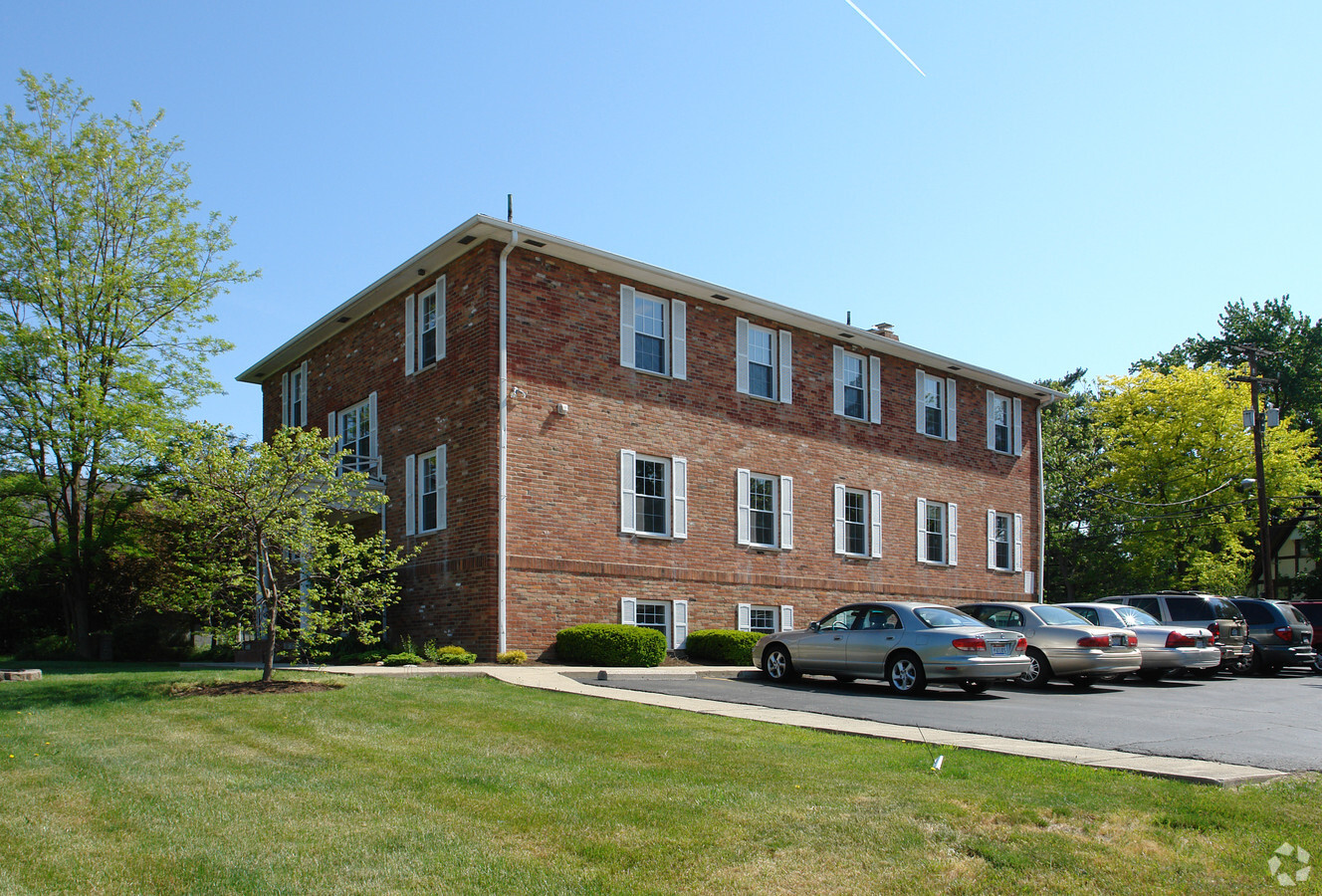
Property Record
5830 N High St, Worthington, OH 43085
Current Lease Availabilities
NEARBY LISTINGS FOR SALE OR LEASE
Property Detail
5830 N High St
Columbus, OH
Colonial Hills
100-000884
5830 N HIGH ST COLONIAL HILLS LOT 4
Charitableorganization
Franklin
X
Ohio
39049C0159K
4
2022
0.16 AC
2023
Worthington
006710
Columbus
DEMOGRAPHICS near 5830 N High St
1 Mile
3 Mile
5 Mile
2024 Total Population
11,540
104,935
320,852
2029 Population
11,511
104,251
321,440
Pop Growth 2024-2029
(0.25%)
(0.65%)
+ 0.18%
Average Age
41
40
38
2024 Total Households
5,214
45,453
135,666
HH Growth 2024-2029
(0.12%)
(0.62%)
+ 0.24%
Median Household Inc
$78,771
$69,326
$68,999
Avg Household Size
2.20
2.20
2.30
2024 Avg HH Vehicles
2.00
2.00
2.00
Median Home Value
$332,373
$287,307
$273,105
Median Year Built
1957
1969
1974
Nearby Places
- Restaurants
- Banks
- Shops
- Fitness
- Groceries
PUBLIC TRANSPORTATION
AIRPORT
John Glenn Columbus International
DRIVE
WALK
Distance
John Glenn Columbus International
22 min
14.2 mi
Rickenbacker International
DRIVE
WALK
Distance
Rickenbacker International
35 min
23.3 mi
Freight Ports
Port of Toledo
DRIVE
WALK
Distance
Port of Toledo
173 min
135.4 mi
Nearby Properties
Address
Land Use
TOTAL SIZE
Lot Size
Zoning
Address
Land Use
TOTAL SIZE
Lot Size
Zoning
548,535 SF
325.61 AC
Address
Land Use
TOTAL SIZE
Lot Size
Zoning
133,425 SF
20.51 AC
Address
Land Use
TOTAL SIZE
Lot Size
Zoning
383,533 SF
84.68 AC
Address
Land Use
TOTAL SIZE
Lot Size
Zoning
703,512 SF
5.40 AC
Address
Land Use
TOTAL SIZE
Lot Size
Zoning
206,724 SF
7.60 AC
Address
Land Use
TOTAL SIZE
Lot Size
Zoning
561,921 SF
6.81 AC
Address
Land Use
TOTAL SIZE
Lot Size
Zoning
1,070,310 SF
2.65 AC
Address
Land Use
TOTAL SIZE
Lot Size
Zoning
286,169 SF
11.08 AC
Address
Land Use
TOTAL SIZE
Lot Size
Zoning
425,872 SF
10.05 AC
Address
Land Use
TOTAL SIZE
Lot Size
Zoning
733,806 SF
27.30 AC
Address
Land Use
TOTAL SIZE
Lot Size
Zoning
148.89 AC
Address
Land Use
TOTAL SIZE
Lot Size
Zoning
413,781 SF
78.36 AC
Address
Land Use
TOTAL SIZE
Lot Size
Zoning
162,728 SF
4.80 AC
Address
Land Use
TOTAL SIZE
Lot Size
Zoning
187,562 SF
8.76 AC
Address
Land Use
TOTAL SIZE
Lot Size
Zoning
273,112 SF
13.97 AC
Address
Land Use
TOTAL SIZE
Lot Size
Zoning
546,096 SF
8.48 AC
Address
Land Use
TOTAL SIZE
Lot Size
Zoning
260,802 SF
8.80 AC
Address
Land Use
TOTAL SIZE
Lot Size
Zoning
170,237 SF
97.38 AC
Address
Land Use
TOTAL SIZE
Lot Size
Zoning
368,077 SF
7.87 AC
Address
Land Use
TOTAL SIZE
Lot Size
Zoning
554,268 SF
23.53 AC
Address
Land Use
TOTAL SIZE
Lot Size
Zoning
1,074,792 SF
10.88 AC
Address
Land Use
TOTAL SIZE
Lot Size
Zoning
451,404 SF
24.57 AC
Address
Land Use
TOTAL SIZE
Lot Size
Zoning
111,168 SF
19.43 AC
Address
Land Use
TOTAL SIZE
Lot Size
Zoning
352,730 SF
17.94 AC
Address
Land Use
TOTAL SIZE
Lot Size
Zoning
242,825 SF
3.22 AC
Address
Land Use
TOTAL SIZE
Lot Size
Zoning
561,675 SF
10.28 AC
Address
Land Use
TOTAL SIZE
Lot Size
Zoning
728,361 SF
21.12 AC
Address
Land Use
TOTAL SIZE
Lot Size
Zoning
198,984 SF
145.98 AC
Address
Land Use
TOTAL SIZE
Lot Size
Zoning
1,221,975 SF
27.53 AC
Address
Land Use
TOTAL SIZE
Lot Size
Zoning
140,912 SF
36.59 AC
The World's #1 Commercial Real Estate Marketplace
Connect with us
© 2025 CoStar Group
The information above has been obtained from sources believed reliable. While we do not doubt its accuracy we have not verified it and make no guarantee, warranty or representation about it. It is your responsibility to independently confirm its accuracy and completeness. Any projections, opinions, assumptions, or estimates used are for example only and do not represent the current or future performance of the property. The value of this transaction to you depends on tax and other factors which should be evaluated by your tax, financial, and legal advisors. You and your advisors should conduct a careful, independent investigation of the property to determine to your satisfaction the suitability of the property for your needs.