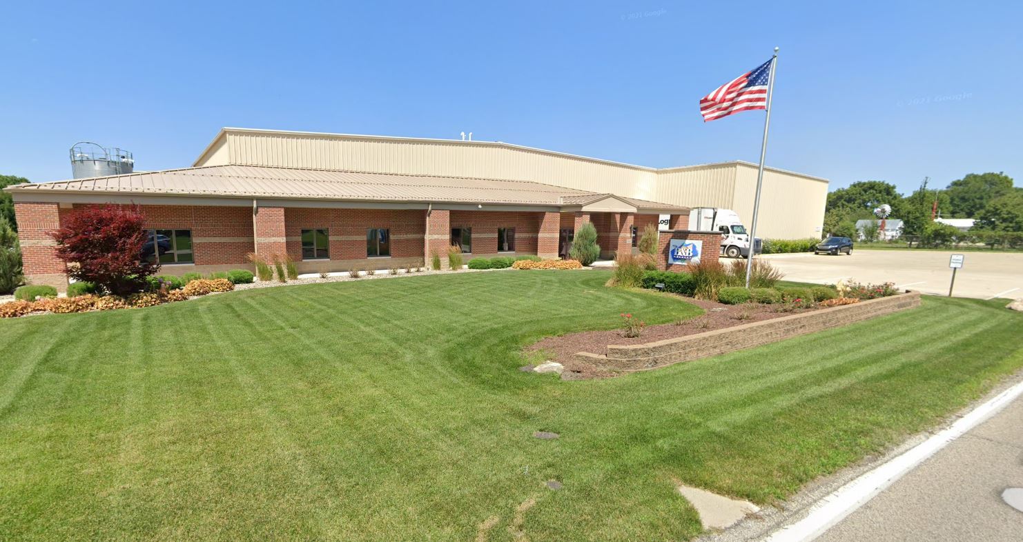
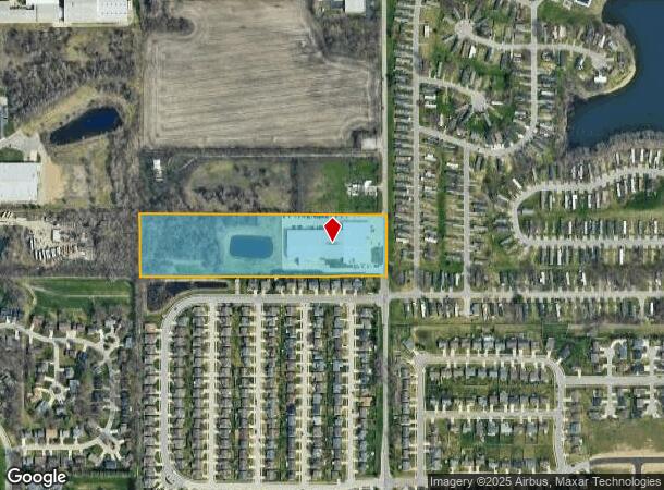
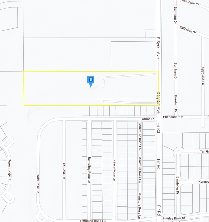
Property Record
58471 Fir Rd, Mishawaka, IN 46544
NEARBY LISTINGS FOR SALE OR LEASE
Property Detail
58471 Fir Rd
71-09-22-276-006.000-031
BEG AT SE COR OF NE 1/4 OF SEC 22 37 3E N 331.29 W 1317.6 S 331.29 E 1317.6 TO POB 17/18 CONS W/014-1027-045701 AND 045702 PER PENN ASSESSORS REQ IC 6-1.1-5-16
Commercialnec
St Joseph
X
Indiana
18141C0218D
10.37 AC
2022
Mishawaka
2023
South Bend/Mishawaka
010300
South Bend-Mishawaka, IN-MI
68,550 SF
DEMOGRAPHICS near 58471 Fir Rd
1 Mile
3 Mile
5 Mile
2024 Total Population
5,601
45,483
118,298
2029 Population
5,557
45,243
117,815
Pop Growth 2024-2029
(0.79%)
(0.53%)
(0.41%)
Average Age
38
39
39
2024 Total Households
2,250
19,637
50,196
HH Growth 2024-2029
(0.93%)
(0.46%)
(0.40%)
Median Household Inc
$58,969
$55,342
$56,485
Avg Household Size
2.50
2.20
2.30
2024 Avg HH Vehicles
2.00
2.00
2.00
Median Home Value
$146,764
$136,956
$147,700
Median Year Built
1982
1966
1964
Nearby Places
- Restaurants
- Banks
- Shops
- Fitness
- Groceries
PUBLIC TRANSPORTATION
COMMUTER RAIL
South Bend Amtrak Station (Capitol Limited - Amtrak, Lake Shore Limited - Amtrak)
DRIVE
WALK
Distance
South Bend Amtrak Station (Capitol Limited - Amtrak, Lake Shore Limited - Amtrak)
17 min
9.0 mi
AIRPORT
South Bend International
DRIVE
WALK
Distance
South Bend International
30 min
13.0 mi
Freight Ports
Port Milwaukee
DRIVE
WALK
Distance
Port Milwaukee
230 min
191.1 mi
Nearby Properties
Address
Land Use
TOTAL SIZE
Lot Size
Zoning
Address
Land Use
TOTAL SIZE
Lot Size
Zoning
1,010,047 SF
73 AC
Address
Land Use
TOTAL SIZE
Lot Size
Zoning
397,501 SF
3.50 AC
Address
Land Use
TOTAL SIZE
Lot Size
Zoning
338,816 SF
33.65 AC
Address
Land Use
TOTAL SIZE
Lot Size
Zoning
617,383 SF
51.29 AC
Address
Land Use
TOTAL SIZE
Lot Size
Zoning
107,258 SF
1.62 AC
Address
Land Use
TOTAL SIZE
Lot Size
Zoning
112,424 SF
5 AC
Address
Land Use
TOTAL SIZE
Lot Size
Zoning
48,034 SF
6.40 AC
Address
Land Use
TOTAL SIZE
Lot Size
Zoning
353.40 AC
Address
Land Use
TOTAL SIZE
Lot Size
Zoning
216,257 SF
35.24 AC
Address
Land Use
TOTAL SIZE
Lot Size
Zoning
122,419 SF
9.03 AC
Address
Land Use
TOTAL SIZE
Lot Size
Zoning
134,785 SF
14.16 AC
Address
Land Use
TOTAL SIZE
Lot Size
Zoning
100,191 SF
11.72 AC
Address
Land Use
TOTAL SIZE
Lot Size
Zoning
389,851 SF
23.89 AC
Address
Land Use
TOTAL SIZE
Lot Size
Zoning
211,773 SF
35.16 AC
Address
Land Use
TOTAL SIZE
Lot Size
Zoning
270,962 SF
27.20 AC
Address
Land Use
TOTAL SIZE
Lot Size
Zoning
177,518 SF
35.64 AC
Address
Land Use
TOTAL SIZE
Lot Size
Zoning
249,072 SF
18.98 AC
Address
Land Use
TOTAL SIZE
Lot Size
Zoning
45,120 SF
20.26 AC
Address
Land Use
TOTAL SIZE
Lot Size
Zoning
102,057 SF
2 AC
Address
Land Use
TOTAL SIZE
Lot Size
Zoning
47,225 SF
7.90 AC
Address
Land Use
TOTAL SIZE
Lot Size
Zoning
66,953 SF
8.59 AC
Address
Land Use
TOTAL SIZE
Lot Size
Zoning
45,700 SF
4.65 AC
Address
Land Use
TOTAL SIZE
Lot Size
Zoning
35,066 SF
3.16 AC
Address
Land Use
TOTAL SIZE
Lot Size
Zoning
198,582 SF
10.37 AC
Address
Land Use
TOTAL SIZE
Lot Size
Zoning
129,536 SF
15.69 AC
Address
Land Use
TOTAL SIZE
Lot Size
Zoning
152,072 SF
7.55 AC
Address
Land Use
TOTAL SIZE
Lot Size
Zoning
51,750 SF
22.16 AC
Address
Land Use
TOTAL SIZE
Lot Size
Zoning
47,068 SF
1.63 AC
Address
Land Use
TOTAL SIZE
Lot Size
Zoning
149,944 SF
16.81 AC
Address
Land Use
TOTAL SIZE
Lot Size
Zoning
28,912 SF
11.40 AC
The World's #1 Commercial Real Estate Marketplace
Connect with us
© 2025 CoStar Group
The information above has been obtained from sources believed reliable. While we do not doubt its accuracy we have not verified it and make no guarantee, warranty or representation about it. It is your responsibility to independently confirm its accuracy and completeness. Any projections, opinions, assumptions, or estimates used are for example only and do not represent the current or future performance of the property. The value of this transaction to you depends on tax and other factors which should be evaluated by your tax, financial, and legal advisors. You and your advisors should conduct a careful, independent investigation of the property to determine to your satisfaction the suitability of the property for your needs.