Property Record
5850 S Pine Island Rd, Davie, FL 33328
NEARBY LISTINGS FOR SALE OR LEASE
-
-
View all Davie listings for sale on LoopNet.com
Property Detail
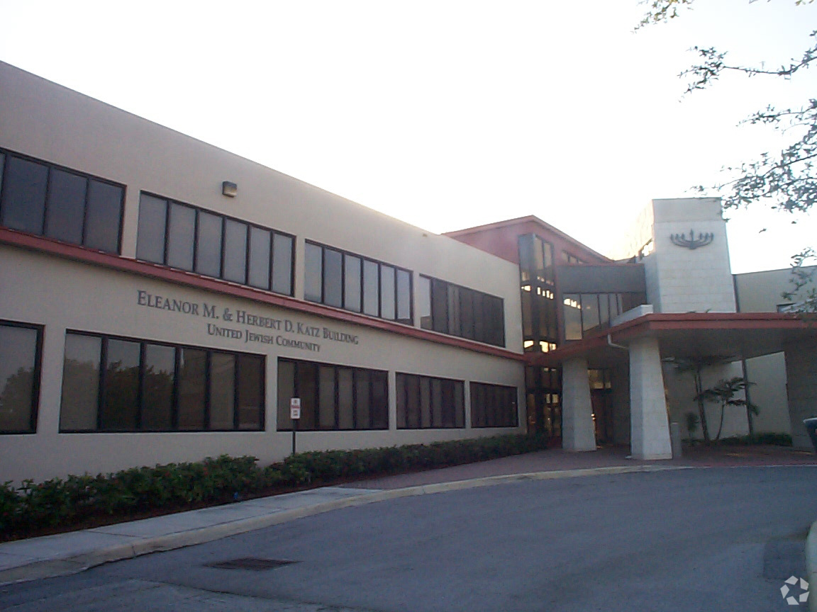
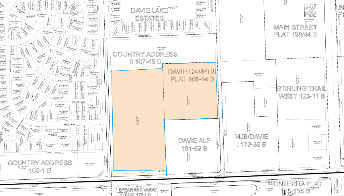
5850 S Pine Island Rd
50-41-33-21-0020
Country Address Ii 107-45 B
Nightclub
COUNTRY ADDRESS II 107-45 B ALL OF COUNTRY ADDRESS II 107-45 B, LESS ROWS, TOG/W THOSE VACAD ROWS AS DESC IN OR 13804/ 727, ALL LESS PTS THEREOF AS DESC IN INSTR #S 117178643 & 117178644
AE
Broward
12011C0545J
Florida
0
16.34 AC
2025
Southwest Broward
070602
South Florida
176,980 SF
Fort Lauderdale-Pompano Beach-Deerfield Beach, FL
DEMOGRAPHICS near 5850 S Pine Island Rd
1 Mile
3 Mile
5 Mile
2024 Total Population
11,006
127,508
348,198
2029 Population
10,826
125,420
343,664
Pop Growth 2024-2029
(1.64%)
(1.64%)
(1.30%)
Average Age
37
39
40
2024 Total Households
3,585
44,360
124,088
HH Growth 2024-2029
(2.23%)
(2.21%)
(1.71%)
Median Household Inc
$99,009
$79,117
$71,624
Avg Household Size
3.00
2.70
2.70
2024 Avg HH Vehicles
2.00
2.00
2.00
Median Home Value
$470,330
$369,179
$348,285
Median Year Built
1992
1980
1982
Nearby Places
- Restaurants
- Banks
- Shops
- Fitness
- Groceries
PUBLIC TRANSPORTATION
COMMUTER RAIL
Sheridan Street (Tri-County Commuter - South Florida Regional Transportation Authority (Tri-Rail))
DRIVE
WALK
Distance
Sheridan Street (Tri-County Commuter - South Florida Regional Transportation Authority (Tri-Rail))
16 min
7.2 mi
Fort Lauderdale/Hollywood International Airport (Tri-County Commuter - South Florida Regional Transportation Authority (Tri-Rail))
DRIVE
WALK
Distance
Fort Lauderdale/Hollywood International Airport (Tri-County Commuter - South Florida Regional Transportation Authority (Tri-Rail))
15 min
7.6 mi
AIRPORT
Fort Lauderdale/Hollywood International
DRIVE
WALK
Distance
Fort Lauderdale/Hollywood International
17 min
8.5 mi
Miami International
DRIVE
WALK
Distance
Miami International
42 min
26.5 mi
Freight Ports
Port Everglades
DRIVE
WALK
Distance
Port Everglades
21 min
11.4 mi
Nearby Properties
Address
Land Use
TOTAL SIZE
Lot Size
Zoning
Address
Land Use
TOTAL SIZE
Lot Size
Zoning
4,212,940 SF
69.36 AC
N/A
Address
Land Use
TOTAL SIZE
Lot Size
Zoning
4,069,966 SF
161.58 AC
RAC-AV
Address
Land Use
TOTAL SIZE
Lot Size
Zoning
1,357,572 SF
126.23 AC
RAC-ED
Address
Land Use
TOTAL SIZE
Lot Size
Zoning
635,706 SF
9.58 AC
GRIFFIN CO
Address
Land Use
TOTAL SIZE
Lot Size
Zoning
456,384 SF
81.33 AC
RAC-ED
Address
Land Use
TOTAL SIZE
Lot Size
Zoning
334,723 SF
7.47 AC
RAC-AV
Address
Land Use
TOTAL SIZE
Lot Size
Zoning
373,348 SF
20.48 AC
(R-MF)
Address
Land Use
TOTAL SIZE
Lot Size
Zoning
308,840 SF
29.85 AC
(B-3)
Address
Land Use
TOTAL SIZE
Lot Size
Zoning
356,053 SF
8.12 AC
RAC-RTE
Address
Land Use
TOTAL SIZE
Lot Size
Zoning
326,240 SF
45.28 AC
N/A
Address
Land Use
TOTAL SIZE
Lot Size
Zoning
385,242 SF
66.40 AC
N/A
Address
Land Use
TOTAL SIZE
Lot Size
Zoning
284,895 SF
16.45 AC
(R-MF)
Address
Land Use
TOTAL SIZE
Lot Size
Zoning
505,730 SF
18.07 AC
RAC-AV
Address
Land Use
TOTAL SIZE
Lot Size
Zoning
292,581 SF
13.64 AC
RM-16
Address
Land Use
TOTAL SIZE
Lot Size
Zoning
281,510 SF
11.39 AC
PMUD
Address
Land Use
TOTAL SIZE
Lot Size
Zoning
302,174 SF
24.49 AC
(R-MF)
Address
Land Use
TOTAL SIZE
Lot Size
Zoning
222,024 SF
13.64 AC
RM-16
Address
Land Use
TOTAL SIZE
Lot Size
Zoning
256,480 SF
9.85 AC
(R-MF)
Address
Land Use
TOTAL SIZE
Lot Size
Zoning
302,410 SF
35.11 AC
X-1
Address
Land Use
TOTAL SIZE
Lot Size
Zoning
317,377 SF
74.64 AC
(A)
Address
Land Use
TOTAL SIZE
Lot Size
Zoning
337,994 SF
3.03 AC
RAC-ND4
Address
Land Use
TOTAL SIZE
Lot Size
Zoning
237,370 SF
12.51 AC
RM-16
Address
Land Use
TOTAL SIZE
Lot Size
Zoning
236,654 SF
14.10 AC
RM-16
Address
Land Use
TOTAL SIZE
Lot Size
Zoning
183,266 SF
83.63 AC
RAC-ED
Address
Land Use
TOTAL SIZE
Lot Size
Zoning
237,411 SF
6.65 AC
PMUD
Address
Land Use
TOTAL SIZE
Lot Size
Zoning
145,318 SF
21.42 AC
RM-16
Address
Land Use
TOTAL SIZE
Lot Size
Zoning
315,799 SF
22.98 AC
(B-3)
Address
Land Use
TOTAL SIZE
Lot Size
Zoning
148,015 SF
23.21 AC
(B-3)
Address
Land Use
TOTAL SIZE
Lot Size
Zoning
16,790 SF
175.19 AC
A-1*
Address
Land Use
TOTAL SIZE
Lot Size
Zoning
61,386 SF
96.41 AC
N/A
The World's #1 Commercial Real Estate Marketplace
Connect with us
© 2025 CoStar Group
The information above has been obtained from sources believed reliable. While we do not doubt its accuracy we have not verified it and make no guarantee, warranty or representation about it. It is your responsibility to independently confirm its accuracy and completeness. Any projections, opinions, assumptions, or estimates used are for example only and do not represent the current or future performance of the property. The value of this transaction to you depends on tax and other factors which should be evaluated by your tax, financial, and legal advisors. You and your advisors should conduct a careful, independent investigation of the property to determine to your satisfaction the suitability of the property for your needs.