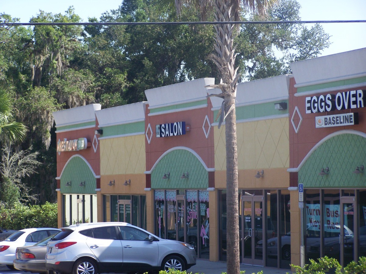
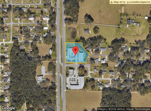
Property Record
5851 Se 5Th St, Ocala, FL 34472
NEARBY LISTINGS FOR SALE OR LEASE
Property Detail
5851 Se 5Th St
Ocala, FL
Peppertree Village
31856-006-01
SEC 18 TWP 15 RGE 23 PLAT BOOK V PAGE 066 PEPPERTREE VILLAGE BLK F LOTS 1.2.3 & EXC RD ROW BEING MORE PARTICULARLY DESC AS: COM AT THE SE COR OF LOT 1 BLK F TH N 88-23-34 W 51.151M (167.85 FT) TO THE POB TH CONT N 88-23-34 W 2.431M (7.98 FT) TO A POC
Regionalshoppingcenterormallwithanchorstore
Marion
X
Florida
12083C0545D
1
2023
1.28 AC
2023
Outlying Marion County
001205
Ocala
13,345 SF
DEMOGRAPHICS near 5851 Se 5Th St
1 Mile
3 Mile
5 Mile
2024 Total Population
5,766
36,166
84,062
2029 Population
6,496
40,732
94,826
Pop Growth 2024-2029
+ 12.66%
+ 12.63%
+ 12.80%
Average Age
45
42
41
2024 Total Households
2,369
14,928
33,897
HH Growth 2024-2029
+ 12.71%
+ 12.63%
+ 12.76%
Median Household Inc
$70,304
$62,752
$58,847
Avg Household Size
2.40
2.40
2.40
2024 Avg HH Vehicles
2.00
2.00
2.00
Median Home Value
$185,113
$181,767
$182,816
Median Year Built
1985
1986
1985
Nearby Places
- Restaurants
- Banks
- Shops
- Fitness
- Groceries
SALE & LEASE HISTORY
LISTING DATE
SALE/LEASE

Nov 04, 2022
For Lease
Feb 06, 2017
For Lease
Aug 31, 2022
For Lease
Aug 03, 2023
For Lease
Aug 01, 2024
For Lease
Nearby Properties
Address
Land Use
TOTAL SIZE
Lot Size
Zoning
Address
Land Use
TOTAL SIZE
Lot Size
Zoning
211,884 SF
80 AC
GU
Address
Land Use
TOTAL SIZE
Lot Size
Zoning
88,462 SF
31.76 AC
INST
Address
Land Use
TOTAL SIZE
Lot Size
Zoning
205,664 SF
22.56 AC
B5
Address
Land Use
TOTAL SIZE
Lot Size
Zoning
5,815 SF
186.33 AC
GU
Address
Land Use
TOTAL SIZE
Lot Size
Zoning
111,395 SF
13 AC
B2
Address
Land Use
TOTAL SIZE
Lot Size
Zoning
116,035 SF
38.20 AC
GU
Address
Land Use
TOTAL SIZE
Lot Size
Zoning
30,334 SF
29.72 AC
GU
Address
Land Use
TOTAL SIZE
Lot Size
Zoning
78,280 SF
12.54 AC
R3
Address
Land Use
TOTAL SIZE
Lot Size
Zoning
196,416 SF
29.65 AC
SC
Address
Land Use
TOTAL SIZE
Lot Size
Zoning
71,065 SF
12.01 AC
B2
Address
Land Use
TOTAL SIZE
Lot Size
Zoning
134,827 SF
14.83 AC
SC
Address
Land Use
TOTAL SIZE
Lot Size
Zoning
132,214 SF
40 AC
GU
Address
Land Use
TOTAL SIZE
Lot Size
Zoning
192,553 SF
21.18 AC
SC
Address
Land Use
TOTAL SIZE
Lot Size
Zoning
134,890 SF
18.90 AC
B4
Address
Land Use
TOTAL SIZE
Lot Size
Zoning
58,040 SF
10.24 AC
INST
Address
Land Use
TOTAL SIZE
Lot Size
Zoning
10,552 SF
51.60 AC
PRV
Address
Land Use
TOTAL SIZE
Lot Size
Zoning
35,356 SF
6.14 AC
R3
Address
Land Use
TOTAL SIZE
Lot Size
Zoning
21,173 SF
216.46 AC
B2
Address
Land Use
TOTAL SIZE
Lot Size
Zoning
390,591 SF
30.62 AC
M2
Address
Land Use
TOTAL SIZE
Lot Size
Zoning
14,344 SF
3.12 AC
B2
Address
Land Use
TOTAL SIZE
Lot Size
Zoning
61,045 SF
22.64 AC
A1
Address
Land Use
TOTAL SIZE
Lot Size
Zoning
62,330 SF
17.71 AC
INST
Address
Land Use
TOTAL SIZE
Lot Size
Zoning
32,675 SF
478 AC
A1
Address
Land Use
TOTAL SIZE
Lot Size
Zoning
60,099 SF
52.96 AC
B2
Address
Land Use
TOTAL SIZE
Lot Size
Zoning
27,949 SF
6.03 AC
R3
Address
Land Use
TOTAL SIZE
Lot Size
Zoning
5,322 SF
403 AC
R1
Address
Land Use
TOTAL SIZE
Lot Size
Zoning
60,576 SF
20.47 AC
INST
Address
Land Use
TOTAL SIZE
Lot Size
Zoning
36,064 SF
5.31 AC
R3
Address
Land Use
TOTAL SIZE
Lot Size
Zoning
85,883 SF
20.30 AC
INST
Address
Land Use
TOTAL SIZE
Lot Size
Zoning
16,667 SF
3.28 AC
B2A
The World's #1 Commercial Real Estate Marketplace
Connect with us
© 2025 CoStar Group
The information above has been obtained from sources believed reliable. While we do not doubt its accuracy we have not verified it and make no guarantee, warranty or representation about it. It is your responsibility to independently confirm its accuracy and completeness. Any projections, opinions, assumptions, or estimates used are for example only and do not represent the current or future performance of the property. The value of this transaction to you depends on tax and other factors which should be evaluated by your tax, financial, and legal advisors. You and your advisors should conduct a careful, independent investigation of the property to determine to your satisfaction the suitability of the property for your needs.