Property Record
5853 N State Road 135, Greenwood, IN 46143
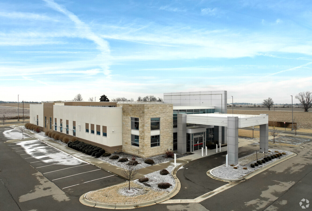
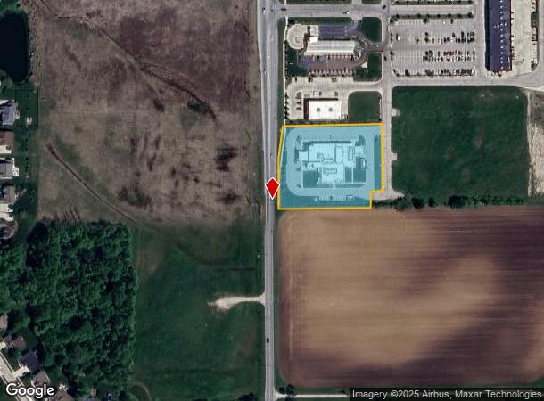
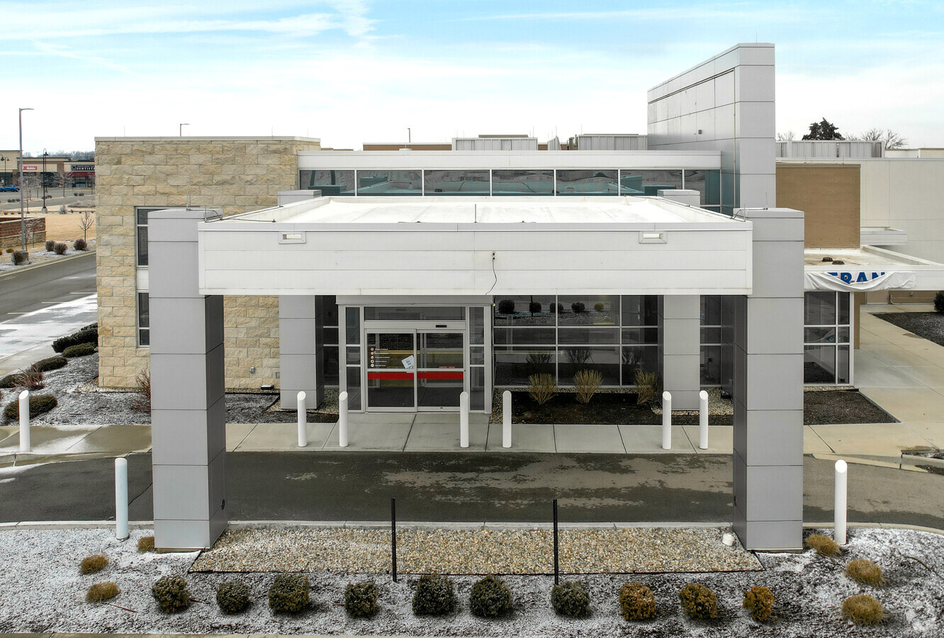
This Property Is For Sale
NEARBY LISTINGS FOR SALE OR LEASE
-
-
View all Greenwood listings for sale on LoopNet.com
Property Detail
5853 N State Road 135
Indianapolis-Carmel-Anderson, IN
Secondary Plat Of Lone Pine
41-04-24-022-012.000-040
LONE PINE COMMERCIAL SUB LOT 4
Officebuilding
Johnson
X
Indiana
18109C0200E
4
2023
2.20 AC
2024
Far South Johnson Cty
610705
Indianapolis
16,699 SF
DEMOGRAPHICS near 5853 N State Road 135
1 Mile
3 Mile
5 Mile
2024 Total Population
3,996
33,117
99,269
2029 Population
4,260
35,374
105,865
Pop Growth 2024-2029
+ 6.61%
+ 6.82%
+ 6.64%
Average Age
34
38
39
2024 Total Households
1,288
11,519
36,076
HH Growth 2024-2029
+ 6.75%
+ 6.99%
+ 6.82%
Median Household Inc
$95,761
$98,938
$86,250
Avg Household Size
3.10
2.80
2.70
2024 Avg HH Vehicles
2.00
2.00
2.00
Median Home Value
$345,633
$316,383
$242,770
Median Year Built
2010
2000
1994
Nearby Places
- Restaurants
- Banks
- Shops
- Fitness
- Groceries
PUBLIC TRANSPORTATION
AIRPORT
Indianapolis International
DRIVE
WALK
Distance
Indianapolis International
39 min
24.0 mi
Freight Ports
Port of Toledo
DRIVE
WALK
Distance
Port of Toledo
292 min
242.2 mi
Nearby Properties
Address
Land Use
TOTAL SIZE
Lot Size
Zoning
Address
Land Use
TOTAL SIZE
Lot Size
Zoning
4,582 SF
30.22 AC
R4
Address
Land Use
TOTAL SIZE
Lot Size
Zoning
19,104 SF
27.27 AC
R2
Address
Land Use
TOTAL SIZE
Lot Size
Zoning
33,790 SF
13.01 AC
Address
Land Use
TOTAL SIZE
Lot Size
Zoning
141,533 SF
16.65 AC
Address
Land Use
TOTAL SIZE
Lot Size
Zoning
82,619 SF
13.50 AC
Address
Land Use
TOTAL SIZE
Lot Size
Zoning
1,426 SF
11.73 AC
Address
Land Use
TOTAL SIZE
Lot Size
Zoning
748 SF
6.83 AC
Address
Land Use
TOTAL SIZE
Lot Size
Zoning
69,215 SF
4.90 AC
B1
Address
Land Use
TOTAL SIZE
Lot Size
Zoning
152,664 SF
14.82 AC
Address
Land Use
TOTAL SIZE
Lot Size
Zoning
24,483 SF
5.48 AC
R4
Address
Land Use
TOTAL SIZE
Lot Size
Zoning
98,409 SF
8.82 AC
Address
Land Use
TOTAL SIZE
Lot Size
Zoning
Address
Land Use
TOTAL SIZE
Lot Size
Zoning
74,067 SF
9.38 AC
R2
Address
Land Use
TOTAL SIZE
Lot Size
Zoning
47,171 SF
4.48 AC
Address
Land Use
TOTAL SIZE
Lot Size
Zoning
26,880 SF
4.70 AC
B1
Address
Land Use
TOTAL SIZE
Lot Size
Zoning
16,000 SF
4.29 AC
Address
Land Use
TOTAL SIZE
Lot Size
Zoning
9,540 SF
3.19 AC
Address
Land Use
TOTAL SIZE
Lot Size
Zoning
29,296 SF
13.33 AC
A1
Address
Land Use
TOTAL SIZE
Lot Size
Zoning
55,632 SF
7.27 AC
B1
Address
Land Use
TOTAL SIZE
Lot Size
Zoning
17,703 SF
1.84 AC
Address
Land Use
TOTAL SIZE
Lot Size
Zoning
43,384 SF
9.17 AC
Address
Land Use
TOTAL SIZE
Lot Size
Zoning
22,590 SF
3.08 AC
R4
Address
Land Use
TOTAL SIZE
Lot Size
Zoning
21,804 SF
1.56 AC
R4
Address
Land Use
TOTAL SIZE
Lot Size
Zoning
23,899 SF
6.89 AC
Address
Land Use
TOTAL SIZE
Lot Size
Zoning
12,236 SF
1.34 AC
Address
Land Use
TOTAL SIZE
Lot Size
Zoning
19,200 SF
2.23 AC
B1
Address
Land Use
TOTAL SIZE
Lot Size
Zoning
13,598 SF
2.50 AC
Address
Land Use
TOTAL SIZE
Lot Size
Zoning
9,892 SF
45.13 AC
Address
Land Use
TOTAL SIZE
Lot Size
Zoning
15,480 SF
5.75 AC
The World's #1 Commercial Real Estate Marketplace
Connect with us
© 2025 CoStar Group
The information above has been obtained from sources believed reliable. While we do not doubt its accuracy we have not verified it and make no guarantee, warranty or representation about it. It is your responsibility to independently confirm its accuracy and completeness. Any projections, opinions, assumptions, or estimates used are for example only and do not represent the current or future performance of the property. The value of this transaction to you depends on tax and other factors which should be evaluated by your tax, financial, and legal advisors. You and your advisors should conduct a careful, independent investigation of the property to determine to your satisfaction the suitability of the property for your needs.