Property Record
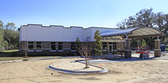
5857 W Tennessee St, Tallahassee, FL 32304


NEARBY LISTINGS FOR SALE OR LEASE
Property Detail
5857 W Tennessee St
21-30-20-617-000.0
Unplatted Land
Medicalbuilding
SECTION 30 T1N R1W OR 4465/1674(BS)
X
Leon
12073C0278F
Florida
2025
2.48 AC
2025
Southwest Leon County
002304
Tallahassee
11,411 SF
Tallahassee, FL
DEMOGRAPHICS near 5857 W Tennessee St
1 Mile
3 Mile
5 Mile
2024 Total Population
3,130
32,664
94,963
2029 Population
3,411
34,470
99,287
Pop Growth 2024-2029
+ 8.98%
+ 5.53%
+ 4.55%
Average Age
37
32
32
2024 Total Households
1,244
13,225
39,234
HH Growth 2024-2029
+ 9.24%
+ 5.48%
+ 4.58%
Median Household Inc
$39,422
$39,486
$38,112
Avg Household Size
2.20
2.30
2.20
2024 Avg HH Vehicles
2.00
2.00
2.00
Median Home Value
$89,415
$139,483
$155,858
Median Year Built
1990
1991
1986
Nearby Places
Map Layers
Map Styles
 Street
 Aerial
- Restaurants
- Banks
- Shops
- Fitness
- Groceries
PUBLIC TRANSPORTATION
AIRPORT
Tallahassee International
DRIVE
WALK
Distance
Tallahassee International
10 min
5.4 mi
Freight Ports
Port of Panama City
DRIVE
WALK
Distance
Port of Panama City
136 min
96.2 mi
Nearby Properties
Address
Land Use
TOTAL SIZE
Lot Size
Zoning
Address
Land Use
TOTAL SIZE
Lot Size
Zoning
1,604,893 SF
175.71 AC
MR1
Address
Land Use
TOTAL SIZE
Lot Size
Zoning
959,505 SF
32.03 AC
M1
Address
Land Use
TOTAL SIZE
Lot Size
Zoning
719,149 SF
40.73 AC
MR1
Address
Land Use
TOTAL SIZE
Lot Size
Zoning
556,751 SF
20.60 AC
CP
Address
Land Use
TOTAL SIZE
Lot Size
Zoning
859,666 SF
20.17 AC
MR1
Address
Land Use
TOTAL SIZE
Lot Size
Zoning
739,671 SF
20.04 AC
MR1
Address
Land Use
TOTAL SIZE
Lot Size
Zoning
660,721 SF
30.95 AC
Address
Land Use
TOTAL SIZE
Lot Size
Zoning
168,448 SF
47.73 AC
I
Address
Land Use
TOTAL SIZE
Lot Size
Zoning
711,296 SF
17.86 AC
PUD
Address
Land Use
TOTAL SIZE
Lot Size
Zoning
127,486 SF
8.23 AC
M1
Address
Land Use
TOTAL SIZE
Lot Size
Zoning
463,831 SF
44.63 AC
M1
Address
Land Use
TOTAL SIZE
Lot Size
Zoning
588,955 SF
36.20 AC
R3
Address
Land Use
TOTAL SIZE
Lot Size
Zoning
456,228 SF
27.14 AC
UT
Address
Land Use
TOTAL SIZE
Lot Size
Zoning
570,525 SF
18.89 AC
MR1
Address
Land Use
TOTAL SIZE
Lot Size
Zoning
123,020 SF
9.45 AC
M1
Address
Land Use
TOTAL SIZE
Lot Size
Zoning
1,792 SF
231.63 AC
M1
Address
Land Use
TOTAL SIZE
Lot Size
Zoning
365,297 SF
9.50 AC
MR1
Address
Land Use
TOTAL SIZE
Lot Size
Zoning
680,597 SF
20.82 AC
UT
Address
Land Use
TOTAL SIZE
Lot Size
Zoning
346,204 SF
52.68 AC
M1
Address
Land Use
TOTAL SIZE
Lot Size
Zoning
198,985 SF
22.18 AC
CP
Address
Land Use
TOTAL SIZE
Lot Size
Zoning
166,646 SF
21.72 AC
CP
Address
Land Use
TOTAL SIZE
Lot Size
Zoning
228,318 SF
10.55 AC
OR3
Address
Land Use
TOTAL SIZE
Lot Size
Zoning
145,331 SF
12.59 AC
MR1
Address
Land Use
TOTAL SIZE
Lot Size
Zoning
87,167 SF
20.36 AC
M1
Address
Land Use
TOTAL SIZE
Lot Size
Zoning
48,375 SF
5.61 AC
CP
Address
Land Use
TOTAL SIZE
Lot Size
Zoning
34,018 SF
10.89 AC
PUD
Address
Land Use
TOTAL SIZE
Lot Size
Zoning
154,499 SF
17.29 AC
PUD
Address
Land Use
TOTAL SIZE
Lot Size
Zoning
11,260 SF
14.13 AC
CP
Address
Land Use
TOTAL SIZE
Lot Size
Zoning
24,864 SF
4.38 AC
PUD
Address
Land Use
TOTAL SIZE
Lot Size
Zoning
195,024 SF
4.90 AC
MR1
The World's #1 Commercial Real Estate Marketplace
Connect with us
© 2026 CoStar Group
The information above has been obtained from sources believed reliable. While we do not doubt its accuracy we have not verified it and make no guarantee, warranty or representation about it. It is your responsibility to independently confirm its accuracy and completeness. Any projections, opinions, assumptions, or estimates used are for example only and do not represent the current or future performance of the property. The value of this transaction to you depends on tax and other factors which should be evaluated by your tax, financial, and legal advisors. You and your advisors should conduct a careful, independent investigation of the property to determine to your satisfaction the suitability of the property for your needs.