Property Record
587 Battlecreek Rd, Jonesboro, GA 30236
NEARBY LISTINGS FOR SALE OR LEASE
Property Detail
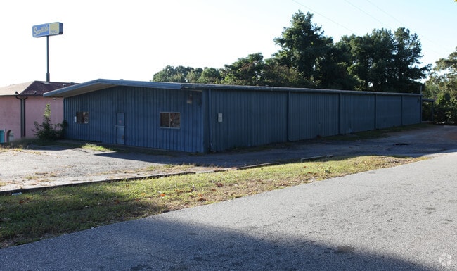
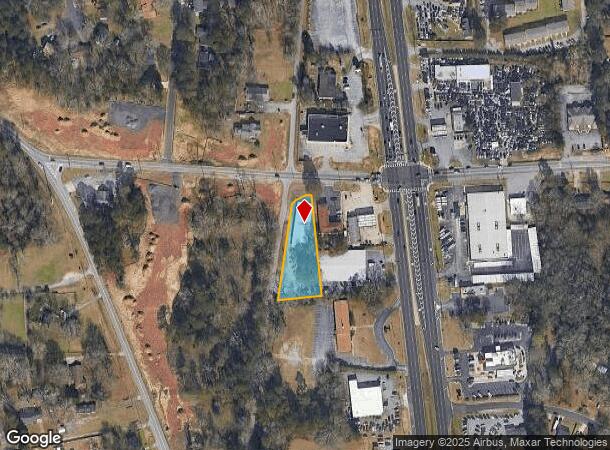
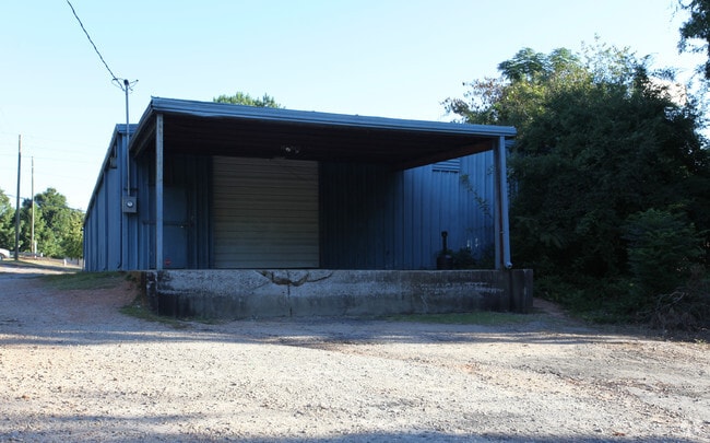
587 Battlecreek Rd
13-0179B-00A-006
Manuel F Casal
Warehouse
Clayton
X
Georgia
13063C0086F
0.81 AC
2025
Airport/North Clayton
2025
Atlanta
040609
Atlanta-Sandy Springs-Roswell, GA
6,250 SF
DEMOGRAPHICS near 587 Battlecreek Rd
1 Mile
3 Mile
5 Mile
2024 Total Population
11,211
82,182
196,932
2029 Population
11,178
81,868
196,249
Pop Growth 2024-2029
(0.29%)
(0.38%)
(0.35%)
Average Age
34
35
36
2024 Total Households
4,146
29,885
71,301
HH Growth 2024-2029
(0.46%)
(0.35%)
(0.30%)
Median Household Inc
$46,847
$48,402
$48,801
Avg Household Size
2.60
2.70
2.70
2024 Avg HH Vehicles
2.00
2.00
2.00
Median Home Value
$148,268
$146,637
$165,526
Median Year Built
1981
1981
1983
Nearby Places
Map Layers
Map Styles
 Street
 Aerial
- Restaurants
- Banks
- Shops
- Fitness
- Groceries
PUBLIC TRANSPORTATION
AIRPORT
Hartsfield - Jackson Atlanta International
DRIVE
WALK
Distance
Hartsfield - Jackson Atlanta International
15 min
8.6 mi
SALE & LEASE HISTORY
LISTING DATE
SALE/LEASE

Nov 07, 2023
For Lease
Nov 07, 2023
For Sale
Nearby Properties
Address
Land Use
TOTAL SIZE
Lot Size
Zoning
Address
Land Use
TOTAL SIZE
Lot Size
Zoning
518,648 SF
31.03 AC
MCD
Address
Land Use
TOTAL SIZE
Lot Size
Zoning
40,472 SF
116.70 AC
HI
Address
Land Use
TOTAL SIZE
Lot Size
Zoning
596 SF
57.40 AC
RM
Address
Land Use
TOTAL SIZE
Lot Size
Zoning
194,682 SF
27.80 AC
OI
Address
Land Use
TOTAL SIZE
Lot Size
Zoning
324 SF
49.49 AC
RM
Address
Land Use
TOTAL SIZE
Lot Size
Zoning
11.31 AC
RM
Address
Land Use
TOTAL SIZE
Lot Size
Zoning
250 SF
31.25 AC
RM
Address
Land Use
TOTAL SIZE
Lot Size
Zoning
123,000 SF
48 AC
RS110
Address
Land Use
TOTAL SIZE
Lot Size
Zoning
200 SF
23.02 AC
RM
Address
Land Use
TOTAL SIZE
Lot Size
Zoning
424 SF
54.79 AC
RM
Address
Land Use
TOTAL SIZE
Lot Size
Zoning
270 SF
28.02 AC
RM
Address
Land Use
TOTAL SIZE
Lot Size
Zoning
230 SF
27.09 AC
RM
Address
Land Use
TOTAL SIZE
Lot Size
Zoning
200,370 SF
23.81 AC
C
Address
Land Use
TOTAL SIZE
Lot Size
Zoning
351,207 SF
20 AC
HI
Address
Land Use
TOTAL SIZE
Lot Size
Zoning
316 SF
34.30 AC
RG75
Address
Land Use
TOTAL SIZE
Lot Size
Zoning
224 SF
25 AC
C
Address
Land Use
TOTAL SIZE
Lot Size
Zoning
252 SF
27.14 AC
RM
Address
Land Use
TOTAL SIZE
Lot Size
Zoning
200 SF
20.23 AC
RM
Address
Land Use
TOTAL SIZE
Lot Size
Zoning
190 SF
21.66 AC
RM
Address
Land Use
TOTAL SIZE
Lot Size
Zoning
410 SF
35 AC
RM
Address
Land Use
TOTAL SIZE
Lot Size
Zoning
14,230 AC
C
Address
Land Use
TOTAL SIZE
Lot Size
Zoning
220 SF
26.84 AC
RM
Address
Land Use
TOTAL SIZE
Lot Size
Zoning
252 SF
23.62 AC
RM
Address
Land Use
TOTAL SIZE
Lot Size
Zoning
30.90 AC
RS110
Address
Land Use
TOTAL SIZE
Lot Size
Zoning
65,798 SF
7.41 AC
C
Address
Land Use
TOTAL SIZE
Lot Size
Zoning
57.05 AC
GB
Address
Land Use
TOTAL SIZE
Lot Size
Zoning
198 SF
32.10 AC
RM
Address
Land Use
TOTAL SIZE
Lot Size
Zoning
250,048 SF
31.80 AC
HI
Address
Land Use
TOTAL SIZE
Lot Size
Zoning
208 SF
19.26 AC
RM
Address
Land Use
TOTAL SIZE
Lot Size
Zoning
203,067 SF
18 AC
C
The World's #1 Commercial Real Estate Marketplace
Connect with us
© 2026 CoStar Group
The information above has been obtained from sources believed reliable. While we do not doubt its accuracy we have not verified it and make no guarantee, warranty or representation about it. It is your responsibility to independently confirm its accuracy and completeness. Any projections, opinions, assumptions, or estimates used are for example only and do not represent the current or future performance of the property. The value of this transaction to you depends on tax and other factors which should be evaluated by your tax, financial, and legal advisors. You and your advisors should conduct a careful, independent investigation of the property to determine to your satisfaction the suitability of the property for your needs.