Property Record
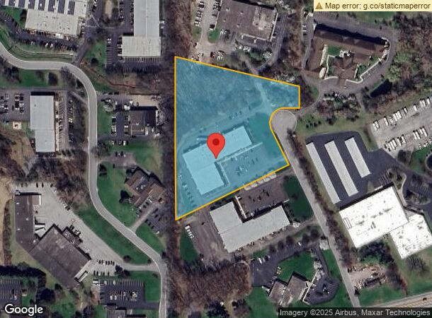
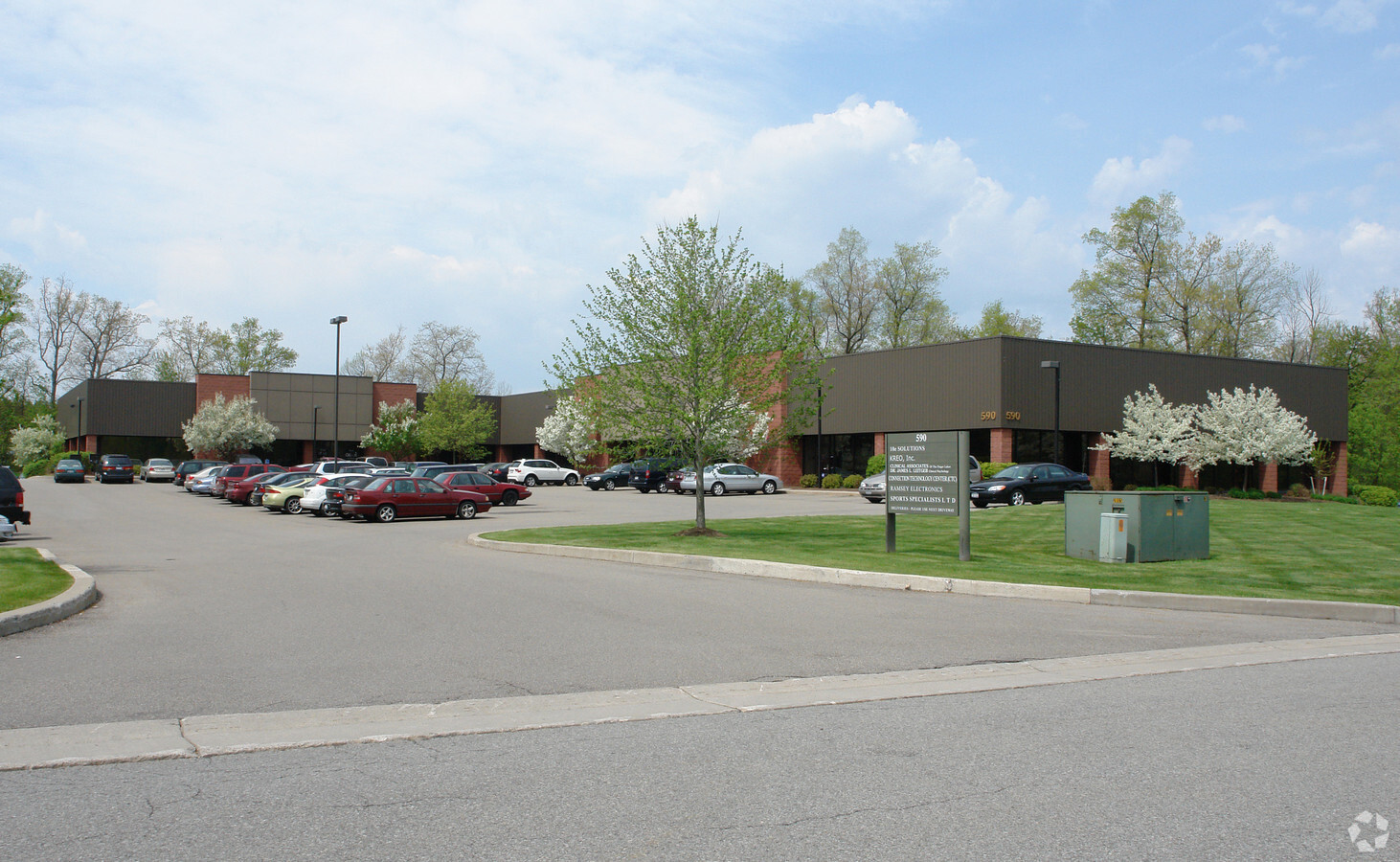
590 Fishers Station Dr, Victor, NY 14564

NEARBY LISTINGS FOR SALE OR LEASE
Property Detail
590 Fishers Station Dr
Rochester, NY
857/896 966/580 LOT R-2A
324889-006-000-0001-059-121
Ontario
Officebuilding
New York
2024
59.121
2023
5.10 AC
050101
Southeast
33,110 SF
Rochester
DEMOGRAPHICS near 590 Fishers Station Dr
1 Mile
3 Mile
5 Mile
2024 Total Population
545
13,531
46,266
2029 Population
532
13,506
45,968
Pop Growth 2024-2029
(2.39%)
(0.18%)
(0.64%)
Average Age
43
43
44
2024 Total Households
222
5,166
18,429
HH Growth 2024-2029
(2.70%)
(0.33%)
(0.74%)
Median Household Inc
$135,185
$145,506
$112,391
Avg Household Size
2.40
2.60
2.50
2024 Avg HH Vehicles
2.00
2.00
2.00
Median Home Value
$379,411
$367,513
$292,120
Median Year Built
1981
1993
1983
Nearby Places
- Restaurants
- Banks
- Shops
- Fitness
- Groceries
PUBLIC TRANSPORTATION
AIRPORT
Frederick Douglass/Greater Rochester International
DRIVE
WALK
Distance
Frederick Douglass/Greater Rochester International
28 min
17.9 mi
Freight Ports
Albany, NY Port
DRIVE
WALK
Distance
Albany, NY Port
250 min
213.2 mi
SALE & LEASE HISTORY
LISTING DATE
SALE/LEASE

Jul 29, 2020
For Lease
Aug 07, 2018
For Lease
Nearby Properties
Address
Land Use
TOTAL SIZE
Lot Size
Zoning
Address
Land Use
TOTAL SIZE
Lot Size
Zoning
667,703 SF
89.60 AC
COMM
Address
Land Use
TOTAL SIZE
Lot Size
Zoning
385,152 SF
124.20 AC
R1-C
Address
Land Use
TOTAL SIZE
Lot Size
Zoning
320,639 SF
94.46 AC
COMM
Address
Land Use
TOTAL SIZE
Lot Size
Zoning
Address
Land Use
TOTAL SIZE
Lot Size
Zoning
86,970 SF
25.70 AC
R-1
Address
Land Use
TOTAL SIZE
Lot Size
Zoning
101,804 SF
26.13 AC
RESTRC BUS
Address
Land Use
TOTAL SIZE
Lot Size
Zoning
Address
Land Use
TOTAL SIZE
Lot Size
Zoning
16,965 SF
9.90 AC
PDD
Address
Land Use
TOTAL SIZE
Lot Size
Zoning
150,814 SF
20.38 AC
INDUSTRIAL
Address
Land Use
TOTAL SIZE
Lot Size
Zoning
145,904 SF
24.20 AC
PDD
Address
Land Use
TOTAL SIZE
Lot Size
Zoning
232,287 SF
22.70 AC
COMM
Address
Land Use
TOTAL SIZE
Lot Size
Zoning
3,864 SF
69.30 AC
MD
Address
Land Use
TOTAL SIZE
Lot Size
Zoning
107,120 SF
9.01 AC
INDUSTRIAL
Address
Land Use
TOTAL SIZE
Lot Size
Zoning
135,844 SF
8.40 AC
COMM
Address
Land Use
TOTAL SIZE
Lot Size
Zoning
Address
Land Use
TOTAL SIZE
Lot Size
Zoning
192,576 SF
14 AC
R-1
Address
Land Use
TOTAL SIZE
Lot Size
Zoning
Address
Land Use
TOTAL SIZE
Lot Size
Zoning
155,915 SF
20.80 AC
PDD
Address
Land Use
TOTAL SIZE
Lot Size
Zoning
123,500 SF
8.80 AC
PDD
Address
Land Use
TOTAL SIZE
Lot Size
Zoning
117,445 SF
11.86 AC
PDD
Address
Land Use
TOTAL SIZE
Lot Size
Zoning
122,402 SF
10 AC
PDD
Address
Land Use
TOTAL SIZE
Lot Size
Zoning
67,898 SF
14.50 AC
LI
Address
Land Use
TOTAL SIZE
Lot Size
Zoning
33,680 SF
34 AC
LI
Address
Land Use
TOTAL SIZE
Lot Size
Zoning
Address
Land Use
TOTAL SIZE
Lot Size
Zoning
114,667 SF
10.30 AC
PDD
Address
Land Use
TOTAL SIZE
Lot Size
Zoning
112,061 SF
20.16 AC
COMM
Address
Land Use
TOTAL SIZE
Lot Size
Zoning
150,192 SF
20 AC
PDD
Address
Land Use
TOTAL SIZE
Lot Size
Zoning
174,700 SF
15.90 AC
COMM
Address
Land Use
TOTAL SIZE
Lot Size
Zoning
98,497 SF
14.10 AC
COMM
Address
Land Use
TOTAL SIZE
Lot Size
Zoning
123,711 SF
13.70 AC
COMM
The World's #1 Commercial Real Estate Marketplace
Connect with us
© 2025 CoStar Group
The information above has been obtained from sources believed reliable. While we do not doubt its accuracy we have not verified it and make no guarantee, warranty or representation about it. It is your responsibility to independently confirm its accuracy and completeness. Any projections, opinions, assumptions, or estimates used are for example only and do not represent the current or future performance of the property. The value of this transaction to you depends on tax and other factors which should be evaluated by your tax, financial, and legal advisors. You and your advisors should conduct a careful, independent investigation of the property to determine to your satisfaction the suitability of the property for your needs.