Property Record
5900 E Division St, Mount Juliet, TN 37122
NEARBY LISTINGS FOR SALE OR LEASE
-
-
View all Mount Juliet listings for sale on LoopNet.com
Property Detail
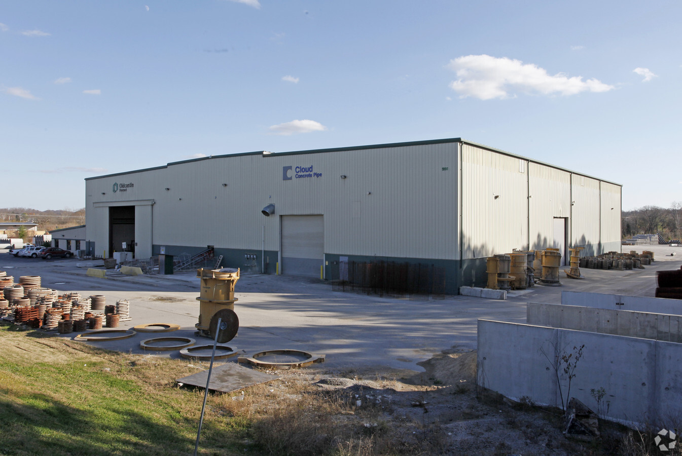
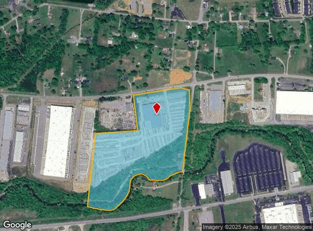
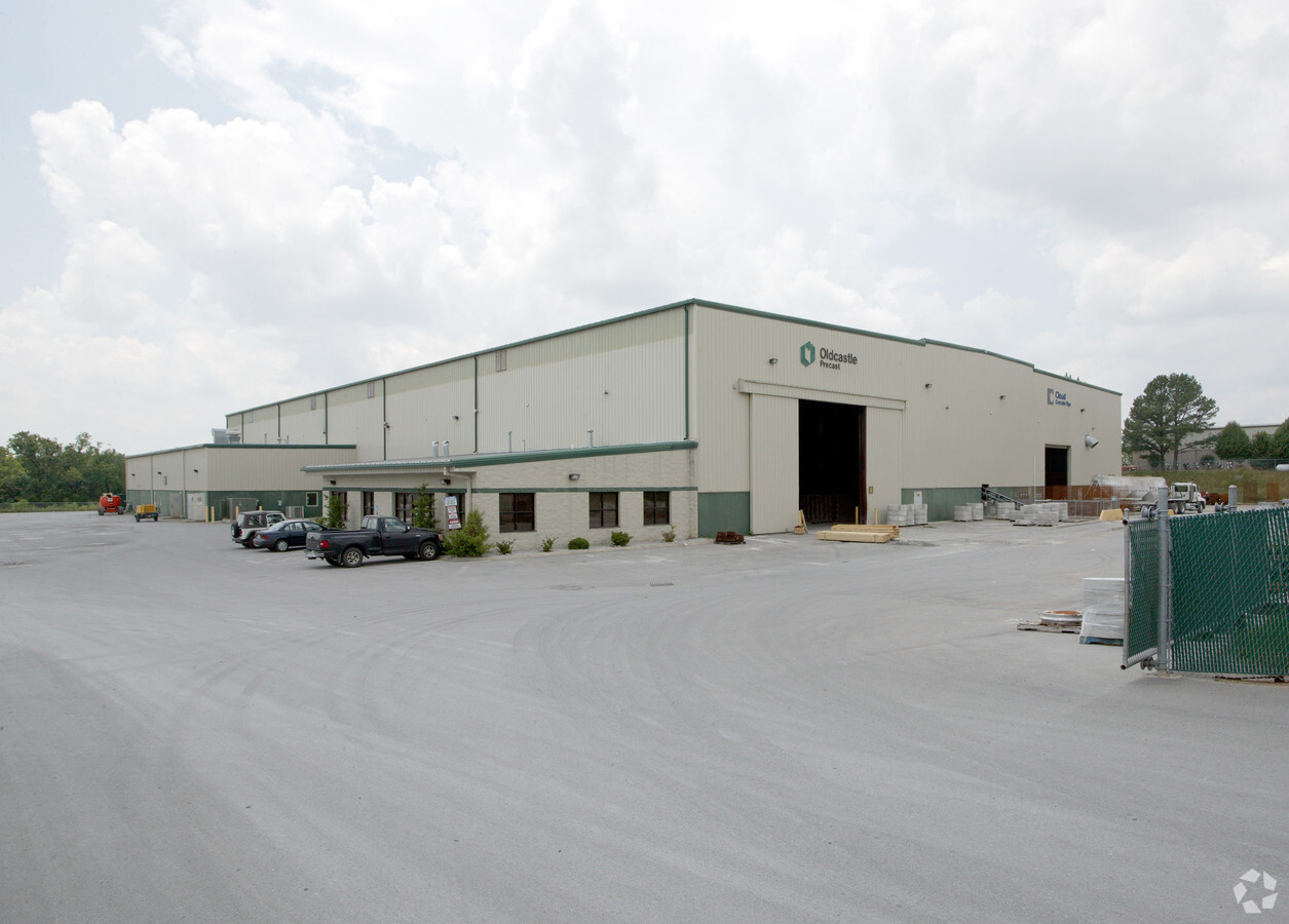
5900 E Division St
079-072.01
DISTRICT: 22, COUNTY AREA: M99
Industrialgeneral
Wilson
AE
Tennessee
47189C0158D
26 AC
2024
Wilson County
2024
Nashville
030202
Nashville-Davidson--Murfreesboro--Franklin, TN
61,641 SF
DEMOGRAPHICS near 5900 E Division St
1 Mile
3 Mile
5 Mile
2024 Total Population
664
9,439
44,254
2029 Population
805
11,502
52,847
Pop Growth 2024-2029
+ 21.23%
+ 21.86%
+ 19.42%
Average Age
41
41
40
2024 Total Households
274
3,828
16,899
HH Growth 2024-2029
+ 21.17%
+ 21.76%
+ 19.30%
Median Household Inc
$77,546
$80,354
$90,419
Avg Household Size
2.40
2.50
2.60
2024 Avg HH Vehicles
2.00
2.00
2.00
Median Home Value
$363,432
$374,907
$400,881
Median Year Built
2010
2010
2010
Nearby Places
- Restaurants
- Banks
- Shops
- Fitness
- Groceries
PUBLIC TRANSPORTATION
COMMUTER RAIL
Martha (East Corridor Line - Tennessee Regional Transportation Authority Music City Star (Music City Star))
DRIVE
WALK
Distance
Martha (East Corridor Line - Tennessee Regional Transportation Authority Music City Star (Music City Star))
5 min
3.5 mi
Hamilton Springs Station (WEGO STAR - WeGo Public Transit)
DRIVE
WALK
Distance
Hamilton Springs Station (WEGO STAR - WeGo Public Transit)
14 min
7.9 mi
AIRPORT
Nashville International
DRIVE
WALK
Distance
Nashville International
23 min
18.5 mi
Freight Ports
Port of Mobile
DRIVE
WALK
Distance
Port of Mobile
507 min
465.3 mi
Nearby Properties
Address
Land Use
TOTAL SIZE
Lot Size
Zoning
Address
Land Use
TOTAL SIZE
Lot Size
Zoning
1,098,108 SF
148 AC
Address
Land Use
TOTAL SIZE
Lot Size
Zoning
247,139 SF
13.21 AC
Address
Land Use
TOTAL SIZE
Lot Size
Zoning
189,300 SF
263 AC
Address
Land Use
TOTAL SIZE
Lot Size
Zoning
553,000 SF
22.12 AC
M4
Address
Land Use
TOTAL SIZE
Lot Size
Zoning
704,800 SF
48.96 AC
Address
Land Use
TOTAL SIZE
Lot Size
Zoning
377,860 SF
32.86 AC
Address
Land Use
TOTAL SIZE
Lot Size
Zoning
586,982 SF
41.71 AC
M4
Address
Land Use
TOTAL SIZE
Lot Size
Zoning
307,128 SF
27.93 AC
Address
Land Use
TOTAL SIZE
Lot Size
Zoning
479,936 SF
27.70 AC
IR
Address
Land Use
TOTAL SIZE
Lot Size
Zoning
308,249 SF
203 AC
Address
Land Use
TOTAL SIZE
Lot Size
Zoning
219,549 SF
210 AC
RM6
Address
Land Use
TOTAL SIZE
Lot Size
Zoning
89,425 SF
20.89 AC
Address
Land Use
TOTAL SIZE
Lot Size
Zoning
405,450 SF
21.26 AC
M4
Address
Land Use
TOTAL SIZE
Lot Size
Zoning
405,450 SF
20.17 AC
M4
Address
Land Use
TOTAL SIZE
Lot Size
Zoning
248,088 SF
17.60 AC
Address
Land Use
TOTAL SIZE
Lot Size
Zoning
265,558 SF
16.23 AC
Address
Land Use
TOTAL SIZE
Lot Size
Zoning
300,570 SF
16.73 AC
Address
Land Use
TOTAL SIZE
Lot Size
Zoning
217,422 SF
13.40 AC
M4
Address
Land Use
TOTAL SIZE
Lot Size
Zoning
225,228 SF
5.22 AC
Address
Land Use
TOTAL SIZE
Lot Size
Zoning
191,476 SF
25.06 AC
Address
Land Use
TOTAL SIZE
Lot Size
Zoning
234,780 SF
15.32 AC
Address
Land Use
TOTAL SIZE
Lot Size
Zoning
42,144 SF
17.78 AC
M4
Address
Land Use
TOTAL SIZE
Lot Size
Zoning
47,502 SF
3.31 AC
Address
Land Use
TOTAL SIZE
Lot Size
Zoning
66,576 SF
9.76 AC
Address
Land Use
TOTAL SIZE
Lot Size
Zoning
114,066 SF
16.91 AC
Address
Land Use
TOTAL SIZE
Lot Size
Zoning
104.54 AC
Address
Land Use
TOTAL SIZE
Lot Size
Zoning
42,407 SF
2.18 AC
Address
Land Use
TOTAL SIZE
Lot Size
Zoning
43,312 SF
2.56 AC
M4
Address
Land Use
TOTAL SIZE
Lot Size
Zoning
23,688 SF
41.56 AC
Address
Land Use
TOTAL SIZE
Lot Size
Zoning
106,000 SF
17.76 AC
The World's #1 Commercial Real Estate Marketplace
Connect with us
© 2025 CoStar Group
The information above has been obtained from sources believed reliable. While we do not doubt its accuracy we have not verified it and make no guarantee, warranty or representation about it. It is your responsibility to independently confirm its accuracy and completeness. Any projections, opinions, assumptions, or estimates used are for example only and do not represent the current or future performance of the property. The value of this transaction to you depends on tax and other factors which should be evaluated by your tax, financial, and legal advisors. You and your advisors should conduct a careful, independent investigation of the property to determine to your satisfaction the suitability of the property for your needs.