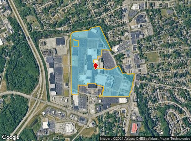
Property Record
5900 Peach St, Erie, PA 16509


NEARBY LISTINGS FOR SALE OR LEASE
Property Detail
5900 Peach St
33-167-667.0-046.03
5900 PEACH ST 84.041 AC NET REF MB 2013-3496
Storebuilding
Erie
AE
Pennsylvania
42049C0203D
84.04 AC
2024
Outlying Erie County
2024
Erie
011001
Erie, PA
35,529 SF
DEMOGRAPHICS near 5900 Peach St
1 Mile
3 Mile
5 Mile
2024 Total Population
6,244
54,608
138,927
2029 Population
6,229
53,934
137,430
Pop Growth 2024-2029
(0.24%)
(1.23%)
(1.08%)
Average Age
42
42
41
2024 Total Households
2,946
23,688
58,528
HH Growth 2024-2029
(0.20%)
(1.33%)
(1.17%)
Median Household Inc
$55,599
$63,122
$52,807
Avg Household Size
1.90
2.20
2.20
2024 Avg HH Vehicles
1.00
2.00
1.00
Median Home Value
$178,919
$154,506
$144,481
Median Year Built
1976
1964
1958
Nearby Places
- Restaurants
- Banks
- Shops
- Fitness
- Groceries
PUBLIC TRANSPORTATION
COMMUTER RAIL
Erie Amtrak Station (Lake Shore Limited - Amtrak)
DRIVE
WALK
Distance
Erie Amtrak Station (Lake Shore Limited - Amtrak)
10 min
4.1 mi
AIRPORT
Erie International/Tom Ridge Field
DRIVE
WALK
Distance
Erie International/Tom Ridge Field
13 min
6.9 mi
Freight Ports
Port of Toledo
DRIVE
WALK
Distance
Port of Toledo
247 min
210.7 mi
Nearby Properties
Address
Land Use
TOTAL SIZE
Lot Size
Zoning
Address
Land Use
TOTAL SIZE
Lot Size
Zoning
24.71 AC
AR
Address
Land Use
TOTAL SIZE
Lot Size
Zoning
8,337 SF
13.31 AC
B1
Address
Land Use
TOTAL SIZE
Lot Size
Zoning
800 SF
10.05 AC
R2
Address
Land Use
TOTAL SIZE
Lot Size
Zoning
14,688 SF
39.53 AC
AR
Address
Land Use
TOTAL SIZE
Lot Size
Zoning
151,500 SF
6.75 AC
Address
Land Use
TOTAL SIZE
Lot Size
Zoning
10,960 SF
29.82 AC
DR
Address
Land Use
TOTAL SIZE
Lot Size
Zoning
22.02 AC
AR
Address
Land Use
TOTAL SIZE
Lot Size
Zoning
227,718 SF
47.43 AC
DB
Address
Land Use
TOTAL SIZE
Lot Size
Zoning
171,306 SF
6.30 AC
AR
Address
Land Use
TOTAL SIZE
Lot Size
Zoning
127,756 SF
7.21 AC
RLB
Address
Land Use
TOTAL SIZE
Lot Size
Zoning
2,754 SF
26.83 AC
DB
Address
Land Use
TOTAL SIZE
Lot Size
Zoning
198,102 SF
27.63 AC
B1
Address
Land Use
TOTAL SIZE
Lot Size
Zoning
80,390 SF
69.53 AC
B1
Address
Land Use
TOTAL SIZE
Lot Size
Zoning
171,966 SF
13.99 AC
RB
Address
Land Use
TOTAL SIZE
Lot Size
Zoning
38 AC
AR
Address
Land Use
TOTAL SIZE
Lot Size
Zoning
178,236 SF
26.15 AC
RLB
Address
Land Use
TOTAL SIZE
Lot Size
Zoning
100,586 SF
4.89 AC
AB
Address
Land Use
TOTAL SIZE
Lot Size
Zoning
73,078 SF
13.80 AC
B1
Address
Land Use
TOTAL SIZE
Lot Size
Zoning
176,811 SF
26.71 AC
B1
Address
Land Use
TOTAL SIZE
Lot Size
Zoning
4,600 SF
50.38 AC
R3
Address
Land Use
TOTAL SIZE
Lot Size
Zoning
100,443 SF
6 AC
B1
Address
Land Use
TOTAL SIZE
Lot Size
Zoning
146.02 AC
R2
Address
Land Use
TOTAL SIZE
Lot Size
Zoning
48,645 SF
3.30 AC
Address
Land Use
TOTAL SIZE
Lot Size
Zoning
36,406 SF
20 AC
Address
Land Use
TOTAL SIZE
Lot Size
Zoning
72,065 SF
5.94 AC
LI
Address
Land Use
TOTAL SIZE
Lot Size
Zoning
125,399 SF
10.93 AC
BB
Address
Land Use
TOTAL SIZE
Lot Size
Zoning
89,004 SF
2.80 AC
Address
Land Use
TOTAL SIZE
Lot Size
Zoning
4,476 SF
70.28 AC
B1
Address
Land Use
TOTAL SIZE
Lot Size
Zoning
37,032 SF
23.84 AC
The World's #1 Commercial Real Estate Marketplace
Connect with us
© 2025 CoStar Group
The information above has been obtained from sources believed reliable. While we do not doubt its accuracy we have not verified it and make no guarantee, warranty or representation about it. It is your responsibility to independently confirm its accuracy and completeness. Any projections, opinions, assumptions, or estimates used are for example only and do not represent the current or future performance of the property. The value of this transaction to you depends on tax and other factors which should be evaluated by your tax, financial, and legal advisors. You and your advisors should conduct a careful, independent investigation of the property to determine to your satisfaction the suitability of the property for your needs.