Property Record
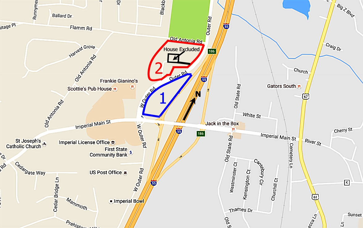
5900 W Outer Rd, Imperial, MO 63052
NEARBY LISTINGS FOR SALE OR LEASE
Property Detail
5900 W Outer Rd
St. Louis, MO-IL
Stovesand Hills 2
09-4.0-18.0-4-003-005.01
STOVESAND HILLS 2 PT LOT 14 & STOVESAND HILLS 3 PT LOTS 4 5 14 15 & PT W IMPERIAL DR
Vacantlandnec
Jefferson
X
Missouri
29099C0232F
14,4
2023
1.56 AC
2023
Jefferson County
700123
St. Louis
1,608 SF
DEMOGRAPHICS near 5900 W Outer Rd
1 Mile
3 Mile
5 Mile
2024 Total Population
3,242
28,767
61,965
2029 Population
3,360
29,399
63,529
Pop Growth 2024-2029
+ 3.64%
+ 2.20%
+ 2.52%
Average Age
42
39
40
2024 Total Households
1,245
10,696
23,081
HH Growth 2024-2029
+ 3.78%
+ 2.32%
+ 2.63%
Median Household Inc
$69,454
$77,256
$79,282
Avg Household Size
2.60
2.70
2.70
2024 Avg HH Vehicles
2.00
2.00
2.00
Median Home Value
$231,432
$215,013
$228,968
Median Year Built
1986
1989
1989
Nearby Places
- Restaurants
- Banks
- Shops
- Fitness
- Groceries
PUBLIC TRANSPORTATION
AIRPORT
St Louis Lambert International
DRIVE
WALK
Distance
St Louis Lambert International
47 min
31.6 mi
Freight Ports
Tulsa Port of Inola
DRIVE
WALK
Distance
Tulsa Port of Inola
423 min
381.7 mi
SALE & LEASE HISTORY
LISTING DATE
SALE/LEASE

Sep 24, 2016
For Sale
Sep 19, 2019
For Sale
Jul 21, 2017
For Sale
Nearby Properties
Address
Land Use
TOTAL SIZE
Lot Size
Zoning
Address
Land Use
TOTAL SIZE
Lot Size
Zoning
127,189 SF
10.76 AC
Address
Land Use
TOTAL SIZE
Lot Size
Zoning
67,462 SF
8.18 AC
CT1
Address
Land Use
TOTAL SIZE
Lot Size
Zoning
116,965 SF
13 AC
Address
Land Use
TOTAL SIZE
Lot Size
Zoning
8.40 AC
Address
Land Use
TOTAL SIZE
Lot Size
Zoning
51,436 SF
9.17 AC
CC2
Address
Land Use
TOTAL SIZE
Lot Size
Zoning
372,506 SF
25.50 AC
PUD
Address
Land Use
TOTAL SIZE
Lot Size
Zoning
33,734 SF
5.61 AC
CC2
Address
Land Use
TOTAL SIZE
Lot Size
Zoning
51,103 SF
14.23 AC
CC2
Address
Land Use
TOTAL SIZE
Lot Size
Zoning
52,870 SF
7.16 AC
CT1
Address
Land Use
TOTAL SIZE
Lot Size
Zoning
46,010 SF
7.84 AC
CC2
Address
Land Use
TOTAL SIZE
Lot Size
Zoning
11,113 SF
1.03 AC
CC2
Address
Land Use
TOTAL SIZE
Lot Size
Zoning
33,802 SF
5.07 AC
CC2
Address
Land Use
TOTAL SIZE
Lot Size
Zoning
27,645 SF
3.10 AC
CT1
Address
Land Use
TOTAL SIZE
Lot Size
Zoning
15.10 AC
CC2
Address
Land Use
TOTAL SIZE
Lot Size
Zoning
14,762 SF
1.10 AC
Address
Land Use
TOTAL SIZE
Lot Size
Zoning
18,601 SF
2.39 AC
Address
Land Use
TOTAL SIZE
Lot Size
Zoning
81,590 SF
5.36 AC
CC2
Address
Land Use
TOTAL SIZE
Lot Size
Zoning
8,156 SF
1.14 AC
CC2
Address
Land Use
TOTAL SIZE
Lot Size
Zoning
71,001 SF
5.38 AC
CC2
Address
Land Use
TOTAL SIZE
Lot Size
Zoning
15,035 SF
2.06 AC
CC2
Address
Land Use
TOTAL SIZE
Lot Size
Zoning
15,580 SF
1.88 AC
CT1
Address
Land Use
TOTAL SIZE
Lot Size
Zoning
10,047 SF
1.20 AC
Address
Land Use
TOTAL SIZE
Lot Size
Zoning
5,472 SF
1.80 AC
CT1
Address
Land Use
TOTAL SIZE
Lot Size
Zoning
11,830 SF
1.46 AC
CT1
Address
Land Use
TOTAL SIZE
Lot Size
Zoning
64,760 SF
5.91 AC
CC2
Address
Land Use
TOTAL SIZE
Lot Size
Zoning
8,365 SF
2.05 AC
Address
Land Use
TOTAL SIZE
Lot Size
Zoning
5,828 SF
0.94 AC
CC2
Address
Land Use
TOTAL SIZE
Lot Size
Zoning
3,257 SF
1.65 AC
Address
Land Use
TOTAL SIZE
Lot Size
Zoning
10,820 SF
1.37 AC
CC2
Address
Land Use
TOTAL SIZE
Lot Size
Zoning
15,130 SF
5 AC
CC2
The World's #1 Commercial Real Estate Marketplace
Connect with us
© 2025 CoStar Group
The information above has been obtained from sources believed reliable. While we do not doubt its accuracy we have not verified it and make no guarantee, warranty or representation about it. It is your responsibility to independently confirm its accuracy and completeness. Any projections, opinions, assumptions, or estimates used are for example only and do not represent the current or future performance of the property. The value of this transaction to you depends on tax and other factors which should be evaluated by your tax, financial, and legal advisors. You and your advisors should conduct a careful, independent investigation of the property to determine to your satisfaction the suitability of the property for your needs.