Property Record
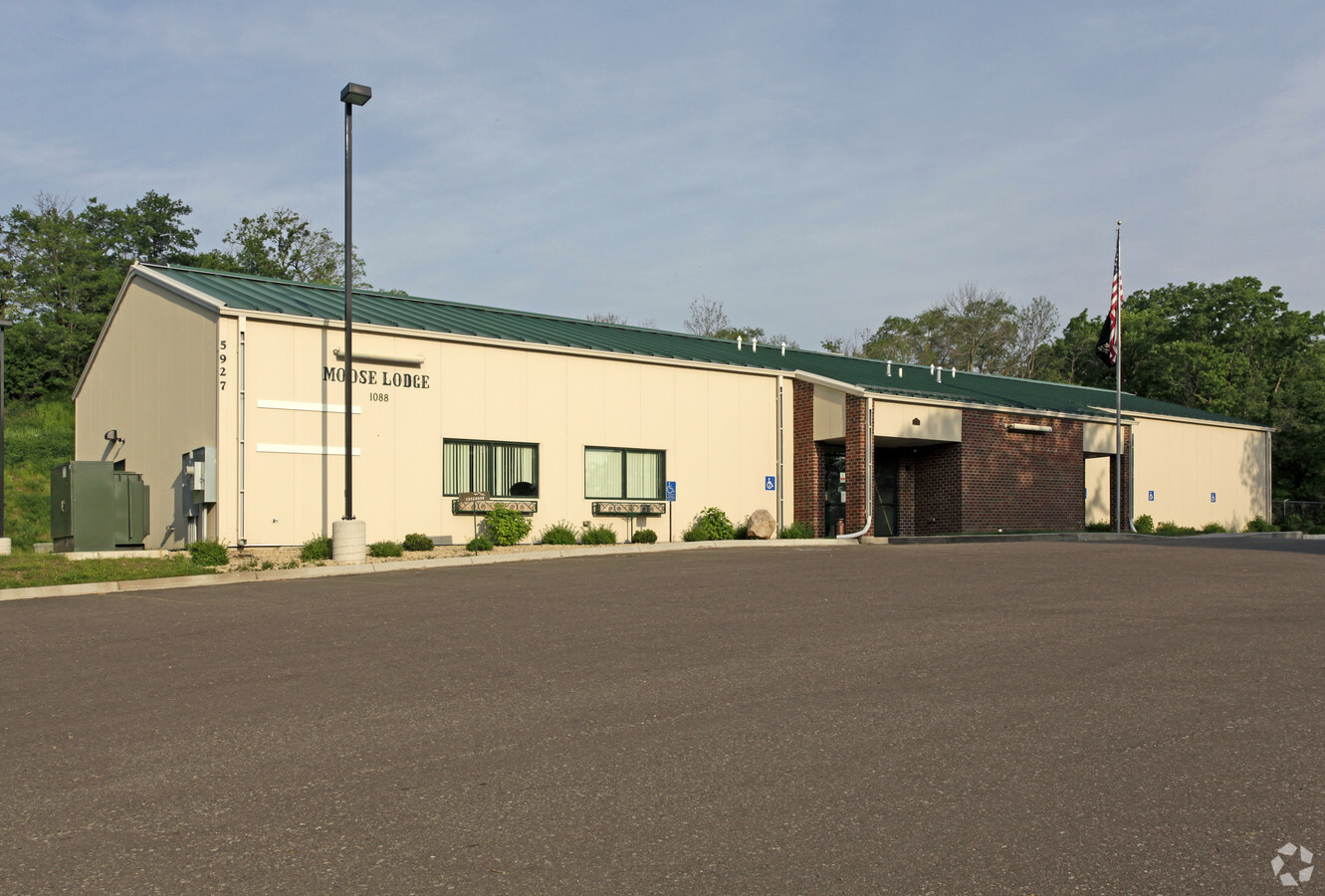
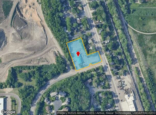
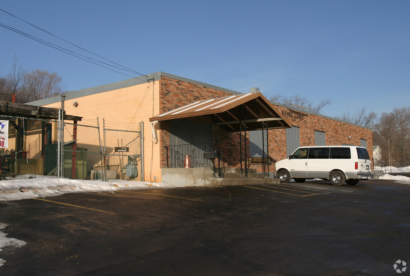
5927 Concord Blvd, Inver Grove Heights, MN 55076
NEARBY LISTINGS FOR SALE OR LEASE
-
-
View all Inver Grove Heights listings for sale on LoopNet.com
Property Detail
5927 Concord Blvd
Minneapolis-St. Paul-Bloomington, MN-WI
Krechs W F 2Nd Addition
20-43251-02-110
KRECHS W F 2ND ADDITION 11 2 ALL OF LOTS 1 TO 11 BLK 2 & VAC ALLEYS SUBJ TO ESMNT OVER S 20 FT OF LOTS 5 THRU 8 & 11 SUBJ TO PARCEL 37 DAKOTA CO R/W MAP 295
Commercialnec
Dakota
X
Minnesota
27037C0107E
110
2024
1.59 AC
2023
Suburban St Paul
060502
Minneapolis/St Paul
6,400 SF
DEMOGRAPHICS near 5927 Concord Blvd
1 Mile
3 Mile
5 Mile
2024 Total Population
5,605
57,628
144,089
2029 Population
5,744
59,600
150,539
Pop Growth 2024-2029
+ 2.48%
+ 3.42%
+ 4.48%
Average Age
39
40
40
2024 Total Households
2,180
23,308
56,394
HH Growth 2024-2029
+ 2.48%
+ 3.35%
+ 4.39%
Median Household Inc
$74,644
$77,083
$83,862
Avg Household Size
2.50
2.40
2.50
2024 Avg HH Vehicles
2.00
2.00
2.00
Median Home Value
$244,615
$278,825
$299,069
Median Year Built
1966
1977
1981
Nearby Places
- Restaurants
- Banks
- Shops
- Fitness
- Groceries
PUBLIC TRANSPORTATION
COMMUTER RAIL
St. Paul-Minneapolis (Empire Builder - Amtrak)
DRIVE
WALK
Distance
St. Paul-Minneapolis (Empire Builder - Amtrak)
14 min
8.7 mi
AIRPORT
Minneapolis-St Paul International/Wold-Chamberlain
DRIVE
WALK
Distance
Minneapolis-St Paul International/Wold-Chamberlain
19 min
12.1 mi
Freight Ports
Port Milwaukee
DRIVE
WALK
Distance
Port Milwaukee
363 min
329.9 mi
Nearby Properties
Address
Land Use
TOTAL SIZE
Lot Size
Zoning
Address
Land Use
TOTAL SIZE
Lot Size
Zoning
Address
Land Use
TOTAL SIZE
Lot Size
Zoning
196,078 SF
31.29 AC
Address
Land Use
TOTAL SIZE
Lot Size
Zoning
228,050 SF
0.32 AC
Address
Land Use
TOTAL SIZE
Lot Size
Zoning
284,876 SF
29.54 AC
Address
Land Use
TOTAL SIZE
Lot Size
Zoning
169,237 SF
23.38 AC
Address
Land Use
TOTAL SIZE
Lot Size
Zoning
Address
Land Use
TOTAL SIZE
Lot Size
Zoning
343,282 SF
10.79 AC
Address
Land Use
TOTAL SIZE
Lot Size
Zoning
191,349 SF
5.10 AC
Address
Land Use
TOTAL SIZE
Lot Size
Zoning
227,382 SF
13.14 AC
Address
Land Use
TOTAL SIZE
Lot Size
Zoning
174,820 SF
7.79 AC
Address
Land Use
TOTAL SIZE
Lot Size
Zoning
111,595 SF
2.24 AC
Address
Land Use
TOTAL SIZE
Lot Size
Zoning
147,944 SF
5.17 AC
Address
Land Use
TOTAL SIZE
Lot Size
Zoning
98,138 SF
2.12 AC
Address
Land Use
TOTAL SIZE
Lot Size
Zoning
219,438 SF
90.20 AC
Address
Land Use
TOTAL SIZE
Lot Size
Zoning
143,712 SF
9.57 AC
Address
Land Use
TOTAL SIZE
Lot Size
Zoning
290,362 SF
12.83 AC
Address
Land Use
TOTAL SIZE
Lot Size
Zoning
117,784 SF
1.86 AC
Address
Land Use
TOTAL SIZE
Lot Size
Zoning
64,860 SF
2.65 AC
Address
Land Use
TOTAL SIZE
Lot Size
Zoning
67,370 SF
1.18 AC
Address
Land Use
TOTAL SIZE
Lot Size
Zoning
87,080 SF
2.16 AC
Address
Land Use
TOTAL SIZE
Lot Size
Zoning
95,693 SF
3.64 AC
Address
Land Use
TOTAL SIZE
Lot Size
Zoning
185,715 SF
11.50 AC
Address
Land Use
TOTAL SIZE
Lot Size
Zoning
110,256 SF
4.04 AC
Address
Land Use
TOTAL SIZE
Lot Size
Zoning
130,171 SF
10.22 AC
Address
Land Use
TOTAL SIZE
Lot Size
Zoning
161,676 SF
13.90 AC
Address
Land Use
TOTAL SIZE
Lot Size
Zoning
86,527 SF
10.21 AC
Address
Land Use
TOTAL SIZE
Lot Size
Zoning
201,558 SF
10.85 AC
Address
Land Use
TOTAL SIZE
Lot Size
Zoning
83,000 SF
6.45 AC
Address
Land Use
TOTAL SIZE
Lot Size
Zoning
61,138 SF
7.67 AC
Address
Land Use
TOTAL SIZE
Lot Size
Zoning
68.15 AC
The World's #1 Commercial Real Estate Marketplace
Connect with us
© 2025 CoStar Group
The information above has been obtained from sources believed reliable. While we do not doubt its accuracy we have not verified it and make no guarantee, warranty or representation about it. It is your responsibility to independently confirm its accuracy and completeness. Any projections, opinions, assumptions, or estimates used are for example only and do not represent the current or future performance of the property. The value of this transaction to you depends on tax and other factors which should be evaluated by your tax, financial, and legal advisors. You and your advisors should conduct a careful, independent investigation of the property to determine to your satisfaction the suitability of the property for your needs.