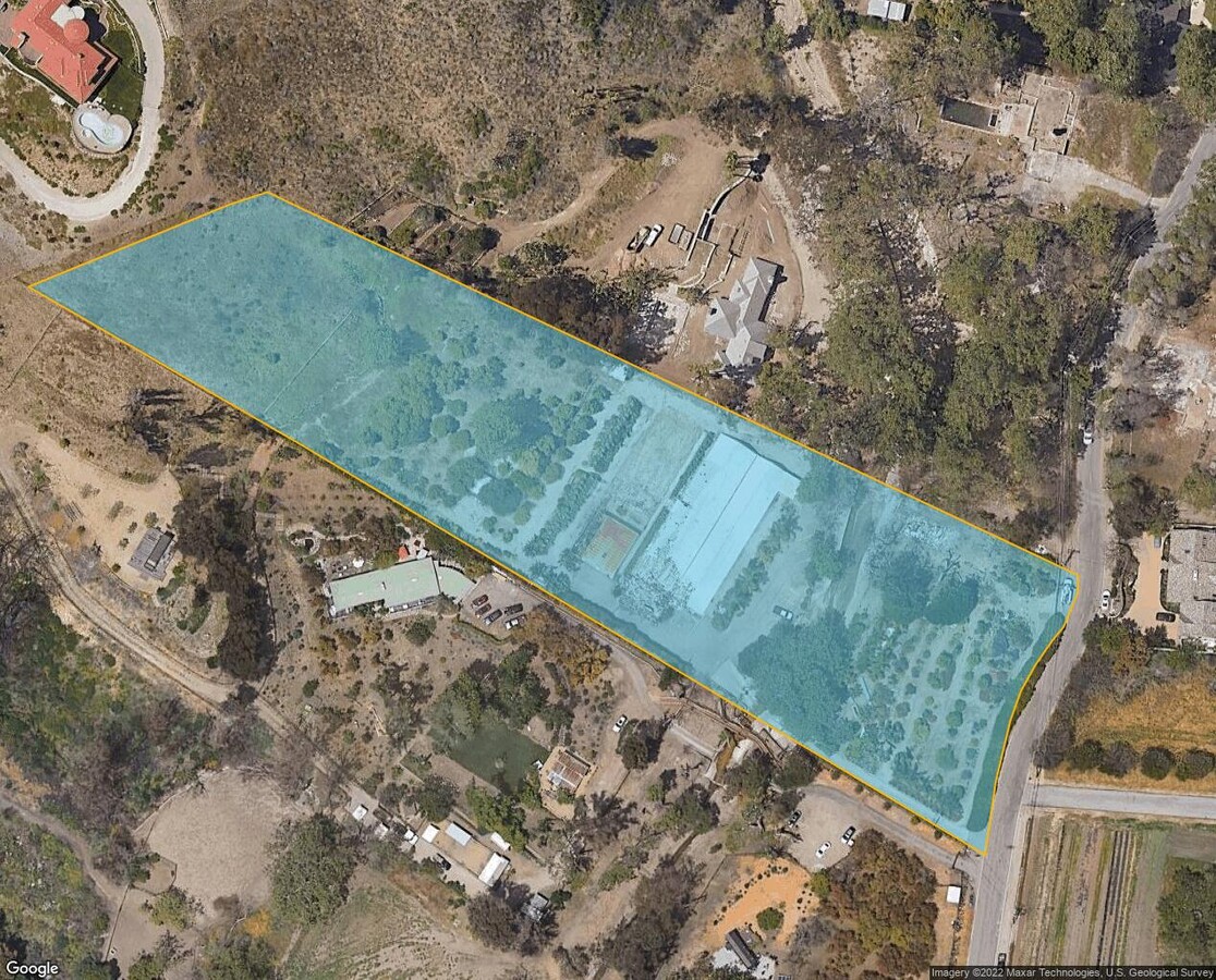
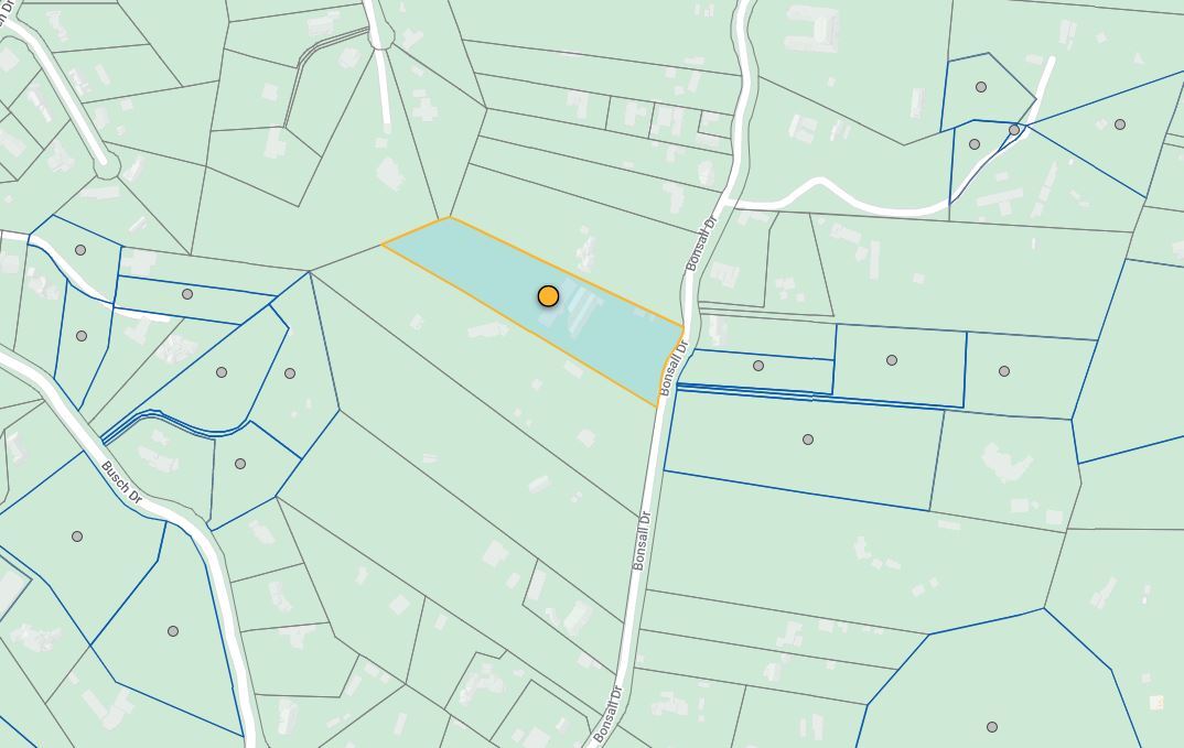
Property Record
5949 Bonsall Dr, Malibu, CA 90265
NEARBY LISTINGS FOR SALE OR LEASE
Property Detail
5949 Bonsall Dr
Los Angeles-Long Beach-Glendale, CA
Portion Rancho Topanga Malibu Sequit
4467-024-003
RECORD OF SURVEY AS PER BK 56 PG 14 TO 17 OF RECORD OF SURVEYS EX OF ST LOT/SEC 10 BLK/DIV/TWN 6
Horticulturegrowinghousesagricultural
Los Angeles
AE
California
06037C1514G
10
2024
3.95 AC
2024
Pacific Palisades/Malibu
800411
Los Angeles
13,370 SF
DEMOGRAPHICS near 5949 Bonsall Dr
1 Mile
3 Mile
5 Mile
2024 Total Population
3,126
8,875
12,029
2029 Population
3,201
9,121
12,309
Pop Growth 2024-2029
+ 2.40%
+ 2.77%
+ 2.33%
Average Age
46
47
45
2024 Total Households
1,248
3,508
4,408
HH Growth 2024-2029
+ 2.16%
+ 2.65%
+ 2.65%
Median Household Inc
$181,521
$177,399
$175,480
Avg Household Size
2.50
2.50
2.50
2024 Avg HH Vehicles
2.00
2.00
2.00
Median Home Value
$1,122,047
$1,126,655
$1,127,524
Median Year Built
1978
1977
1978
Nearby Places
- Restaurants
- Banks
- Shops
- Fitness
- Groceries
PUBLIC TRANSPORTATION
AIRPORT
Los Angeles International
DRIVE
WALK
Distance
Los Angeles International
53 min
29.3 mi
Bob Hope
DRIVE
WALK
Distance
Bob Hope
60 min
41.3 mi
Freight Ports
The Port of Hueneme
DRIVE
WALK
Distance
The Port of Hueneme
39 min
26.8 mi
Nearby Properties
Address
Land Use
TOTAL SIZE
Lot Size
Zoning
Address
Land Use
TOTAL SIZE
Lot Size
Zoning
41,478 SF
13.39 AC
MACC
Address
Land Use
TOTAL SIZE
Lot Size
Zoning
83,298 SF
2.46 AC
LCC3*
Address
Land Use
TOTAL SIZE
Lot Size
Zoning
0.93 AC
LCRA1*
Address
Land Use
TOTAL SIZE
Lot Size
Zoning
64,471 SF
1.30 AC
LCC3*
Address
Land Use
TOTAL SIZE
Lot Size
Zoning
3,354 SF
0.73 AC
LCR3-1*
Address
Land Use
TOTAL SIZE
Lot Size
Zoning
5,192 SF
1.03 AC
LCR220000*
Address
Land Use
TOTAL SIZE
Lot Size
Zoning
1.05 AC
LCRA1*
Address
Land Use
TOTAL SIZE
Lot Size
Zoning
0.42 AC
LCR110000*
Address
Land Use
TOTAL SIZE
Lot Size
Zoning
2.94 AC
LCR111000*
Address
Land Use
TOTAL SIZE
Lot Size
Zoning
30,629 SF
1.62 AC
LCC2*
Address
Land Use
TOTAL SIZE
Lot Size
Zoning
1.22 AC
LCRA1*
Address
Land Use
TOTAL SIZE
Lot Size
Zoning
0.39 AC
LUCR110000
Address
Land Use
TOTAL SIZE
Lot Size
Zoning
0.26 AC
LCR110000*
Address
Land Use
TOTAL SIZE
Lot Size
Zoning
3.08 AC
LCR11*
Address
Land Use
TOTAL SIZE
Lot Size
Zoning
9.87 AC
LCRA1Y
Address
Land Use
TOTAL SIZE
Lot Size
Zoning
12,316 SF
0.43 AC
LCC1-2*
Address
Land Use
TOTAL SIZE
Lot Size
Zoning
1.18 AC
LCRA1*
Address
Land Use
TOTAL SIZE
Lot Size
Zoning
11,854 SF
3.21 AC
LCR3*
Address
Land Use
TOTAL SIZE
Lot Size
Zoning
0.50 AC
LCRR10
Address
Land Use
TOTAL SIZE
Lot Size
Zoning
0.53 AC
LCRR10
Address
Land Use
TOTAL SIZE
Lot Size
Zoning
0.55 AC
LCRR10
Address
Land Use
TOTAL SIZE
Lot Size
Zoning
0.54 AC
LCRR10
Address
Land Use
TOTAL SIZE
Lot Size
Zoning
1.08 AC
LCRA1*
Address
Land Use
TOTAL SIZE
Lot Size
Zoning
7.13 AC
LCRA1*
Address
Land Use
TOTAL SIZE
Lot Size
Zoning
0.51 AC
LCR120000*
Address
Land Use
TOTAL SIZE
Lot Size
Zoning
12,110 SF
1.01 AC
LCR220000*
Address
Land Use
TOTAL SIZE
Lot Size
Zoning
0.92 AC
LCRR1*
Address
Land Use
TOTAL SIZE
Lot Size
Zoning
2,166 SF
6.55 AC
LCRA1*
Address
Land Use
TOTAL SIZE
Lot Size
Zoning
0.67 AC
LCR220000*
The World's #1 Commercial Real Estate Marketplace
Connect with us
© 2025 CoStar Group
The information above has been obtained from sources believed reliable. While we do not doubt its accuracy we have not verified it and make no guarantee, warranty or representation about it. It is your responsibility to independently confirm its accuracy and completeness. Any projections, opinions, assumptions, or estimates used are for example only and do not represent the current or future performance of the property. The value of this transaction to you depends on tax and other factors which should be evaluated by your tax, financial, and legal advisors. You and your advisors should conduct a careful, independent investigation of the property to determine to your satisfaction the suitability of the property for your needs.