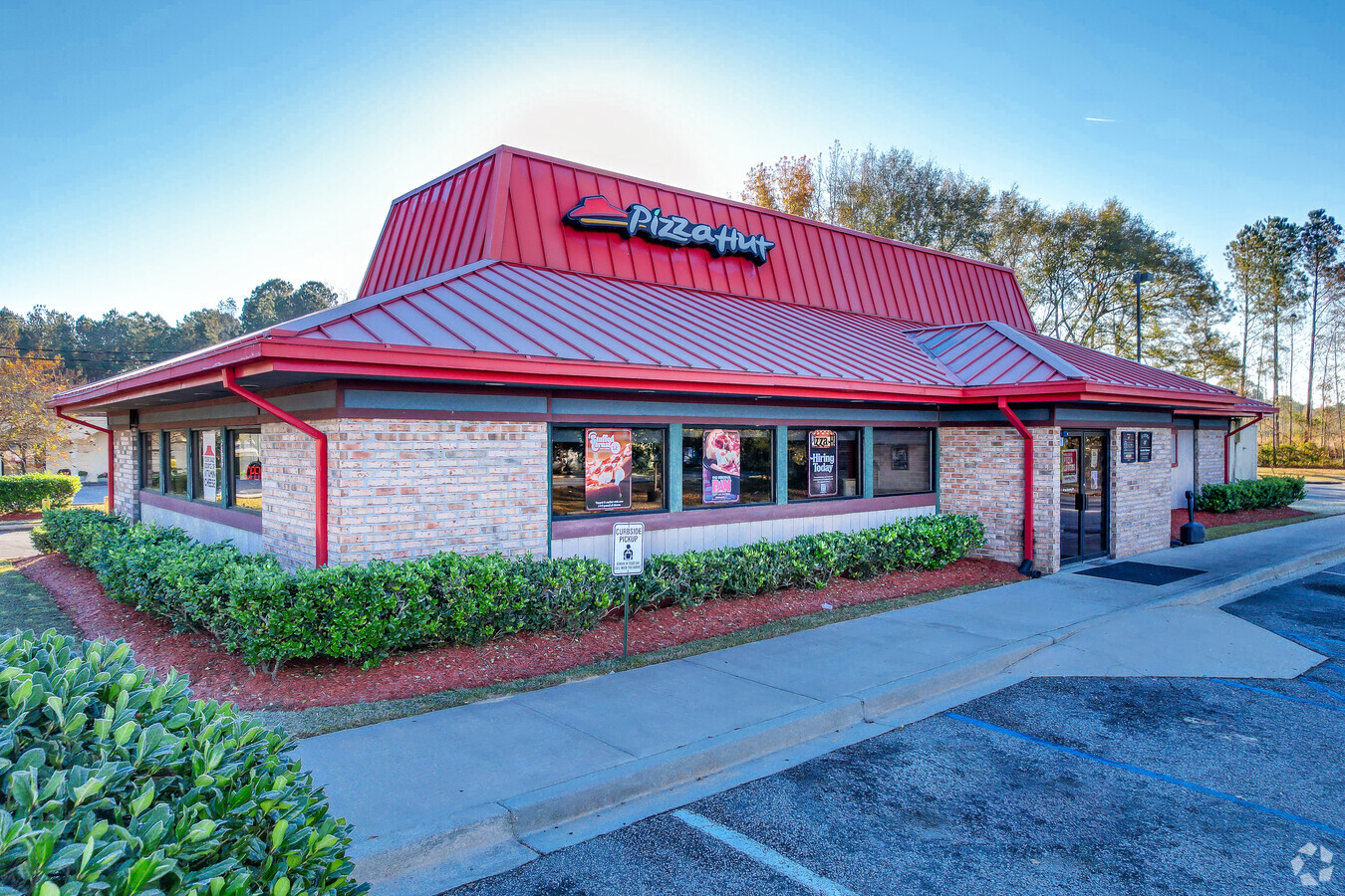
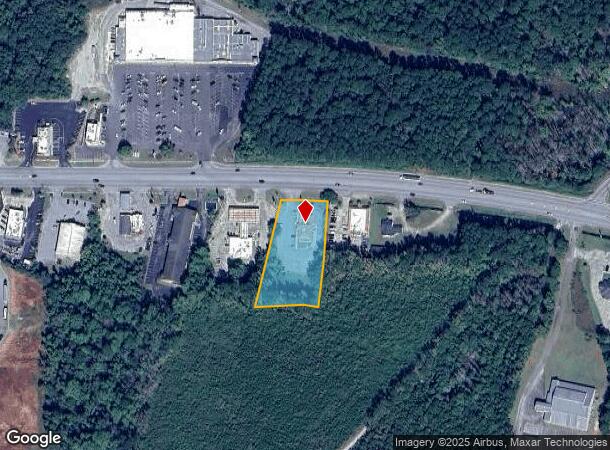
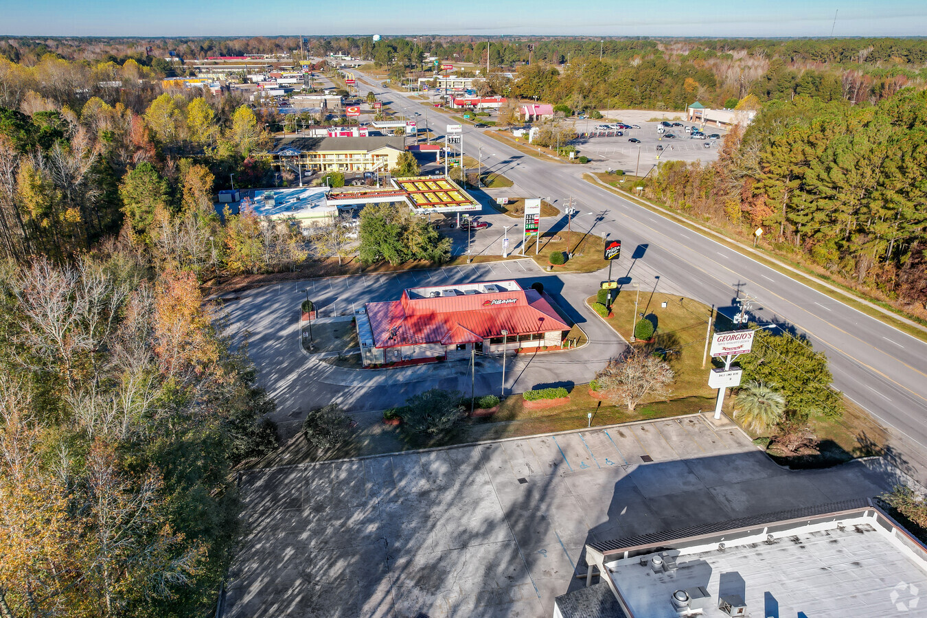
Property Record
5953 W Jim Bilton Blvd, Saint George, SC 29477
NEARBY LISTINGS FOR SALE OR LEASE
Property Detail
5953 W Jim Bilton Blvd
044-00-00-025
5953 W JIM BILTON BLVD COMMERCIAL
Restaurantdrivein
Dorchester
AE
South Carolina
45035C0153E
1.50 AC
2024
Dorchester County
2024
Charleston/N Charleston
010200
Charleston-North Charleston, SC
3,363 SF
DEMOGRAPHICS near 5953 W Jim Bilton Blvd
1 Mile
3 Mile
5 Mile
2024 Total Population
462
3,912
6,280
2029 Population
508
4,283
6,868
Pop Growth 2024-2029
+ 9.96%
+ 9.48%
+ 9.36%
Average Age
47
45
45
2024 Total Households
192
1,649
2,645
HH Growth 2024-2029
+ 9.90%
+ 9.46%
+ 9.26%
Median Household Inc
$30,526
$34,361
$36,357
Avg Household Size
2.30
2.30
2.30
2024 Avg HH Vehicles
2.00
2.00
2.00
Median Home Value
$145,161
$145,727
$140,884
Median Year Built
1977
1979
1980
Nearby Places
- Restaurants
- Banks
- Shops
- Fitness
- Groceries
SALE & LEASE HISTORY
LISTING DATE
SALE/LEASE

Nov 20, 2018
For Sale
Nearby Properties
Address
Land Use
TOTAL SIZE
Lot Size
Zoning
Address
Land Use
TOTAL SIZE
Lot Size
Zoning
107,670 SF
17 AC
RMU_SG
Address
Land Use
TOTAL SIZE
Lot Size
Zoning
37,376 SF
2.20 AC
RMD_SG
Address
Land Use
TOTAL SIZE
Lot Size
Zoning
51,281 SF
7.54 AC
CC_SG
Address
Land Use
TOTAL SIZE
Lot Size
Zoning
38,467 SF
3.70 AC
SFR_SG
Address
Land Use
TOTAL SIZE
Lot Size
Zoning
9,053 SF
29.87 AC
CC_SG
Address
Land Use
TOTAL SIZE
Lot Size
Zoning
8,232 SF
5.30 AC
CC_SG
Address
Land Use
TOTAL SIZE
Lot Size
Zoning
62,937 SF
6.04 AC
SFR_SG
Address
Land Use
TOTAL SIZE
Lot Size
Zoning
3,268 SF
4.21 AC
AR_DC
Address
Land Use
TOTAL SIZE
Lot Size
Zoning
19,625 SF
37.60 AC
CC_SG
Address
Land Use
TOTAL SIZE
Lot Size
Zoning
28,395 SF
5.24 AC
SFR_SG
Address
Land Use
TOTAL SIZE
Lot Size
Zoning
29,117 SF
1.56 AC
TC_RE
Address
Land Use
TOTAL SIZE
Lot Size
Zoning
14,193 SF
0.37 AC
RMU_SG
Address
Land Use
TOTAL SIZE
Lot Size
Zoning
11,945 SF
2.85 AC
LC_SG
Address
Land Use
TOTAL SIZE
Lot Size
Zoning
10,447 SF
82.62 AC
LC_SG
Address
Land Use
TOTAL SIZE
Lot Size
Zoning
33,158 SF
5 AC
SFR_SG
Address
Land Use
TOTAL SIZE
Lot Size
Zoning
52,080 SF
11.96 AC
I_DC
Address
Land Use
TOTAL SIZE
Lot Size
Zoning
46,681 SF
15.40 AC
SFR_SG
Address
Land Use
TOTAL SIZE
Lot Size
Zoning
38,783 SF
18.63 AC
RMD_SG
Address
Land Use
TOTAL SIZE
Lot Size
Zoning
41,438 SF
5.10 AC
CC_SG
Address
Land Use
TOTAL SIZE
Lot Size
Zoning
320 SF
420.09 AC
AR_DC
Address
Land Use
TOTAL SIZE
Lot Size
Zoning
18,857 SF
2.08 AC
AR_DC
Address
Land Use
TOTAL SIZE
Lot Size
Zoning
19,166 SF
2.06 AC
CC_SG
Address
Land Use
TOTAL SIZE
Lot Size
Zoning
8,343 SF
1.30 AC
CC_SG
Address
Land Use
TOTAL SIZE
Lot Size
Zoning
31,372 SF
0.87 AC
RMU_SG
Address
Land Use
TOTAL SIZE
Lot Size
Zoning
20,766 SF
7.28 AC
RMU_SG
Address
Land Use
TOTAL SIZE
Lot Size
Zoning
3,917 SF
1.30 AC
CC_SG
Address
Land Use
TOTAL SIZE
Lot Size
Zoning
22,875 SF
1.64 AC
CC_SG
Address
Land Use
TOTAL SIZE
Lot Size
Zoning
294 AC
AR_DC
Address
Land Use
TOTAL SIZE
Lot Size
Zoning
5,639 SF
4.40 AC
LC_SG
Address
Land Use
TOTAL SIZE
Lot Size
Zoning
44.98 AC
RMD_SG
The World's #1 Commercial Real Estate Marketplace
Connect with us
© 2025 CoStar Group
The information above has been obtained from sources believed reliable. While we do not doubt its accuracy we have not verified it and make no guarantee, warranty or representation about it. It is your responsibility to independently confirm its accuracy and completeness. Any projections, opinions, assumptions, or estimates used are for example only and do not represent the current or future performance of the property. The value of this transaction to you depends on tax and other factors which should be evaluated by your tax, financial, and legal advisors. You and your advisors should conduct a careful, independent investigation of the property to determine to your satisfaction the suitability of the property for your needs.