Property Record
5901 N State Road 135, Greenwood, IN 46143


NEARBY LISTINGS FOR SALE OR LEASE
Property Detail
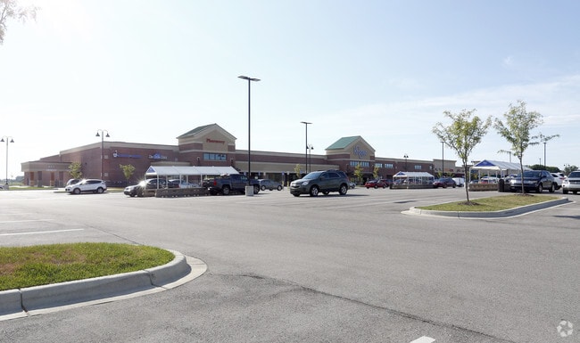
5901 N State Road 135
Indianapolis-Carmel-Anderson, IN
Lone Pine Comm Sub
41-04-24-022-013.000-040
LONE PINE COMMERCIAL SUB LOT 3
Stripcommercialcenter
Johnson
X
Indiana
18109C0200E
3
2024
6.89 AC
2025
Far South Johnson Cty
610705
Indianapolis
23,899 SF
DEMOGRAPHICS near 5901 N State Road 135
1 Mile
3 Mile
5 Mile
2024 Total Population
3,863
34,640
103,907
2029 Population
4,119
36,971
110,806
Pop Growth 2024-2029
+ 6.63%
+ 6.73%
+ 6.64%
Average Age
34
38
39
2024 Total Households
1,245
12,082
38,090
HH Growth 2024-2029
+ 6.83%
+ 6.89%
+ 6.82%
Median Household Inc
$95,598
$96,936
$84,787
Avg Household Size
3.10
2.80
2.70
2024 Avg HH Vehicles
2.00
2.00
2.00
Median Home Value
$344,772
$307,993
$240,343
Median Year Built
2010
2000
1993
Nearby Places
Map Layers
Map Styles
 Street
 Aerial
- Restaurants
- Banks
- Shops
- Fitness
- Groceries
PUBLIC TRANSPORTATION
AIRPORT
Indianapolis International
DRIVE
WALK
Distance
Indianapolis International
41 min
24.2 mi
SALE & LEASE HISTORY
LISTING DATE
SALE/LEASE

Sep 25, 2016
For Lease
Nearby Properties
Address
Land Use
TOTAL SIZE
Lot Size
Zoning
Address
Land Use
TOTAL SIZE
Lot Size
Zoning
4,582 SF
30.22 AC
R4
Address
Land Use
TOTAL SIZE
Lot Size
Zoning
39,866 SF
19.99 AC
Address
Land Use
TOTAL SIZE
Lot Size
Zoning
19,104 SF
27.27 AC
R2
Address
Land Use
TOTAL SIZE
Lot Size
Zoning
3,346 SF
21.35 AC
Address
Land Use
TOTAL SIZE
Lot Size
Zoning
13,896 SF
20.98 AC
Address
Land Use
TOTAL SIZE
Lot Size
Zoning
33,790 SF
13.01 AC
Address
Land Use
TOTAL SIZE
Lot Size
Zoning
152,664 SF
14.82 AC
Address
Land Use
TOTAL SIZE
Lot Size
Zoning
4,982 SF
15.06 AC
R4
Address
Land Use
TOTAL SIZE
Lot Size
Zoning
82,619 SF
13.50 AC
Address
Land Use
TOTAL SIZE
Lot Size
Zoning
173,052 SF
17.35 AC
Address
Land Use
TOTAL SIZE
Lot Size
Zoning
748 SF
6.83 AC
Address
Land Use
TOTAL SIZE
Lot Size
Zoning
69,215 SF
4.90 AC
B1
Address
Land Use
TOTAL SIZE
Lot Size
Zoning
98,409 SF
8.82 AC
Address
Land Use
TOTAL SIZE
Lot Size
Zoning
98,316 SF
10.58 AC
Address
Land Use
TOTAL SIZE
Lot Size
Zoning
74,067 SF
9.38 AC
R2
Address
Land Use
TOTAL SIZE
Lot Size
Zoning
47,171 SF
4.48 AC
Address
Land Use
TOTAL SIZE
Lot Size
Zoning
Address
Land Use
TOTAL SIZE
Lot Size
Zoning
1,426 SF
11.73 AC
Address
Land Use
TOTAL SIZE
Lot Size
Zoning
43,384 SF
9.17 AC
Address
Land Use
TOTAL SIZE
Lot Size
Zoning
16,699 SF
2.20 AC
Address
Land Use
TOTAL SIZE
Lot Size
Zoning
9,540 SF
3.19 AC
Address
Land Use
TOTAL SIZE
Lot Size
Zoning
29,296 SF
13.33 AC
A1
Address
Land Use
TOTAL SIZE
Lot Size
Zoning
55,632 SF
7.27 AC
B1
Address
Land Use
TOTAL SIZE
Lot Size
Zoning
16,000 SF
4.29 AC
Address
Land Use
TOTAL SIZE
Lot Size
Zoning
2,464 SF
32.91 AC
Address
Land Use
TOTAL SIZE
Lot Size
Zoning
9,769 SF
24.05 AC
Address
Land Use
TOTAL SIZE
Lot Size
Zoning
22,590 SF
3.08 AC
R4
Address
Land Use
TOTAL SIZE
Lot Size
Zoning
21,804 SF
1.56 AC
R4
Address
Land Use
TOTAL SIZE
Lot Size
Zoning
12,236 SF
1.34 AC
Address
Land Use
TOTAL SIZE
Lot Size
Zoning
17,703 SF
1.84 AC
The World's #1 Commercial Real Estate Marketplace
Connect with us
© 2026 CoStar Group
The information above has been obtained from sources believed reliable. While we do not doubt its accuracy we have not verified it and make no guarantee, warranty or representation about it. It is your responsibility to independently confirm its accuracy and completeness. Any projections, opinions, assumptions, or estimates used are for example only and do not represent the current or future performance of the property. The value of this transaction to you depends on tax and other factors which should be evaluated by your tax, financial, and legal advisors. You and your advisors should conduct a careful, independent investigation of the property to determine to your satisfaction the suitability of the property for your needs.