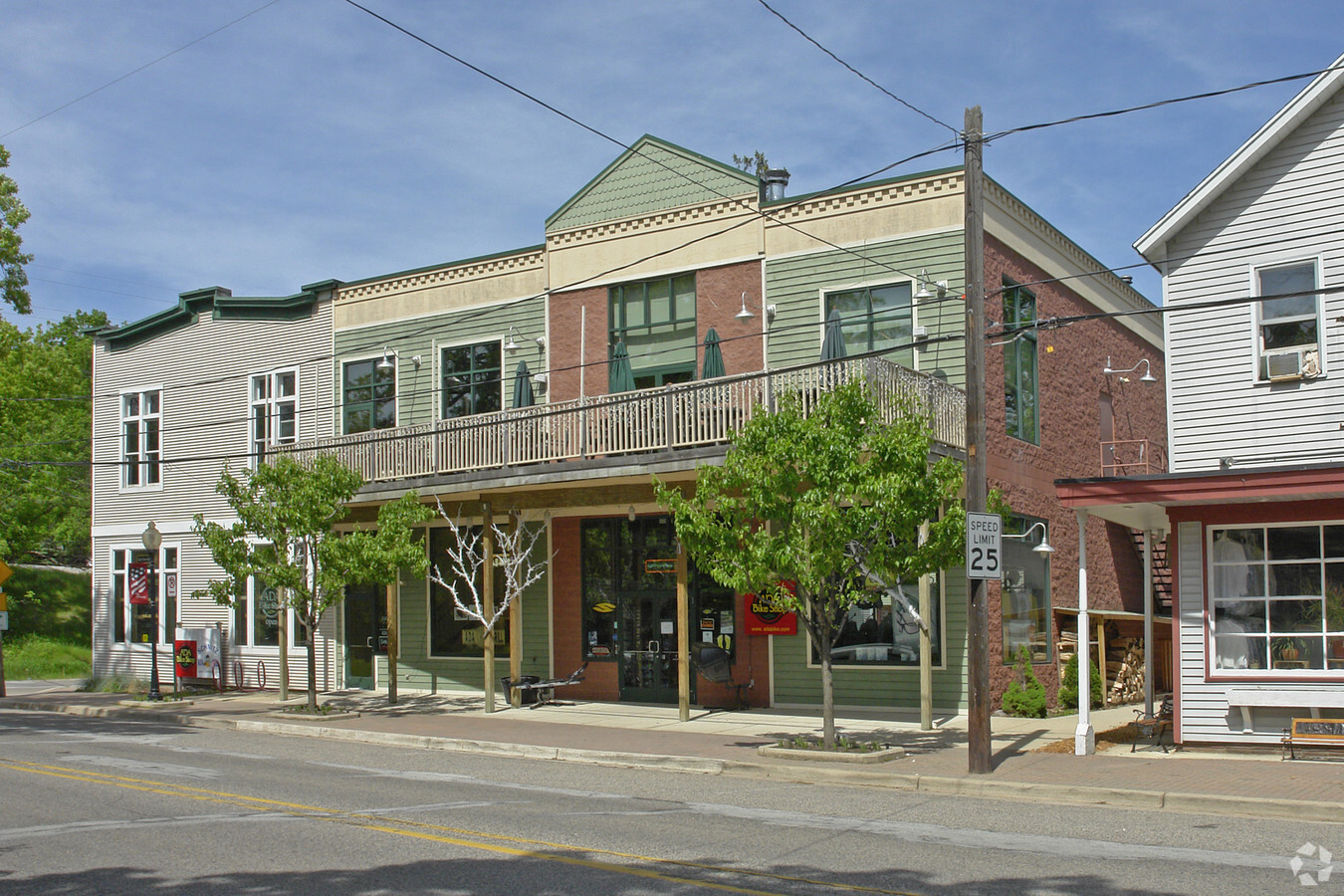
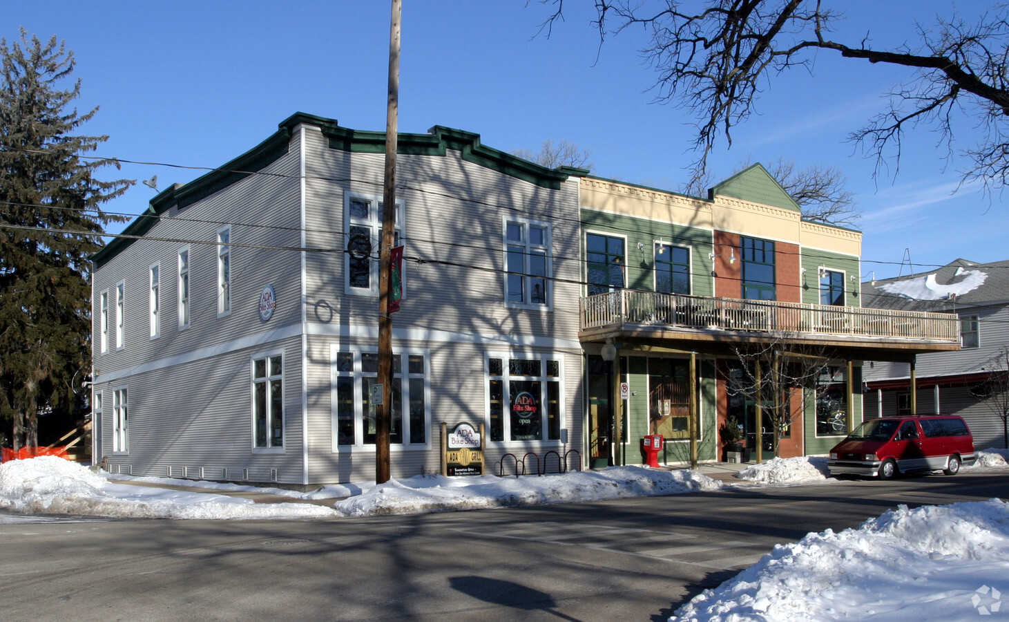
Property Record
597 Ada Dr Se, Ada, MI 49301
NEARBY LISTINGS FOR SALE OR LEASE
-
-
View all Ada listings for sale on LoopNet.com
Property Detail
597 Ada Dr Se
West Michigan
Citizens' Plat Of The Village Of Ada
Grand Rapids-Wyoming, MI
LOTS 27 & 28 EX NELY 2.17 FT OF LOT 28 BLK 2 * CITIZENS' PLAT OF THE VILLAGE OF ADA
41-15-34-103-020
Kent
Commercialnec
Michigan
2023
27-28
2024
0.23 AC
0119023009
Ada/Lowell
10,492 SF
DEMOGRAPHICS near 597 Ada Dr Se
1 Mile
3 Mile
5 Mile
2024 Total Population
2,314
19,164
50,446
2029 Population
2,364
19,385
51,007
Pop Growth 2024-2029
+ 2.16%
+ 1.15%
+ 1.11%
Average Age
39
41
41
2024 Total Households
772
6,650
17,965
HH Growth 2024-2029
+ 2.20%
+ 1.11%
+ 1.16%
Median Household Inc
$145,883
$135,963
$112,638
Avg Household Size
2.90
2.90
2.70
2024 Avg HH Vehicles
2.00
2.00
2.00
Median Home Value
$354,213
$404,789
$385,853
Median Year Built
1987
1990
1987
Nearby Places
- Restaurants
- Banks
- Shops
- Fitness
- Groceries
PUBLIC TRANSPORTATION
AIRPORT
Gerald R Ford International
DRIVE
WALK
Distance
Gerald R Ford International
22 min
10.9 mi
Freight Ports
Port Milwaukee
DRIVE
WALK
Distance
Port Milwaukee
318 min
273.0 mi
SALE & LEASE HISTORY
LISTING DATE
SALE/LEASE

Sep 18, 2018
For Sale
Nearby Properties
Address
Land Use
TOTAL SIZE
Lot Size
Zoning
Address
Land Use
TOTAL SIZE
Lot Size
Zoning
277.36 AC
I
Address
Land Use
TOTAL SIZE
Lot Size
Zoning
709,488 SF
106.95 AC
LI
Address
Land Use
TOTAL SIZE
Lot Size
Zoning
Address
Land Use
TOTAL SIZE
Lot Size
Zoning
226,877 SF
22.40 AC
R2
Address
Land Use
TOTAL SIZE
Lot Size
Zoning
8.97 AC
Address
Land Use
TOTAL SIZE
Lot Size
Zoning
Address
Land Use
TOTAL SIZE
Lot Size
Zoning
Address
Land Use
TOTAL SIZE
Lot Size
Zoning
33,540 SF
5.67 AC
PO
Address
Land Use
TOTAL SIZE
Lot Size
Zoning
14,700 SF
1.44 AC
Address
Land Use
TOTAL SIZE
Lot Size
Zoning
77,995 SF
8.74 AC
B2
Address
Land Use
TOTAL SIZE
Lot Size
Zoning
64,790 SF
290,921.90 AC
PUD
Address
Land Use
TOTAL SIZE
Lot Size
Zoning
0.20 AC
Address
Land Use
TOTAL SIZE
Lot Size
Zoning
0.65 AC
Address
Land Use
TOTAL SIZE
Lot Size
Zoning
4,600 SF
0.64 AC
Address
Land Use
TOTAL SIZE
Lot Size
Zoning
29,224 SF
5.48 AC
I
Address
Land Use
TOTAL SIZE
Lot Size
Zoning
39,312 SF
7.01 AC
R2
Address
Land Use
TOTAL SIZE
Lot Size
Zoning
44,215 SF
12.51 AC
PUD
Address
Land Use
TOTAL SIZE
Lot Size
Zoning
18,096 SF
2.52 AC
PO
Address
Land Use
TOTAL SIZE
Lot Size
Zoning
Address
Land Use
TOTAL SIZE
Lot Size
Zoning
79,921 SF
420,750 AC
PUD
Address
Land Use
TOTAL SIZE
Lot Size
Zoning
39,536 SF
6.47 AC
B2
Address
Land Use
TOTAL SIZE
Lot Size
Zoning
34,276 SF
6.40 AC
PO
Address
Land Use
TOTAL SIZE
Lot Size
Zoning
22,848 SF
0.28 AC
Address
Land Use
TOTAL SIZE
Lot Size
Zoning
9,414 SF
1.64 AC
Address
Land Use
TOTAL SIZE
Lot Size
Zoning
87,210 SF
4 AC
I
Address
Land Use
TOTAL SIZE
Lot Size
Zoning
14,026 SF
2.57 AC
R3
Address
Land Use
TOTAL SIZE
Lot Size
Zoning
1.24 AC
Address
Land Use
TOTAL SIZE
Lot Size
Zoning
0.44 AC
Address
Land Use
TOTAL SIZE
Lot Size
Zoning
2.84 AC
Address
Land Use
TOTAL SIZE
Lot Size
Zoning
20,334 SF
1.80 AC
PO
The World's #1 Commercial Real Estate Marketplace
Connect with us
© 2025 CoStar Group
The information above has been obtained from sources believed reliable. While we do not doubt its accuracy we have not verified it and make no guarantee, warranty or representation about it. It is your responsibility to independently confirm its accuracy and completeness. Any projections, opinions, assumptions, or estimates used are for example only and do not represent the current or future performance of the property. The value of this transaction to you depends on tax and other factors which should be evaluated by your tax, financial, and legal advisors. You and your advisors should conduct a careful, independent investigation of the property to determine to your satisfaction the suitability of the property for your needs.