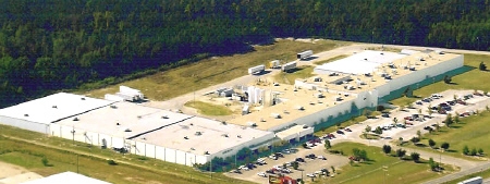
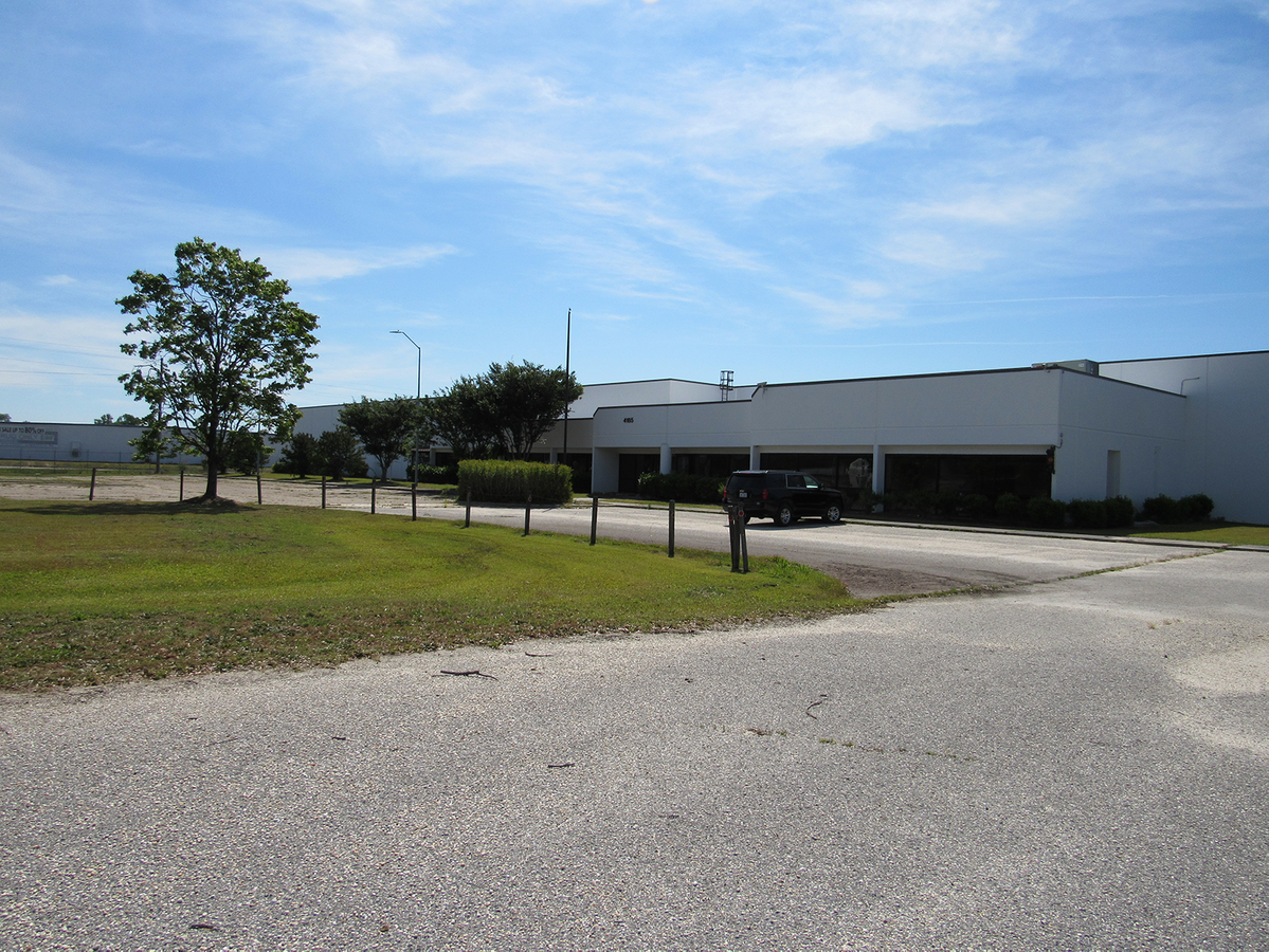
Property Record
5Th St, Lumberton, NC 28358
Current Lease Availabilities
NEARBY LISTINGS FOR SALE OR LEASE
-
-
View all Lumberton listings for lease on LoopNet.com
Property Detail
5Th St
0204-01-00902A
AC S E/S HWY I 95
Heavymanufacturing
Robeson
AE
North Carolina
3710937100K
10.35 AC
2024
North Carolina Southeast Area
2024
Other Market Areas
960801
Lumberton, NC
260,616 SF
DEMOGRAPHICS near 5Th St
1 Mile
3 Mile
5 Mile
2024 Total Population
88
4,673
19,324
2029 Population
91
4,792
19,650
Pop Growth 2024-2029
+ 3.41%
+ 2.55%
+ 1.69%
Average Age
36
39
39
2024 Total Households
34
1,625
7,282
HH Growth 2024-2029
+ 2.94%
+ 3.14%
+ 1.83%
Median Household Inc
$32,500
$33,825
$37,809
Avg Household Size
2.70
2.50
2.50
2024 Avg HH Vehicles
1.00
2.00
2.00
Median Home Value
$57,142
$72,009
$88,804
Median Year Built
1971
1982
1978
Nearby Places
- Restaurants
- Banks
- Shops
- Fitness
- Groceries
PUBLIC TRANSPORTATION
AIRPORT
Fayetteville Regional/Grannis Field
DRIVE
WALK
Distance
Fayetteville Regional/Grannis Field
43 min
32.2 mi
Freight Ports
Port of Wilmington
DRIVE
WALK
Distance
Port of Wilmington
106 min
81.7 mi
Nearby Properties
Address
Land Use
TOTAL SIZE
Lot Size
Zoning
Address
Land Use
TOTAL SIZE
Lot Size
Zoning
16,128 SF
51.95 AC
M2
Address
Land Use
TOTAL SIZE
Lot Size
Zoning
234,074 SF
63.48 AC
M2
Address
Land Use
TOTAL SIZE
Lot Size
Zoning
10,197 SF
417.66 AC
M1
Address
Land Use
TOTAL SIZE
Lot Size
Zoning
39,628 SF
34.85 AC
M2
Address
Land Use
TOTAL SIZE
Lot Size
Zoning
418,000 SF
31.52 AC
M2
Address
Land Use
TOTAL SIZE
Lot Size
Zoning
62,840 SF
60.96 AC
M2
Address
Land Use
TOTAL SIZE
Lot Size
Zoning
120,000 SF
17.10 AC
M2
Address
Land Use
TOTAL SIZE
Lot Size
Zoning
1,650 SF
26.34 AC
RA
Address
Land Use
TOTAL SIZE
Lot Size
Zoning
297,300 SF
128.80 AC
M2
Address
Land Use
TOTAL SIZE
Lot Size
Zoning
24,984 SF
41.13 AC
R11
Address
Land Use
TOTAL SIZE
Lot Size
Zoning
106,046 SF
31.24 AC
RA
Address
Land Use
TOTAL SIZE
Lot Size
Zoning
158,379 SF
17.47 AC
I2
Address
Land Use
TOTAL SIZE
Lot Size
Zoning
1,894 SF
11.48 AC
R3
Address
Land Use
TOTAL SIZE
Lot Size
Zoning
71,260 SF
7.69 AC
B4
Address
Land Use
TOTAL SIZE
Lot Size
Zoning
118,875 SF
7.17 AC
M1
Address
Land Use
TOTAL SIZE
Lot Size
Zoning
173,232 SF
13.83 AC
M2
Address
Land Use
TOTAL SIZE
Lot Size
Zoning
134,250 SF
56.70 AC
M2
Address
Land Use
TOTAL SIZE
Lot Size
Zoning
9,439 SF
6.40 AC
Address
Land Use
TOTAL SIZE
Lot Size
Zoning
25,056 SF
6.76 AC
Address
Land Use
TOTAL SIZE
Lot Size
Zoning
18,000 SF
31.35 AC
R20
Address
Land Use
TOTAL SIZE
Lot Size
Zoning
5,675 SF
1.76 AC
B4
Address
Land Use
TOTAL SIZE
Lot Size
Zoning
149,575 SF
28.83 AC
M2
Address
Land Use
TOTAL SIZE
Lot Size
Zoning
20,000 SF
8.85 AC
M2
Address
Land Use
TOTAL SIZE
Lot Size
Zoning
111,915 SF
55.38 AC
I2
Address
Land Use
TOTAL SIZE
Lot Size
Zoning
5,370 SF
2.11 AC
B4
Address
Land Use
TOTAL SIZE
Lot Size
Zoning
14,024 SF
4.58 AC
RA
Address
Land Use
TOTAL SIZE
Lot Size
Zoning
30 AC
R20
Address
Land Use
TOTAL SIZE
Lot Size
Zoning
87,800 SF
15 AC
RA
Address
Land Use
TOTAL SIZE
Lot Size
Zoning
19,440 SF
19.73 AC
R20
The World's #1 Commercial Real Estate Marketplace
Connect with us
© 2025 CoStar Group
The information above has been obtained from sources believed reliable. While we do not doubt its accuracy we have not verified it and make no guarantee, warranty or representation about it. It is your responsibility to independently confirm its accuracy and completeness. Any projections, opinions, assumptions, or estimates used are for example only and do not represent the current or future performance of the property. The value of this transaction to you depends on tax and other factors which should be evaluated by your tax, financial, and legal advisors. You and your advisors should conduct a careful, independent investigation of the property to determine to your satisfaction the suitability of the property for your needs.