Property Record
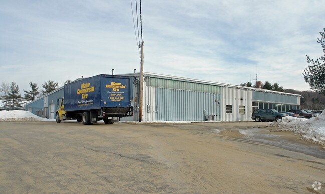
6 Enterprise St, Lewiston, ME 04240


Property Detail
6 Enterprise St
LEWI-000124-000000-000041
ANDROSCOGGIN
Industrialgeneral
Maine
B and X Area of moderate flood hazard, usually the area between the limits of the 100-year and 500-year floods.
41
2025
2 AC
2025
Maine South & Augusta
020802
Other Market Areas
21,600 SF
Lewiston-Auburn, ME
NEARBY LISTINGS FOR SALE OR LEASE
-
-
View all Lewiston listings for sale on LoopNet.com
DEMOGRAPHICS near 6 Enterprise St
1 mile
3 mile
5 mile
2025 Total Population
2,555
38,180
66,516
2030 Population
2,592
39,077
68,041
Pop Growth 2025-2030
+ 1.45%
+ 2.35%
+ 2.29%
Average Age
45
39
41
2025 Total Households
1,135
15,497
26,940
HH Growth 2025-2030
+ 1.85%
+ 2.31%
+ 2.31%
Median Household Inc
$70,466
$51,862
$56,901
Avg Household Size
2.20
2.20
2.20
2025 Avg HH Vehicles
2.00
1.00
2.00
Median Home Value
$252,982
$237,755
$246,327
Median Year Built
1967
1953
1957
Nearby Places
Map Layers
Map Styles
 Street
 Aerial
Layers
 Traffic
 Biking
Places
Listings with unknown addresses are not visible on the map
- Restaurants
- Banks
- Shops
- Fitness
- Groceries
PUBLIC TRANSPORTATION
AIRPORT
Portland International Jetport
Drive
Walk
Distance
Portland International Jetport
46 min
36.3 mi
Freight Ports
Portland, ME
Drive
Walk
Distance
Portland, ME
47 min
36.1 mi
Nearby Properties
Address
Land Use
TOTAL SIZE
Lot Size
Zoning
Address
Land Use
TOTAL SIZE
Lot Size
Zoning
542,760 SF
8.12 AC
Address
Land Use
TOTAL SIZE
Lot Size
Zoning
489,464 SF
117.19 AC
Address
Land Use
TOTAL SIZE
Lot Size
Zoning
Address
Land Use
TOTAL SIZE
Lot Size
Zoning
7.76 AC
Address
Land Use
TOTAL SIZE
Lot Size
Zoning
Address
Land Use
TOTAL SIZE
Lot Size
Zoning
50,000 SF
86.08 AC
Address
Land Use
TOTAL SIZE
Lot Size
Zoning
1.53 AC
Address
Land Use
TOTAL SIZE
Lot Size
Zoning
49,842 SF
23 AC
Address
Land Use
TOTAL SIZE
Lot Size
Zoning
144,650 SF
16.19 AC
Address
Land Use
TOTAL SIZE
Lot Size
Zoning
67,873 SF
Address
Land Use
TOTAL SIZE
Lot Size
Zoning
106,600 SF
0.73 AC
Address
Land Use
TOTAL SIZE
Lot Size
Zoning
127,660 SF
9.24 AC
Address
Land Use
TOTAL SIZE
Lot Size
Zoning
27,606 SF
1.10 AC
Address
Land Use
TOTAL SIZE
Lot Size
Zoning
144,665 SF
36.25 AC
Address
Land Use
TOTAL SIZE
Lot Size
Zoning
210,388 SF
1.46 AC
Address
Land Use
TOTAL SIZE
Lot Size
Zoning
125,449 SF
Address
Land Use
TOTAL SIZE
Lot Size
Zoning
94,914 SF
Address
Land Use
TOTAL SIZE
Lot Size
Zoning
60,728 SF
0.86 AC
Address
Land Use
TOTAL SIZE
Lot Size
Zoning
136,901 SF
10.50 AC
Address
Land Use
TOTAL SIZE
Lot Size
Zoning
93.04 AC
Address
Land Use
TOTAL SIZE
Lot Size
Zoning
49,638 SF
0.76 AC
Address
Land Use
TOTAL SIZE
Lot Size
Zoning
96,073 SF
Address
Land Use
TOTAL SIZE
Lot Size
Zoning
22,184 SF
Address
Land Use
TOTAL SIZE
Lot Size
Zoning
66,622 SF
6.18 AC
Address
Land Use
TOTAL SIZE
Lot Size
Zoning
95,299 SF
67 AC
Address
Land Use
TOTAL SIZE
Lot Size
Zoning
185,466 SF
0.97 AC
Address
Land Use
TOTAL SIZE
Lot Size
Zoning
109,282 SF
20.80 AC
Address
Land Use
TOTAL SIZE
Lot Size
Zoning
33,954 SF
Address
Land Use
TOTAL SIZE
Lot Size
Zoning
2,306 SF
1.56 AC
Address
Land Use
TOTAL SIZE
Lot Size
Zoning
53,352 SF
1.02 AC
The World's #1 Commercial Real Estate Marketplace
Connect with us
© 2026 CoStar Group
The information above has been obtained from sources believed reliable. While we do not doubt its accuracy we have not verified it and make no guarantee, warranty or representation about it. It is your responsibility to independently confirm its accuracy and completeness. Any projections, opinions, assumptions, or estimates used are for example only and do not represent the current or future performance of the property. The value of this transaction to you depends on tax and other factors which should be evaluated by your tax, financial, and legal advisors. You and your advisors should conduct a careful, independent investigation of the property to determine to your satisfaction the suitability of the property for your needs.