Property Record
6 Greenleaf Woods Dr, Portsmouth, NH 03801


NEARBY LISTINGS FOR SALE OR LEASE
Property Detail
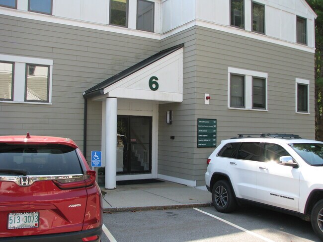
6 Greenleaf Woods Dr
Officecondo
Rockingham
X
New Hampshire
33015C0270F
o101
2024
Rockingham
2024
Boston
107200
Boston-Cambridge-Newton, MA-NH
1,418 SF
0243-0006-0101
DEMOGRAPHICS near 6 Greenleaf Woods Dr
1 Mile
3 Mile
5 Mile
2024 Total Population
3,866
28,710
45,130
2029 Population
4,024
30,021
47,235
Pop Growth 2024-2029
+ 4.09%
+ 4.57%
+ 4.66%
Average Age
43
44
45
2024 Total Households
1,617
13,368
20,427
HH Growth 2024-2029
+ 4.02%
+ 4.53%
+ 4.62%
Median Household Inc
$103,214
$102,632
$101,443
Avg Household Size
2.20
2.10
2.10
2024 Avg HH Vehicles
2.00
2.00
2.00
Median Home Value
$569,293
$629,886
$606,182
Median Year Built
1954
1961
1968
Nearby Places
Map Layers
Map Styles
 Street
 Aerial
- Restaurants
- Banks
- Shops
- Fitness
- Groceries
PUBLIC TRANSPORTATION
AIRPORT
Portsmouth International at Pease
DRIVE
WALK
Distance
Portsmouth International at Pease
11 min
4.6 mi
Freight Ports
Portland, ME
DRIVE
WALK
Distance
Portland, ME
65 min
53.6 mi
SALE & LEASE HISTORY
LISTING DATE
SALE/LEASE

Sep 25, 2016
For Lease
Sep 19, 2024
For Sale
Sep 19, 2024
For Lease
Nov 02, 2016
For Lease
Nearby Properties
Address
Land Use
TOTAL SIZE
Lot Size
Zoning
Address
Land Use
TOTAL SIZE
Lot Size
Zoning
54.20 AC
M
Address
Land Use
TOTAL SIZE
Lot Size
Zoning
6.20 AC
G1
Address
Land Use
TOTAL SIZE
Lot Size
Zoning
138,881 SF
7.54 AC
PD PL
Address
Land Use
TOTAL SIZE
Lot Size
Zoning
152,028 SF
CD5
Address
Land Use
TOTAL SIZE
Lot Size
Zoning
144,226 SF
5.72 AC
M
Address
Land Use
TOTAL SIZE
Lot Size
Zoning
Address
Land Use
TOTAL SIZE
Lot Size
Zoning
35.53 AC
GA/MH
Address
Land Use
TOTAL SIZE
Lot Size
Zoning
1,288 AC
GBW
Address
Land Use
TOTAL SIZE
Lot Size
Zoning
102,617 SF
1.27 AC
CD5
Address
Land Use
TOTAL SIZE
Lot Size
Zoning
28.05 AC
GA/MH
Address
Land Use
TOTAL SIZE
Lot Size
Zoning
57,711 SF
1.44 AC
CD4
Address
Land Use
TOTAL SIZE
Lot Size
Zoning
136,711 SF
1.85 AC
CD5
Address
Land Use
TOTAL SIZE
Lot Size
Zoning
19.26 AC
G1
Address
Land Use
TOTAL SIZE
Lot Size
Zoning
11.30 AC
G1
Address
Land Use
TOTAL SIZE
Lot Size
Zoning
4.73 AC
CD4-W
Address
Land Use
TOTAL SIZE
Lot Size
Zoning
86,293 SF
0.64 AC
CD5
Address
Land Use
TOTAL SIZE
Lot Size
Zoning
15.94 AC
G1
Address
Land Use
TOTAL SIZE
Lot Size
Zoning
114,194 SF
G1
Address
Land Use
TOTAL SIZE
Lot Size
Zoning
11.23 AC
OR
Address
Land Use
TOTAL SIZE
Lot Size
Zoning
33.39 AC
IND
Address
Land Use
TOTAL SIZE
Lot Size
Zoning
25.08 AC
NRP
Address
Land Use
TOTAL SIZE
Lot Size
Zoning
15.20 AC
G1
Address
Land Use
TOTAL SIZE
Lot Size
Zoning
18.49 AC
GRB
Address
Land Use
TOTAL SIZE
Lot Size
Zoning
4,776 SF
19.32 AC
PREC
Address
Land Use
TOTAL SIZE
Lot Size
Zoning
23.29 AC
G1
Address
Land Use
TOTAL SIZE
Lot Size
Zoning
17.11 AC
ABC
Address
Land Use
TOTAL SIZE
Lot Size
Zoning
77,523 SF
CD5
Address
Land Use
TOTAL SIZE
Lot Size
Zoning
190,444 SF
20.38 AC
G1
Address
Land Use
TOTAL SIZE
Lot Size
Zoning
137,809 SF
13.18 AC
ABC
Address
Land Use
TOTAL SIZE
Lot Size
Zoning
69,457 SF
0.98 AC
CD5
The World's #1 Commercial Real Estate Marketplace
Connect with us
© 2026 CoStar Group
The information above has been obtained from sources believed reliable. While we do not doubt its accuracy we have not verified it and make no guarantee, warranty or representation about it. It is your responsibility to independently confirm its accuracy and completeness. Any projections, opinions, assumptions, or estimates used are for example only and do not represent the current or future performance of the property. The value of this transaction to you depends on tax and other factors which should be evaluated by your tax, financial, and legal advisors. You and your advisors should conduct a careful, independent investigation of the property to determine to your satisfaction the suitability of the property for your needs.