Property Record
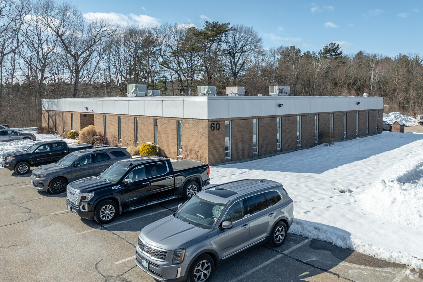
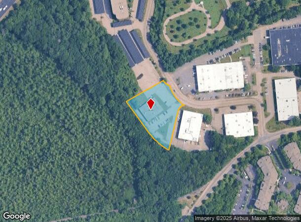
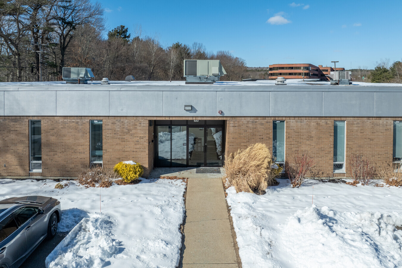
60 Brooks Dr, Braintree, MA 02184
Current Lease Availabilities
NEARBY LISTINGS FOR SALE OR LEASE
Property Detail
60 Brooks Dr
BRAI-002053D-000000-000007
Norfolk
Industrialgeneral
Massachusetts
AE
7
25021C0208E
1.62 AC
2024
Quincy/Braintree
2024
Boston
419100
Boston-Cambridge-Newton, MA-NH
10,509 SF
DEMOGRAPHICS near 60 Brooks Dr
1 Mile
3 Mile
5 Mile
2024 Total Population
2,131
73,671
244,474
2029 Population
2,118
73,174
241,485
Pop Growth 2024-2029
(0.61%)
(0.67%)
(1.22%)
Average Age
40
41
41
2024 Total Households
738
28,647
96,427
HH Growth 2024-2029
(0.68%)
(0.60%)
(1.27%)
Median Household Inc
$97,115
$98,616
$95,861
Avg Household Size
2.70
2.50
2.40
2024 Avg HH Vehicles
2.00
2.00
2.00
Median Home Value
$480,508
$571,744
$594,917
Median Year Built
1958
1962
1958
Nearby Places
- Restaurants
- Banks
- Shops
- Fitness
- Groceries
PUBLIC TRANSPORTATION
COMMUTER RAIL
Braintree (Kingston/Plymouth Line - Massachusetts Bay Transportation Authority Commuter Rail (Purple Line), Middleborough/Lakeville Line - Massachusetts Bay Transportation Authority Commuter Rail (Purple Line))
DRIVE
WALK
Distance
Braintree (Kingston/Plymouth Line - Massachusetts Bay Transportation Authority Commuter Rail (Purple Line), Middleborough/Lakeville Line - Massachusetts Bay Transportation Authority Commuter Rail (Purple Line))
6 min
2.6 mi
Quincy Center Station (Greenbush Line - Massachusetts Bay Transportation Authority Commuter Rail (Purple Line), Kingston/Plymouth Line - Massachusetts Bay Transportation Authority Commuter Rail (Purple Line), Middleborough/Lakeville Line - Massachusetts Bay Transportation Authority Commuter Rail (Purple Line), Red Line - Massachusetts Bay Transportation Authority Commuter Rail (Purple Line))
DRIVE
WALK
Distance
Quincy Center Station (Greenbush Line - Massachusetts Bay Transportation Authority Commuter Rail (Purple Line), Kingston/Plymouth Line - Massachusetts Bay Transportation Authority Commuter Rail (Purple Line), Middleborough/Lakeville Line - Massachusetts Bay Transportation Authority Commuter Rail (Purple Line), Red Line - Massachusetts Bay Transportation Authority Commuter Rail (Purple Line))
10 min
4.5 mi
AIRPORT
General Edward Lawrence Logan International
DRIVE
WALK
Distance
General Edward Lawrence Logan International
25 min
14.7 mi
Freight Ports
Port of Boston
DRIVE
WALK
Distance
Port of Boston
22 min
12.5 mi
Nearby Properties
Address
Land Use
TOTAL SIZE
Lot Size
Zoning
Address
Land Use
TOTAL SIZE
Lot Size
Zoning
26,430 SF
38.40 AC
RMFD
Address
Land Use
TOTAL SIZE
Lot Size
Zoning
17.33 AC
Address
Land Use
TOTAL SIZE
Lot Size
Zoning
152,495 SF
6.51 AC
Address
Land Use
TOTAL SIZE
Lot Size
Zoning
20,596 SF
16.20 AC
PUD
Address
Land Use
TOTAL SIZE
Lot Size
Zoning
15.81 AC
Address
Land Use
TOTAL SIZE
Lot Size
Zoning
14.81 AC
Address
Land Use
TOTAL SIZE
Lot Size
Zoning
23.20 AC
RH
Address
Land Use
TOTAL SIZE
Lot Size
Zoning
202,858 SF
2.30 AC
Address
Land Use
TOTAL SIZE
Lot Size
Zoning
5.06 AC
BUSC
Address
Land Use
TOTAL SIZE
Lot Size
Zoning
38.48 AC
B
Address
Land Use
TOTAL SIZE
Lot Size
Zoning
232,262 SF
15 AC
INDB
Address
Land Use
TOTAL SIZE
Lot Size
Zoning
10.38 AC
Address
Land Use
TOTAL SIZE
Lot Size
Zoning
66,750 SF
4.50 AC
OS
Address
Land Use
TOTAL SIZE
Lot Size
Zoning
5.38 AC
Address
Land Use
TOTAL SIZE
Lot Size
Zoning
238,217 SF
10.76 AC
INDB
Address
Land Use
TOTAL SIZE
Lot Size
Zoning
16.08 AC
OSC
Address
Land Use
TOTAL SIZE
Lot Size
Zoning
13.86 AC
I
Address
Land Use
TOTAL SIZE
Lot Size
Zoning
132,143 SF
23.70 AC
RH
Address
Land Use
TOTAL SIZE
Lot Size
Zoning
272,440 SF
13.16 AC
INDB
Address
Land Use
TOTAL SIZE
Lot Size
Zoning
395,130 SF
6.50 AC
IND
Address
Land Use
TOTAL SIZE
Lot Size
Zoning
162,790 SF
2 AC
PUD
Address
Land Use
TOTAL SIZE
Lot Size
Zoning
114,248 SF
2.63 AC
RESC
Address
Land Use
TOTAL SIZE
Lot Size
Zoning
38.67 AC
PUD
Address
Land Use
TOTAL SIZE
Lot Size
Zoning
122,808 SF
3.41 AC
Address
Land Use
TOTAL SIZE
Lot Size
Zoning
122,160 SF
6.61 AC
PUD
Address
Land Use
TOTAL SIZE
Lot Size
Zoning
80,226 SF
6.60 AC
RES
Address
Land Use
TOTAL SIZE
Lot Size
Zoning
114,256 SF
4.61 AC
Address
Land Use
TOTAL SIZE
Lot Size
Zoning
494,520 SF
20.80 AC
IND
Address
Land Use
TOTAL SIZE
Lot Size
Zoning
131,359 SF
5.42 AC
INDB
Address
Land Use
TOTAL SIZE
Lot Size
Zoning
146,402 SF
10 AC
RES
The World's #1 Commercial Real Estate Marketplace
Connect with us
© 2025 CoStar Group
The information above has been obtained from sources believed reliable. While we do not doubt its accuracy we have not verified it and make no guarantee, warranty or representation about it. It is your responsibility to independently confirm its accuracy and completeness. Any projections, opinions, assumptions, or estimates used are for example only and do not represent the current or future performance of the property. The value of this transaction to you depends on tax and other factors which should be evaluated by your tax, financial, and legal advisors. You and your advisors should conduct a careful, independent investigation of the property to determine to your satisfaction the suitability of the property for your needs.