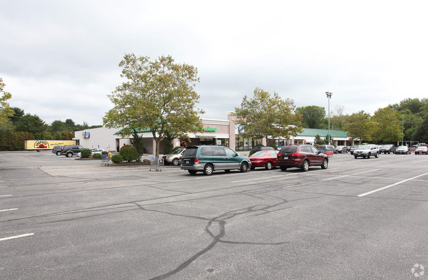
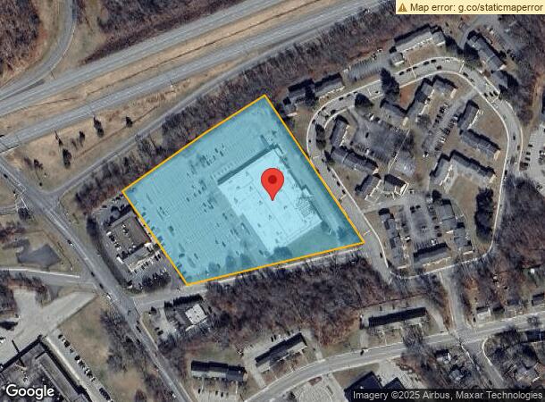
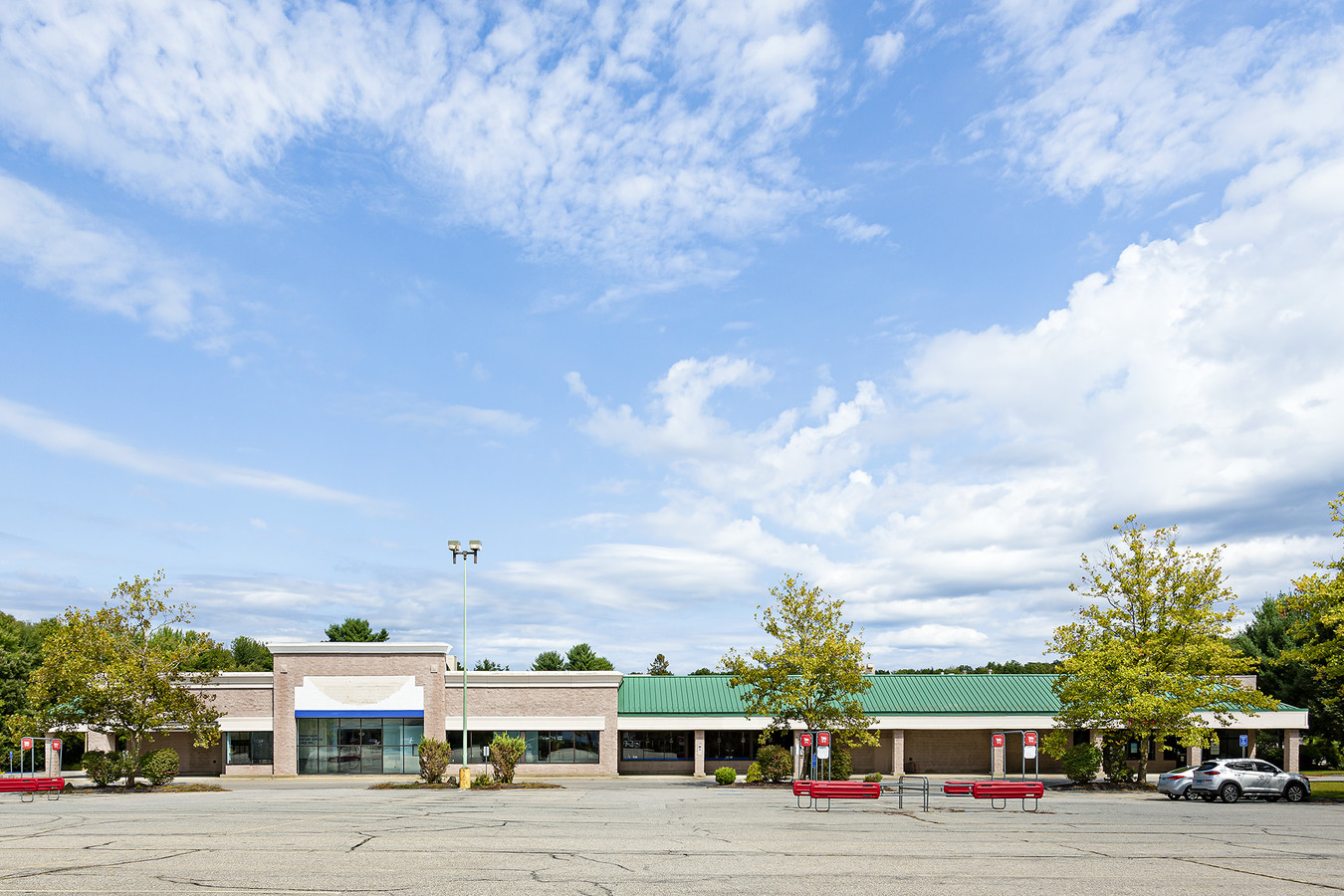
Property Record
60 Cantor Dr, Willimantic, CT 06226
NEARBY LISTINGS FOR SALE OR LEASE
Property Detail
60 Cantor Dr
Worcester, MA-CT
Windham
WIND-000206-000009-000079-000001
Connecticut
Commercialbuilding
79-1
2024
6.23 AC
2024
Windham County
800300
Hartford
60,564 SF
DEMOGRAPHICS near 60 Cantor Dr
1 Mile
3 Mile
5 Mile
2024 Total Population
5,849
26,178
40,319
2029 Population
5,932
26,198
40,328
Pop Growth 2024-2029
+ 1.42%
+ 0.08%
+ 0.02%
Average Age
32
37
39
2024 Total Households
1,545
9,486
15,063
HH Growth 2024-2029
+ 1.49%
(0.07%)
(0.13%)
Median Household Inc
$31,182
$47,420
$55,946
Avg Household Size
2.40
2.40
2.40
2024 Avg HH Vehicles
1.00
2.00
2.00
Median Home Value
$173,704
$192,405
$230,473
Median Year Built
1963
1961
1967
Nearby Places
- Restaurants
- Banks
- Shops
- Fitness
- Groceries
PUBLIC TRANSPORTATION
AIRPORT
Bradley International
DRIVE
WALK
Distance
Bradley International
64 min
41.5 mi
Freight Ports
Port of Davisville, RI
DRIVE
WALK
Distance
Port of Davisville, RI
85 min
62.6 mi
SALE & LEASE HISTORY
LISTING DATE
SALE/LEASE

Feb 19, 2019
For Lease
Feb 19, 2019
For Sale
Nearby Properties
Address
Land Use
TOTAL SIZE
Lot Size
Zoning
Address
Land Use
TOTAL SIZE
Lot Size
Zoning
14.62 AC
B2
Address
Land Use
TOTAL SIZE
Lot Size
Zoning
33,366 SF
R6
Address
Land Use
TOTAL SIZE
Lot Size
Zoning
145,144 SF
R6
Address
Land Use
TOTAL SIZE
Lot Size
Zoning
111,757 SF
6.74 AC
RL
Address
Land Use
TOTAL SIZE
Lot Size
Zoning
90,450 SF
R6
Address
Land Use
TOTAL SIZE
Lot Size
Zoning
73,691 SF
R6
Address
Land Use
TOTAL SIZE
Lot Size
Zoning
99,139 SF
R6
Address
Land Use
TOTAL SIZE
Lot Size
Zoning
68,508 SF
R6
Address
Land Use
TOTAL SIZE
Lot Size
Zoning
316,812 SF
39.88 AC
R4
Address
Land Use
TOTAL SIZE
Lot Size
Zoning
57,648 SF
R6
Address
Land Use
TOTAL SIZE
Lot Size
Zoning
22.30 AC
RL
Address
Land Use
TOTAL SIZE
Lot Size
Zoning
28,231 SF
R6
Address
Land Use
TOTAL SIZE
Lot Size
Zoning
158,766 SF
3.91 AC
R6
Address
Land Use
TOTAL SIZE
Lot Size
Zoning
24,313 SF
R6
Address
Land Use
TOTAL SIZE
Lot Size
Zoning
200 AC
R2 - 1
Address
Land Use
TOTAL SIZE
Lot Size
Zoning
63,224 SF
2.68 AC
R6
Address
Land Use
TOTAL SIZE
Lot Size
Zoning
300,483 SF
R6
Address
Land Use
TOTAL SIZE
Lot Size
Zoning
275,230 SF
27.63 AC
PB1
Address
Land Use
TOTAL SIZE
Lot Size
Zoning
44,000 SF
R6
Address
Land Use
TOTAL SIZE
Lot Size
Zoning
90.58 AC
M1
Address
Land Use
TOTAL SIZE
Lot Size
Zoning
3.50 AC
R6
Address
Land Use
TOTAL SIZE
Lot Size
Zoning
131 SF
M1 - 1
Address
Land Use
TOTAL SIZE
Lot Size
Zoning
64,490 SF
R6
Address
Land Use
TOTAL SIZE
Lot Size
Zoning
174 SF
R5
Address
Land Use
TOTAL SIZE
Lot Size
Zoning
14.12 AC
B2A
Address
Land Use
TOTAL SIZE
Lot Size
Zoning
58,264 SF
5.97 AC
B2A
Address
Land Use
TOTAL SIZE
Lot Size
Zoning
142 AC
R5 - 1
Address
Land Use
TOTAL SIZE
Lot Size
Zoning
14.50 AC
R20
Address
Land Use
TOTAL SIZE
Lot Size
Zoning
37,665 SF
0.42 AC
B1
Address
Land Use
TOTAL SIZE
Lot Size
Zoning
71,976 SF
3.15 AC
R6
The World's #1 Commercial Real Estate Marketplace
Connect with us
© 2025 CoStar Group
The information above has been obtained from sources believed reliable. While we do not doubt its accuracy we have not verified it and make no guarantee, warranty or representation about it. It is your responsibility to independently confirm its accuracy and completeness. Any projections, opinions, assumptions, or estimates used are for example only and do not represent the current or future performance of the property. The value of this transaction to you depends on tax and other factors which should be evaluated by your tax, financial, and legal advisors. You and your advisors should conduct a careful, independent investigation of the property to determine to your satisfaction the suitability of the property for your needs.