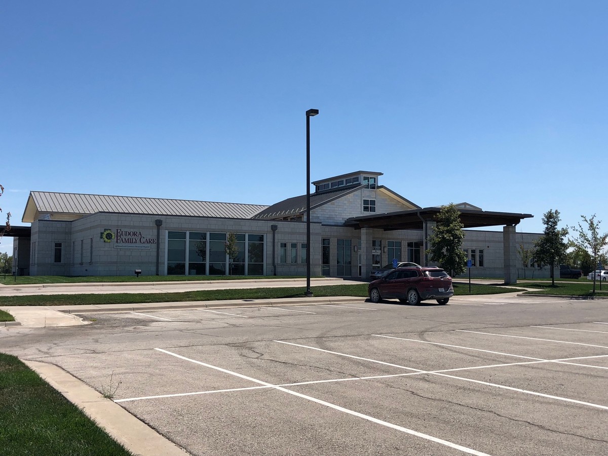
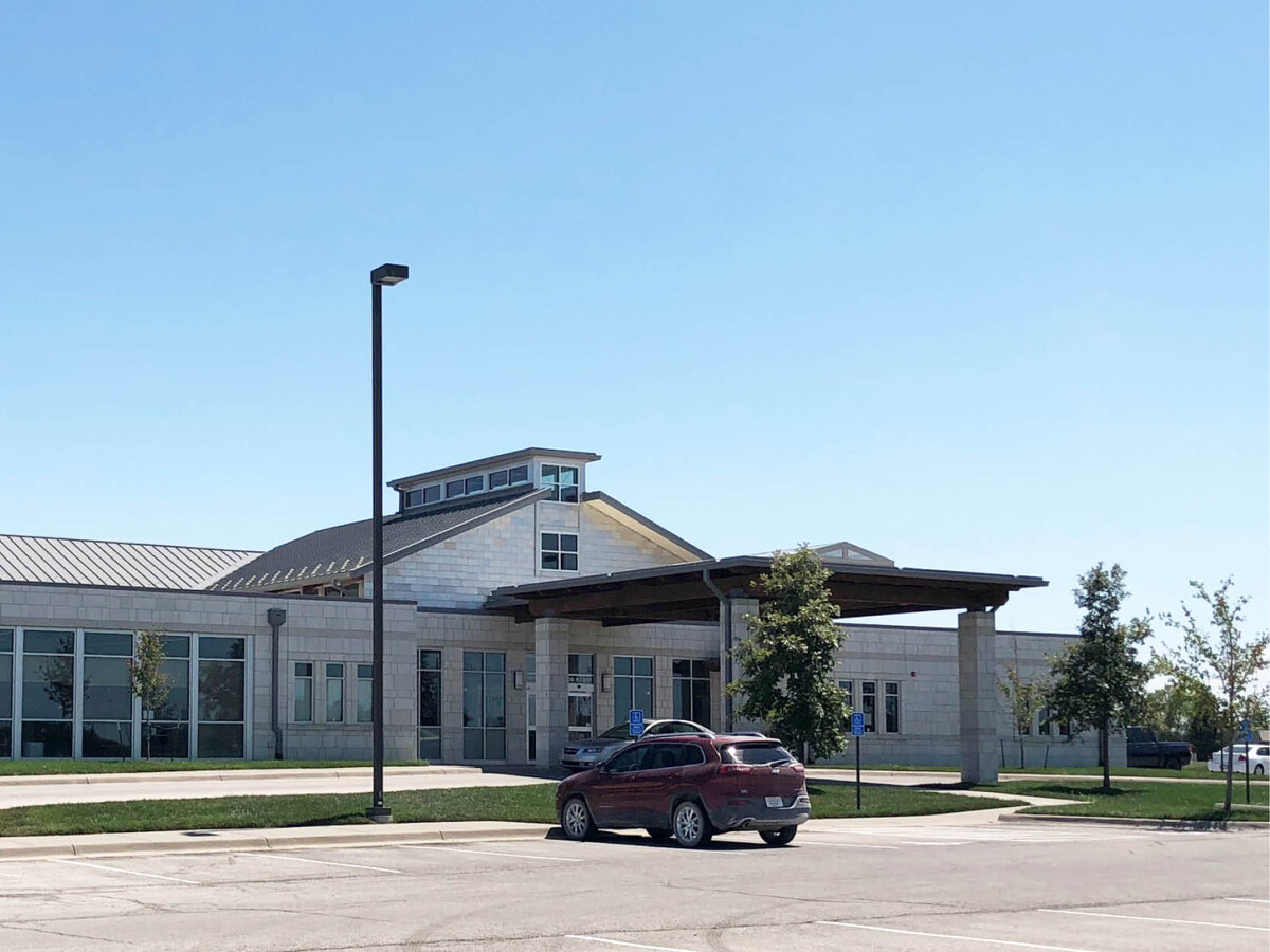
Property Record
600 E 20Th St, Eudora, KS 66025
NEARBY LISTINGS FOR SALE OR LEASE
-
-
View all Eudora listings for lease on LoopNet.com
Property Detail
600 E 20Th St
Lawrence, KS
Lmh Eudora Addition
023-092-09-0-30-02-003.00-0
LMH EUDORA ADD LT 1
Warehouse
Douglas
X
Kansas
20103C0400G
1
0
15.32 AC
2024
Lawrence
0012021
Kansas City
2,500 SF
DEMOGRAPHICS near 600 E 20Th St
1 Mile
3 Mile
5 Mile
2024 Total Population
3,907
7,322
8,872
2029 Population
3,969
7,454
9,059
Pop Growth 2024-2029
+ 1.59%
+ 1.80%
+ 2.11%
Average Age
36
37
38
2024 Total Households
1,398
2,634
3,223
HH Growth 2024-2029
+ 1.72%
+ 1.94%
+ 2.23%
Median Household Inc
$89,605
$90,335
$87,603
Avg Household Size
2.70
2.70
2.70
2024 Avg HH Vehicles
2.00
2.00
2.00
Median Home Value
$201,227
$214,239
$233,928
Median Year Built
2000
1999
1998
Nearby Places
- Restaurants
- Banks
- Shops
- Fitness
- Groceries
PUBLIC TRANSPORTATION
COMMUTER RAIL
Lawrence Amtrak Station (Southwest Chief - Amtrak)
DRIVE
WALK
Distance
Lawrence Amtrak Station (Southwest Chief - Amtrak)
17 min
9.9 mi
Freight Ports
Tulsa Port Of Catoosa
DRIVE
WALK
Distance
Tulsa Port Of Catoosa
260 min
219.0 mi
SALE & LEASE HISTORY
LISTING DATE
SALE/LEASE

Aug 20, 2018
For Lease
Nearby Properties
Address
Land Use
TOTAL SIZE
Lot Size
Zoning
Address
Land Use
TOTAL SIZE
Lot Size
Zoning
140,436 SF
46.74 AC
AG
Address
Land Use
TOTAL SIZE
Lot Size
Zoning
118,000 SF
39.69 AC
AG
Address
Land Use
TOTAL SIZE
Lot Size
Zoning
55,400 SF
44.90 AC
I
Address
Land Use
TOTAL SIZE
Lot Size
Zoning
39,052 SF
7.71 AC
R1
Address
Land Use
TOTAL SIZE
Lot Size
Zoning
23,908 SF
4.39 AC
Address
Land Use
TOTAL SIZE
Lot Size
Zoning
11,886 SF
5.80 AC
Address
Land Use
TOTAL SIZE
Lot Size
Zoning
13,200 SF
35.20 AC
AG
Address
Land Use
TOTAL SIZE
Lot Size
Zoning
1,874 SF
46.62 AC
RUR
Address
Land Use
TOTAL SIZE
Lot Size
Zoning
37.03 AC
RUR
Address
Land Use
TOTAL SIZE
Lot Size
Zoning
0.62 AC
I1
Address
Land Use
TOTAL SIZE
Lot Size
Zoning
0.26 AC
I1
Address
Land Use
TOTAL SIZE
Lot Size
Zoning
12,721 SF
1.76 AC
R1
Address
Land Use
TOTAL SIZE
Lot Size
Zoning
5,536 SF
0.13 AC
Address
Land Use
TOTAL SIZE
Lot Size
Zoning
117,120 SF
21 AC
I
Address
Land Use
TOTAL SIZE
Lot Size
Zoning
7,800 SF
2.47 AC
R1
Address
Land Use
TOTAL SIZE
Lot Size
Zoning
15,300 SF
4.72 AC
UPR
Address
Land Use
TOTAL SIZE
Lot Size
Zoning
6,040 SF
0.47 AC
C1
Address
Land Use
TOTAL SIZE
Lot Size
Zoning
16.48 AC
AG
Address
Land Use
TOTAL SIZE
Lot Size
Zoning
4,419 SF
0.22 AC
R1
Address
Land Use
TOTAL SIZE
Lot Size
Zoning
4,320 SF
0.24 AC
R1
Address
Land Use
TOTAL SIZE
Lot Size
Zoning
3,306 SF
1.12 AC
R3
Address
Land Use
TOTAL SIZE
Lot Size
Zoning
5,000 SF
5 AC
AG
Address
Land Use
TOTAL SIZE
Lot Size
Zoning
7,920 SF
2.50 AC
R1
Address
Land Use
TOTAL SIZE
Lot Size
Zoning
3,882 SF
0.44 AC
UPR
Address
Land Use
TOTAL SIZE
Lot Size
Zoning
18,597 SF
5.67 AC
I
Address
Land Use
TOTAL SIZE
Lot Size
Zoning
4,600 SF
1.52 AC
R1
Address
Land Use
TOTAL SIZE
Lot Size
Zoning
0.66 AC
Address
Land Use
TOTAL SIZE
Lot Size
Zoning
44,856 SF
3.90 AC
R1
Address
Land Use
TOTAL SIZE
Lot Size
Zoning
3,283 SF
0.12 AC
C1
The World's #1 Commercial Real Estate Marketplace
Connect with us
© 2025 CoStar Group
The information above has been obtained from sources believed reliable. While we do not doubt its accuracy we have not verified it and make no guarantee, warranty or representation about it. It is your responsibility to independently confirm its accuracy and completeness. Any projections, opinions, assumptions, or estimates used are for example only and do not represent the current or future performance of the property. The value of this transaction to you depends on tax and other factors which should be evaluated by your tax, financial, and legal advisors. You and your advisors should conduct a careful, independent investigation of the property to determine to your satisfaction the suitability of the property for your needs.