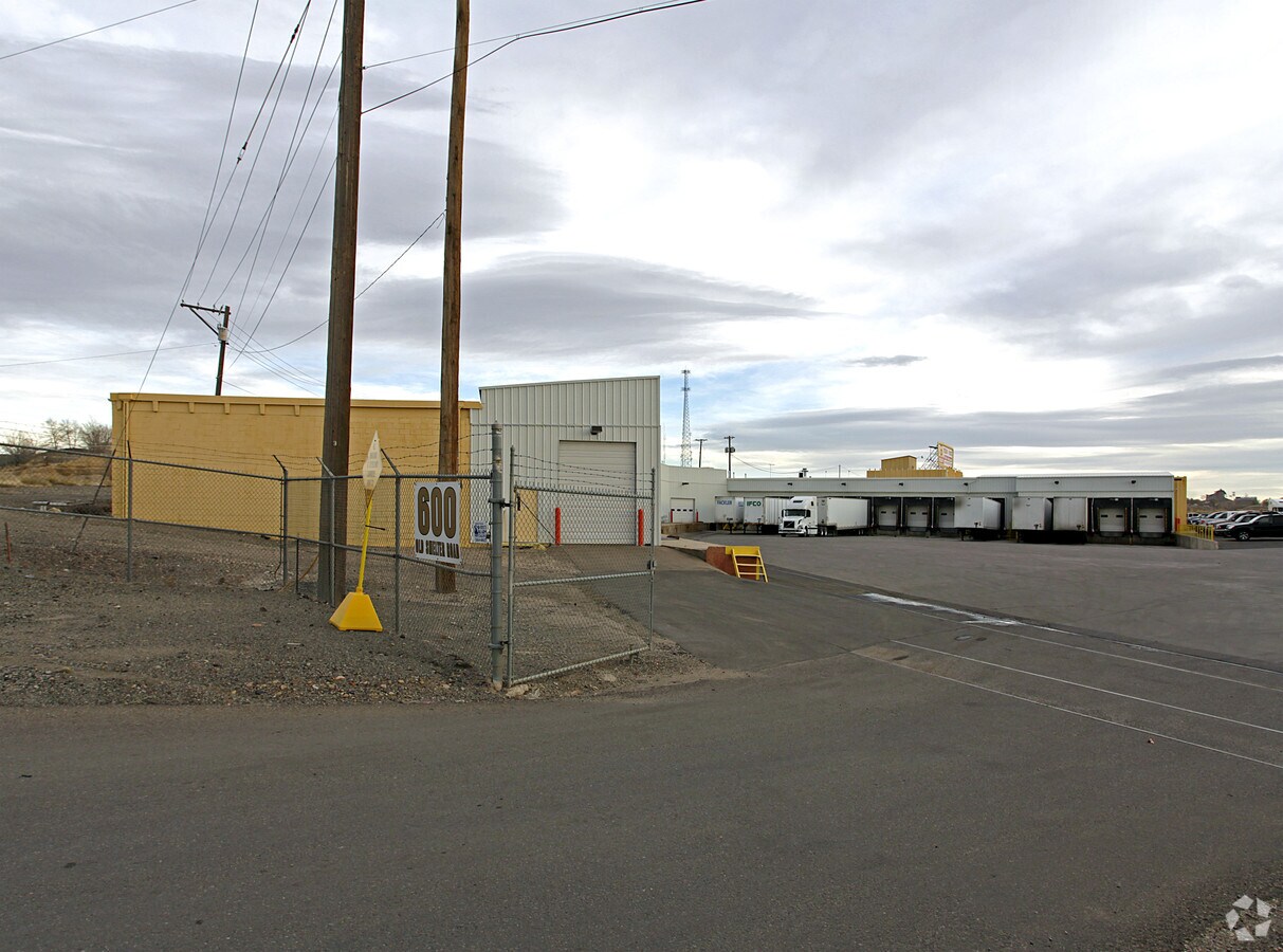
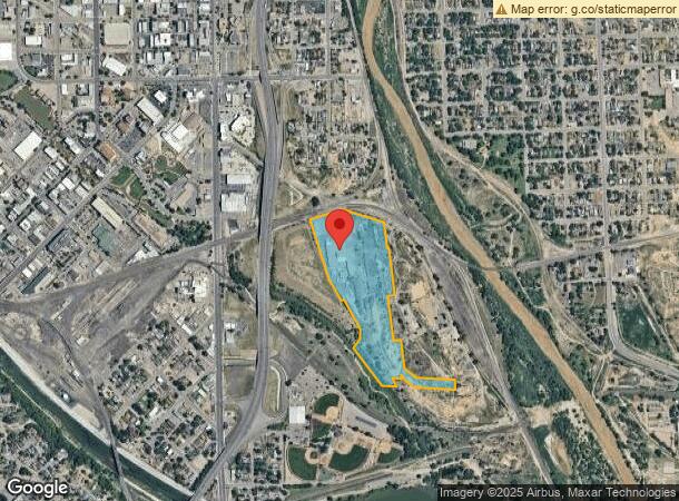
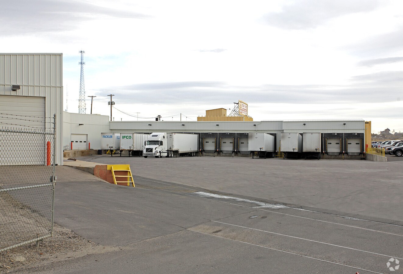
Property Record
600 Gruma Dr, Pueblo, CO 81003
NEARBY LISTINGS FOR SALE OR LEASE
Property Detail
600 Gruma Dr
Pueblo, CO
Com-Fountain I-25 Ip
0-4-31-3-23-002
LOT 2 WHEELSTAR SUB FORMERLY 04-313-00-012 + 019
Industrialgeneral
Pueblo
X
Colorado
08101C0513D
2
2023
23.33 AC
2023
Colorado East Area
000600
Other Market Areas
59,982 SF
DEMOGRAPHICS near 600 Gruma Dr
1 Mile
3 Mile
5 Mile
2024 Total Population
7,136
73,394
121,218
2029 Population
7,285
75,282
124,263
Pop Growth 2024-2029
+ 2.09%
+ 2.57%
+ 2.51%
Average Age
39
40
40
2024 Total Households
2,390
30,306
49,639
HH Growth 2024-2029
+ 2.76%
+ 2.69%
+ 2.64%
Median Household Inc
$21,979
$39,586
$50,044
Avg Household Size
2.20
2.30
2.30
2024 Avg HH Vehicles
1.00
2.00
2.00
Median Home Value
$108,421
$187,761
$226,629
Median Year Built
1947
1956
1967
Nearby Places
- Restaurants
- Banks
- Shops
- Fitness
- Groceries
Nearby Properties
Address
Land Use
TOTAL SIZE
Lot Size
Zoning
Address
Land Use
TOTAL SIZE
Lot Size
Zoning
486,484 SF
3.75 AC
R5:RES/MUL
Address
Land Use
TOTAL SIZE
Lot Size
Zoning
51,206 SF
3.69 AC
S-1
Address
Land Use
TOTAL SIZE
Lot Size
Zoning
6,710 SF
49.97 AC
Address
Land Use
TOTAL SIZE
Lot Size
Zoning
205,608 SF
4.51 AC
Address
Land Use
TOTAL SIZE
Lot Size
Zoning
3.18 AC
Address
Land Use
TOTAL SIZE
Lot Size
Zoning
4,322,517 SF
488.39 AC
Address
Land Use
TOTAL SIZE
Lot Size
Zoning
59,581 SF
2.06 AC
B4:COMM/RE
Address
Land Use
TOTAL SIZE
Lot Size
Zoning
6,206 SF
5.57 AC
R5:RES/MUL
Address
Land Use
TOTAL SIZE
Lot Size
Zoning
71,345 SF
5.17 AC
Address
Land Use
TOTAL SIZE
Lot Size
Zoning
71,936 SF
3.43 AC
R4:RES/MUL
Address
Land Use
TOTAL SIZE
Lot Size
Zoning
42,289 SF
0.54 AC
B4:COMM/RE
Address
Land Use
TOTAL SIZE
Lot Size
Zoning
40,986 SF
0.65 AC
R5:RES/MUL
Address
Land Use
TOTAL SIZE
Lot Size
Zoning
26,255 SF
2.08 AC
Address
Land Use
TOTAL SIZE
Lot Size
Zoning
Address
Land Use
TOTAL SIZE
Lot Size
Zoning
12,096 SF
4 AC
R5:RES/MUL
Address
Land Use
TOTAL SIZE
Lot Size
Zoning
195,456 SF
21.03 AC
B4:COMM/RE
Address
Land Use
TOTAL SIZE
Lot Size
Zoning
3,224 SF
1.42 AC
R5:RES/MUL
Address
Land Use
TOTAL SIZE
Lot Size
Zoning
122,704 SF
2.72 AC
B4:COMM/RE
Address
Land Use
TOTAL SIZE
Lot Size
Zoning
25,655 SF
43.08 AC
R5:RES/MUL
Address
Land Use
TOTAL SIZE
Lot Size
Zoning
25,714 SF
1 AC
Address
Land Use
TOTAL SIZE
Lot Size
Zoning
1 SF
1.21 AC
R5:RES/MUL
Address
Land Use
TOTAL SIZE
Lot Size
Zoning
3,061 SF
1.10 AC
R2:RES/1 F
Address
Land Use
TOTAL SIZE
Lot Size
Zoning
84,872 SF
0.76 AC
B4:COMM/RE
Address
Land Use
TOTAL SIZE
Lot Size
Zoning
35,530 SF
0.55 AC
R-4
Address
Land Use
TOTAL SIZE
Lot Size
Zoning
35,530 SF
0.54 AC
S1:SPC/PUB
Address
Land Use
TOTAL SIZE
Lot Size
Zoning
9,024 SF
6.85 AC
S1:SPC/PUB
Address
Land Use
TOTAL SIZE
Lot Size
Zoning
17,849 SF
0.55 AC
B4:COMM/RE
Address
Land Use
TOTAL SIZE
Lot Size
Zoning
62,718 SF
4.76 AC
I3:IND/HEA
Address
Land Use
TOTAL SIZE
Lot Size
Zoning
73,768 SF
3.58 AC
Address
Land Use
TOTAL SIZE
Lot Size
Zoning
1 SF
0.97 AC
B4:COMM/RE
The World's #1 Commercial Real Estate Marketplace
Connect with us
© 2025 CoStar Group
The information above has been obtained from sources believed reliable. While we do not doubt its accuracy we have not verified it and make no guarantee, warranty or representation about it. It is your responsibility to independently confirm its accuracy and completeness. Any projections, opinions, assumptions, or estimates used are for example only and do not represent the current or future performance of the property. The value of this transaction to you depends on tax and other factors which should be evaluated by your tax, financial, and legal advisors. You and your advisors should conduct a careful, independent investigation of the property to determine to your satisfaction the suitability of the property for your needs.