Property Record
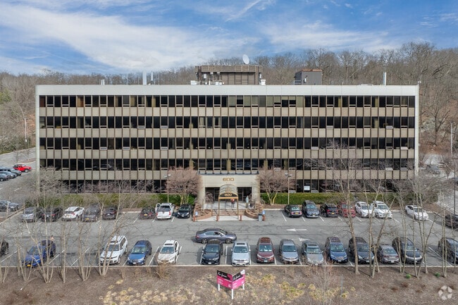
600 Mamaroneck Ave, Harrison, NY 10528


Current Lease Availabilities
Property Detail
600 Mamaroneck Ave
2801-000-482-00000-000-0027
Westchester
Officebuilding
New York
B and X Area of moderate flood hazard, usually the area between the limits of the 100-year and 500-year floods.
27
2025
6.97 AC
2025
East I-287 Corridor
008401
Westchester/So Connecticut
106,080 SF
New York-Jersey City-White Plains, NY-NJ
NEARBY LISTINGS FOR SALE OR LEASE
DEMOGRAPHICS near 600 Mamaroneck Ave
1 mile
3 mile
5 mile
2025 Total Population
3,514
90,256
304,146
2030 Population
3,566
91,223
306,893
Pop Growth 2025-2030
+ 1.48%
+ 1.07%
+ 0.90%
Average Age
43
42
42
2025 Total Households
1,143
31,442
110,021
HH Growth 2025-2030
+ 1.57%
+ 1.09%
+ 1.03%
Median Household Inc
$230,769
$194,559
$142,387
Avg Household Size
3.00
2.80
2.60
2025 Avg HH Vehicles
2.00
2.00
2.00
Median Home Value
$1,065,527
$966,828
$810,716
Median Year Built
1968
1956
1956
Nearby Places
Map Layers
Map Styles
 Street
 Aerial
Layers
 Traffic
 Biking
Places
Listings with unknown addresses are not visible on the map
- Restaurants
- Banks
- Shops
- Fitness
- Groceries
PUBLIC TRANSPORTATION
COMMUTER RAIL
Mamaroneck Station (New Haven Line - Metro-North Commuter Railroad Company (Metro-North))
Drive
Walk
Distance
Mamaroneck Station (New Haven Line - Metro-North Commuter Railroad Company (Metro-North))
6 min
2.6 mi
Harrison Station (New Haven Line - Metro-North Commuter Railroad Company (Metro-North))
Drive
Walk
Distance
Harrison Station (New Haven Line - Metro-North Commuter Railroad Company (Metro-North))
10 min
2.8 mi
AIRPORT
Westchester County
Drive
Walk
Distance
Westchester County
15 min
9.2 mi
LaGuardia
Drive
Walk
Distance
LaGuardia
35 min
20.6 mi
John F Kennedy International
Drive
Walk
Distance
John F Kennedy International
41 min
28.2 mi
Freight Ports
NY - Red Hook Container Terminal
Drive
Walk
Distance
NY - Red Hook Container Terminal
49 min
31.1 mi
Nearby Properties
Address
Land Use
TOTAL SIZE
Lot Size
Zoning
Address
Land Use
TOTAL SIZE
Lot Size
Zoning
Address
Land Use
TOTAL SIZE
Lot Size
Zoning
381,836 SF
16.68 AC
A3
Address
Land Use
TOTAL SIZE
Lot Size
Zoning
413,946 SF
20.27 AC
Address
Land Use
TOTAL SIZE
Lot Size
Zoning
Address
Land Use
TOTAL SIZE
Lot Size
Zoning
237,313 SF
22.67 AC
A1
Address
Land Use
TOTAL SIZE
Lot Size
Zoning
125,010 SF
4.02 AC
Address
Land Use
TOTAL SIZE
Lot Size
Zoning
5COMMUND
Address
Land Use
TOTAL SIZE
Lot Size
Zoning
21.33 AC
Address
Land Use
TOTAL SIZE
Lot Size
Zoning
82,895 SF
23.03 AC
A2
Address
Land Use
TOTAL SIZE
Lot Size
Zoning
188.31 AC
Address
Land Use
TOTAL SIZE
Lot Size
Zoning
67.51 AC
Address
Land Use
TOTAL SIZE
Lot Size
Zoning
1,056 SF
42.50 AC
PB
Address
Land Use
TOTAL SIZE
Lot Size
Zoning
108,367 SF
5.57 AC
AA1
Address
Land Use
TOTAL SIZE
Lot Size
Zoning
48,499 SF
8.52 AC
A2/A3
Address
Land Use
TOTAL SIZE
Lot Size
Zoning
61,606 SF
19.99 AC
A4/A3
Address
Land Use
TOTAL SIZE
Lot Size
Zoning
132,505 SF
5.53 AC
R6
Address
Land Use
TOTAL SIZE
Lot Size
Zoning
48,267 SF
11.04 AC
A2 A
Address
Land Use
TOTAL SIZE
Lot Size
Zoning
6.31 AC
R-5 SFR
Address
Land Use
TOTAL SIZE
Lot Size
Zoning
37,187 SF
2.62 AC
Address
Land Use
TOTAL SIZE
Lot Size
Zoning
67,917 SF
6.79 AC
A4
Address
Land Use
TOTAL SIZE
Lot Size
Zoning
34,454 SF
216.47 AC
Address
Land Use
TOTAL SIZE
Lot Size
Zoning
99,502 SF
11.97 AC
Address
Land Use
TOTAL SIZE
Lot Size
Zoning
48,240 SF
3.89 AC
Address
Land Use
TOTAL SIZE
Lot Size
Zoning
64,966 SF
4.92 AC
R20
Address
Land Use
TOTAL SIZE
Lot Size
Zoning
68,022 SF
4.31 AC
Address
Land Use
TOTAL SIZE
Lot Size
Zoning
2,100 SF
24.12 AC
A3
Address
Land Use
TOTAL SIZE
Lot Size
Zoning
76,258 SF
4.22 AC
R7.5
Address
Land Use
TOTAL SIZE
Lot Size
Zoning
93,226 SF
0.82 AC
RM2
Address
Land Use
TOTAL SIZE
Lot Size
Zoning
52,138 SF
3.24 AC
R6
Address
Land Use
TOTAL SIZE
Lot Size
Zoning
21,524 SF
11.06 AC
A2 A
The World's #1 Commercial Real Estate Marketplace
Connect with us
© 2026 CoStar Group
The information above has been obtained from sources believed reliable. While we do not doubt its accuracy we have not verified it and make no guarantee, warranty or representation about it. It is your responsibility to independently confirm its accuracy and completeness. Any projections, opinions, assumptions, or estimates used are for example only and do not represent the current or future performance of the property. The value of this transaction to you depends on tax and other factors which should be evaluated by your tax, financial, and legal advisors. You and your advisors should conduct a careful, independent investigation of the property to determine to your satisfaction the suitability of the property for your needs.