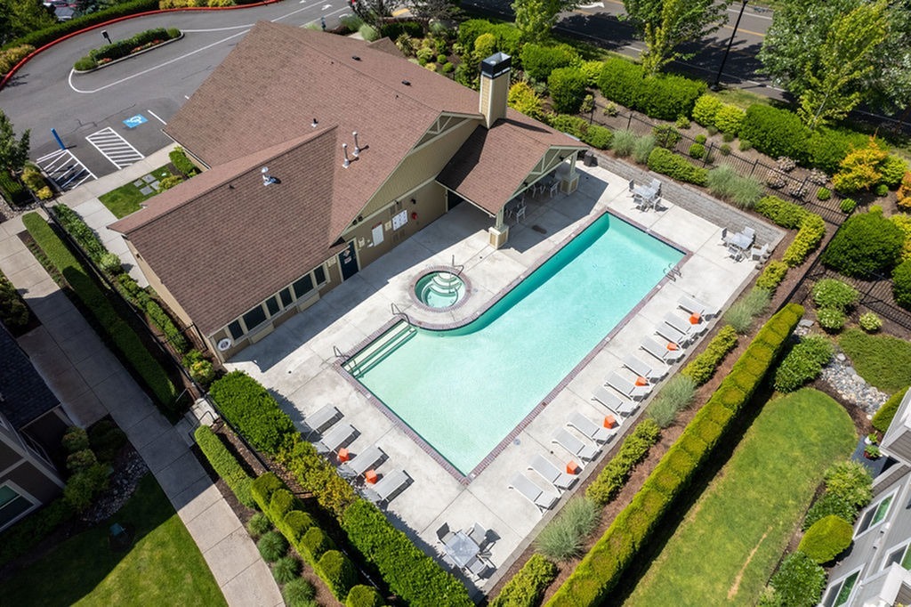
Property Record
600 Se 177Th Ave, Vancouver, WA 98683

NEARBY LISTINGS FOR SALE OR LEASE
Property Detail
600 Se 177Th Ave
176601-000
#13 SEC 31 T2N R3EWM 6.09A FOR ASSESSOR USE ONLY REAL PROPERTY SITUATED IN THE CITY OF VANCOUVER, CLARK COUNTY, WASHINGTON, LYING IN THE NORTHWEST QUARTER OF SECTION 31, TOWNSHIP 2 NORTH, RANGE 3 EAST OF THE WILLAMETTE MERIDIAN. DESCRIBED AS FOLLOWS:
Multifamilydwelling
Clark
X
Washington
53011C0530D
6.09 AC
2025
Bennington
2025
Portland
041329
Portland-Vancouver-Hillsboro, OR-WA
192,238 SF
DEMOGRAPHICS near 600 Se 177Th Ave
1 Mile
3 Mile
5 Mile
2024 Total Population
15,564
92,374
190,096
2029 Population
16,709
99,888
204,549
Pop Growth 2024-2029
+ 7.36%
+ 8.13%
+ 7.60%
Average Age
39
41
40
2024 Total Households
6,299
35,096
70,701
HH Growth 2024-2029
+ 7.38%
+ 8.29%
+ 7.72%
Median Household Inc
$82,204
$88,970
$83,910
Avg Household Size
2.40
2.60
2.60
2024 Avg HH Vehicles
2.00
2.00
2.00
Median Home Value
$426,502
$452,174
$435,252
Median Year Built
1996
1994
1993
Nearby Places
- Restaurants
- Banks
- Shops
- Fitness
- Groceries
PUBLIC TRANSPORTATION
AIRPORT
Portland International
DRIVE
WALK
Distance
Portland International
19 min
9.9 mi
Freight Ports
Port of Vancouver
DRIVE
WALK
Distance
Port of Vancouver
24 min
13.5 mi
Nearby Properties
Address
Land Use
TOTAL SIZE
Lot Size
Zoning
Address
Land Use
TOTAL SIZE
Lot Size
Zoning
309,088 SF
17.57 AC
RC
Address
Land Use
TOTAL SIZE
Lot Size
Zoning
817,650 SF
119.73 AC
LI/BP
Address
Land Use
TOTAL SIZE
Lot Size
Zoning
339,894 SF
27.82 AC
R-22
Address
Land Use
TOTAL SIZE
Lot Size
Zoning
929,350 SF
143.57 AC
LI/BP
Address
Land Use
TOTAL SIZE
Lot Size
Zoning
399,563 SF
12.98 AC
CC
Address
Land Use
TOTAL SIZE
Lot Size
Zoning
233,766 SF
5.34 AC
R-30
Address
Land Use
TOTAL SIZE
Lot Size
Zoning
264,044 SF
11.16 AC
CC
Address
Land Use
TOTAL SIZE
Lot Size
Zoning
253,976 SF
11.46 AC
MX
Address
Land Use
TOTAL SIZE
Lot Size
Zoning
285,765 SF
14.41 AC
R-22
Address
Land Use
TOTAL SIZE
Lot Size
Zoning
171,584 SF
6.26 AC
MX
Address
Land Use
TOTAL SIZE
Lot Size
Zoning
237,558 SF
15.48 AC
R-22
Address
Land Use
TOTAL SIZE
Lot Size
Zoning
301,864 SF
9.53 AC
R-22
Address
Land Use
TOTAL SIZE
Lot Size
Zoning
188,974 SF
7.19 AC
R-30
Address
Land Use
TOTAL SIZE
Lot Size
Zoning
204,999 SF
5.71 AC
MX
Address
Land Use
TOTAL SIZE
Lot Size
Zoning
273,844 SF
13.09 AC
R-22
Address
Land Use
TOTAL SIZE
Lot Size
Zoning
247,598 SF
45.75 AC
CG
Address
Land Use
TOTAL SIZE
Lot Size
Zoning
603,750 SF
49.11 AC
IL
Address
Land Use
TOTAL SIZE
Lot Size
Zoning
199,197 SF
10.60 AC
R-22
Address
Land Use
TOTAL SIZE
Lot Size
Zoning
175,840 SF
12.30 AC
R-18
Address
Land Use
TOTAL SIZE
Lot Size
Zoning
199,550 SF
12.27 AC
R-30
Address
Land Use
TOTAL SIZE
Lot Size
Zoning
197,911 SF
12.96 AC
R-18
Address
Land Use
TOTAL SIZE
Lot Size
Zoning
174,240 SF
11.25 AC
R-22
Address
Land Use
TOTAL SIZE
Lot Size
Zoning
166,444 SF
9.80 AC
R-22
Address
Land Use
TOTAL SIZE
Lot Size
Zoning
164,030 SF
24.75 AC
R-6
Address
Land Use
TOTAL SIZE
Lot Size
Zoning
357,948 SF
8.03 AC
IL
Address
Land Use
TOTAL SIZE
Lot Size
Zoning
170,275 SF
9.74 AC
R-22
Address
Land Use
TOTAL SIZE
Lot Size
Zoning
155,156 SF
2.04 AC
R-22
Address
Land Use
TOTAL SIZE
Lot Size
Zoning
706,024 SF
16.41 AC
IL
The World's #1 Commercial Real Estate Marketplace
Connect with us
© 2025 CoStar Group
The information above has been obtained from sources believed reliable. While we do not doubt its accuracy we have not verified it and make no guarantee, warranty or representation about it. It is your responsibility to independently confirm its accuracy and completeness. Any projections, opinions, assumptions, or estimates used are for example only and do not represent the current or future performance of the property. The value of this transaction to you depends on tax and other factors which should be evaluated by your tax, financial, and legal advisors. You and your advisors should conduct a careful, independent investigation of the property to determine to your satisfaction the suitability of the property for your needs.