Property Record
6000 Grover Burchfield Dr, Tuscaloosa, AL 35401
NEARBY LISTINGS FOR SALE OR LEASE
-
-
View all Tuscaloosa listings for sale on LoopNet.com
Property Detail
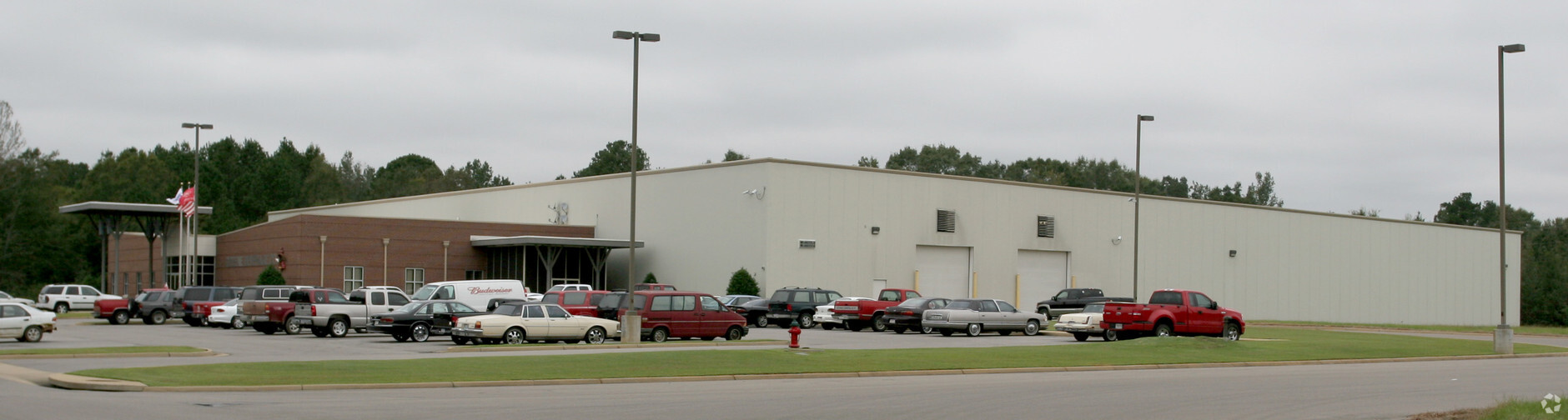
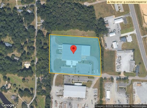
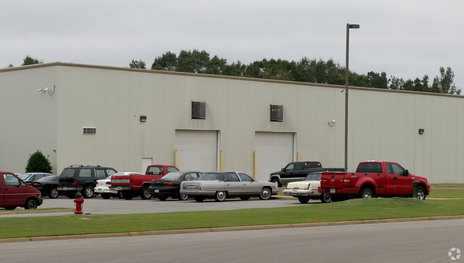
6000 Grover Burchfield Dr
Tuscaloosa, AL
Ellis Property Development One
31-09-32-3-001-003.004
LOT 1 ELLIS PROPERTY DEVELOPMENT ONE LESS & EXCEPT THE SOUTH 50' OF SAID LOT
Distributionwarehouseregional
Tuscaloosa
X
Alabama
01125C0511G
1
2024
8.30 AC
2024
Tuscaloosa
012501
Birmingham
8,739 SF
DEMOGRAPHICS near 6000 Grover Burchfield Dr
1 Mile
3 Mile
5 Mile
2024 Total Population
1,393
15,487
76,255
2029 Population
1,600
17,717
86,799
Pop Growth 2024-2029
+ 14.86%
+ 14.40%
+ 13.83%
Average Age
43
39
35
2024 Total Households
548
6,147
31,369
HH Growth 2024-2029
+ 14.78%
+ 13.47%
+ 14.34%
Median Household Inc
$49,285
$34,609
$37,159
Avg Household Size
2.50
2.40
2.10
2024 Avg HH Vehicles
2.00
1.00
2.00
Median Home Value
$145,478
$135,183
$181,872
Median Year Built
1974
1974
1987
Nearby Places
- Restaurants
- Banks
- Shops
- Fitness
- Groceries
PUBLIC TRANSPORTATION
COMMUTER RAIL
Tuscaloosa Amtrak Station (Crescent - Amtrak)
DRIVE
WALK
Distance
Tuscaloosa Amtrak Station (Crescent - Amtrak)
8 min
4.7 mi
Freight Ports
Port of Mobile
DRIVE
WALK
Distance
Port of Mobile
235 min
196.1 mi
Nearby Properties
Address
Land Use
TOTAL SIZE
Lot Size
Zoning
Address
Land Use
TOTAL SIZE
Lot Size
Zoning
24,360 SF
142 AC
Address
Land Use
TOTAL SIZE
Lot Size
Zoning
10,852 SF
46 AC
I
Address
Land Use
TOTAL SIZE
Lot Size
Zoning
68,796 SF
11.30 AC
MG
Address
Land Use
TOTAL SIZE
Lot Size
Zoning
100,000 SF
27.22 AC
MG
Address
Land Use
TOTAL SIZE
Lot Size
Zoning
260,950 SF
12.84 AC
MG
Address
Land Use
TOTAL SIZE
Lot Size
Zoning
6,882 SF
11.10 AC
RMF1
Address
Land Use
TOTAL SIZE
Lot Size
Zoning
2,400 SF
11 AC
ML
Address
Land Use
TOTAL SIZE
Lot Size
Zoning
9,328 SF
2.31 AC
MH
Address
Land Use
TOTAL SIZE
Lot Size
Zoning
36,144 SF
22.50 AC
Address
Land Use
TOTAL SIZE
Lot Size
Zoning
40,138 SF
24 AC
Address
Land Use
TOTAL SIZE
Lot Size
Zoning
12,000 SF
8.30 AC
MG
Address
Land Use
TOTAL SIZE
Lot Size
Zoning
1,560 SF
6.50 AC
Address
Land Use
TOTAL SIZE
Lot Size
Zoning
3,750 SF
5.73 AC
ML
Address
Land Use
TOTAL SIZE
Lot Size
Zoning
4,916 SF
12 AC
Address
Land Use
TOTAL SIZE
Lot Size
Zoning
45,000 SF
11 AC
Address
Land Use
TOTAL SIZE
Lot Size
Zoning
22,186 SF
0.77 AC
BC
Address
Land Use
TOTAL SIZE
Lot Size
Zoning
16,623 SF
10.80 AC
R-3
Address
Land Use
TOTAL SIZE
Lot Size
Zoning
2,816 SF
4.09 AC
MG
Address
Land Use
TOTAL SIZE
Lot Size
Zoning
3,850 SF
5 AC
Address
Land Use
TOTAL SIZE
Lot Size
Zoning
44,000 SF
11.19 AC
ML
Address
Land Use
TOTAL SIZE
Lot Size
Zoning
4,256 SF
5.80 AC
Address
Land Use
TOTAL SIZE
Lot Size
Zoning
134.31 AC
MH
Address
Land Use
TOTAL SIZE
Lot Size
Zoning
26,492 SF
15.86 AC
Address
Land Use
TOTAL SIZE
Lot Size
Zoning
Address
Land Use
TOTAL SIZE
Lot Size
Zoning
2,040 SF
3.60 AC
R4
Address
Land Use
TOTAL SIZE
Lot Size
Zoning
49,500 SF
3.19 AC
ML
Address
Land Use
TOTAL SIZE
Lot Size
Zoning
19,185 SF
44 SF
Address
Land Use
TOTAL SIZE
Lot Size
Zoning
37,768 SF
4 AC
BN
Address
Land Use
TOTAL SIZE
Lot Size
Zoning
50,676 SF
7.49 AC
The World's #1 Commercial Real Estate Marketplace
Connect with us
© 2025 CoStar Group
The information above has been obtained from sources believed reliable. While we do not doubt its accuracy we have not verified it and make no guarantee, warranty or representation about it. It is your responsibility to independently confirm its accuracy and completeness. Any projections, opinions, assumptions, or estimates used are for example only and do not represent the current or future performance of the property. The value of this transaction to you depends on tax and other factors which should be evaluated by your tax, financial, and legal advisors. You and your advisors should conduct a careful, independent investigation of the property to determine to your satisfaction the suitability of the property for your needs.