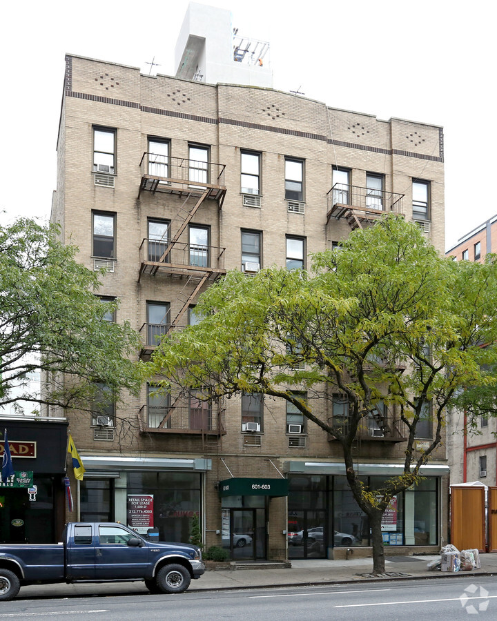
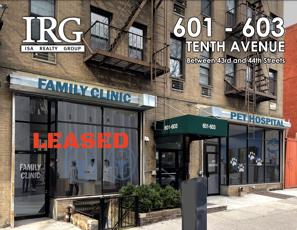
Property Record
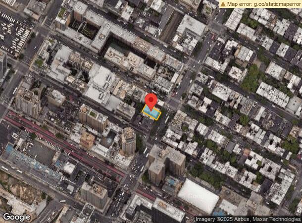
601 10Th Ave, New York, NY 10036

NEARBY LISTINGS FOR SALE OR LEASE
Property Detail
601 10Th Ave
1072-0033
Estate/James Clinton Norton
Apartment
Manhattan
X
New York
3604970088F
33
2024
0.12 AC
2024
Midtown West
012901
New York City
26,700 SF
New York-Jersey City-White Plains, NY-NJ
DEMOGRAPHICS near 601 10Th Ave
1 Mile
3 Mile
5 Mile
2024 Total Population
133,095
1,243,594
2,493,769
2029 Population
123,763
1,163,554
2,352,482
Pop Growth 2024-2029
(7.01%)
(6.44%)
(5.67%)
Average Age
41
41
40
2024 Total Households
72,130
620,768
1,149,200
HH Growth 2024-2029
(7.15%)
(6.76%)
(6.02%)
Median Household Inc
$96,866
$107,820
$93,758
Avg Household Size
1.70
1.90
2.10
2024 Avg HH Vehicles
.00
.00
.00
Median Home Value
$940,023
$930,823
$869,323
Median Year Built
1982
1958
1958
Nearby Places
- Restaurants
- Banks
- Shops
- Fitness
- Groceries
PUBLIC TRANSPORTATION
TRANSIT/SUBWAY
42 Street-Port Authority Bus Terminal (A - New York MTA Subway (The Subway), C - New York MTA Subway (The Subway), E - New York MTA Subway (The Subway))
DRIVE
WALK
Distance
42 Street-Port Authority Bus Terminal (A - New York MTA Subway (The Subway), C - New York MTA Subway (The Subway), E - New York MTA Subway (The Subway))
2 min
8 min
0.4 mi
Times Square-42 Street (1 - New York MTA Subway (The Subway), 2 - New York MTA Subway (The Subway), 3 - New York MTA Subway (The Subway), 42 St Shuttle - New York MTA Subway (The Subway), 7 - New York MTA Subway (The Subway), N - New York MTA Subway (The Subway), Q - New York MTA Subway (The Subway), R - New York MTA Subway (The Subway))
DRIVE
WALK
Distance
Times Square-42 Street (1 - New York MTA Subway (The Subway), 2 - New York MTA Subway (The Subway), 3 - New York MTA Subway (The Subway), 42 St Shuttle - New York MTA Subway (The Subway), 7 - New York MTA Subway (The Subway), N - New York MTA Subway (The Subway), Q - New York MTA Subway (The Subway), R - New York MTA Subway (The Subway))
3 min
11 min
0.6 mi
50 Street (A,C,E Line) (A - New York MTA Subway (The Subway), C - New York MTA Subway (The Subway), E - New York MTA Subway (The Subway))
DRIVE
WALK
Distance
50 Street (A,C,E Line) (A - New York MTA Subway (The Subway), C - New York MTA Subway (The Subway), E - New York MTA Subway (The Subway))
3 min
12 min
0.7 mi
49 Street (N - New York MTA Subway (The Subway), R - New York MTA Subway (The Subway))
DRIVE
WALK
Distance
49 Street (N - New York MTA Subway (The Subway), R - New York MTA Subway (The Subway))
4 min
15 min
0.8 mi
50 Street (1,2 Line) (1 - New York MTA Subway (The Subway), 2 - New York MTA Subway (The Subway))
DRIVE
WALK
Distance
50 Street (1,2 Line) (1 - New York MTA Subway (The Subway), 2 - New York MTA Subway (The Subway))
3 min
15 min
0.8 mi
COMMUTER RAIL
New York Penn Station (NJT) (Montclair-Boonton Line - NJ Transit Commuter Rail (NJ Transit), Morris & Essex Gladstone Branch - NJ Transit Commuter Rail (NJ Transit), Morris & Essex Morristown Line - NJ Transit Commuter Rail (NJ Transit), North Jersey Coast Line - NJ Transit Commuter Rail (NJ Transit), Northeast Corridor Line - NJ Transit Commuter Rail (NJ Transit))
DRIVE
WALK
Distance
New York Penn Station (NJT) (Montclair-Boonton Line - NJ Transit Commuter Rail (NJ Transit), Morris & Essex Gladstone Branch - NJ Transit Commuter Rail (NJ Transit), Morris & Essex Morristown Line - NJ Transit Commuter Rail (NJ Transit), North Jersey Coast Line - NJ Transit Commuter Rail (NJ Transit), Northeast Corridor Line - NJ Transit Commuter Rail (NJ Transit))
6 min
19 min
1.0 mi
New York Penn Station (LIRR) (Babylon Branch - Long Island Rail Road, Far Rockaway Branch - Long Island Rail Road, Hempstead Branch - Long Island Rail Road, Long Beach Branch - Long Island Rail Road, Montauk Branch - Long Island Rail Road, Port Jefferson Branch - Long Island Rail Road, Port Washington Branch - Long Island Rail Road, Ronkonkoma Branch - Long Island Rail Road, West Hempstead Branch - Long Island Rail Road)
DRIVE
WALK
Distance
New York Penn Station (LIRR) (Babylon Branch - Long Island Rail Road, Far Rockaway Branch - Long Island Rail Road, Hempstead Branch - Long Island Rail Road, Long Beach Branch - Long Island Rail Road, Montauk Branch - Long Island Rail Road, Port Jefferson Branch - Long Island Rail Road, Port Washington Branch - Long Island Rail Road, Ronkonkoma Branch - Long Island Rail Road, West Hempstead Branch - Long Island Rail Road)
6 min
19 min
1.0 mi
AIRPORT
La Guardia
DRIVE
WALK
Distance
La Guardia
20 min
10.2 mi
Newark Liberty International
DRIVE
WALK
Distance
Newark Liberty International
19 min
13.9 mi
John F. Kennedy International
DRIVE
WALK
Distance
John F. Kennedy International
30 min
18.1 mi
Freight Ports
NY - Red Hook Container Terminal
DRIVE
WALK
Distance
NY - Red Hook Container Terminal
1 min
5.2 mi
SALE & LEASE HISTORY
LISTING DATE
SALE/LEASE

Mar 11, 2022
For Lease
Jul 28, 2017
For Lease
Nearby Properties
Address
Land Use
TOTAL SIZE
Lot Size
Zoning
Address
Land Use
TOTAL SIZE
Lot Size
Zoning
4,060,596 SF
22.09 AC
M2-3
Address
Land Use
TOTAL SIZE
Lot Size
Zoning
1,783,434 SF
1.94 AC
C5-3
Address
Land Use
TOTAL SIZE
Lot Size
Zoning
2,245,112 SF
2.02 AC
C6-6
Address
Land Use
TOTAL SIZE
Lot Size
Zoning
8,462,176 SF
61.41 AC
R7-2
Address
Land Use
TOTAL SIZE
Lot Size
Zoning
2,521,850 SF
1.59 AC
C6-4
Address
Land Use
TOTAL SIZE
Lot Size
Zoning
2,221,336 SF
1.55 AC
C6-4
Address
Land Use
TOTAL SIZE
Lot Size
Zoning
2,161,994 SF
3.79 AC
M1-5
Address
Land Use
TOTAL SIZE
Lot Size
Zoning
2,636,182 SF
2.35 AC
C65.5
Address
Land Use
TOTAL SIZE
Lot Size
Zoning
2,354,289 SF
3.96 AC
C6-4
Address
Land Use
TOTAL SIZE
Lot Size
Zoning
1,678,135 SF
1.01 AC
C5-3
Address
Land Use
TOTAL SIZE
Lot Size
Zoning
2,734,038 SF
4.24 AC
C52.5
Address
Land Use
TOTAL SIZE
Lot Size
Zoning
1,897,491 SF
2.06 AC
C52.5
Address
Land Use
TOTAL SIZE
Lot Size
Zoning
1,638,259 SF
1.42 AC
C52.5
Address
Land Use
TOTAL SIZE
Lot Size
Zoning
1,233,684 SF
16.94 AC
PARK
Address
Land Use
TOTAL SIZE
Lot Size
Zoning
1,984,228 SF
1.95 AC
C65.5
Address
Land Use
TOTAL SIZE
Lot Size
Zoning
2,360,627 SF
2.08 AC
C6-7
Address
Land Use
TOTAL SIZE
Lot Size
Zoning
1,586,876 SF
1.87 AC
C5-3
Address
Land Use
TOTAL SIZE
Lot Size
Zoning
1,048,620 SF
5.67 AC
C6-4
Address
Land Use
TOTAL SIZE
Lot Size
Zoning
1,946,157 SF
1.49 AC
C6-4
Address
Land Use
TOTAL SIZE
Lot Size
Zoning
1,962,900 SF
1.89 AC
C66.5
Address
Land Use
TOTAL SIZE
Lot Size
Zoning
1,842,991 SF
2.08 AC
C66.5
Address
Land Use
TOTAL SIZE
Lot Size
Zoning
1,178,640 SF
0.92 AC
C6-4
Address
Land Use
TOTAL SIZE
Lot Size
Zoning
2,535,958 SF
2.94 AC
C6-4
Address
Land Use
TOTAL SIZE
Lot Size
Zoning
1,751,641 SF
1.84 AC
C6-4
Address
Land Use
TOTAL SIZE
Lot Size
Zoning
6,877 SF
27.74 AC
R-1E
Address
Land Use
TOTAL SIZE
Lot Size
Zoning
1,642,675 SF
1.05 AC
C6-7
Address
Land Use
TOTAL SIZE
Lot Size
Zoning
1,613,847 SF
1.84 AC
C66.5
Address
Land Use
TOTAL SIZE
Lot Size
Zoning
2,215,000 SF
6.43 AC
R9
Address
Land Use
TOTAL SIZE
Lot Size
Zoning
1,596,521 SF
1.34 AC
C6-4
Address
Land Use
TOTAL SIZE
Lot Size
Zoning
1,805,894 SF
1.42 AC
C6-4
The World's #1 Commercial Real Estate Marketplace
Connect with us
© 2025 CoStar Group
The information above has been obtained from sources believed reliable. While we do not doubt its accuracy we have not verified it and make no guarantee, warranty or representation about it. It is your responsibility to independently confirm its accuracy and completeness. Any projections, opinions, assumptions, or estimates used are for example only and do not represent the current or future performance of the property. The value of this transaction to you depends on tax and other factors which should be evaluated by your tax, financial, and legal advisors. You and your advisors should conduct a careful, independent investigation of the property to determine to your satisfaction the suitability of the property for your needs.