Property Record
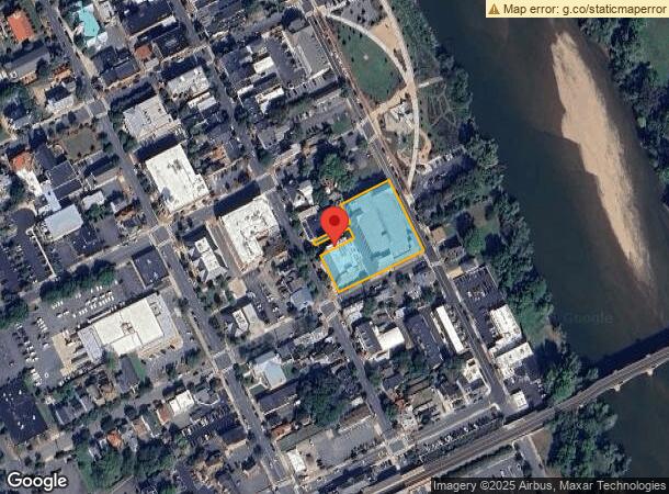
601 Caroline St, Fredericksburg, VA 22401
NEARBY LISTINGS FOR SALE OR LEASE
Property Detail
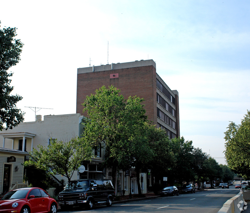
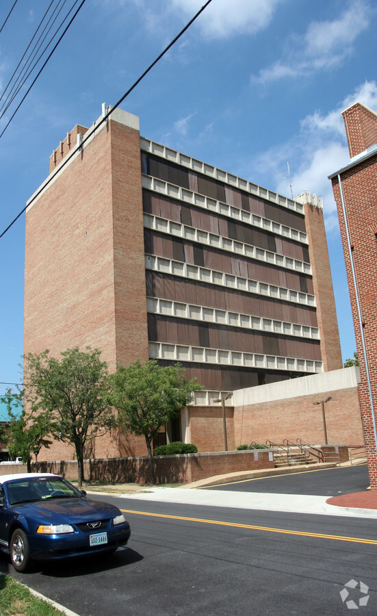
601 Caroline St
45-601
Executive Plaza
Municipalproperty
47,840SF BL 45-601 EXECUTIVE PLAZA
AE
Fredericksburg
51179C0212F
Virginia
2025
1.10 AC
2025
Fredericksburg City
000100
Washington, DC
141,338 SF
Washington-Arlington-Alexandria, DC-VA-MD-WV
DEMOGRAPHICS near 601 Caroline St
1 Mile
3 Mile
5 Mile
2024 Total Population
9,624
58,150
108,066
2029 Population
10,223
63,141
118,703
Pop Growth 2024-2029
+ 6.22%
+ 8.58%
+ 9.84%
Average Age
38
37
38
2024 Total Households
3,729
21,579
40,369
HH Growth 2024-2029
+ 7.05%
+ 8.63%
+ 9.92%
Median Household Inc
$93,689
$93,671
$92,161
Avg Household Size
2.10
2.60
2.60
2024 Avg HH Vehicles
2.00
2.00
2.00
Median Home Value
$443,323
$372,431
$356,824
Median Year Built
1954
1986
1992
Nearby Places
- Restaurants
- Banks
- Shops
- Fitness
- Groceries
PUBLIC TRANSPORTATION
COMMUTER RAIL
Fredericksburg (Fredericksburg Line - Virginia Railway Express)
DRIVE
WALK
Distance
Fredericksburg (Fredericksburg Line - Virginia Railway Express)
1 min
4 min
0.2 mi
Leeland Road (Fredericksburg Line - Virginia Railway Express)
DRIVE
WALK
Distance
Leeland Road (Fredericksburg Line - Virginia Railway Express)
10 min
4.5 mi
Freight Ports
Virginia Port Authority - Richmond
DRIVE
WALK
Distance
Virginia Port Authority - Richmond
82 min
63.4 mi
Nearby Properties
Address
Land Use
TOTAL SIZE
Lot Size
Zoning
Address
Land Use
TOTAL SIZE
Lot Size
Zoning
945,573 SF
22.10 AC
PDMC
Address
Land Use
TOTAL SIZE
Lot Size
Zoning
14,500 SF
CT
Address
Land Use
TOTAL SIZE
Lot Size
Zoning
343,471 SF
14.61 AC
CD
Address
Land Use
TOTAL SIZE
Lot Size
Zoning
201,350 SF
43.05 AC
CT
Address
Land Use
TOTAL SIZE
Lot Size
Zoning
121,832 SF
0.23 AC
R2
Address
Land Use
TOTAL SIZE
Lot Size
Zoning
421,851 SF
7.05 AC
PDMU
Address
Land Use
TOTAL SIZE
Lot Size
Zoning
198,000 SF
23.67 AC
R2
Address
Land Use
TOTAL SIZE
Lot Size
Zoning
252,616 SF
22.31 AC
R16
Address
Land Use
TOTAL SIZE
Lot Size
Zoning
80,000 SF
0.51 AC
R2
Address
Land Use
TOTAL SIZE
Lot Size
Zoning
143,003 SF
38.64 AC
R2
Address
Land Use
TOTAL SIZE
Lot Size
Zoning
230,664 SF
60.21 AC
A2
Address
Land Use
TOTAL SIZE
Lot Size
Zoning
105,564 SF
1.07 AC
R2
Address
Land Use
TOTAL SIZE
Lot Size
Zoning
156,241 SF
12.73 AC
R16
Address
Land Use
TOTAL SIZE
Lot Size
Zoning
100 AC
R2
Address
Land Use
TOTAL SIZE
Lot Size
Zoning
187,097 SF
16.66 AC
R16
Address
Land Use
TOTAL SIZE
Lot Size
Zoning
76,950 SF
0.47 AC
CD
Address
Land Use
TOTAL SIZE
Lot Size
Zoning
192,485 SF
17.39 AC
R12
Address
Land Use
TOTAL SIZE
Lot Size
Zoning
56,004 SF
0.46 AC
R2
Address
Land Use
TOTAL SIZE
Lot Size
Zoning
26.99 AC
PDR
Address
Land Use
TOTAL SIZE
Lot Size
Zoning
Address
Land Use
TOTAL SIZE
Lot Size
Zoning
355,593 SF
39.40 AC
I1 - INDUS
Address
Land Use
TOTAL SIZE
Lot Size
Zoning
162,535 SF
10.67 AC
CH
Address
Land Use
TOTAL SIZE
Lot Size
Zoning
30,964 SF
68.81 AC
R2
Address
Land Use
TOTAL SIZE
Lot Size
Zoning
75,441 SF
0.27 AC
R2
Address
Land Use
TOTAL SIZE
Lot Size
Zoning
139,413 SF
9.29 AC
R12
Address
Land Use
TOTAL SIZE
Lot Size
Zoning
42,093 SF
0.66 AC
R2
Address
Land Use
TOTAL SIZE
Lot Size
Zoning
77,108 SF
5.67 AC
PDMC
Address
Land Use
TOTAL SIZE
Lot Size
Zoning
164,539 SF
11.69 AC
R16
Address
Land Use
TOTAL SIZE
Lot Size
Zoning
172,380 SF
17.86 AC
R16
Address
Land Use
TOTAL SIZE
Lot Size
Zoning
58,812 SF
0.47 AC
R2
The World's #1 Commercial Real Estate Marketplace
Connect with us
© 2025 CoStar Group
The information above has been obtained from sources believed reliable. While we do not doubt its accuracy we have not verified it and make no guarantee, warranty or representation about it. It is your responsibility to independently confirm its accuracy and completeness. Any projections, opinions, assumptions, or estimates used are for example only and do not represent the current or future performance of the property. The value of this transaction to you depends on tax and other factors which should be evaluated by your tax, financial, and legal advisors. You and your advisors should conduct a careful, independent investigation of the property to determine to your satisfaction the suitability of the property for your needs.