Property Record
601 Cherry Hill Rd, Brooklyn, MD 21225


Property Detail
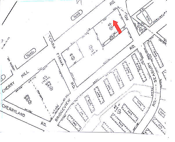
601 Cherry Hill Rd
7625-046
200X115-1
Regionalshoppingcenterormallwithanchorstore
Baltimore City
C-2
Maryland
B and X Area of moderate flood hazard, usually the area between the limits of the 100-year and 500-year floods.
46
2024
0.52 AC
2025
Baltimore Southwest
250203
Baltimore
11,110 SF
Baltimore-Columbia-Towson, MD
NEARBY LISTINGS FOR SALE OR LEASE
DEMOGRAPHICS near 601 Cherry Hill Rd
1 mile
3 mile
5 mile
2025 Total Population
7,563
128,885
389,846
2030 Population
7,376
129,123
390,745
Pop Growth 2025-2030
(2.47%)
+ 0.18%
+ 0.23%
Average Age
35
37
38
2025 Total Households
2,970
55,174
165,717
HH Growth 2025-2030
(2.63%)
+ 0.03%
+ 0.02%
Median Household Inc
$31,106
$69,701
$62,042
Avg Household Size
2.50
2.30
2.20
2025 Avg HH Vehicles
1.00
1.00
1.00
Median Home Value
$139,759
$276,696
$264,334
Median Year Built
1955
1954
1950
Nearby Places
Map Layers
Map Styles
 Street
 Aerial
Transit
 Traffic
 Biking
Places
Listings with unknown addresses are not visible on the map
- Restaurants
- Banks
- Shops
- Fitness
- Groceries
PUBLIC TRANSPORTATION
TRANSIT/SUBWAY
Cherry Hill (Hunt Valley & BWI Marshall - Maryland Transit Administration Light Rail (Baltimore Light Rail), Timonium & Cromwell - Maryland Transit Administration Light Rail (Baltimore Light Rail))
Drive
Walk
Distance
Cherry Hill (Hunt Valley & BWI Marshall - Maryland Transit Administration Light Rail (Baltimore Light Rail), Timonium & Cromwell - Maryland Transit Administration Light Rail (Baltimore Light Rail))
3 min
19 min
0.9 mi
COMMUTER RAIL
Drive
Walk
Distance
8 min
3.2 mi
Drive
Walk
Distance
12 min
5.4 mi
AIRPORT
Baltimore/Washington International Thurgood Marshall
Drive
Walk
Distance
Baltimore/Washington International Thurgood Marshall
17 min
9.0 mi
Freight Ports
Port of Baltimore
Drive
Walk
Distance
Port of Baltimore
8 min
3.4 mi
SALE & LEASE HISTORY
LISTING DATE
SALE/LEASE

Sep 28, 2021
For Sale
Aug 22, 2022
For Lease
Nearby Properties
Address
Land Use
TOTAL SIZE
Lot Size
Zoning
Address
Land Use
TOTAL SIZE
Lot Size
Zoning
1,871,691 SF
6.77 AC
C-5DC
Address
Land Use
TOTAL SIZE
Lot Size
Zoning
20.26 AC
C-5DC
Address
Land Use
TOTAL SIZE
Lot Size
Zoning
308,887 SF
3.98 AC
C-5DC
Address
Land Use
TOTAL SIZE
Lot Size
Zoning
21.27 AC
C-5DC
Address
Land Use
TOTAL SIZE
Lot Size
Zoning
739,000 SF
2.79 AC
C-5DC
Address
Land Use
TOTAL SIZE
Lot Size
Zoning
3.89 AC
C-5DC
Address
Land Use
TOTAL SIZE
Lot Size
Zoning
400,000 SF
13.98 AC
0B051
Address
Land Use
TOTAL SIZE
Lot Size
Zoning
654,224 SF
14.98 AC
C-5DC
Address
Land Use
TOTAL SIZE
Lot Size
Zoning
833,702 SF
1.74 AC
C-5DC
Address
Land Use
TOTAL SIZE
Lot Size
Zoning
911,487 SF
5.27 AC
C-5DC
Address
Land Use
TOTAL SIZE
Lot Size
Zoning
381,152 SF
3.46 AC
C-5DC
Address
Land Use
TOTAL SIZE
Lot Size
Zoning
2.61 AC
C-5DE
Address
Land Use
TOTAL SIZE
Lot Size
Zoning
289,515 SF
1.10 AC
BSC
Address
Land Use
TOTAL SIZE
Lot Size
Zoning
656,306 SF
1.10 AC
C-5DC
Address
Land Use
TOTAL SIZE
Lot Size
Zoning
579,351 SF
0.96 AC
C-5DC
Address
Land Use
TOTAL SIZE
Lot Size
Zoning
642,817 SF
1.91 AC
PC-2
Address
Land Use
TOTAL SIZE
Lot Size
Zoning
625,217 SF
2.12 AC
C-5DC
Address
Land Use
TOTAL SIZE
Lot Size
Zoning
520,407 SF
16.85 AC
H
Address
Land Use
TOTAL SIZE
Lot Size
Zoning
621,210 SF
2.26 AC
C-5DC
Address
Land Use
TOTAL SIZE
Lot Size
Zoning
765,243 SF
0.69 AC
C-5DC
Address
Land Use
TOTAL SIZE
Lot Size
Zoning
277,050 SF
1.27 AC
C-5DE
Address
Land Use
TOTAL SIZE
Lot Size
Zoning
363,350 SF
3.22 AC
C-5DC
Address
Land Use
TOTAL SIZE
Lot Size
Zoning
416,790 SF
9.57 AC
C-5DC
Address
Land Use
TOTAL SIZE
Lot Size
Zoning
465,042 SF
2.37 AC
OR-2
Address
Land Use
TOTAL SIZE
Lot Size
Zoning
210,000 SF
3.52 AC
C-5IH
Address
Land Use
TOTAL SIZE
Lot Size
Zoning
356,750 SF
8.19 AC
C-5DC
Address
Land Use
TOTAL SIZE
Lot Size
Zoning
600,798 SF
1.07 AC
2-4
Address
Land Use
TOTAL SIZE
Lot Size
Zoning
22,912 SF
0.55 AC
C-5DC
Address
Land Use
TOTAL SIZE
Lot Size
Zoning
522,990 SF
2.31 AC
TOD-4
Address
Land Use
TOTAL SIZE
Lot Size
Zoning
309,558 SF
3.01 AC
C-2
The World's #1 Commercial Real Estate Marketplace
Connect with us
© 2026 CoStar Group
The information above has been obtained from sources believed reliable. While we do not doubt its accuracy we have not verified it and make no guarantee, warranty or representation about it. It is your responsibility to independently confirm its accuracy and completeness. Any projections, opinions, assumptions, or estimates used are for example only and do not represent the current or future performance of the property. The value of this transaction to you depends on tax and other factors which should be evaluated by your tax, financial, and legal advisors. You and your advisors should conduct a careful, independent investigation of the property to determine to your satisfaction the suitability of the property for your needs.