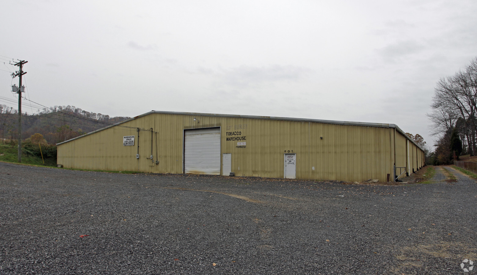
Property Record
601 Highway 70 N, Rogersville, TN 37857
NEARBY LISTINGS FOR SALE OR LEASE
-
-
View all Rogersville listings for lease on LoopNet.com
Property Detail
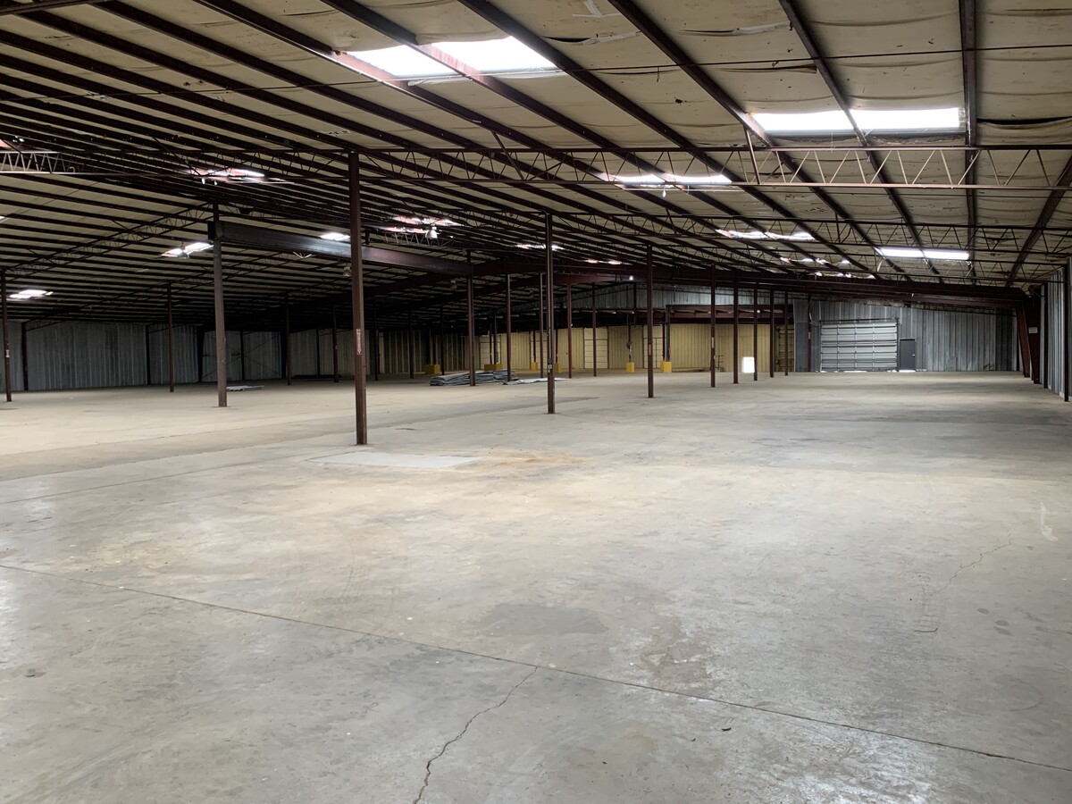
601 Highway 70 N
Kingsport-Bristol-Bristol, TN-VA
Starnes Est
088-013.00
STARNES EST PB: 9 PG: 106 LOT: 9 ALSO LOT 10
Commercialnec
Hawkins
X
Tennessee
47073C0236D
9
2024
2.80 AC
2024
Hawkins County
050200
Kingsport/Bristol/Bristol
45,759 SF
DEMOGRAPHICS near 601 Highway 70 N
1 Mile
3 Mile
5 Mile
2024 Total Population
817
7,216
12,577
2029 Population
856
7,584
13,197
Pop Growth 2024-2029
+ 4.77%
+ 5.10%
+ 4.93%
Average Age
45
43
43
2024 Total Households
329
2,977
5,187
HH Growth 2024-2029
+ 4.56%
+ 5.11%
+ 4.88%
Median Household Inc
$56,845
$48,712
$50,230
Avg Household Size
2.40
2.30
2.30
2024 Avg HH Vehicles
2.00
2.00
2.00
Median Home Value
$174,418
$152,485
$147,155
Median Year Built
1984
1974
1978
Nearby Places
- Restaurants
- Banks
- Shops
- Fitness
- Groceries
SALE & LEASE HISTORY
LISTING DATE
SALE/LEASE

Mar 02, 2021
For Sale
Jan 31, 2023
For Lease
Jan 02, 2018
For Lease
Dec 01, 2016
For Sale
Nearby Properties
Address
Land Use
TOTAL SIZE
Lot Size
Zoning
Address
Land Use
TOTAL SIZE
Lot Size
Zoning
74,178 SF
7.17 AC
B-3
Address
Land Use
TOTAL SIZE
Lot Size
Zoning
42,146 SF
5.76 AC
R-3
Address
Land Use
TOTAL SIZE
Lot Size
Zoning
84,450 SF
8.43 AC
B-3
Address
Land Use
TOTAL SIZE
Lot Size
Zoning
25,983 SF
2.38 AC
B-3
Address
Land Use
TOTAL SIZE
Lot Size
Zoning
21,154 SF
MR
Address
Land Use
TOTAL SIZE
Lot Size
Zoning
12,314 SF
89 AC
HB-2
Address
Land Use
TOTAL SIZE
Lot Size
Zoning
18,900 SF
3.19 AC
B3
Address
Land Use
TOTAL SIZE
Lot Size
Zoning
6,750 SF
1.40 AC
B-3
Address
Land Use
TOTAL SIZE
Lot Size
Zoning
35,232 SF
5.69 AC
B-3
Address
Land Use
TOTAL SIZE
Lot Size
Zoning
30,715 SF
3.10 AC
B-3
Address
Land Use
TOTAL SIZE
Lot Size
Zoning
8,607 SF
1.06 AC
B-3
Address
Land Use
TOTAL SIZE
Lot Size
Zoning
34,224 SF
1.79 AC
B-4
Address
Land Use
TOTAL SIZE
Lot Size
Zoning
14,070 SF
2.89 AC
B-3
Address
Land Use
TOTAL SIZE
Lot Size
Zoning
10,422 SF
60 AC
HB-2
Address
Land Use
TOTAL SIZE
Lot Size
Zoning
9,080 SF
1.18 AC
B-4
Address
Land Use
TOTAL SIZE
Lot Size
Zoning
44,292 SF
5.24 AC
R-3
Address
Land Use
TOTAL SIZE
Lot Size
Zoning
12,825 SF
MR
Address
Land Use
TOTAL SIZE
Lot Size
Zoning
31,012 SF
2.20 AC
R-2
Address
Land Use
TOTAL SIZE
Lot Size
Zoning
24,070 SF
1.25 AC
HB-3
Address
Land Use
TOTAL SIZE
Lot Size
Zoning
43,543 SF
6.72 AC
R-1
Address
Land Use
TOTAL SIZE
Lot Size
Zoning
19,140 SF
3.67 AC
B-3
Address
Land Use
TOTAL SIZE
Lot Size
Zoning
11,042 SF
34.26 AC
Address
Land Use
TOTAL SIZE
Lot Size
Zoning
34,804 SF
1.90 AC
R-2
Address
Land Use
TOTAL SIZE
Lot Size
Zoning
7.44 AC
M-R
Address
Land Use
TOTAL SIZE
Lot Size
Zoning
33,660 SF
2.45 AC
R-2
Address
Land Use
TOTAL SIZE
Lot Size
Zoning
9,120 SF
130 AC
HB-3
Address
Land Use
TOTAL SIZE
Lot Size
Zoning
35,226 SF
1 AC
HB-2
Address
Land Use
TOTAL SIZE
Lot Size
Zoning
14,560 SF
160 AC
HB-3
Address
Land Use
TOTAL SIZE
Lot Size
Zoning
21,400 SF
1.50 AC
B-4
Address
Land Use
TOTAL SIZE
Lot Size
Zoning
2,977 SF
1.45 AC
B-4
The World's #1 Commercial Real Estate Marketplace
Connect with us
© 2025 CoStar Group
The information above has been obtained from sources believed reliable. While we do not doubt its accuracy we have not verified it and make no guarantee, warranty or representation about it. It is your responsibility to independently confirm its accuracy and completeness. Any projections, opinions, assumptions, or estimates used are for example only and do not represent the current or future performance of the property. The value of this transaction to you depends on tax and other factors which should be evaluated by your tax, financial, and legal advisors. You and your advisors should conduct a careful, independent investigation of the property to determine to your satisfaction the suitability of the property for your needs.