Property Record
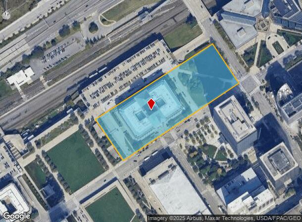
601 Lakeside Ave E, Cleveland, OH 44114


NEARBY LISTINGS FOR SALE OR LEASE
Property Detail
601 Lakeside Ave E
Cleveland-Elyria, OH
Buckley & Holdens
101-03-005
PCL E VOL 365 PG 00 & VOL 364 PG 99 FF 831.38 D 287.75 5.5687 AC OL 18-24 2011S/R
Municipalproperty
Cuyahoga
X
Ohio
39035C0064F
17
0
5.57 AC
2024
CBD
107101
Cleveland
314,625 SF
DEMOGRAPHICS near 601 Lakeside Ave E
1 Mile
3 Mile
5 Mile
2024 Total Population
16,311
70,779
220,094
2029 Population
16,547
69,882
215,950
Pop Growth 2024-2029
+ 1.45%
(1.27%)
(1.88%)
Average Age
34
36
37
2024 Total Households
9,485
35,256
101,659
HH Growth 2024-2029
+ 2.36%
(0.87%)
(1.71%)
Median Household Inc
$61,956
$40,558
$34,704
Avg Household Size
1.40
1.80
2.00
2024 Avg HH Vehicles
1.00
1.00
1.00
Median Home Value
$395,945
$198,629
$97,002
Median Year Built
1973
1948
1948
Nearby Places
- Restaurants
- Banks
- Shops
- Fitness
- Groceries
PUBLIC TRANSPORTATION
TRANSIT/SUBWAY
Tower City - Public Square (Blue Line - Greater Cleveland Regional Transit Authority Rapid Transit (The Rapid), Green Line - Greater Cleveland Regional Transit Authority Rapid Transit (The Rapid), Red Line - Greater Cleveland Regional Transit Authority Rapid Transit (The Rapid))
DRIVE
WALK
Distance
Tower City - Public Square (Blue Line - Greater Cleveland Regional Transit Authority Rapid Transit (The Rapid), Green Line - Greater Cleveland Regional Transit Authority Rapid Transit (The Rapid), Red Line - Greater Cleveland Regional Transit Authority Rapid Transit (The Rapid))
2 min
11 min
0.6 mi
COMMUTER RAIL
Cleveland Lakefront Station (Blue Line - Greater Cleveland Regional Transit Authority Rapid Transit (The Rapid), Green Line - Greater Cleveland Regional Transit Authority Rapid Transit (The Rapid))
DRIVE
WALK
Distance
Cleveland Lakefront Station (Blue Line - Greater Cleveland Regional Transit Authority Rapid Transit (The Rapid), Green Line - Greater Cleveland Regional Transit Authority Rapid Transit (The Rapid))
5 min
8 min
0.5 mi
AIRPORT
Cleveland-Hopkins International
DRIVE
WALK
Distance
Cleveland-Hopkins International
24 min
14.0 mi
Freight Ports
Port of Toledo
DRIVE
WALK
Distance
Port of Toledo
138 min
114.4 mi
Nearby Properties
Address
Land Use
TOTAL SIZE
Lot Size
Zoning
Address
Land Use
TOTAL SIZE
Lot Size
Zoning
3,491,901 SF
34.32 AC
Address
Land Use
TOTAL SIZE
Lot Size
Zoning
753,970 SF
9.31 AC
GR
Address
Land Use
TOTAL SIZE
Lot Size
Zoning
1,570,958 SF
1.33 AC
GR
Address
Land Use
TOTAL SIZE
Lot Size
Zoning
17.45 AC
GI
Address
Land Use
TOTAL SIZE
Lot Size
Zoning
16.78 AC
SI
Address
Land Use
TOTAL SIZE
Lot Size
Zoning
710,780 SF
4.33 AC
GR
Address
Land Use
TOTAL SIZE
Lot Size
Zoning
765,607 SF
12.15 AC
GR
Address
Land Use
TOTAL SIZE
Lot Size
Zoning
788,580 SF
4.85 AC
GR
Address
Land Use
TOTAL SIZE
Lot Size
Zoning
434,475 SF
0.53 AC
Address
Land Use
TOTAL SIZE
Lot Size
Zoning
1,191,268 SF
3.94 AC
SI
Address
Land Use
TOTAL SIZE
Lot Size
Zoning
6.98 AC
SI
Address
Land Use
TOTAL SIZE
Lot Size
Zoning
148,486 SF
489.21 AC
GI
Address
Land Use
TOTAL SIZE
Lot Size
Zoning
5,100 SF
9.41 AC
GI
Address
Land Use
TOTAL SIZE
Lot Size
Zoning
652,455 SF
2.04 AC
GR
Address
Land Use
TOTAL SIZE
Lot Size
Zoning
263,723 SF
7.48 AC
GI
Address
Land Use
TOTAL SIZE
Lot Size
Zoning
1,130,924 SF
4.02 AC
SI
Address
Land Use
TOTAL SIZE
Lot Size
Zoning
299,515 SF
1.30 AC
GR
Address
Land Use
TOTAL SIZE
Lot Size
Zoning
1,181,536 SF
27.82 AC
RO
Address
Land Use
TOTAL SIZE
Lot Size
Zoning
228,154 SF
0.48 AC
GR
Address
Land Use
TOTAL SIZE
Lot Size
Zoning
3.23 AC
LLR
Address
Land Use
TOTAL SIZE
Lot Size
Zoning
2.74 AC
Address
Land Use
TOTAL SIZE
Lot Size
Zoning
1,003,787 SF
2.12 AC
GR
Address
Land Use
TOTAL SIZE
Lot Size
Zoning
1,467,599 SF
1.66 AC
GR
Address
Land Use
TOTAL SIZE
Lot Size
Zoning
758,394 SF
2.24 AC
GR
Address
Land Use
TOTAL SIZE
Lot Size
Zoning
493,911 SF
1.88 AC
LLR
Address
Land Use
TOTAL SIZE
Lot Size
Zoning
1.53 AC
LLR
Address
Land Use
TOTAL SIZE
Lot Size
Zoning
299,507 SF
2.14 AC
LR
Address
Land Use
TOTAL SIZE
Lot Size
Zoning
194,478 SF
9.61 AC
SI
Address
Land Use
TOTAL SIZE
Lot Size
Zoning
2.83 AC
LLR
Address
Land Use
TOTAL SIZE
Lot Size
Zoning
723,254 SF
1.28 AC
SI
The World's #1 Commercial Real Estate Marketplace
Connect with us
© 2025 CoStar Group
The information above has been obtained from sources believed reliable. While we do not doubt its accuracy we have not verified it and make no guarantee, warranty or representation about it. It is your responsibility to independently confirm its accuracy and completeness. Any projections, opinions, assumptions, or estimates used are for example only and do not represent the current or future performance of the property. The value of this transaction to you depends on tax and other factors which should be evaluated by your tax, financial, and legal advisors. You and your advisors should conduct a careful, independent investigation of the property to determine to your satisfaction the suitability of the property for your needs.