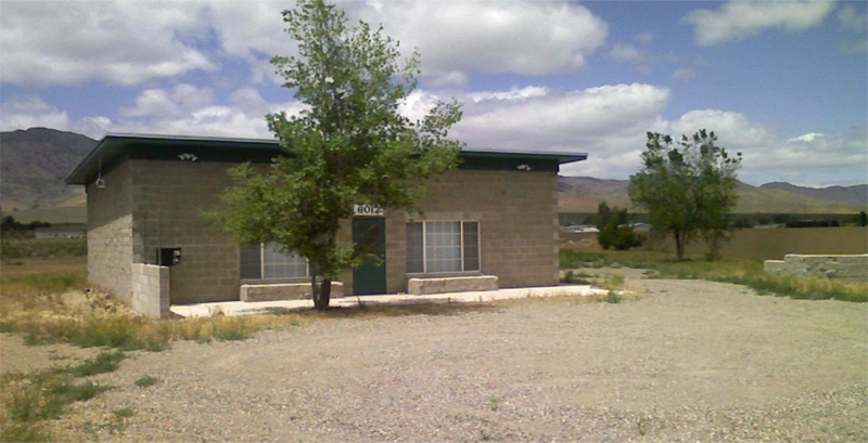
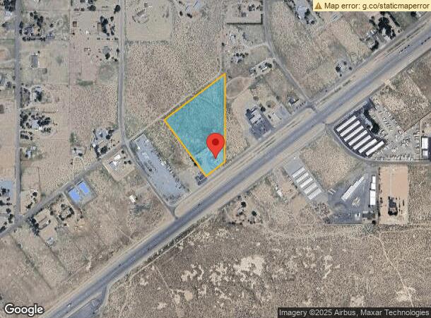
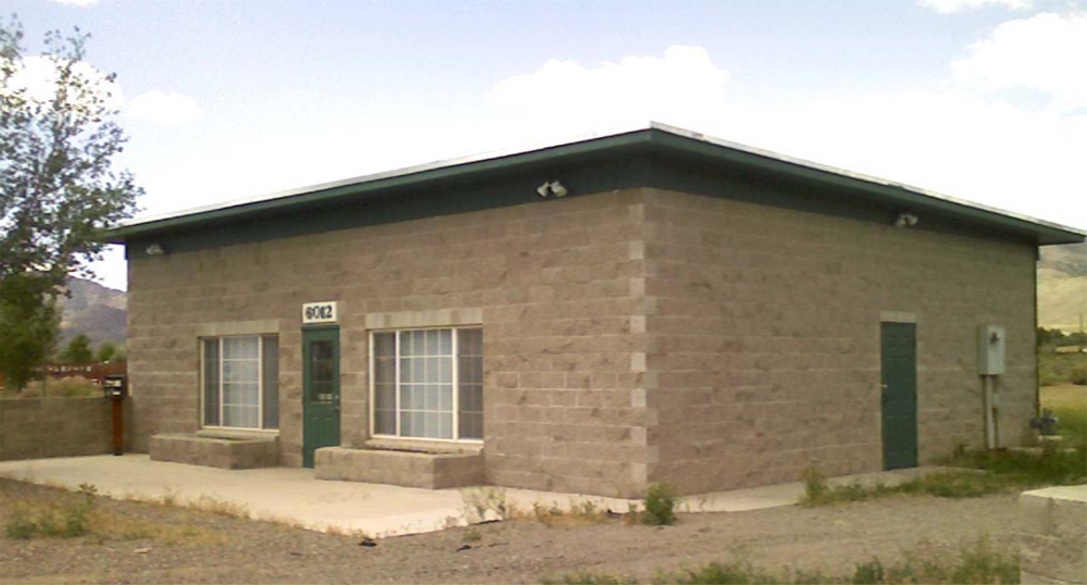
Property Record
6012 Us Highway 50 E, Dayton, NV 89403
NEARBY LISTINGS FOR SALE OR LEASE
-
-
View all Dayton listings for sale on LoopNet.com
Property Detail
6012 Us Highway 50 E
Fernley, NV
Mark Twain Est 2
019-241-01
FRANK & FRANKIES RETAIL STORE
Commercialnec
Lyon
X
Nevada
32019C0292F
12
2024
5.89 AC
2024
Lyon County
960304
Reno/Sparks
1,360 SF
DEMOGRAPHICS near 6012 Us Highway 50 E
1 Mile
3 Mile
5 Mile
2024 Total Population
1,652
8,043
13,270
2029 Population
1,832
8,836
14,527
Pop Growth 2024-2029
+ 10.90%
+ 9.86%
+ 9.47%
Average Age
44
44
44
2024 Total Households
608
3,053
5,132
HH Growth 2024-2029
+ 10.86%
+ 9.73%
+ 9.39%
Median Household Inc
$77,446
$82,132
$80,900
Avg Household Size
2.70
2.60
2.60
2024 Avg HH Vehicles
3.00
3.00
3.00
Median Home Value
$338,571
$348,850
$352,848
Median Year Built
2006
2002
2001
Nearby Places
- Restaurants
- Banks
- Shops
- Fitness
- Groceries
PUBLIC TRANSPORTATION
AIRPORT
Reno/Tahoe International
DRIVE
WALK
Distance
Reno/Tahoe International
71 min
33.4 mi
Freight Ports
Port of Stockton
DRIVE
WALK
Distance
Port of Stockton
244 min
169.5 mi
Nearby Properties
Address
Land Use
TOTAL SIZE
Lot Size
Zoning
Address
Land Use
TOTAL SIZE
Lot Size
Zoning
50,495 SF
10.76 AC
E1
Address
Land Use
TOTAL SIZE
Lot Size
Zoning
24.60 AC
MULT
Address
Land Use
TOTAL SIZE
Lot Size
Zoning
9,600 SF
4.50 AC
C2
Address
Land Use
TOTAL SIZE
Lot Size
Zoning
7,771 SF
1.20 AC
C2
Address
Land Use
TOTAL SIZE
Lot Size
Zoning
7,488 SF
5.07 AC
C2
Address
Land Use
TOTAL SIZE
Lot Size
Zoning
5,880 SF
2.70 AC
C2
Address
Land Use
TOTAL SIZE
Lot Size
Zoning
4,000 SF
3.59 AC
C1
Address
Land Use
TOTAL SIZE
Lot Size
Zoning
4,644 SF
1.18 AC
C2
Address
Land Use
TOTAL SIZE
Lot Size
Zoning
0.51 AC
RR2T
Address
Land Use
TOTAL SIZE
Lot Size
Zoning
5,715 SF
1.02 AC
C1
Address
Land Use
TOTAL SIZE
Lot Size
Zoning
729 SF
28.50 AC
RR2T
Address
Land Use
TOTAL SIZE
Lot Size
Zoning
1,620 SF
2.81 AC
C2
Address
Land Use
TOTAL SIZE
Lot Size
Zoning
2,400 SF
3.01 AC
C2
Address
Land Use
TOTAL SIZE
Lot Size
Zoning
10,125 SF
2.03 AC
C2
Address
Land Use
TOTAL SIZE
Lot Size
Zoning
3,860 SF
0.93 AC
C2
Address
Land Use
TOTAL SIZE
Lot Size
Zoning
67.47 AC
E1
Address
Land Use
TOTAL SIZE
Lot Size
Zoning
10,800 SF
2.73 AC
C2
Address
Land Use
TOTAL SIZE
Lot Size
Zoning
0.51 AC
RR2T
Address
Land Use
TOTAL SIZE
Lot Size
Zoning
2,301 SF
4.98 AC
C2
Address
Land Use
TOTAL SIZE
Lot Size
Zoning
4,500 SF
5.71 AC
P
Address
Land Use
TOTAL SIZE
Lot Size
Zoning
5.75 AC
C2
Address
Land Use
TOTAL SIZE
Lot Size
Zoning
1.86 AC
C2
Address
Land Use
TOTAL SIZE
Lot Size
Zoning
3,264 SF
300 AC
I-2;INDUST
Address
Land Use
TOTAL SIZE
Lot Size
Zoning
11,800 SF
3.42 AC
ME
Address
Land Use
TOTAL SIZE
Lot Size
Zoning
6,600 SF
2.75 AC
C2
Address
Land Use
TOTAL SIZE
Lot Size
Zoning
4,800 SF
1.51 AC
C2
Address
Land Use
TOTAL SIZE
Lot Size
Zoning
150 AC
MULT
Address
Land Use
TOTAL SIZE
Lot Size
Zoning
14.02 AC
C2
Address
Land Use
TOTAL SIZE
Lot Size
Zoning
4,800 SF
2.70 AC
C2
Address
Land Use
TOTAL SIZE
Lot Size
Zoning
1,200 SF
0.56 AC
E1
The World's #1 Commercial Real Estate Marketplace
Connect with us
© 2025 CoStar Group
The information above has been obtained from sources believed reliable. While we do not doubt its accuracy we have not verified it and make no guarantee, warranty or representation about it. It is your responsibility to independently confirm its accuracy and completeness. Any projections, opinions, assumptions, or estimates used are for example only and do not represent the current or future performance of the property. The value of this transaction to you depends on tax and other factors which should be evaluated by your tax, financial, and legal advisors. You and your advisors should conduct a careful, independent investigation of the property to determine to your satisfaction the suitability of the property for your needs.