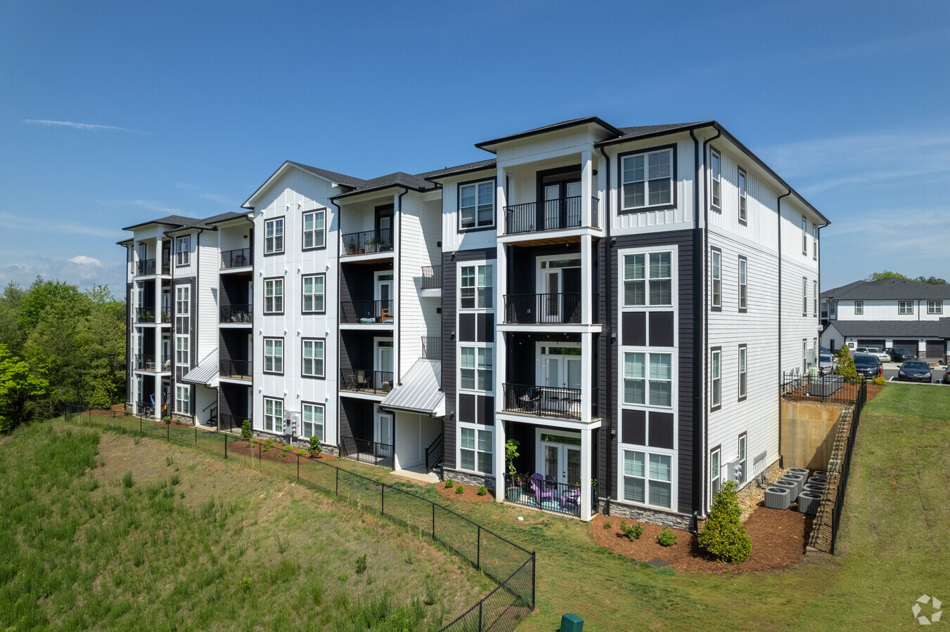
Property Record
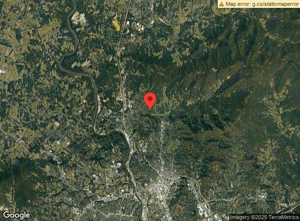
602 Highline Dr, Asheville, NC 28804
NEARBY LISTINGS FOR SALE OR LEASE
-
-
View all Asheville listings for sale on LoopNet.com
Property Detail
602 Highline Dr
9732-53-4847-00000
LOT: LOT 3 PLAT: 0207-0029
Apartment
Buncombe
X
North Carolina
3700973200J
3
2023
24.68 AC
2023
Woodfin
001601
Asheville
108,788 SF
Asheville, NC
DEMOGRAPHICS near 602 Highline Dr
1 Mile
3 Mile
5 Mile
2024 Total Population
2,557
17,395
44,302
2029 Population
2,684
18,169
46,089
Pop Growth 2024-2029
+ 4.97%
+ 4.45%
+ 4.03%
Average Age
48
46
45
2024 Total Households
1,180
7,444
18,614
HH Growth 2024-2029
+ 4.41%
+ 4.02%
+ 3.53%
Median Household Inc
$69,068
$75,643
$76,223
Avg Household Size
2.10
2.20
2.20
2024 Avg HH Vehicles
2.00
2.00
2.00
Median Home Value
$367,408
$376,197
$383,944
Median Year Built
1988
1993
1987
Nearby Places
- Restaurants
- Banks
- Shops
- Fitness
- Groceries
PUBLIC TRANSPORTATION
AIRPORT
Asheville Regional
DRIVE
WALK
Distance
Asheville Regional
25 min
17.7 mi
Freight Ports
North Charleston Terminal
DRIVE
WALK
Distance
North Charleston Terminal
297 min
261.5 mi
Nearby Properties
Address
Land Use
TOTAL SIZE
Lot Size
Zoning
Address
Land Use
TOTAL SIZE
Lot Size
Zoning
358,828 SF
137.57 AC
RESORT
Address
Land Use
TOTAL SIZE
Lot Size
Zoning
291,240 SF
86.10 AC
INST EXP
Address
Land Use
TOTAL SIZE
Lot Size
Zoning
40,152 SF
2.78 AC
CBD
Address
Land Use
TOTAL SIZE
Lot Size
Zoning
31,034 SF
1.12 AC
CBD
Address
Land Use
TOTAL SIZE
Lot Size
Zoning
94,004 SF
2.74 AC
CBD
Address
Land Use
TOTAL SIZE
Lot Size
Zoning
118,000 SF
0.17 AC
CBD
Address
Land Use
TOTAL SIZE
Lot Size
Zoning
51,476 SF
5.82 AC
CBD
Address
Land Use
TOTAL SIZE
Lot Size
Zoning
103,525 SF
18.23 AC
CWO-CS
Address
Land Use
TOTAL SIZE
Lot Size
Zoning
20,352 SF
0.67 AC
CBD
Address
Land Use
TOTAL SIZE
Lot Size
Zoning
47,729 SF
5.50 AC
CBD
Address
Land Use
TOTAL SIZE
Lot Size
Zoning
153,383 SF
10.78 AC
CWO-CS
Address
Land Use
TOTAL SIZE
Lot Size
Zoning
114,700 SF
8.91 AC
RM16
Address
Land Use
TOTAL SIZE
Lot Size
Zoning
80,319 SF
CBD
Address
Land Use
TOTAL SIZE
Lot Size
Zoning
75,122 SF
16.91 AC
CWO-CS
Address
Land Use
TOTAL SIZE
Lot Size
Zoning
68,767 SF
11.59 AC
UP
Address
Land Use
TOTAL SIZE
Lot Size
Zoning
47,653 SF
0.45 AC
CBD
Address
Land Use
TOTAL SIZE
Lot Size
Zoning
64,089 SF
0.72 AC
CBD
Address
Land Use
TOTAL SIZE
Lot Size
Zoning
98,024 SF
0.40 AC
CBD
Address
Land Use
TOTAL SIZE
Lot Size
Zoning
141,911 SF
51.27 AC
RM16
Address
Land Use
TOTAL SIZE
Lot Size
Zoning
59,200 SF
31.39 AC
R-2
Address
Land Use
TOTAL SIZE
Lot Size
Zoning
131,755 SF
1.37 AC
CBD
Address
Land Use
TOTAL SIZE
Lot Size
Zoning
45,999 SF
131.92 AC
CWO-HI
Address
Land Use
TOTAL SIZE
Lot Size
Zoning
70,237 SF
2.93 AC
CBD
Address
Land Use
TOTAL SIZE
Lot Size
Zoning
56,042 SF
16.60 AC
INST
Address
Land Use
TOTAL SIZE
Lot Size
Zoning
84,458 SF
16.51 AC
RM16
Address
Land Use
TOTAL SIZE
Lot Size
Zoning
61,043 SF
6.89 AC
CWO-CS
Address
Land Use
TOTAL SIZE
Lot Size
Zoning
316,821 SF
23.88 AC
CI
Address
Land Use
TOTAL SIZE
Lot Size
Zoning
23,248 SF
0.74 AC
CBD
Address
Land Use
TOTAL SIZE
Lot Size
Zoning
61,416 SF
3.11 AC
CBD
Address
Land Use
TOTAL SIZE
Lot Size
Zoning
25,537 SF
0.61 AC
CBD
The World's #1 Commercial Real Estate Marketplace
Connect with us
© 2025 CoStar Group
The information above has been obtained from sources believed reliable. While we do not doubt its accuracy we have not verified it and make no guarantee, warranty or representation about it. It is your responsibility to independently confirm its accuracy and completeness. Any projections, opinions, assumptions, or estimates used are for example only and do not represent the current or future performance of the property. The value of this transaction to you depends on tax and other factors which should be evaluated by your tax, financial, and legal advisors. You and your advisors should conduct a careful, independent investigation of the property to determine to your satisfaction the suitability of the property for your needs.