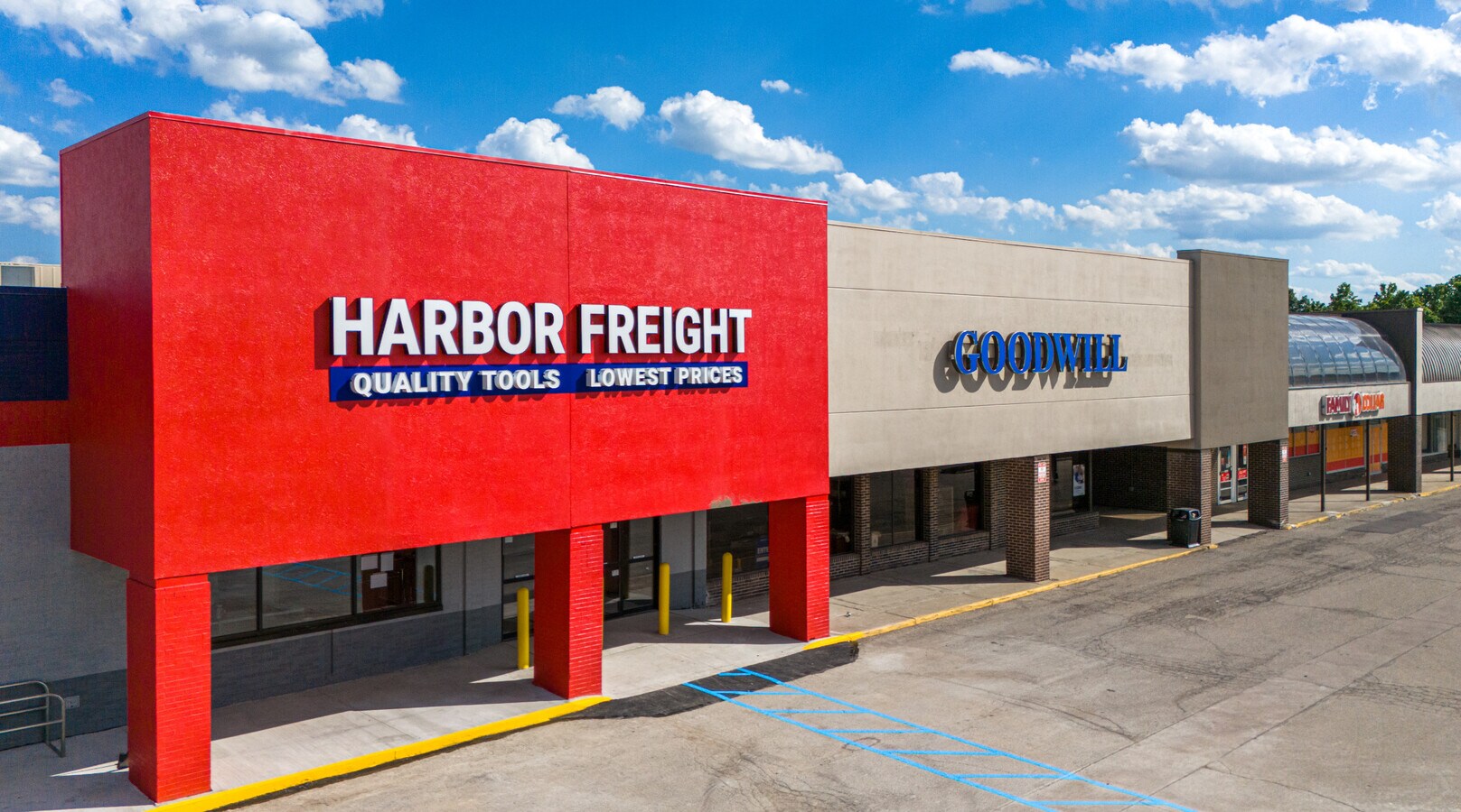
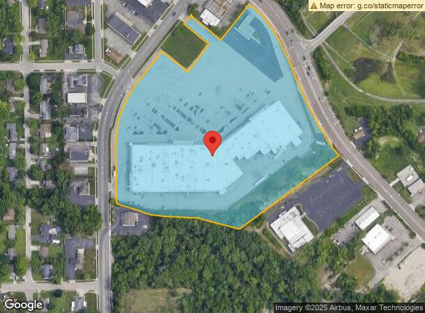
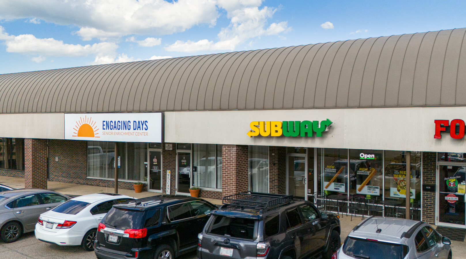
Property Record
604 Taywood Rd, Englewood, OH 45322
NEARBY LISTINGS FOR SALE OR LEASE
Property Detail
604 Taywood Rd
M57-00202-0037
5-5-23 2-2-65,67,81,82,83
Regionalshoppingcenterormallwithanchorstore
Montgomery
X
Ohio
39113C0131E
37
2023
14.99 AC
2024
North Dayton
125102
Cincinnati/Dayton
132,723 SF
Dayton, OH
DEMOGRAPHICS near 604 Taywood Rd
1 Mile
3 Mile
5 Mile
2024 Total Population
5,802
31,772
68,028
2029 Population
5,715
31,216
66,817
Pop Growth 2024-2029
(1.50%)
(1.75%)
(1.78%)
Average Age
43
42
43
2024 Total Households
2,497
13,277
29,090
HH Growth 2024-2029
(1.48%)
(1.75%)
(1.80%)
Median Household Inc
$63,183
$69,063
$63,876
Avg Household Size
2.20
2.30
2.30
2024 Avg HH Vehicles
2.00
2.00
2.00
Median Home Value
$153,069
$164,301
$161,336
Median Year Built
1971
1972
1969
Nearby Places
- Restaurants
- Banks
- Shops
- Fitness
- Groceries
PUBLIC TRANSPORTATION
AIRPORT
James M Cox Dayton International
DRIVE
WALK
Distance
James M Cox Dayton International
10 min
5.3 mi
Freight Ports
Port of Toledo
DRIVE
WALK
Distance
Port of Toledo
175 min
150.0 mi
SALE & LEASE HISTORY
LISTING DATE
SALE/LEASE

Jan 16, 2019
For Sale
Dec 30, 2016
For Lease
Dec 30, 2016
For Lease
Nearby Properties
Address
Land Use
TOTAL SIZE
Lot Size
Zoning
Address
Land Use
TOTAL SIZE
Lot Size
Zoning
586,025 SF
194.14 AC
Address
Land Use
TOTAL SIZE
Lot Size
Zoning
1,545,368 SF
162.29 AC
Address
Land Use
TOTAL SIZE
Lot Size
Zoning
52.03 AC
Address
Land Use
TOTAL SIZE
Lot Size
Zoning
177,309 SF
41.46 AC
Address
Land Use
TOTAL SIZE
Lot Size
Zoning
177,309 SF
41.46 AC
Address
Land Use
TOTAL SIZE
Lot Size
Zoning
522,340 SF
36.59 AC
Address
Land Use
TOTAL SIZE
Lot Size
Zoning
Address
Land Use
TOTAL SIZE
Lot Size
Zoning
23,020 SF
15.14 AC
Address
Land Use
TOTAL SIZE
Lot Size
Zoning
25.82 AC
Address
Land Use
TOTAL SIZE
Lot Size
Zoning
558,933 SF
19.55 AC
Address
Land Use
TOTAL SIZE
Lot Size
Zoning
200,716 SF
32.06 AC
Address
Land Use
TOTAL SIZE
Lot Size
Zoning
222,799 SF
13.74 AC
Address
Land Use
TOTAL SIZE
Lot Size
Zoning
0.45 AC
Address
Land Use
TOTAL SIZE
Lot Size
Zoning
252,449 SF
19.41 AC
Address
Land Use
TOTAL SIZE
Lot Size
Zoning
12,924 SF
51.33 AC
Address
Land Use
TOTAL SIZE
Lot Size
Zoning
92,440 SF
3.01 AC
Address
Land Use
TOTAL SIZE
Lot Size
Zoning
82,155 SF
7.85 AC
Address
Land Use
TOTAL SIZE
Lot Size
Zoning
212,060 SF
29.77 AC
Address
Land Use
TOTAL SIZE
Lot Size
Zoning
4.37 AC
Address
Land Use
TOTAL SIZE
Lot Size
Zoning
125,183 SF
10.51 AC
Address
Land Use
TOTAL SIZE
Lot Size
Zoning
87,797 SF
43.13 AC
Address
Land Use
TOTAL SIZE
Lot Size
Zoning
11,282 SF
11.60 AC
Address
Land Use
TOTAL SIZE
Lot Size
Zoning
107,907 SF
20.54 AC
Address
Land Use
TOTAL SIZE
Lot Size
Zoning
9.36 AC
Address
Land Use
TOTAL SIZE
Lot Size
Zoning
196,976 SF
20.24 AC
Address
Land Use
TOTAL SIZE
Lot Size
Zoning
2,520 SF
11.66 AC
Address
Land Use
TOTAL SIZE
Lot Size
Zoning
88,642 SF
11.85 AC
Address
Land Use
TOTAL SIZE
Lot Size
Zoning
23,776 SF
12.39 AC
Address
Land Use
TOTAL SIZE
Lot Size
Zoning
81,471 SF
9.92 AC
Address
Land Use
TOTAL SIZE
Lot Size
Zoning
24,264 SF
5.72 AC
The World's #1 Commercial Real Estate Marketplace
Connect with us
© 2025 CoStar Group
The information above has been obtained from sources believed reliable. While we do not doubt its accuracy we have not verified it and make no guarantee, warranty or representation about it. It is your responsibility to independently confirm its accuracy and completeness. Any projections, opinions, assumptions, or estimates used are for example only and do not represent the current or future performance of the property. The value of this transaction to you depends on tax and other factors which should be evaluated by your tax, financial, and legal advisors. You and your advisors should conduct a careful, independent investigation of the property to determine to your satisfaction the suitability of the property for your needs.